Install
Kingston, MA Weather
Current conditions
Forecast for this hour (no station report in the last two hours)
Forecast
10-day-
Thursday Night
Mostly clear, with a low around 39. North wind 12 to 16 mph, with gusts as high as 28 mph.
-
Friday
Sunny, with a high near 50. North wind 9 to 16 mph, with gusts as high as 28 mph.
-
Friday Night
Mostly clear, with a low around 36. North wind around 8 mph.
National Weather Service forecast updated 1 day ago.
Hourly
Hourly forecast- Now56°
- 7 PM53°
- 8 PM51°
- 9 PM50°
- 10 PM48°
- 11 PM47°
- Fri12 AM45°
- 1 AM44°
- 2 AM42°
- 3 AM41°
- 4 AM40°
- 5 AM39°
- 6 AM39°
- 7 AM39°
- 8 AM39°
- 9 AM42°
- 10 AM44°
- 11 AM47°
- 12 PM48°
- 1 PM49°
- 2 PM49°
- 3 PM50°
- 4 PM50°
- 5 PM50°
10-day forecast
Details- TonightOct 20Partly Cloudy51°
- WedOct 21Mostly Cloudy22%47°53°
- TodayOct 22Partly Sunny39°58°
- FriOct 23Sunny36°50°
- SatOct 24Sunny39°55°
- SunOct 25Sunny44°61°
- MonOct 26Sunny47°65°
- TueOct 27Mostly Sunny58°
- WedOct 28Rain0.06 in48°51°
- ThuOct 29Cloudy0.03 in40°52°
Days after the National Weather Service's seven are MET Norway's outlook, a computer model with no forecaster's review.
Radar
Full mapWeather news in Massachusetts
More weather news-
 Dangerous Storm and Gale Warnings Issued for New York, Massachusetts, and the Rest of New England
The nor’easter’s strongest winds are shifting north, with Storm Warnings for waters south of New England, Gale Warnings for Massachusetts and Rhode Island waters, and coastal flooding on Long Island. The storm stays…
- New England Could Face Another Fall Nor’easter – Maine, New Hampshire, & Massachusetts Take Note
Even though we normally think of Nor'easters as being a winter weather event, they can happen at any time during the year. In fact, we have already had a Nor'easter this year. It rolled through New England in September…
-
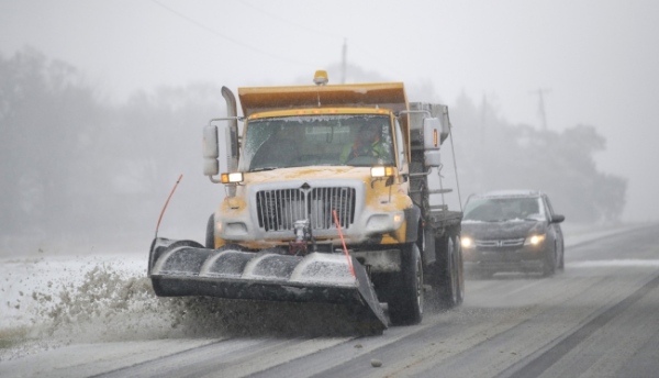 NOAA Outlook predicts wet winter for Massachusetts, Rhode Island, Connecticut, southern states
Fall River Reporter Winter Outlook has been released and it shows how El Nino will likely influence the upcoming winter months (December 2026 to February 2027), with warmer-than-average temperatures expected across the…
-
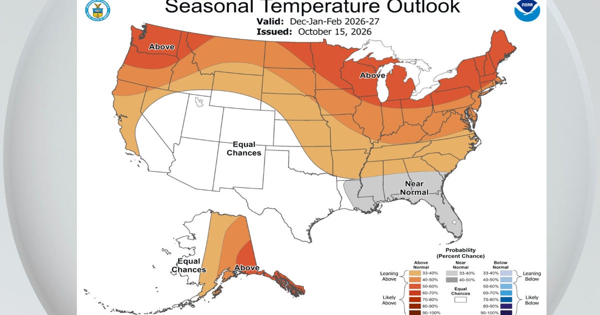 El Niño a major factor in NOAA's winter outlook. Maps show how it could affect Massachusetts.
October 15, 2026 / 1:30 PM EDT / CBS Boston NOAA's National Weather Service announced its winter outlook for the United States Thursday and there were no big surprises for Massachusetts. El Niño is ruling the roost. As…
-
 Heavy rain warning as Storm Austen sweeps across Scotland
Scotland is braced for a wet and windy weekend as two named storms hit in two days. Storm Austen is the first to sweep across the country, with the Met Office issuing a a yellow warning for rain, external in central and…
-
 First Alert Weather: Mild afternoons before weekend local nor’easter
Here's what the First Alert Weather Team said you can expect in the forecast: This evening will be dry and clear. Tomorrow morning, temperatures will drop to the lower to mid-50s around Jacksonville and upper 60s along…
-
 South East prepares for impact of Storm Austen
Seafront closures, cancelled events and travel disruption are expected as the first named storm of the season approaches south-east England. The Met Office has issued a yellow weather warning for wind across the region…
-
 Subtropical Storm Josephine forms in the Atlantic
Strong winds are expected to continue affecting offshore waters and coastal regions, with numerous gale warnings remaining in effect through at least Friday afternoon, especially across coastal New England. Winds will…
-
 Super Typhoon Champi, one of the strongest storms this year, will impact Taiwan, China and Japan
Super Typhoon Champi made a close pass to Guam, tied for strongest storm of the year, and will now affect Taiwan, China and Japan. Published Oct 19, 2026 12:22 PM EDT | Updated Oct 22, 2026 12:45 PM EDT Depending on the…
-
 Halloween weather forecast. See you need a coat for trick-or-treating
After all the planning and struggling to find the perfect Halloween costume, it's difficult for children going trick-or-treating to hear those dreadful words: You need a coat to stay warm and dry. However, that might be…
Air quality
Air quality is satisfactory, and air pollution poses little or no risk.
Forecast
- ThuGood
- FriGood
- SatGood
North Bristol-Plymouth, MA reporting area · 1 hr ago. Data from AirNow (EPA and its state, local and tribal partners); preliminary and subject to change.
Sun & moon
Almanac
MonthlyBrockton, records since 1894. Normals 1991–2020. Data from NOAA's Regional Climate Centers (ACIS).
Nearby
- Boston 49 km
- Cambridge 53 km
- New Bedford 43 km
- Dorchester 44 km
- Brockton 26 km
- Fall River 48 km
- Quincy 37 km
- Lynn 56 km
- Newton 55 km
- Somerville 54 km
- Pawtucket 56 km
- Waltham 60 km
Forecasters' discussion
From the National Weather Service office in BOX, issued 3 hrs ago
What Has Changed
Gale Warnings have begun to be replaced by Small Craft Advisories for near shore southern waters, and this will continue over the next 24 hours.
Key Messages
-Cooler day on Friday with plenty of sun and diminishing wind.
- Prolonged stretch of dry weather with seasonable temperatures prevails this weekend into much of next week.
Discussion
KEY MESSAGE 1...Cooler day on Friday with plenty of sun and diminishing wind.
Friday will continue the stretch of beautiful Fall weather for the region as we say goodbye to any influence from Subtropical Storm Josephine, replaced by building high pressure encroaching from the north. The weakening gradient will mean less of that northerly wind through the day. After winds initially start out breezy, gusting 15- 25 mph they'll end the day much lighter. Overnight in fact, under high pressure winds will become calm under clear skies, so lows were trended toward the colder MOS guidance, in the upper 20s to low 30s. This, after a cooler day on Friday after cold advection kicks in aloft; 925mb temps drop from 9C today to 0-1C on Friday leading to highs in the 50s.
KEY MESSAGE 2...Prolonged stretch of dry weather with seasonable temperatures prevails this weekend into much of next week.
A prolonged stretch of dry but pleasant autumn weather is in store for Southern New England spanning this weekend then continuing into a large portion of the upcoming workweek. Expansive area of surface high pressure of around 1030-1034 mb will remain anchored across the Northeast and mid-Atlantic region, with mild days and cool nights with strong diurnal temperature ranges. About the only nuanced difference is that a cold front sags southward Monday night into Tuesday with a cooler northern-stream airmass filtering southward; but the front is moisture-starved and only seems capable of producing some enhanced cloudiness Monday evening and a cooldown in high temps moving into next week. Mildest days look to be this weekend with temperatures in the mid to upper 60s, but there could be a shot at 70 degrees with several days of dry weather serving as a mild feedback mechanism for overachieving maximum temps over guidance. Highs then cool off into the mid 50s to low 60s for early next week as the cooler lower-level airmass works it way in (925 mb temps dip to around +2 to +4C), only modifying toward mid to late next week.
Aviation
Forecaster Confidence Levels...
Low - less than 30 percent. Moderate - 30 to 60 percent. High - greater than 60 percent.
18Z TAF Update:
This afternoon...High confidence in trends.
VFR. NE winds of 15 to 25 kt along the eastern and southeastern coast, with gusts of 25 to 40 kt. Strongest gusts expected at ACK, with lower gusts along the coastal plain. Farther inland, N winds of 10 to 14 kt with gusts of 20 to 25 kts.
Tonight...High confidence.
Forecasts, observations and alerts in the United States come from the National Weather Service (NOAA); radar from NOAA's Multi-Radar Multi-Sensor system; satellite imagery from NASA's Global Imagery Browse Services (GIBS) and NOAA's GOES satellites; the map from the U.S. Geological Survey's National Map; air quality from AirNow (EPA and its partners); hurricane information from the National Hurricane Center; climate normals and records from NOAA's Regional Climate Centers (ACIS). Forecasts outside the United States and the UV index: MET Norway (CC BY 4.0); observations outside the U.S.: airport reports via NOAA's Aviation Weather Center. Place names: GeoNames (CC BY 4.0). Data are copied on a schedule and may lag the sources; for warnings that affect your safety, follow your local National Weather Service office and emergency officials. Weather news is drawn from the 4Search index and reflects what the press published. Terms of use.