Install
Medicine Lodge, KS Weather
Current conditions
Forecast for this hour (no station report in the last two hours)
Forecast
10-day-
Tonight
Mostly cloudy, with a low around 57. South southeast wind around 9 mph.
-
Monday
A slight chance of rain showers between 11am and 4pm, then a slight chance of showers and thunderstorms between 4pm and 5pm. Partly sunny, with a high near 75. South southeast wind 7 to 14 mph. Chance of precipitation is 20%. New rainfall amounts less than a tenth of an inch possible.
-
Monday Night
A slight chance of showers and thunderstorms before 7pm, then a chance of showers and thunderstorms between 8pm and 9pm, then a slight chance of showers and thunderstorms between 9pm and 1am, then showers and thunderstorms likely. Mostly cloudy, with a low around 56. South wind 6 to 10 mph. Chance of precipitation is 60%. New rainfall amounts less than a tenth of an inch possible.
National Weather Service forecast updated 10 hrs ago.
Hourly
Hourly forecast- Now61°
- 4 AM60°
- 5 AM59°
- 6 AM58°
- 7 AM58°
- 8 AM57°
- 9 AM58°
- 10 AM63°
- 11 AM66°15%
- 12 PM69°
- 1 PM73°10%
- 2 PM74°14%
- 3 PM75°19%
- 4 PM75°20%
- 5 PM74°10%
- 6 PM72°18%
- 7 PM69°
- 8 PM67°26%
- 9 PM65°18%
- 10 PM64°20%
- 11 PM63°23%
- Tue12 AM62°19%
- 1 AM61°35%
- 2 AM61°46%
10-day forecast
Details- TonightOct 25Mostly Cloudy57°
- TodayOct 26Slight Chance Rain Showers then Slight Chance Showers And Thunderstorms63%56°75°
- TueOct 27Chance Rain Showers47%57°73°
- WedOct 28Sunny59°80°
- ThuOct 29Mostly Sunny31%59°82°
- FriOct 30Showers And Thunderstorms76%55°72°
- SatOct 31Chance Rain Showers48%54°73°
- SunNov 1Mostly Sunny72°
- MonNov 2Partly cloudy0.04 in51°75°
- TueNov 3Cloudy45°60°
Days after the National Weather Service's seven are MET Norway's outlook, a computer model with no forecaster's review.
Radar
Full mapWeather news near Medicine Lodge
More weather news-
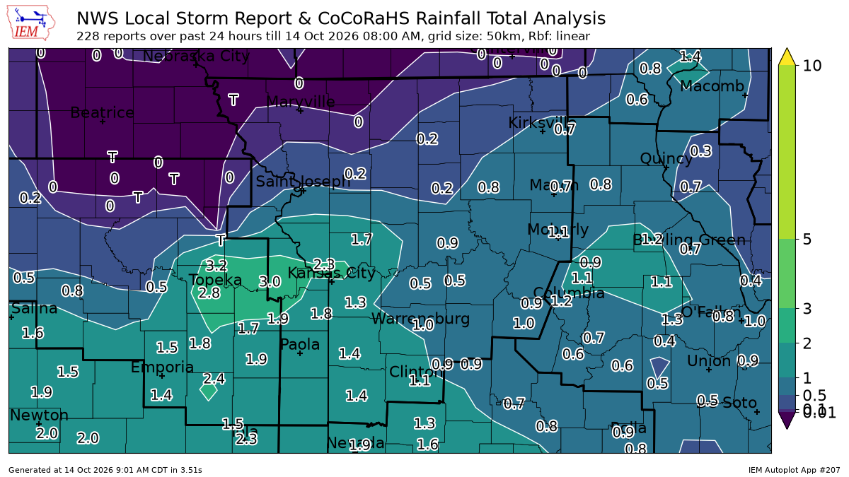 See Kansas City rainfall totals after overnight storms prompted tornado warning
Strong overnight storms brought heavy rain and damaging winds to the Kansas City area, leaving parts of the metro soaked with 1 to 2 inches of rain. Rainfall totals from automated weather stations show that several…
-
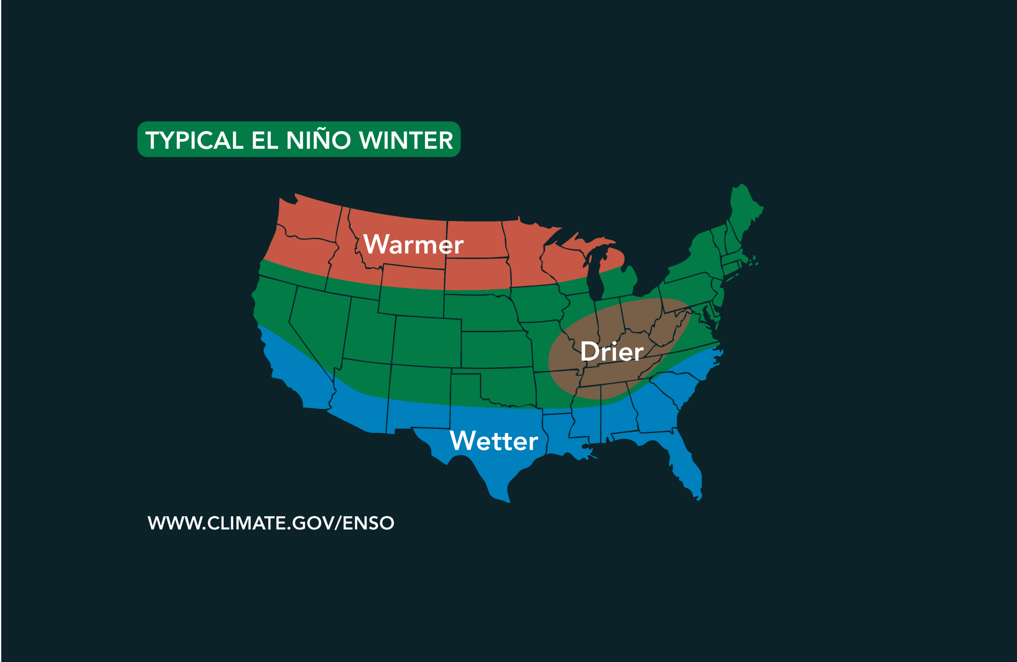 Potential El Niño to affect Kansas agriculture
Student critically injured after falling 70 feet in effort to avoid incoming vehicle • 2338 views College of Arts and Sciences to face future budget cuts • 2090 views K-State President Richard Linton to leave Wildcats…
-
 #Drought news October 22, 2026: Improvements occurred across portions of #Kansas, #Nebraska, #Colorado, #Wyoming, #Utah, #Arizona and #NewMexico
Drought news October 22, 2026: Improvements occurred across portions of #Kansas, #Nebraska, #Colorado, #Wyoming, #Utah, #Arizona and #NewMexico coyotegulch.blog Click on a thumbnail graphic to view a gallery of drought…
-
 30 years since ‘October Surprise’ snowstorm hit Kansas City
KANSAS CITY, Mo. -- The thought of snow this October seems far away with the first part of the month still feeling like summer with temperatures reaching 90 degrees and severe weather last week. Thursday marks 30 years…
-
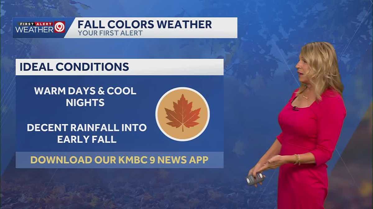 More sunny and warm weather in Kansas City
Wed: rain is falling from clouds this morning but only a few sprinkles will make it through the dry air. Clouds will clear this afternoon. High 75. Thu-Sun: Lows 50’s, Highs upper 70’s. Light South breeze under 10 mph…
-
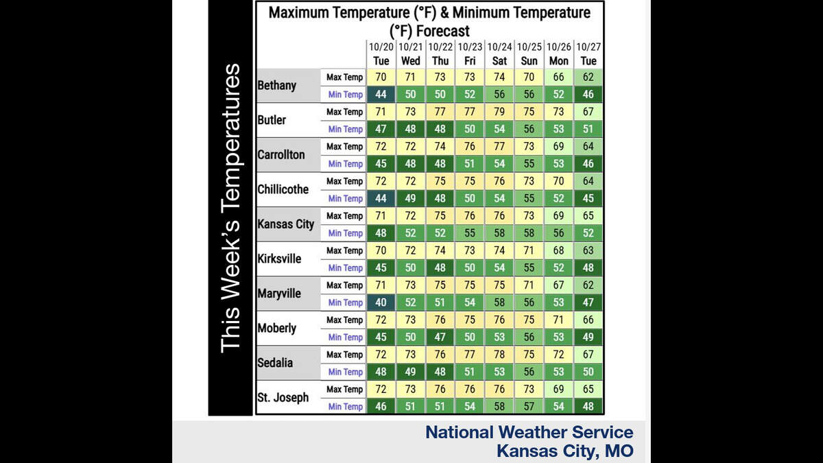 Kansas City’s warm, mostly dry stretch lasts through Sunday. What comes next?
Fall temperatures are climbing in Kansas City again Tuesday, with warmer-than-normal weather expected through the weekend, the National Weather Service says. Skies will become increasingly cloudy as metro temperatures…
-
 Warming trend continues for Kansas City
You may encounter a stray sprinkle but otherwise, we continue a warming trend KMBC Tuesday: mix sun and clouds. High 70, wind: S 5-10 mph Wed: Partly cloudy 51/73 Wind: S 5 mph Thu: Mostly sunny: 52/75 wind: SSE 5-10 mph
-
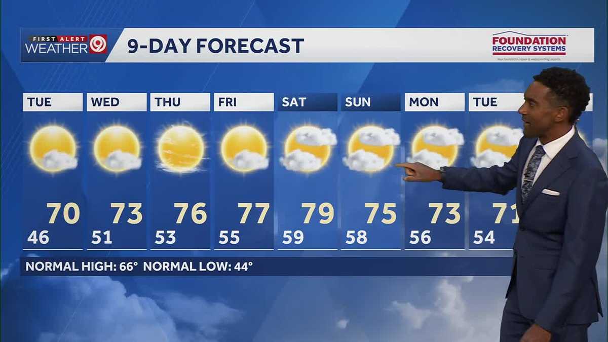 After a cool few days, warmer temperatures return starting Tuesday in Kansas City
After some cool and comfortable fall temperatures, things start to warm up once again for the rest of the week! Expect sunshine and dry conditions for the next few days. Tuesday will be partly cloudy with highs in the…
Sun & moon
Almanac
MonthlyMedicine Lodge 1e, records since 1998. Normals 1991–2020. Data from NOAA's Regional Climate Centers (ACIS).
Nearby
Forecasters' discussion
From the National Weather Service office in DDC, issued 2 hrs ago
Key Messages
- Redevelopment of showers and widely scattered thunderstorms Monday afternoon and evening, favoring areas generally east and southeast of Dodge City.
- No severe weather is forecast tomorrow evening, however the strongest storm may produce some small hail in the 4 PM to 8 PM time frame, roughly.
- Warm temperatures, well above normal for late October, with highs Wednesday and Thursday mid to upper 70s most areas.
- Increasing rain chances Thursday Night into Friday, but best chances will be south across Oklahoma and Texas with the next storm system.
Discussion
Issued at 118 AM CDT Mon Oct 26 2026
Western Kansas remains well within the warm/moist conveyor belt of the mid-latitude cyclone centered over Colorado. The upper low will lift north-northeast across western Nebraska on Monday. A storm track of this type will lead to negligible cold front push and will help keep the remnant warm/moist conveyor belt across southern Kansas. As tonight and early Monday morning's remnant showers move off to the northeast, the cold front will push fairly slowly south across western Kansas with southerly to southwesterly (yet still fairly moist) ahead of the front. Given the continued fairly high precipitable water values of 1.00 to 1.20 inches Monday late aftenoon and evening and surface-based CAPE values 500 to 1000 J/kg thanks to a little bit of insolation, additional showers and thunderstorms will likely develop generally south and east of a Liberal to Dodge City to Larned line. NBM POPs of 40-70% appear good with no adjustment necessary. One or two of the storms late afternoon/early evening may produce some small hail and/or gusty winds, but given the absence of large scale CAPE greater than 1000 J/kg, no severe hail or wind gusts are expected.
Moving ahead through the week, the theme will be warm temperatures as the overall large scale pattern will revert quickly back to lower heights in the west with higher mid level heights over the southeastern CONUS. Thus, persistent southwest flow throughout much of the troposphere will favor warm temperatures. Wednesday and Thursday will be the warmest days with highs both days well into the mid to perhaps upper 70s. Nighttime lows will be nowhere near freezing temperatures through at least next Sunday with lows most mornings in the upper 40s west to mid to upper 50s across south central Kansas.
Aviation
Issued at 1209 AM CDT Mon Oct 26 2026
Aviation weather will remain tricky to forecast through at least the late morning hours Monday as the last of rain showers move out of western Kansas. Heavier rain showers will actually raise the ceiling well above 3000 feet. However, outside of rain areas, will be watching HYS and GCK airports closely for intermittent IFR or even LIFR at times through early Monday morning. Aviation weather will improve by midday to early afternoon with VFR flight category becoming more widespread. Southeasterly winds will gradually become southwesterly through the morning hours.
Ddc Watches
None.
Forecasts, observations and alerts in the United States come from the National Weather Service (NOAA); radar from NOAA's Multi-Radar Multi-Sensor system; satellite imagery from NASA's Global Imagery Browse Services (GIBS) and NOAA's GOES satellites; the map from the U.S. Geological Survey's National Map; air quality from AirNow (EPA and its partners); hurricane information from the National Hurricane Center; climate normals and records from NOAA's Regional Climate Centers (ACIS). Forecasts outside the United States and the UV index: MET Norway (CC BY 4.0); observations outside the U.S.: airport reports via NOAA's Aviation Weather Center. Place names: GeoNames (CC BY 4.0). Data are copied on a schedule and may lag the sources; for warnings that affect your safety, follow your local National Weather Service office and emergency officials. Weather news is drawn from the 4Search index and reflects what the press published. Terms of use. How to use Weather