Install
Lakes of the Four Seasons, IN Weather
Current conditions
Observed at Valparaiso Porter County Municipal Airport · 1 hr ago
Forecast
10-day-
Overnight
Partly cloudy, with a low around 49. East wind around 5 mph.
-
Tuesday
Partly sunny, with a high near 71. South southeast wind 5 to 10 mph.
-
Tuesday Night
Mostly cloudy, with a low around 51. South southeast wind 0 to 5 mph.
National Weather Service forecast updated 3 hrs ago.
Hourly
Hourly forecast- Now49°
- 5 AM49°
- 6 AM49°
- 7 AM49°
- 8 AM50°
- 9 AM54°
- 10 AM57°
- 11 AM62°
- 12 PM66°
- 1 PM69°
- 2 PM70°
- 3 PM71°
- 4 PM71°
- 5 PM70°
- 6 PM66°
- 7 PM63°
- 8 PM60°
- 9 PM58°
- 10 PM57°
- 11 PM56°
- Wed12 AM56°
- 1 AM55°
- 2 AM54°
- 3 AM53°
10-day forecast
Details- TonightOct 26Partly Cloudy49°
- TodayOct 27Partly Sunny51°71°
- WedOct 28Mostly Sunny54°74°
- ThuOct 29Mostly Sunny then Chance Rain Showers25%52°77°
- FriOct 30Partly Sunny then Slight Chance Rain Showers20%53°72°
- SatOct 31Slight Chance Rain Showers30%54°71°
- SunNov 1Chance Rain Showers38%54°70°
- MonNov 2Chance Rain Showers54%69°
- TueNov 3Rain0.79 in60°65°
- WedNov 4Rain0.37 in56°69°
Days after the National Weather Service's seven are MET Norway's outlook, a computer model with no forecaster's review.
Radar
Full mapWeather news in Indiana
More weather news-
 Highs above average continue
Highs well above average this week. Our average is near 60 degrees, we’ll be nearly 15 degrees higher than that each day. Clouds appear Monday continuing through Wednesday. Lows overnight also begin ... LAFAYETTE, Ind…
-
 Chicago weather: A few showers could impact trick-or-treaters on Saturday
Emily Wahls has your weather update! CHICAGO - Chicagoland has been in and out of the clouds today with mid-afternoon temperatures ranging from upper 50s near the lakefront to near 70 degrees inland. Tonight will be…
-
 Sunny, 70s, and dry this entire school week
CINCINNATI (WXIX) - Monday starts off in the 40s with filtered sun. We’ll top out more than 10 degrees above normal in the low to mid 70s. We stay dry through the work week, with a slight rise in ... CINCINNATI (WXIX)…
-
 FIRST ALERT: Small showers through the week
MARQUETTE, Mich. (WLUC) - A dreary Sunday as showers will continue through the evening and possible overnight into Monday morning. A cold front passes after the rain and drops temperatures to below average, into the mid…
-
 Harvest Weather Forecast: Dry Days Keep Indiana Combines Rolling Before Early November Rain Threat
A nice harvest window remains in place for the next two weeks, although conditions will not be quite as perfect as they were this past week in your Beacon Credit Union Harvest Weather Forecast. We remain completely dry…
- Rain holds off until next weekend
Wet weather returns Halloween weekend Monday starts off in the 40s with filtered sun. We’ll top out more than 10 degrees above normal; in the low to mid 70s. We stay dry through the work week, with a slight rise in…
-
 Gorgeous Fall Week Ahead
CINCINNATI (WXIX) - Some patchy fog may develop by morning as temperatures fall into the mid 40s. Expect mostly sunny skies Sunday, with pleasant afternoon temperatures in the low 70s. Monday starts ... Monday starts…
-
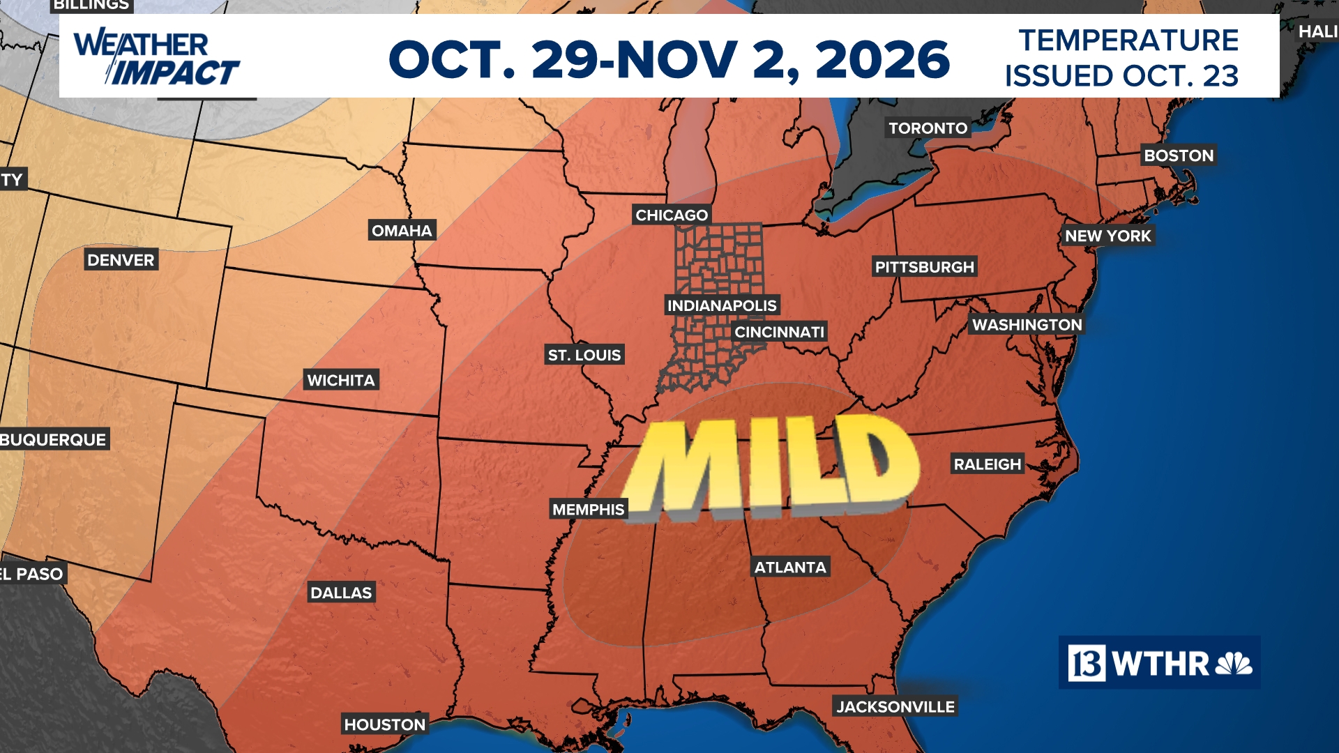 Mild afternoon highs expected to continue another week | 13Weather Blog
More in Weather blog After a crisp start to the day, temperatures will rebound nicely, with afternoon highs climbing into the 70s once again. A few more mid- to high-level clouds may drift through from time to time, but…
-
 Northeast Ohio weather: Dry stretch continues this weekend
CLEVELAND, Ohio (WOIO) - High pressure keeps dry weather around through the weekend and beyond. High temperatures rise to the mid 60s this afternoon under a sunny sky. Low temperatures drop to the upper 30s and low 40s…
- It’s a Fabulous Fall Weekend!
Temperatures continue to trend above average in the 70s into next week Some high, thin clouds will start to filter into the area over the weekend, with more clouds likely throughout next week. However, no rain is…
Air quality
Air quality is satisfactory, and air pollution poses little or no risk.
Forecast
- TueModerate
- WedModerate
Hammond-Gary, IN reporting area · 1 hr ago. Data from AirNow (EPA and its state, local and tribal partners); preliminary and subject to change.
Sun & moon
Almanac
MonthlyWanatah 2 Wnw, records since 1961. Normals 1991–2020. Data from NOAA's Regional Climate Centers (ACIS).
Nearby
- Hammond 31 km
- Gary 23 km
- Orland Park 59 km
- Tinley Park 51 km
- Oak Lawn 56 km
- Calumet City 35 km
- Portage 19 km
- Merrillville 13 km
- Valparaiso 14 km
- Michigan City 42 km
- Chicago Heights 37 km
- Burbank 59 km
Forecasters' discussion
From the National Weather Service office in LOT, issued 2 hrs ago
Key Messages
- Above to much above average temperatures expected to continue through the upcoming weekend.
- While not a wash out, there will be some periodic chances for showers and perhaps isolated thunderstorms at times late Wednesday night through the upcoming weekend.
Discussion
Issued at 155 AM CDT Tue Oct 27 2026
The cold front that shifted across our area yesterday morning has stalled across central Illinois and Indiana. Light winds and low dew point depressions near the front may support a brief period of early morning fog, primarily across the southern counties. We will continue to monitor this overnight, but widespread dense fog appears unlikely.
During the day today, this front will lift back northward as a warm front as a shortwave impulse over Kansas and Oklahoma tracks northeastward across the Mid and Upper Mississippi Valley. This impulse will bring extensive mid- and upper-level cloud cover through the day, but a drier low-level airmass should keep conditions rain-free. Despite the cloud cover, warm air advection will push temperatures inland into the upper 60s to low 70s this afternoon. Closer to the lake, southeasterly winds ahead of the approaching front will favor an afternoon lake breeze into northeastern Illinois, slowing the warm front's progress and keeping temperatures several degrees cooler than inland areas.
After the warm front shifts north of the area tonight, Wednesday is shaping up to be unseasonably mild area-wide. High temperatures are forecast in the low to mid-70s Wednesday afternoon.
The next notable shortwave impulse is expected to track well north across southern Canada Wednesday night. As an associated surface low moves eastward across Ontario, a southwestward- trailing cold front will push southward into our area by Thursday. Although the strongest large-scale forcing will pass well to the north, pooling low-level moisture (dew points in the mid to upper 50s) along the frontal boundary could support isolated to widely scattered showers, particularly late Wednesday night into Thursday. Consequently, we maintain low- end (2030%) chances of precipitation during this period.
Temperatures will turn slightly cooler for the end of the week behind this front. However, with no strong cold airmass behind Thursday's front, temperatures should remain above average through the weekend. Periodic rain chances (and possibly a few thunderstorms) will increase late in the weekend and into next week. Ensemble guidance suggests a series of impulses will track from Mexico east-northeastward into the Lower Great Lakes region during the weekend, followed by a potentially more substantial system tracking slowly across the central U.S. next week. As a result, there will be daily chances for rain from Saturday into next week. Dry periods are still expected, so it will not be raining continuously throughout the weekend.
Aviation
Issued at 1228 AM CDT Tue Oct 27 2026
There are no key concerns to highlight for the 06Z TAF period.
NE winds below 10 kt will veer to SE by morning. Expect SE to SSE at near or below 10 kt during the day on Tuesday, subsiding and veering to S for the evening and overnight. VFR throughout the period.
Doom
Lot Watches
IL...None. IN...None. LM...Small Craft Advisory until 10 AM CDT this morning for Winthrop Harbor to Wilmette Harbor IL.
Forecasts, observations and alerts in the United States come from the National Weather Service (NOAA); radar from NOAA's Multi-Radar Multi-Sensor system; satellite imagery from NASA's Global Imagery Browse Services (GIBS) and NOAA's GOES satellites; the map from the U.S. Geological Survey's National Map; air quality from AirNow (EPA and its partners); hurricane information from the National Hurricane Center; climate normals and records from NOAA's Regional Climate Centers (ACIS). Forecasts outside the United States and the UV index: MET Norway (CC BY 4.0); observations outside the U.S.: airport reports via NOAA's Aviation Weather Center. Place names: GeoNames (CC BY 4.0). Data are copied on a schedule and may lag the sources; for warnings that affect your safety, follow your local National Weather Service office and emergency officials. Weather news is drawn from the 4Search index and reflects what the press published. Terms of use. How to use Weather