Install
Oglesby, IL Weather
Current conditions
Observed at Marshall County Airport · 1 hr ago
Forecast
10-day-
Friday
Sunny. High near 75, with temperatures falling to around 73 in the afternoon. Southeast wind 0 to 5 mph, with gusts as high as 10 mph.
-
Friday Night
Mostly clear, with a low around 48. Southeast wind around 5 mph.
-
Saturday
Mostly sunny, with a high near 75. South southeast wind 5 to 10 mph.
National Weather Service forecast updated 1 day ago.
Hourly
Hourly forecast- Now73°
- 6 PM69°
- 7 PM64°
- 8 PM61°
- 9 PM60°
- 10 PM58°
- 11 PM56°
- Sat12 AM55°
- 1 AM54°
- 2 AM53°
- 3 AM52°
- 4 AM51°
- 5 AM50°
- 6 AM49°
- 7 AM48°
- 8 AM51°
- 9 AM55°
- 10 AM60°
- 11 AM65°
- 12 PM68°
- 1 PM71°
- 2 PM74°
- 3 PM75°
- 4 PM74°
Daily forecast
Details- ThuOct 22Sunny48°76°
- TodayOct 23Sunny48°75°
- SatOct 24Mostly Sunny49°75°
- SunOct 25Mostly Sunny50°76°
- MonOct 26Partly Sunny48°72°
- TueOct 27Mostly Cloudy46°67°
- WedOct 28Partly Sunny15%47°68°
- ThuOct 29Partly cloudy34°54°
Days after the National Weather Service's seven are MET Norway's outlook, a computer model with no forecaster's review.
Radar
Full mapWeather news in Illinois
More weather news- Capitol Fax.com - Your Illinois News Radar » Good morning!
Thursday, Oct 22, 2026 - Posted by Isabel Miller DOMi & JD BECK, Herbie Hancock… - Barton - Thursday, Oct 22, 26 @ 8:53 am: Oh yeah, and you have to monitor comments between it all. Thank you for the lessons…
-
 Strong El Niño likely means a milder winter for northern Illinois, climatologist says
After a record tornado year, northern Illinois may get a break: forecasters favor a warmer-than-average winter as El Niño strengthens in the Pacific. El Niño refers to a warming of the Pacific Ocean’s surface that…
-
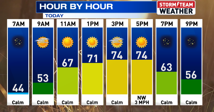 Gorgeous weather continues for Central Illinois
WEDNESDAY: Warming up with sunny skies and calm conditions. High: 75 Low: 47 THURSDAY: Above average with sunny skies. High: 76 Low: 47 FRIDAY: Nice weather continues with sunny skies. High: 76 Low: 46 SATURDAY: Some…
-
 Another beautiful day ahead for Central Illinois
DECATUR, Ill. (WAND) – If you’re looking for a reason to get outside, Tuesday is your day. A high-pressure system settling over the Midwest is bringing abundant sunshine and calm winds to Central Illinois, with…
- Central Illinois Winter Weather Outlook
The winter weather outlook for central and southeast Illinois has been released, and a detailed summary is available at this link. Some of the highlights: Current Conditions Latest Observations Daily Climate Maps…
-
 One of the year’s most pleasant weather stretches arrives in Central Illinois
DECATUR, Ill. (WAND) – A beautiful stretch of sunshine and mild temperatures is settling into the region, and it’s the perfect time to get outside and enjoy it. High pressure is taking control of the Midwest, locking in…
-
 A great week ahead for Central Illinois
WAND DECATUR, Ill. (WAND) – A wonderful weekend across Central Illinois carries into the start of the workweek. Overnight lows dip back into the upper 30s tonight with a small risk for patchy frost, though coverage will…
-
 Sunshine, chilly mornings and a big warm-up ahead for central Illinois
CENTRAL ILLINOIS (25News Now) - Fall is making an appearance across central Illinois this weekend, but don’t get too comfortable with the chilly temperatures. After a cold start on Sunday morning, sunshine will help…
-
 Overnight Frost Advisory for parts of Illinois, NW Indiana
CBS News Colorado 10pm Saturday CBS News Detroit Weekend 11pm CBS News Los Angeles Weekend 9pm CBS News Philadelphia Weekend 11pm KDKA News Weekend 11pm CBS News Texas Weekend 10pm
-
 Frost advisory back in effect for Central Illinois
WAND DECATUR, Ill. (WAND) – Another cool day starts the weekend across Central Illinois with highs Saturday only reaching the upper 50s under plenty of sunny skies. Strong high pressure remains in control keeping skies…
Air quality
Acceptable. Unusually sensitive people should consider limiting prolonged outdoor exertion.
Forecast
- FriModerate
- SatModerate
- SunModerate
Peoria, IL reporting area · 1 hr ago. Data from AirNow (EPA and its state, local and tribal partners); preliminary and subject to change.
Sun & moon
Almanac
MonthlyOttawa 4sw, records since 1890. Normals 1991–2020. Data from NOAA's Regional Climate Centers (ACIS).
Nearby
Forecasters' discussion
From the National Weather Service office in LOT, issued 3 hrs ago
Key Messages
- Precipitation free, unseasonably warm weather will continue through this weekend, with temperatures continuing to generally run above average through next week.
- Chances for any meaningful rainfall are low through next workweek.
Discussion
Issued at 150 PM CDT Fri Oct 23 2026
Tonight through Sunday:
As of this writing, what had been a bank of extensive fog and very low clouds across Chicago's far northern suburbs this morning has finally contracted to a remaining patch near Winthrop Harbor, IL. With lake enhanced moisture evident in the Waukegan and southeast WI dew point obs, wouldn't be surprised if patchy fog sneaks back into northeastern Lake County this evening from continued light to moderate southeasterly boundary layer flow.
Another calm night is in store tonight, with the main change happening aloft in terms of strengthening southerly flow just above the nocturnal inversion. Over the southeast half or third of the area (I-88 corridor in interior Chicago metro and points southeast), flow aloft should be sufficiently weak to enable patchy shallow ground fog development. Can't completely rule out very localized dense fog, but the setup isn't nearly as favorable as this (Friday) morning. High clouds will filter in from the northwest overnight into Saturday morning, keeping overnight lows a bit milder across interior northern Illinois in particular.
On Saturday, high temperatures will likely be close to a carbon copy of today (Friday), in the lower to mid 70s. Illinois side lake cooling will be confined to the immediate shoreline during the afternoon as southerly winds back to southeast with lake influence. Following a calm and cool (relative to Saturday afternoon's warmth) Saturday night, Sunday will likely be the warmest day of this stretch unless mid and high cloud cover limits high temps a bit.
Sunday Night through Friday:
Aviation
Issued at 1247 PM CDT Fri Oct 23 2026
VFR conditions are currently forecast through the period. Patchy shallow fog can't be ruled out in low-lying and grassy areas outside of Chicago early Saturday morning, though the potential remains too low to include in the TAFs with this update.
Winds will remain light through tonight initially out of the SSE then turning E to ESE behind a weak lake breeze this afternoon (ENE at GYY). Occasional patches of VFR high clouds may drift through this evening and overnight with greater coverage expected Saturday morning. Winds also begin to turn SSE to S by mid-morning Saturday and increase to around 10 kt.
Petr
Lot Watches
IL...None. IN...None. LM...None.
Forecasts, observations and alerts in the United States come from the National Weather Service (NOAA); radar from NOAA's Multi-Radar Multi-Sensor system; satellite imagery from NASA's Global Imagery Browse Services (GIBS) and NOAA's GOES satellites; the map from the U.S. Geological Survey's National Map; air quality from AirNow (EPA and its partners); hurricane information from the National Hurricane Center; climate normals and records from NOAA's Regional Climate Centers (ACIS). Forecasts outside the United States and the UV index: MET Norway (CC BY 4.0); observations outside the U.S.: airport reports via NOAA's Aviation Weather Center. Place names: GeoNames (CC BY 4.0). Data are copied on a schedule and may lag the sources; for warnings that affect your safety, follow your local National Weather Service office and emergency officials. Weather news is drawn from the 4Search index and reflects what the press published. Terms of use.