Install
Iroquois Point, HI Weather
Current conditions
Forecast for this hour (no station report in the last two hours)
Forecast
10-day-
Sunday
Mostly cloudy, with a high near 85. East northeast wind 9 to 13 mph.
-
Sunday Night
Isolated rain showers after midnight. Mostly cloudy, with a low around 73. East northeast wind around 10 mph. Chance of precipitation is 20%.
-
Monday
Scattered rain showers before noon, then scattered showers and thunderstorms. Cloudy, with a high near 85. East northeast wind 7 to 10 mph. Chance of precipitation is 50%.
National Weather Service forecast updated 4 days ago.
Hourly
Hourly forecast- Now81°
- 6 PM78°
- 7 PM76°
- 8 PM75°
- 9 PM75°
- 10 PM75°
- 11 PM75°
- Mon12 AM74°22%
- 1 AM74°22%
- 2 AM74°22%
- 3 AM73°22%
- 4 AM73°22%
- 5 AM73°22%
- 6 AM73°28%
- 7 AM73°28%
- 8 AM75°28%
- 9 AM77°28%
- 10 AM81°28%
- 11 AM83°28%
- 12 PM85°52%
- 1 PM85°52%
- 2 PM85°52%
- 3 PM85°52%
- 4 PM84°52%
Daily forecast
Details- WedOct 21Sunny74°86°
- ThuOct 22Mostly Sunny73°86°
- FriOct 23Mostly Cloudy73°86°
- SatOct 24Partly Sunny73°86°
- TodayOct 25Mostly Cloudy22%73°85°
- MonOct 26Scattered Rain Showers52%73°85°
- TueOct 27Chance Showers And Thunderstorms65%74°85°
- WedOct 28Heavy rain0.48 in67°78°
- ThuOct 29Rain0.18 in70°79°
Days after the National Weather Service's seven are MET Norway's outlook, a computer model with no forecaster's review.
Radar
Full mapWeather news near Iroquois Point
More weather news- Honolulu Weather Forecast Brings Morning Showers And Gusty Trades
Showers may occur Monday, especially along windward and mauka areas rather than in drier leeward neighborhoods. East-northeast winds will run 13 to 20 mph, with gusts up to 28 mph. Monday night will be partly cloudy…
-
 First Alert Forecast: Trending drier with lighter trades
Hawaii News Now HONOLULU (HawaiiNewsNow) - After a stretch of breezy and wet weather, we’re in store for drier conditions with calmer winds the second half of the work week. Tomorrow is transition day, but you will…
-
 Tuesday Evening Forecast - Lighter winds for remainder of the week; possible disturbance developing next week
HONOLULU (Island News) -- Lighter trades are expected Wednesday with just a few trade wind showers. Rain chances will increase late next week. Tonight, it will be partly cloudy with temperatures in the middle 70…
-
 First Alert Forecast: Breezy winds with scattered showers persist today, lighter winds with drier conditions due in tomorrow
Hawaii News Now HONOLULU (HawaiiNewsNow) - Moderate to locally windy trade winds will persist into the middle of the week. An area of showers will be moving over the windward and mountains into Tuesday. Moderate trades…
-
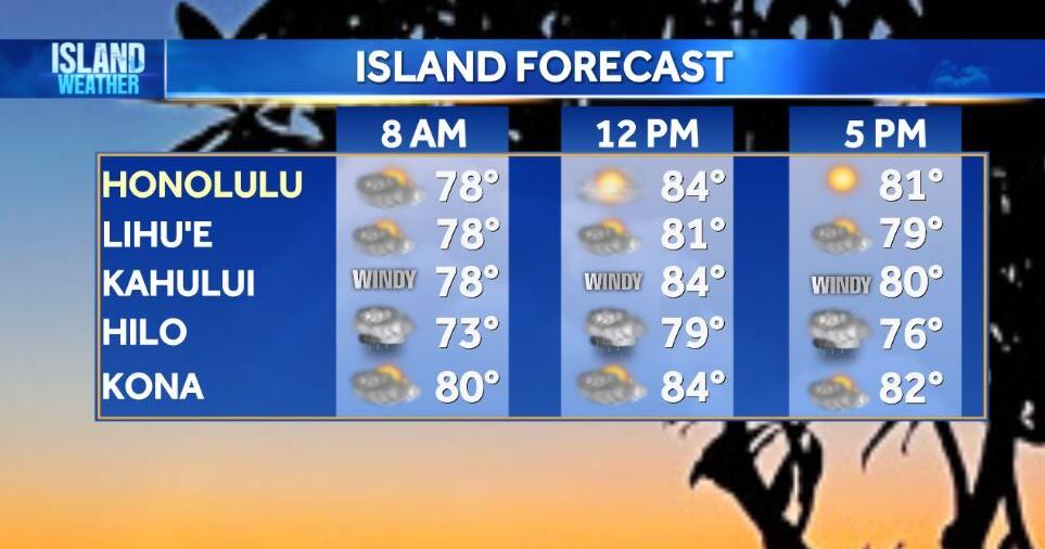 Tuesday Weather | Breezy trade winds and passing showers continue
HONOLULU (Island News) -- Breezy trade winds and passing showers are expected across Hawaiʻi today. Showers will mainly affect windward and mountain areas, especially overnight and during the early morning. Some areas…
-
 First Alert Forecast: Breezy with passing showers
Hawaii News Now HONOLULU (HawaiiNewsNow) - The breezy trade winds will continue through Tuesday, with a transition to more moderate wind speeds on Wednesday/Thursday. Passing showers will be enhanced by a low-level…
- Honolulu Weather Forecast: Gusty Trades And Passing Showers
Honolulu is lined up for a mostly sunny Sunday with a high near 86 degrees, but the trade winds will make sure the day does not feel completely sleepy. East-northeast winds of 16 to 21 mph could gust as high as 29 mph…
-
 First Alert Forecast: Breezy winds with a passing showers expected through Tuesday
HONOLULU (HawaiiNewsNow) - Trade winds will be in the moderate to locally windy range through Tuesday. A weak disturbance passing through the islands will keep enhanced showers in the forecast favoring the windward…
- These Are the States With the Best Weather Year-round
California and Hawaii are strong contenders for the best weather in the U.S. year-round. Coastal California offers comfortable temperatures with limited seasonal swings; Hawaii delivers consistent coastal warmth. But…
-
 First Alert Forecast: Gusty trades start the work week
Locally windy conditions are possible with light to moderate showers for windward and mauka areas. HONOLULU (HawaiiNewsNow) - Moderate to locally windy trades will blow over the islands for the next several days…
Air quality
Air quality is satisfactory, and air pollution poses little or no risk.
Sand Island, HI reporting area · 1 hr ago. Data from AirNow (EPA and its state, local and tribal partners); preliminary and subject to change.
Sun & moon
Almanac
MonthlyHonolulu Area, records since 1940. Normals 1991–2020. Data from NOAA's Regional Climate Centers (ACIS).
Nearby
- Honolulu 13 km
- East Honolulu 28 km
- Pearl City 8 km
- Makakilo / Kapolei / Honokai Hale 12 km
- Joint Base Pearl Harbor Hickam 4 km
- Aliamanu / Salt Lakes / Foster Village 8 km
- Kailua 26 km
- Waipahu 7 km
- ʻEwa Gentry-West Loch 5 km
- Kaneohe 21 km
- Makiki / Lower Punchbowl / Tantalus 16 km
- Mililani Town 14 km
Forecasters' discussion
From the National Weather Service office in HFO, issued 2 hrs ago
Synopsis
Northeasterly trade winds will weaken through Monday. Brief passing showers will drift into the islands on the trade winds, favoring windward and mountain areas during the overnight to early morning hours. Deep tropical moisture will bring the potential for heavy rain and thunderstorms across the state starting early Tuesday and lasting through at least Thursday. The forecast for next weekend is a return of trades but continued above-normal rainfall.
Discussion
Trade winds were still present this afternoon, averaging 10 to 20 mph, with a few gusts around 25 mph at the usual breezy spots. Isolated showers were noted on radar, most numerous near Volcano on the Big Island, and over northeast Molokai. Skies were the usual mix of mostly sunny all the way to overcast, with the majority of the clouds windward and mauka.
There's a complicated weather pattern over the area, and it's just going to get more complicated over the next few days. This afternoon, there's a large closed low about 1000 miles to our northeast. At the surface, a closed low sits directly beneath it. A front extends to the east and then south of the low, and a trough extends southwest from the decaying end of the front toward Hawaii. A separate upper level trough to our northwest will move southeast, helping to push Tropical Storm Olana toward us. The good news is that Olana is forecast to weaken back into a depression by Tuesday, and the remnants are expected to remain west of the state. The trough extending from the low to our northeast will eventually extend all the way to the remnants of Olana, and then drift north over the state. The trough will bring a great deal of moisture with it. PW values are still forecast to be close to 2.5 inches, which is extremely high.
This trough will remain nearly stationary over the area from Tuesday through the end of the week. A series of small lows will form and slide east, with one or more potentially moving over the state. Models show different timings on these features, but the point is that each time one of these lows moves across the immediate area, the winds will shift direction and different parts of each island will briefly become "windward" and "leeward". As the wind blows toward the mountains, rain efficiency will increase, giving brief increases in rain rate and the potential for flooding. The exact locations and timings of these subtle features are not yet predictable with any confidence. Therefore, the QPF will undergo (perhaps significant) revision over the next couple of days. We have opted to go with another hydrologic statement today discussing the potential for heavy rain, as opposed to a flood watch. One other consideration in this decision is that the latest models are slower to bring heavy rain to the state. It now looks like it should arrive Tuesday as opposed to Monday night.
At this time, it appears the threat of heavy rain will extend from Tuesday through the end of the week, and possibly into the weekend. Obviously our confidence gets lower with time, so the current forecast does not explicitly depict high PoPs and heavy rain beyond Thursday. The best chance for heavy rain appears to be from Tuesday afternoon through Wednesday afternoon, but I wouldn't be surprised if that ended up being extended into Thursday or even Friday. Total rainfall amounts in our QPF grids from Tuesday through Thursday, using broad numbers, currently range from 2 to 8 inches, with the highest amounts in the higher elevations. These numbers will change over the next few days as higher resolution guidance becomes available (when the forecast is within 48 hours, generally).
There is also a chance of thunderstorms at times during this period, but we have adjusted the wording from "scattered" to "isolated", indicating a slight lessening of the threat based on the latest guidance. Upper level temperatures are cold enough for thunderstorms, especially considering the high moisture content of the atmosphere, but it's close. We feel that isolated should best convey what we're thinking at this time. As with any thunderstorm, brief gusty winds are possible, but overall this setup should not bring strong winds to large areas of the state.
Aviation
Moderate trade winds will prevail the rest of today with some isolated breezy conditions at PNHY and PHMK. Otherwise, windward and mountain areas on Big Island will see an increase in showers which may cause temporary MVFR ceilings and visibilities in any shower that passes through.
Moderate turbulence has been reported between 23,000 and 34,000 feet over the open water areas north and east of the islands. The moderate nature and forecast for continued weakening of the winds preclude any AIRMET or SIGMET headlines at this time.
Looking ahead, widespread MVFR/IFR conditions in heavy showers and low ceilings are possible beginning late Monday Night into Tuesday morning; see the main discussion for details on the upcoming heavy rain and flooding potential.
Marine
A surface low far northeast of the Hawaiian Islands will continue to dig south tonight and stall roughly 800 nm northeast of the state by Monday, resulting in relatively weak wind flow across the area this week. A low pressure trough will then approach the area from the southwest late Monday and bring heavy showers with embedded thunderstorms to the waters over the next several days. Winds may become locally breezy along the trough and around showers.
A short period north northwest swell will gradually lower over the next couple of days. An overlapping, moderate, mid-period northwest swell is expected to build through the day Monday, with surf reaching near advisory along north and west facing shores through Wednesday. A small north northeast swell should arrive during the second half of the week.
Overlapping south-southwest swells will keep surf along south-facing shores to around seasonal averages through Tuesday. A larger south swell may push surf up to near advisory levels Thursday and Friday.
Surf along most east-facing shores will be small through early next week, but areas exposed to wrapping northerly swells will experience periods of moderate surf through Monday. East-facing shores should also see a bump in surf if the north-northeast swell materializes during the latter half of this week.
Forecasts, observations and alerts in the United States come from the National Weather Service (NOAA); radar from NOAA's Multi-Radar Multi-Sensor system; satellite imagery from NASA's Global Imagery Browse Services (GIBS) and NOAA's GOES satellites; the map from the U.S. Geological Survey's National Map; air quality from AirNow (EPA and its partners); hurricane information from the National Hurricane Center; climate normals and records from NOAA's Regional Climate Centers (ACIS). Forecasts outside the United States and the UV index: MET Norway (CC BY 4.0); observations outside the U.S.: airport reports via NOAA's Aviation Weather Center. Place names: GeoNames (CC BY 4.0). Data are copied on a schedule and may lag the sources; for warnings that affect your safety, follow your local National Weather Service office and emergency officials. Weather news is drawn from the 4Search index and reflects what the press published. Terms of use. How to use Weather