Install
Country Club Estates, GA Weather
Current conditions
Observed at Athens, Athens Airport · 33 min ago
Forecast
10-day-
Today
Sunny, with a high near 75. East wind 0 to 5 mph.
-
Tonight
Mostly clear, with a low around 46. Northeast wind 0 to 5 mph.
-
Wednesday
Mostly sunny, with a high near 73. Northeast wind 5 to 10 mph, with gusts as high as 20 mph.
National Weather Service forecast updated 8 hrs ago.
Hourly
Hourly forecast- Now73°
- 3 PM74°
- 4 PM75°
- 5 PM75°
- 6 PM73°
- 7 PM68°
- 8 PM61°
- 9 PM59°
- 10 PM55°
- 11 PM53°
- Wed12 AM52°
- 1 AM50°
- 2 AM49°
- 3 AM48°
- 4 AM48°
- 5 AM47°
- 6 AM47°
- 7 AM47°
- 8 AM47°
- 9 AM50°
- 10 AM58°
- 11 AM63°
- 12 PM66°
- 1 PM70°
10-day forecast
Details- TodayOct 27Sunny46°75°
- WedOct 28Mostly Sunny52°73°
- ThuOct 29Sunny51°77°
- FriOct 30Sunny56°79°
- SatOct 31Mostly Cloudy then Slight Chance Rain Showers58%57°75°
- SunNov 1Rain Showers Likely66%57°71°
- MonNov 2Slight Chance Rain Showers then Partly Sunny16%56°77°
- TueNov 3Cloudy58°76°
- WedNov 4Partly cloudy0.04 in61°80°
- ThuNov 5Heavy rain0.63 in63°70°
Days after the National Weather Service's seven are MET Norway's outlook, a computer model with no forecaster's review.
Radar
Full mapWeather news in Georgia
More weather news-
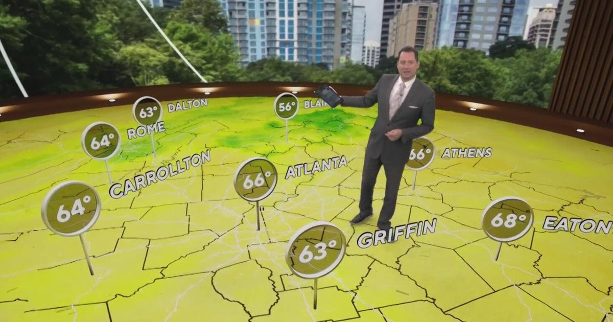 Temperatures warming up after chilly mornings across Georgia
CBS News Atlanta is a local news organization that is part of CBS News and Stations. Also referred to as WUPA and channel 69, CBS News Atlanta offers local breaking news, weather coverage and investigative reporting…
-
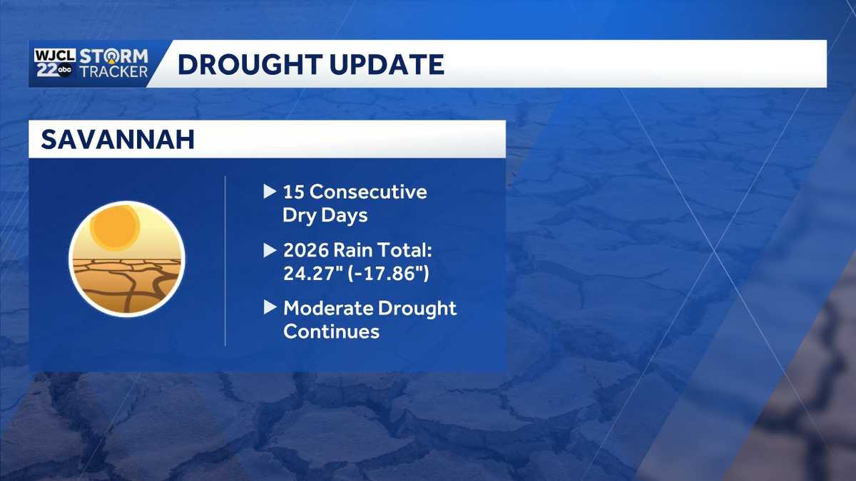 Rain chances on the horizon...the timing for Southeast Georgia, Lowcountry
A two plus week dry spell will continue for the next several days across Southeast Georgia and the Lowcountry. The next chance of showers is Saturday. The year to date rainfall deficit in Savannah is now at nearly 18"!…
-
 Hottest Mays in Georgia since 1895
Stacker compiled a ranking of the hottest Mays in Georgia since 1895 using data from the National Centers for Environmental Information. Rankings are based on the highest average temperature in each month. For each of…
-
 Winter weather preparedness checklist: Items to stock in your home, car
An ice storm warning and winter weather advisory are now in effect for north Georgia for this weekend’s winter storm. Significant ice accumulation is possible with the system. Combine the weight of the ice with gusty…
-
 What is black ice? How freezing rain, sleet and winter weather create dangerous road conditions
January 23, 2026 / 10:55 AM CST / CBS Texas A drop in temperatures can turn an ordinary commute into a dangerous one, as black ice, freezing rain and other winter weather hazards create slick, often invisible conditions…
-
 Minnesota weather warms to 67, then later rain and a chance of thunderstorms | Oct. 27, 2026
CBS News Minnesota is a local news organization that is part of CBS News and Stations. Also referred to as WCCO-TV and channel 4, CBS News Minnesota offers local breaking news, weather coverage and investigative…
-
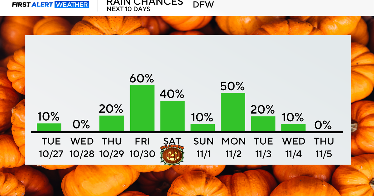 Rain chances return end of the week as temperatures remain in 70s, low 80s
Updated on: October 27, 2026 / 8:27 AM CDT / CBS Texas North Texans are waking up to mainly dry conditions Tuesday morning, with very isolated showers lingering across parts of the area. Expect a mix of clouds and sun…
-
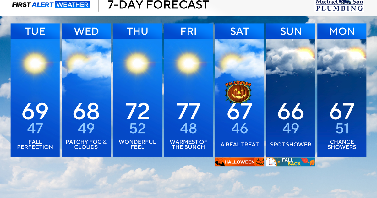 Beautiful weather continues right into Halloween for Maryland
Updated on: October 27, 2026 / 8:34 AM EDT / CBS Baltimore Several more days of sunshine, dry, and comfortable weather are in the forecast. Looking ahead, a pattern change brings our next chance of needed rain heading…
-
 How much snow are you getting this weekend? See how many inches you're forecast to get in the winter storm.
Updated on: January 24, 2026 / 8:47 AM EST / CBS News As much of the United States prepares for a winter storm that is forecast to dump well above 12 inches of snow in some places this weekend, many are wondering: How…
-
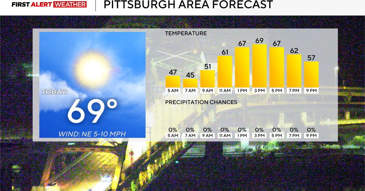 Rain chances could return to the Pittsburgh-area forecast early next week
October 27, 2026 / 7:54 AM EDT / CBS Pittsburgh Rain chances could return to the forecast for the Pittsburgh area next week. Any alert days ahead? Nope. Aware: Yesterday was the tenth day in a row with no measurable…
Air quality
Air quality is satisfactory, and air pollution poses little or no risk.
Athens-Clarke County, GA reporting area · 1 hr ago. Data from AirNow (EPA and its state, local and tribal partners); preliminary and subject to change.
Sun & moon
Almanac
MonthlyAthens Area, records since 1893. Normals 1991–2020. Data from NOAA's Regional Climate Centers (ACIS).
Nearby
- Athens 4 km
- Gainesville 51 km
- Lawrenceville 53 km
- Sugar Hill 59 km
- Snellville 58 km
- Winder 29 km
- Buford 57 km
- Monroe 35 km
- Loganville 48 km
- Jefferson 21 km
- Braselton 35 km
- Auburn 39 km
Forecasters' discussion
From the National Weather Service office in FFC, issued 7 hrs ago
Key Messages
- Rain-free conditions will remain through the end of the work week.
- Near-seasonal temperatures expected with a slight warm up by the end of the week.
- Precipitation chances begin to increase as we get into the weekend.
Short Term
(Today through Wednesday) Issued at 315 AM EDT Tue Oct 27 2026
For today expecting mostly clear skies again with the influence of high pressure still solidly in place. Tomorrow a shortwave pushes into southern TN, N AL, and NW GA which will allow for clouds to filter into the area as early as Wednesday morning. Should remain over northern Georgia with mostly clear skies over the remainder of the area. Despite the shortwave, the dry airmass in place will keep the area free from rain chances, as is expected through much of the week. Winds will remain out of the northeast through the next two days with speeds at 5-8mph throughout the next two days. Temperatures are unfortunately beginning to rise with high temperatures today in the mid to upper 70s across the area which is 5-7 degrees above normal. High temps tomorrow will be closer to the low to mid 70s across the area with the influence of cloud cover. Lows will continue to be in the upper 40s to low 50s. With the dry airmass in place, will be keeping an eye on RH values in central Georgia although they currently remain above critical thresholds.
Long Term
(Wednesday night through Monday) Issued at 315 AM EDT Tue Oct 27 2026
The long term discussion remains mostly the same with little to talk about on the front end other than some lovely Fall weather until we get to Halloween, where rain chances will start to increase a bit. There does seem to be some increasing probabilities that everyone will see some rain that is more than just a few sprinkles with the weekend system.
Going into Wednesday night, surface high pressure over the Northeast will move off the east coast into the Atlantic. Temps will warm a bit, into the mid to upper 70s for highs on Thursday, but high pressure will continue to keep us dry. A very quick moving clipper- like system will move across the Great Lakes and Northeast on Thursday, squeezing our current airmass between dry, cold air to the north and the more subtropical air well to our south. This air mass will modify, warming a bit more through mixing process on Friday and bringing temperatures at or above 10 degrees above normal in some locations across north and central Georgia. Increasing cloud cover into Friday night will mean temperatures only get down into the mid to upper 50s, compared to the widespread 40s we've been experiencing.
Some uncertainty still remains around timing for rainfall moving into Saturday and Sunday. Strong upper level system will move out of the Northeast, driving another surface high along the Appalachians that should bring another wedge/CAD event into the CWA. Machine Learning guidance definitely leans into a pretty decent wedge, perhaps showing some needed bias correction for the current models. Either way, rain chances start to show up between 18Z and 00Z, picking up even more overnight into Sunday. The GFS ensemble seems a bit of an outlier in terms of a faster timing for the rain, but we shall see. Still worth preparing for some potential showers during trick-or-treat, especially in parts of western Georgia. Once rain does move through into Sunday, probabilities of greater than 0.1" are starting to move up, showing widespread 70+% across Georgia. Current forecast would bring a quarter to half an inch of rain to some areas by the time the system moves out Sunday evening.
Aviation
(12Z TAFS) Issued at 653 AM EDT Tue Oct 27 2026
VFR conditions through the period with sct to bkn high level clouds at 25k feet through morning before clearing out. NE winds continue at 4-7kts.
//ATL Confidence...12Z Update... High confidence on all elements.Hernandez
Forecasts, observations and alerts in the United States come from the National Weather Service (NOAA); radar from NOAA's Multi-Radar Multi-Sensor system; satellite imagery from NASA's Global Imagery Browse Services (GIBS) and NOAA's GOES satellites; the map from the U.S. Geological Survey's National Map; air quality from AirNow (EPA and its partners); hurricane information from the National Hurricane Center; climate normals and records from NOAA's Regional Climate Centers (ACIS). Forecasts outside the United States and the UV index: MET Norway (CC BY 4.0); observations outside the U.S.: airport reports via NOAA's Aviation Weather Center. Place names: GeoNames (CC BY 4.0). Data are copied on a schedule and may lag the sources; for warnings that affect your safety, follow your local National Weather Service office and emergency officials. Weather news is drawn from the 4Search index and reflects what the press published. Terms of use. How to use Weather