Install
South Daytona, FL Weather
Current conditions
Observed at Daytona Beach International Airport · 45 min ago
Forecast
10-day-
Sunday Night
Showers and thunderstorms likely. Partly cloudy, with a low around 75. Northeast wind 25 to 30 mph. Chance of precipitation is 70%. New rainfall amounts between a quarter and half of an inch possible.
-
Monday
A chance of rain showers. Mostly sunny, with a high near 79. Northeast wind 25 to 30 mph. Chance of precipitation is 50%.
-
Monday Night
A chance of rain showers before 2am. Partly cloudy, with a low around 75. Northeast wind around 25 mph, with gusts as high as 35 mph. Chance of precipitation is 50%.
National Weather Service forecast updated 1 day ago.
Hourly
Hourly forecast- Now76°71%
- 8 PM76°42%
- 9 PM76°49%
- 10 PM76°57%
- 11 PM76°58%
- Mon12 AM77°68%
- 1 AM77°62%
- 2 AM76°45%
- 3 AM76°31%
- 4 AM76°36%
- 5 AM76°34%
- 6 AM75°29%
- 7 AM76°39%
- 8 AM75°51%
- 9 AM76°51%
- 10 AM76°51%
- 11 AM77°51%
- 12 PM77°51%
- 1 PM77°51%
- 2 PM77°46%
- 3 PM77°46%
- 4 PM77°46%
- 5 PM77°46%
- 6 PM77°46%
10-day forecast
Details- TonightOct 24Showers And Thunderstorms Likely74%74°
- TodayOct 25Showers And Thunderstorms Likely72%75°79°
- MonOct 26Chance Rain Showers51%75°79°
- TueOct 27Sunny11%75°79°
- WedOct 28Mostly Sunny then Chance Showers And Thunderstorms31%75°79°
- ThuOct 29Chance Rain Showers36%74°79°
- FriOct 30Chance Rain Showers25%74°78°
- SatOct 31Chance Rain Showers25%78°
- SunNov 1Showers0.16 in73°80°
- MonNov 2Sunny72°79°
Days after the National Weather Service's seven are MET Norway's outlook, a computer model with no forecaster's review.
Radar
Full mapWeather news in Florida
More weather news-
 Moving showers, rain chances to continue in Central Florida
A development of onshore moving showers will continue through Sunday, with rain chances ranging between 30% to 70%, according to the National Weather Service of Melbourne. Forecasters reported a possibility of rainfall…
-
 FIRST ALERT | In for another perfect Florida Fall Day, but watch for these risks
WJHG FIRST ALERT | In for another perfect Florida Fall Day, but watch for these risks PANAMA CITY, Fla. (WJHG/WECP) - Low humidity and gusty winds still pose a fire risk continued throughout the weekend. Small Craft…
-
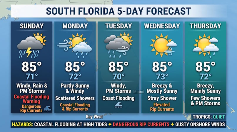 Windy Conditions, Coastal Flooding, and Passing Storms Target South Florida Through Midweek
Donna Thomas has studied hurricanes for two decades. She holds a PhD in history when her experience with Hurricane Andrew ultimately led her to earn a degree in broadcast meteorology from Mississippi State University…
-
 Buckle Up, Southwest Florida! Windy Days Ahead Before Spotty Storms Return
Southwest Florida is heading into a windy stretch to start the week, with gusts potentially topping 35 mph Sunday and Monday. Temperatures will remain near normal, while a few showers are possible Sunday before…
-
 First Alert Weather Forecast: King Tides and NE Winds Bring Coastal Flood Warnings to Florida East Coast Beaches and St. Johns River Basin
GAINESVILLE, Fla. (WCJB) - A strong pressure gradient is bringing gale conditions to the east coast and gusty winds on Sunday to NCFL. The pressure gradient is increasing between an area of high pressure over the…
-
 Talking the Tropics w/Mike: Low pressure to form east of Florida next week
104.5 WOKV The Atlantic hurricane season is June 1st through Nov. 30th. The peak of the season is September 10th. Strong wind shear has dominated much of the Atlantic Basin - especially south of about 20 degrees N. This…
-
 Low-pressure center brings strong winds and rain to central Florida
The wind today could gust to more than 30 mph across central Florida and up to 45 mph along the coast. These numbers will only increase on Sunday and Monday, when Orlando could have winds around 45 mph, and we could see…
-
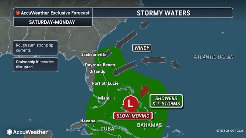 Rough Seas and Tropical Threats Loom Over Florida’s Atlantic Coast
Florida’s East Coast is already dealing with coastal flooding, gusty winds and dangerous surf, and a new area of potential tropical development could prolong or worsen those conditions early next week. Higher tides…
- Rain, strong winds and high surf ahead for Central Florida this weekend
ORLANDO, Fla. — Central Florida’s quiet weather will give way to increasing rain chances and gusty winds this weekend, with hazardous conditions developing along the coast. A trough of low pressure is expected to…
- A trough of low pressure will bring rain and wind to Central Florida
CENTRAL FLA. — After a quiet Friday, we are tracking Weather On the Way for the weekend. A trough of low pressure will develop over the Bahamas, increasing rain chances and wind over Central Florida. Tonight will be…
Air quality
Air quality is satisfactory, and air pollution poses little or no risk.
Forecast
- SunGood
- MonGood
- TueGood
Daytona Beach, FL reporting area · 1 hr ago. Data from AirNow (EPA and its state, local and tribal partners); preliminary and subject to change.
Sun & moon
Nearby
- Deltona 39 km
- Palm Coast 51 km
- Daytona Beach 5 km
- Port Orange 3 km
- Sanford 48 km
- Ormond Beach 14 km
- Oviedo 59 km
- Winter Springs 60 km
- DeLand 33 km
- New Smyrna Beach 17 km
- Edgewater 22 km
- DeBary 43 km
Forecasters' discussion
From the National Weather Service office in MLB, issued 4 hrs ago
Key Messages
Issued at 258 PM EDT Sun Oct 25 2026
- A prolonged period of hazardous to dangerous beach and boating conditions are forecast across east central Florida through at least the middle of this week. Heading to the beach and entering the ocean is not advised!
- Rough, dangerous surf, minor to moderate coastal flooding, moderate to major beach erosion, a high risk of rip currents, and Gale conditions are forecast over the next several days.
- Scattered onshore-moving showers are forecast over the next several days, with the highest rain chances focused along the coast.
Discussion
Issued at 258 PM EDT Sun Oct 25 2026
Current-Tuesday... Surface high pressure remains in place over the eastern U.S. early this week, gradually broadening on Tuesday. A tight pressure gradient is maintained locally across east central Florida as low pressure develops along a stalled frontal boundary near the Bahamas and across the western Atlantic. Gusty northeast winds have continued today, with peak gusts observed around 25-30 mph across the interior and higher gusts observed along the coast. Models have indicated an additional surge of gusts late this afternoon or evening over the Atlantic waters and near the coast, and today's peak wind gusts may not be observed until late in the day. Therefore, have opted to extend the current Wind Advisory along the coast through tonight, ending at 8AM Monday, and cannot rule out additional extensions further through Monday. With elevated onshore winds forecast to persist the next several days, numerous coastal hazards will continue. Life threatening rip currents and rough surf are present at all local beaches, and a High Surf Advisory is in effect for large breaking waves 7-12 ft in the surf zone. Entering the water is not advised! Pounding surf and long period onshore swells will continue Moderate to Major beach erosion at times of high tide. Of note, this significant coastal event coincides with a period of astronomical high tides, and Minor to Moderate saltwater flooding is also forecast. During this morning's high tide cycle, the observation gauge at Trident Pier crested at 2.84 ft (MHHW Datum), reaching Moderate Flood Stage. Additional higher crests are expected during the Monday and Tuesday morning high tide cycles, and saltwater flooding will impact low-lying roads, lots, docks, and yards near the coast and intracoastal waterways. A Coastal Flood Warning remains in effect.
Shifting focus towards the precipitation forecast and trends, a pocket of higher moisture (PWAT ~ 1.7-1.9") across portions of the Treasure coast and near Lake Okeechobee fueled several rounds of onshore moving showers across the south early today. Highest rainfall totals from showers that occurred early this morning were generally observed around Fort Pierce (~2-2.5") and Port St. Lucie (~1.5"). While coverage further north has been more limited up to this point, an additional plume of moisture should increase coverage of onshore moving showers north of the Cape this afternoon and early this evening with some activity sneaking inland. More periodic rounds of isolated to scattered showers may continue overnight and on Monday, especially near the coast. A drier airmass will then work to reduce overall rain chances by Tuesday. Temperatures aloft (500mb) have warmed several degrees compared to yesterday, and poor lapse rates above 700mb will largely limit lightning potential.
Afternoon temperatures remain seasonal, mostly in the low 80s. Low temperatures in the mid to upper 60s across the far interior will remain warmer in the low 70s near and east of the Orlando Metro and Lake Okeechobee
Wednesday-Saturday... High pressure across the eastern U.S. becomes reinforced by a second area of high pressure moving near the Great Lakes mid week. Breezy and gusty onshore flow looks to persist each day through the back half of the week, and poor to hazardous coastal conditions should generally continue alongside a period of high astronomical tides. Models show differences in moisture through the extended period, but generally expect rounds of scattered onshore moving showers to return with the highest coverage along the coast and across inland areas south of the Cape. Near to slightly above seasonal temperatures are forecast with highs in the low to mid 80s.
Marine
Issued at 258 PM EDT Sun Oct 25 2026
Modified Previous... Dangerous boating conditions persist across the local Atlantic waters as the area remains wedged between strengthening high pressure to the north and a stalled boundary to the south. Northeast winds of 20 to 30 knots and gusts up to 35 knots are anticipated to continue through early this week, with Gale Warnings in effect. Gale Warnings will continue across all legs of the local waters through at least Monday before shifting focus across the Gulf Stream waters into Tuesday. Additional extensions in time may be needed. With these windy and gusty conditions across the waters, seas are forecast to continue building locally, ranging between 9 to 15 feet through early this week. Conditions across the local waters will be slow to improve, with hazardous to dangerous conditions anticipated to persist through much of the week.
Rain chances are forecast to remain medium to high (40-70%) through the forecast period across the local waters due to the persistent northeast winds and some moist air present. Chances for an isolated storm remains low (20% or less).
Aviation
(18Z TAFs) Issued at 134 PM EDT Sun Oct 25 2026
Breezy to windy conditions continue across the area, with N/NE winds around 15-20 knots and gusts up to 25-30 knots (higher at times, especially along the coast). Winds will decrease over the interior past sunset, but still remain breezy at times, especially into the evening. Along the coast, a fresh onshore breeze will largely persist, with winds again increasing to 15-20 knots and gusts 25-30 knots across the interior by late tomorrow morning and into the afternoon. Brief MVFR cigs will be possible at times, especially with passing isolated to scattered onshore moving showers that will also produce tempo IFR/MVFR visibilities, and brief gusts up to 35-40 knots.
Forecasts, observations and alerts in the United States come from the National Weather Service (NOAA); radar from NOAA's Multi-Radar Multi-Sensor system; satellite imagery from NASA's Global Imagery Browse Services (GIBS) and NOAA's GOES satellites; the map from the U.S. Geological Survey's National Map; air quality from AirNow (EPA and its partners); hurricane information from the National Hurricane Center; climate normals and records from NOAA's Regional Climate Centers (ACIS). Forecasts outside the United States and the UV index: MET Norway (CC BY 4.0); observations outside the U.S.: airport reports via NOAA's Aviation Weather Center. Place names: GeoNames (CC BY 4.0). Data are copied on a schedule and may lag the sources; for warnings that affect your safety, follow your local National Weather Service office and emergency officials. Weather news is drawn from the 4Search index and reflects what the press published. Terms of use. How to use Weather