Install
Willcox, AZ Weather
Current conditions
Forecast for this hour (no station report in the last two hours)
Forecast
10-day-
Today
A slight chance of showers and thunderstorms between 11am and 2pm, then a chance of showers and thunderstorms between 2pm and 5pm, then a slight chance of showers and thunderstorms. Mostly sunny. High near 81, with temperatures falling to around 77 in the afternoon. Southeast wind around 6 mph. Chance of precipitation is 30%.
-
Tonight
A slight chance of showers and thunderstorms before 8pm. Mostly cloudy, with a low around 59. East northeast wind around 3 mph. Chance of precipitation is 20%.
-
Wednesday
A chance of showers and thunderstorms between 11am and 2pm, then a chance of showers and thunderstorms between 2pm and 5pm, then a chance of showers and thunderstorms. Mostly cloudy. High near 82, with temperatures falling to around 76 in the afternoon. East southeast wind around 5 mph. Chance of precipitation is 50%.
National Weather Service forecast updated 12 hrs ago.
Hourly
Hourly forecast- Now80°30%
- 3 PM79°30%
- 4 PM78°30%
- 5 PM77°15%
- 6 PM72°15%
- 7 PM69°15%
- 8 PM68°
- 9 PM66°
- 10 PM65°
- 11 PM64°
- Wed12 AM64°
- 1 AM63°
- 2 AM62°
- 3 AM61°
- 4 AM60°
- 5 AM60°
- 6 AM59°
- 7 AM60°
- 8 AM64°
- 9 AM69°
- 10 AM73°
- 11 AM76°44%
- 12 PM78°44%
- 1 PM80°44%
Daily forecast
Details- TodayOct 20Slight Chance Showers And Thunderstorms30%59°81°
- WedOct 21Chance Showers And Thunderstorms61%60°82°
- ThuOct 22Showers And Thunderstorms89%56°78°
- FriOct 23Sunny51°75°
- SatOct 24Sunny51°71°
- SunOct 25Sunny53°72°
- MonOct 26Mostly Sunny52°71°
- TueOct 27Mostly sunny53°70°
- WedOct 28Partly cloudy52°71°
Days after the National Weather Service's seven are MET Norway's outlook, a computer model with no forecaster's review.
Radar
Full mapWeather news near Willcox
More weather news-
 Rain chances continue this week before cool down this weekend
TUCSON, Ariz. (KGUN) — Southern Arizona is in for an unsettled week, with daily chances for showers and thunderstorms and the best odds for rain areawide arriving Wednesday afternoon and lasting into Thursday…
-
 Southeastern Arizona urged to brace for powerful winds
Powerful winds are expected across southeastern Arizona beginning Thursday night, with gusts reaching up to 75 mph in some areas, the National Weather Service in Tucson says. A high wind warning will be in effect from…
-
 Strong storm system headed to Arizona — here's when it'll hit
AZ Family Strong storm system headed to Arizona — here's when it'll hit How much rain could Phoenix get? Here’s the latest forecast Heavy rain, strong storms across Phoenix area expected later this week Sunny, warm…
-
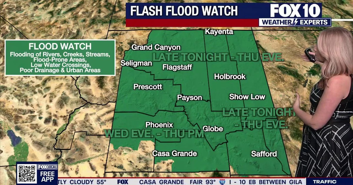 Arizona weather forecast: Heavy rain and severe storms approaching
The National Weather Service has issued flood watches across Arizona as heavy rain and severe storms are set to move into the region. PHOENIX - Plenty of change is expected over the next several days. What to Expect…
-
 Timing rain chances across Arizona this week
AZ Family Timing rain chances across Arizona this week Heavy rain, strong storms across Phoenix area expected later this week Sunny, warm conditions in Arizona followed by rain this week Rain in forecast over the next…
-
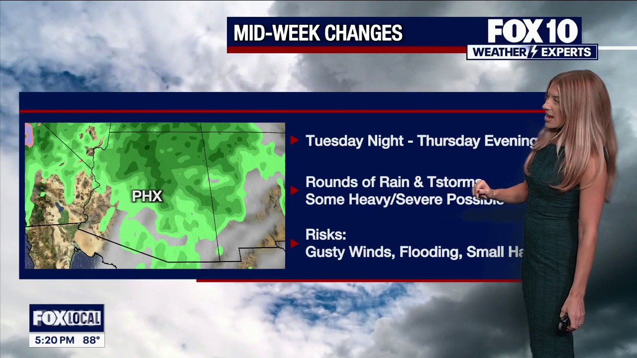 Rain is on the way to Arizona this week
FOX 10 Phoenix FOX 10's Erica Horvatin has the details on a storm that's headed our way this week. She has where it's expected to hit and when.
-
 Another storm system on the way to Arizona this week
ABC15 Arizona Another storm system on the way to Arizona this week
-
 Unsettled weather pattern keeps rain chances alive through Thursday across southern Arizona
KOLD Unsettled weather pattern keeps rain chances alive through Thursday across southern Arizona Tucson eyes active pattern with cooling temperatures ahead Wind Advisory until this afternoon, rain chances return…
-
 Fall system to bring heavy rain, strong storms to Arizona
PHOENIX (AZFamily) — A big weather change is ahead with a strong fall storm system headed toward the Desert Southwest. Wednesday and Thursday are First Alert Weather Days as several rounds of showers and thunderstorms…
-
 Unsettled weather pattern keeps rain chance alive through Thursday for southern Arizona
TUCSON, Ariz. (13 News) - Tonight: Partly cloudy, with a low around 65. East wind around 6 mph. Tuesday: A 20 percent chance of showers and thunderstorms after 11am. Mostly sunny, with a high near 89. East northeast…
Sun & moon
Almanac
MonthlyWillcox, records since 1903. Normals 1991–2020. Data from NOAA's Regional Climate Centers (ACIS).
Nearby
- Benson 54 km
- Swift Trail Junction 54 km
Forecasters' discussion
From the National Weather Service office in TWC, issued 11 hrs ago
Synopsis
Temperatures at or slightly above normal today through Thursday, then cooler than normal Friday into the upcoming weekend. An unsettled weather pattern will be around this week with daily chances of shower and thunderstorms with Wednesday afternoon through Thursday having the best chances area wide with localized heavy rainfall
Discussion
Infrared satellite imagery this morning showed clear to partly cloudy skies across the area. Water vapor imagery showed tail end of upper trof moving through the 4-corners with ridging pushing in from the southwest. Moisture remains in place across the area and with surface dewpoints in the upper 50s to lower 60s this afternoon, widely scattered showers and thunderstorms will develop mainly north and east of Tucson.
To our west is our next significant weather maker with satellite imagery showing the upper low about 450 miles west of San Francisco as of 230 am. This system will continue to move to S-SE over the next 48 hours and then move inland Wednesday night and become negatively tilted on Thursday while lifting to the E-NE. Southerly flow out ahead of this system will keep higher than normal moisture values across the region. On Wednesday there is an increased risk of severe thunderstorms, especially north of Tucson where SPC has this area painted in slight risk. Heavy rain is the other risk, especially northeast of Tucson where WPC Excessive Rainfall Outlook has this area painted as slight risk for flash flooding.
Thursday looks like it will be the more impactful day as the upper trof becomes negatively tilted. Heavy rain and flash flooding threat continues, especially Pinal, Graham and Greenlee counties while the severe threat is minimized a bit due to cloud cover. WPC Excessive Rainfall outlook has areas NE of Tucson painted in slight risk, while on the severe side, most of the area has a marginal risk with this possibly being upgraded over the next 48 hours.
The heaviest rainfall is expected to occur across Pinal, Graham and Greenlee counties where 48 hour NBM probabilities, ending Thursday night, off greater than 1.50" being 25-85% chance and greater than 2" being 20-60% chance. With that said and in coordination with WFOs Phoenix and Flagstaff, a Flood Watch was issued Pinal, Graham and Greenlee counties has various time frames but mainly from late Wednesday morning until late Thursday night. Overall QPF for Wed/Thu range from less 0.10" far west areas to over 1" across Greenlee, Graham and eastern Pinal counties with higher totals in the mountains due to upsloping.
Drier air moves in for Friday, though some lingering showers possible near the NM border, which could linger into the weekend as well.
Temperatures through Thursday will be at or slightly above normal, then cooler than normal Friday into the upcoming weekend. Latest NBM has possible first freeze of the season at the highest elevations of the White Mountains.
Aviation
Valid thru 21/12Z. SCT-BKN 8k-10k ft AGL. ISOLD -SHRA/-TSRA mainly NE of KTUS from 20/19Z thru end of valid period. SFC winds ELY/SELY at 5-15 kts with gusty winds psbl near -TSRA. Aviation discussion not updated for TAF amendments.
Fire Weather
Temperatures at or slightly above normal through Thursday, then cooler than normal Friday into the upcoming weekend. Wind speeds mostly less than 15 mph this week except for Thursday with southwest winds around 15 to 20 mph. Minimum relative humidity remains above 25-40 percent through most of the week with most days seeing anywhere from a 20-80 percent chance of showers with embedded thunderstorms at times as an unsettled pattern continues.
Forecasts, observations and alerts in the United States come from the National Weather Service (NOAA); radar from NOAA's Multi-Radar Multi-Sensor system; satellite imagery from NASA's Global Imagery Browse Services (GIBS) and NOAA's GOES satellites; the map from the U.S. Geological Survey's National Map; air quality from AirNow (EPA and its partners); hurricane information from the National Hurricane Center; climate normals and records from NOAA's Regional Climate Centers (ACIS). Forecasts outside the United States and the UV index: MET Norway (CC BY 4.0); observations outside the U.S.: airport reports via NOAA's Aviation Weather Center. Place names: GeoNames (CC BY 4.0). Data are copied on a schedule and may lag the sources; for warnings that affect your safety, follow your local National Weather Service office and emergency officials. Weather news is drawn from the 4Search index and reflects what the press published. Terms of use.