Install
Monterey, CA 93940 Weather
Current conditions
Observed at Monterey Regional Airport · 20 min ago
Forecast
10-day-
Wednesday
A chance of rain showers between 7am and 11am, then showers and thunderstorms likely. Mostly cloudy. High near 65, with temperatures falling to around 63 in the afternoon. East wind around 5 mph. Chance of precipitation is 70%. New rainfall amounts between a quarter and half of an inch possible.
-
Wednesday Night
Showers and thunderstorms. Mostly cloudy, with a low around 53. East wind 0 to 5 mph. Chance of precipitation is 80%. New rainfall amounts between a quarter and half of an inch possible.
-
Thursday
Rain showers likely. Mostly cloudy, with a high near 63. Southwest wind 2 to 10 mph. Chance of precipitation is 70%. New rainfall amounts between a tenth and quarter of an inch possible.
National Weather Service forecast updated 5 hrs ago.
Hourly
Hourly forecast- Now54°27%
- 8 AM54°42%
- 9 AM57°29%
- 10 AM59°40%
- 11 AM62°55%
- 12 PM63°67%
- 1 PM64°69%
- 2 PM65°68%
- 3 PM65°54%
- 4 PM64°59%
- 5 PM63°71%
- 6 PM62°67%
- 7 PM60°74%
- 8 PM60°71%
- 9 PM59°65%
- 10 PM58°58%
- 11 PM58°61%
- Thu12 AM57°71%
- 1 AM56°71%
- 2 AM56°80%
- 3 AM55°79%
- 4 AM55°61%
- 5 AM54°54%
- 6 AM54°41%
10-day forecast
Details- TonightOct 20Mostly Cloudy10%53°
- TodayOct 21Showers And Thunderstorms Likely80%53°65°
- ThuOct 22Rain Showers Likely73%53°63°
- FriOct 23Mostly Sunny50°65°
- SatOct 24Sunny53°70°
- SunOct 25Mostly Sunny53°72°
- MonOct 26Mostly Sunny53°72°
- TueOct 27Mostly Sunny70°
- WedOct 28Cloudy60°81°
- ThuOct 29Partly cloudy58°74°
Days after the National Weather Service's seven are MET Norway's outlook, a computer model with no forecaster's review.
Radar
Full mapWeather news near Monterey
More weather news-
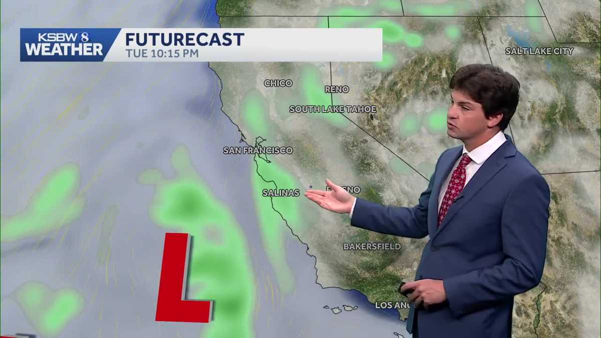 A cooler, wetter pattern takes hold across the Central Coast
A midweek storm brings light rain to the Central Coast and Bay Area, with a slight chance of thunderstorms near the Santa Lucia Range and southern Monterey County ... The cooldown continues Monday as a low-pressure…
-
 With the heat finished, Bay Area’s attention turns to rain
Only a handful of days ago, the Bay Area was enduring a last slice of heat, courtesy of the second heat wave in three weeks and one that took temperatures in downtown San Francisco into the mid-70s. Now, rain coats and…
-
 First rain of the season to arrive in Bay Area Tuesday night
SAN FRANCISCO (KRON) -- The first rain of the season is due to arrive in the Bay Area Tuesday night, according to the National Weather Service. The NWS is advising of rain showers continuing through Thursday morning…
-
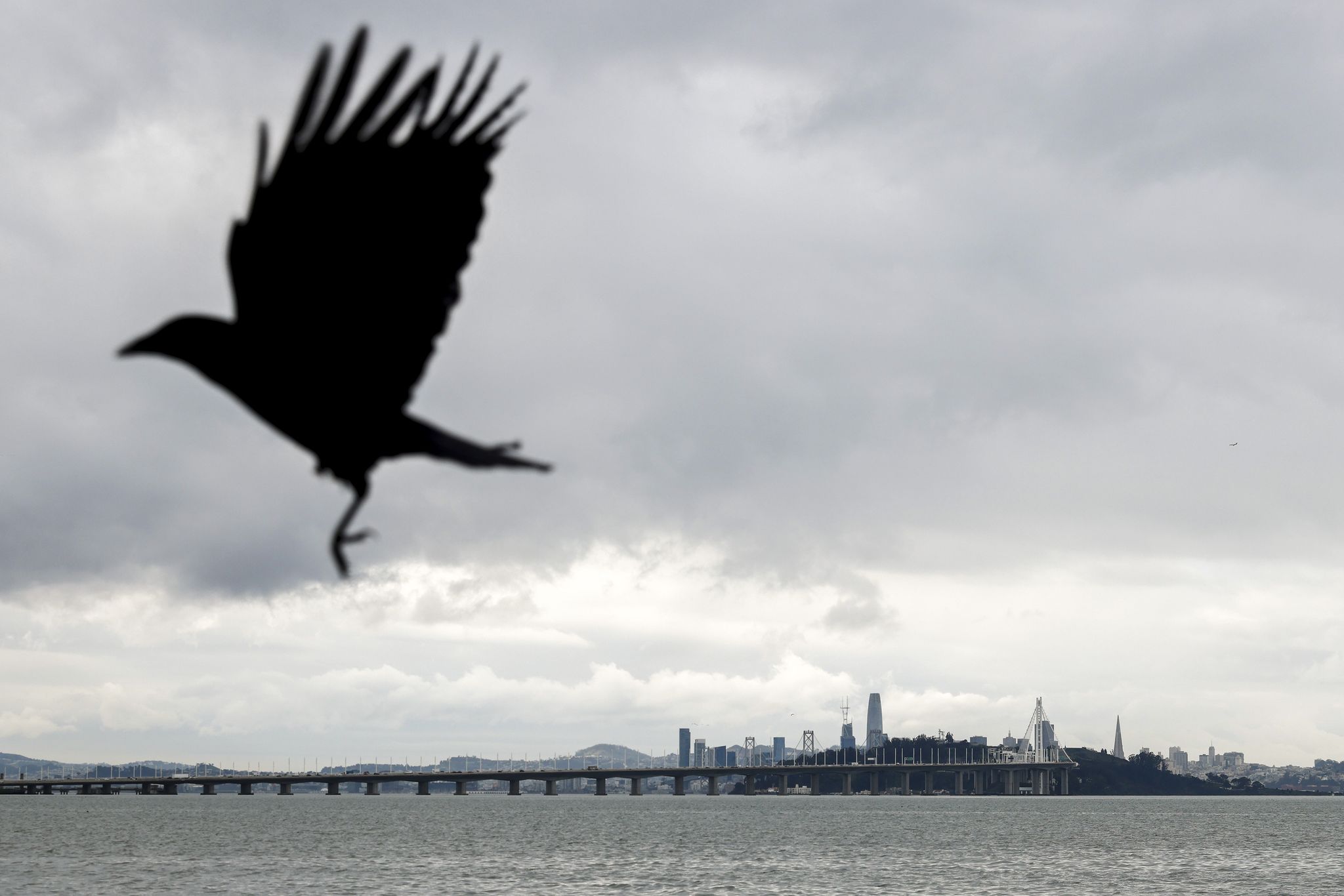 Bay Area weather: Rain showers expected midweek as fall-like temperatures return
Rain clouds loom over San Francisco as seen from the Emeryville waterfront last December. Rain and cooler temperatures are forecast this week after the recent heat and sunshine. Cooler temperatures and rain showers are…
-
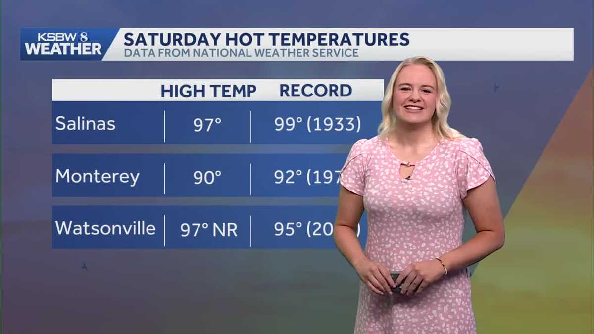 Near-record heat gives way to cooler weather and possible midweek rain
After near-record heat and a record-breaking day in Watsonville, cooler temperatures are on the way, with rain chances increasing by midweek and hazardous beach conditions continuing through Sunday evening. The Central…
- Beach hazards statement affecting Bay Area Shorelines until Sunday night
A beach hazards statement was issued by the NWS San Francisco CA on Saturday at 6:02 a.m. in effect until Sunday at 9 p.m. The statement is for Coastal North Bay Including Point Reyes National Seashore, San Francisco…
- Beach hazards statement issued for Bay Area Shorelines for Saturday and Sunday
At 9:31 a.m. on Friday, the NWS San Francisco CA issued a beach hazards statement valid from Saturday 3 a.m. until Sunday 9 p.m. The statement is for Coastal North Bay Including Point Reyes National Seashore, San…
-
 Recently chilly Bay Area about to get warm again
The Bay Area’s back-and-forth pendulum of hotter weather followed by a significant cooldown followed by more heat followed by more cool is about to swing back to the warmer end of the scale. But this heat-up might be…
-
 California's rainy season to arrive with flood threat, tornado risk and Sierra snow
California's wet season is starting off with a bang. The first significant storm of the season is forecast to bring heavy rain to vulnerable burn scars near Big Sur, coastal tornado risk to the Los Angeles area, and a…
-
 Storms descend on Southern California, raising risk of dangerous surf, flooding, debris flows
Rain is anticipated for Southern California on Wednesday into Thursday as the National Weather Service cautioned about potential beach hazards and thunderstorms from Oxnard to the Mexico border. The weather service's…
Air quality
Forecast
- WedGood (36)
- ThuGood
- FriGood
Marina and Seaside, CA reporting area. Data from AirNow (EPA and its state, local and tribal partners); preliminary and subject to change.
Sun & moon
Almanac
MonthlyMonterey, records since 1941. Normals 1991–2020. Data from NOAA's Regional Climate Centers (ACIS).
Nearby
- Salinas 20 km
- Santa Cruz 47 km
- Watsonville 38 km
- Gilroy 53 km
- Hollister 50 km
- Seaside 3 km
- Soledad 49 km
- Marina 12 km
- Prunedale 27 km
- Live Oak 46 km
- Pacific Grove 8 km
- Scotts Valley 55 km
Forecasters' discussion
From the National Weather Service office in MTR, issued 2 hrs ago
Key Messages
Updated at 801 PM PDT Tue Oct 20 2026
- Cooling trend continues through the end of the week
- Beneficial light rain showers expected Wednesday through Thursday
- Thunderstorms possible Wednesday afternoon into Thursday morning across Central Coast
- Warm and dry next weekend
Short Term
Issued at 1230 AM PDT Wed Oct 21 2026 (Today and tonight)
The center of the 500 mb cut-low is inching closer to the coast as the sub-tropical jet stream supports the left portion of the system, bringing enhanced momentum and moisture flux. This is where the most instability and lift can be found. As of 11:30 PM PDT, KMUX radar is picking up on a few cells offshore exhibiting a ~10-25% chance of lightning with a few lightning strikes observed along the occluded front (~250-300 miles SW from Monterey). The current offshore activity is foreshadowing what is to come early Wednesday morning.
The first few rain bands are expected to make their way over the Central Coast just before sunrise. Going into the afternoon, precipitation gets wrapped around the system's center and eventually spreads through the rest of the Bay Area. Precipitable water is expected to rise above the 90th percentile for this time of year, which prompted WPC to include the southern Central Coast in a marginal risk of excessive rainfall for Wednesday.
To further assess the potential for severe thunderstorms, three high- resolution model soundings were analyzed: the 3km NAM, 10km RDPS, and the RRFS. Keep in mind that the NAM tends to be the most pessimistic model out of the three in terms of moisture. Upon evaluation of the near-storm environment for each, there are a few inconsistencies across the models in terms of the severe thunderstorm threat and whether the environment is conducive to tornado spin-ups.
Before getting into what *is* consistent across the models, let's run through a quick overview of a couple notable stability indices: the Total-Totals and K index. The Total-Totals index measures atmospheric instability by taking the thermal difference between 850 to 500 mb to identify the potential for severe thunderstorms or tornadoes. The K index is used to assess atmospheric buoyancy by measuring the low to mid-level moisture as well as the 850-500 mb thermal difference. The greater the K index value, the greater the potential is for widespread thunderstorms (K > 20 = scattered thunderstorms, K > 35 = numerous thunderstorms). Similarly, higher Total-Totals (TT) index values indicate an enhanced potential for severe thunderstorms and/or tornadoes (TT > 48 = severe thunderstorms, TT > 50 = tornadoes).
Why am I talking about stability indices? Well, according to these indices and other environmental parameters, the three high-res model soundings that were analyzed all indicate a heightened risk for at least scattered, severe thunderstorms along the Big Sur coastline. The NAM estimates TT ~ 56 and a K index ~ 36, RDPS estimates TT ~ 54 and a K index ~ 30, and RRFS estimates TT ~ 50 and K index ~ 31.
Long Term
Issued at 1230 AM PDT Wed Oct 21 2026 (Thursday through Tuesday)
The rain and thunderstorm threat are gone by Friday. With the trough to our east, building high pressure brings warm and dry conditions into early next week. Euro and GFS ensemble members suggest warming to near seasonal averages meanwhile precipitable water values are forecast to dip below the 25th percentile. Monday onward, there is a great deal of uncertainty on when the weak ridge breaks down. An energetic Central Pacific plus the most recent 6-10 day Climate Prediction Center precipitation outlook suggests another trough coming our way with the potential for more rain.
Aviation
(12Z TAFS) Issued at 418 AM PDT Wed Oct 21 2026
Shower activity is picking up across the marine environment with increasing confidence in thunderstorm development along the Central Coast. Thunderstorm potential increases for MRY and SNS by late morning as the bulk of the convective activity moves onshore. Highest confidence in thunderstorms impacting MRY/SNS but if the HRRR is correct thunderstorm activity may move into the Bay Area by early this afternoon as the main line moves through. Moderate to at times heavy rain is likely with the first round of showers across the Central Coast starting around 17Z. It will spread slightly slower into the Bay Area (reaching it around ~20-03Z) with recent guidance slowing down the arrival of rain even further. Confidence remains low in the overall wind forecast given the close proximity of the low offshore. Winds will likely stay variable for much of today but we may see periods of stronger, erratic winds particularly if a thunderstorm is able to develop. Expect temporary reductions in visibility and ceiling heights as stronger showers move through. Showers may become more scattered overnight Wednesday into Thursday but the prevailing trend will be for showers to continue through the end of the TAF period.
Vicinity of SFO...Showers will reach SFO by late morning/early afternoon with temporary reductions in visibility and ceiling heights likely as stronger showers impact the airport. A low potential for thunderstorms continues through the day with confidence too low to include TS in TAF as of this moment. This may change as convective activity to our south gets within range of KMUX and we get a better idea of how robust thunderstorm activity will be today. If thunderstorms do reach SFO it would likely be between 18 to 00Z as the main convective region moves through. Confidence in wind directions remains low due to the close proximity of the low.
SFO Bridge Approach...Similar to SFO.
Monterey Bay Terminals...Increasing confidence in thunderstorms impacting MRY and SNS this morning/afternoon as showers move in. Thunderstorms will result in erratic winds and reductions in visibility/ceiling heights below what is currently in the TAF. The timing of rain arrival to MRY/SNS remains on track with guidance suggesting the arrival of rain/thunderstorms may be speeding up. The bulk of the convection is currently to the south of Point Piedras Blancas but will reach the Monterey Bay region within the next few hours. The heaviest showers are likely this morning but lighter, at times more scattered, showers will prevail through the end of the TAF period.
Forecasts, observations and alerts in the United States come from the National Weather Service (NOAA); radar from NOAA's Multi-Radar Multi-Sensor system; satellite imagery from NASA's Global Imagery Browse Services (GIBS) and NOAA's GOES satellites; the map from the U.S. Geological Survey's National Map; air quality from AirNow (EPA and its partners); hurricane information from the National Hurricane Center; climate normals and records from NOAA's Regional Climate Centers (ACIS). Forecasts outside the United States and the UV index: MET Norway (CC BY 4.0); observations outside the U.S.: airport reports via NOAA's Aviation Weather Center. Place names: GeoNames (CC BY 4.0). Data are copied on a schedule and may lag the sources; for warnings that affect your safety, follow your local National Weather Service office and emergency officials. Weather news is drawn from the 4Search index and reflects what the press published. Terms of use.