Install
King City, CA 93930 Weather
Current conditions
Forecast for this hour (no station report in the last two hours)
Forecast
10-day-
Today
A chance of rain showers before 11am, then showers and thunderstorms. Mostly cloudy. High near 65, with temperatures falling to around 61 in the afternoon. South wind around 10 mph, with gusts as high as 21 mph. Chance of precipitation is 80%. New rainfall amounts less than a tenth of an inch possible.
-
Tonight
A chance of showers and thunderstorms before 9pm, then a chance of rain showers and patchy fog. Mostly cloudy. Low around 48, with temperatures rising to around 50 overnight. North northwest wind 1 to 8 mph. Chance of precipitation is 40%. New rainfall amounts less than a tenth of an inch possible.
-
Friday
Patchy fog before 8am. Mostly sunny. High near 67, with temperatures falling to around 64 in the afternoon. Northwest wind 2 to 16 mph, with gusts as high as 29 mph.
National Weather Service forecast updated 5 hrs ago.
Hourly
Hourly forecast- Now64°73%
- 3 PM64°74%
- 4 PM63°76%
- 5 PM61°56%
- 6 PM58°44%
- 7 PM57°44%
- 8 PM57°31%
- 9 PM56°38%
- 10 PM56°31%
- 11 PM55°14%
- Fri12 AM55°
- 1 AM54°
- 2 AM53°
- 3 AM52°
- 4 AM51°
- 5 AM50°
- 6 AM50°
- 7 AM49°
- 8 AM50°
- 9 AM52°
- 10 AM55°
- 11 AM56°
- 12 PM59°
- 1 PM62°
Daily forecast
Details- TodayOct 22Showers And Thunderstorms76%48°65°
- FriOct 23Patchy Fog then Mostly Sunny45°67°
- SatOct 24Areas Of Fog then Sunny45°72°
- SunOct 25Areas Of Fog then Sunny46°77°
- MonOct 26Areas Of Fog then Mostly Sunny44°76°
- TueOct 27Areas Of Fog then Mostly Sunny45°74°
- WedOct 28Areas Of Fog then Mostly Sunny47°74°
- ThuOct 29Cloudy52°82°
- FriOct 30Mostly sunny52°79°
Days after the National Weather Service's seven are MET Norway's outlook, a computer model with no forecaster's review.
Radar
Full mapWeather news in California
More weather news-
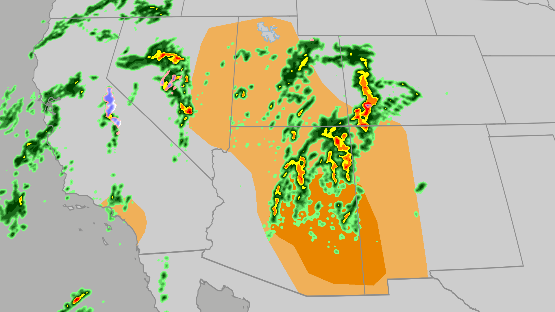 Severe weather, flood risk across Four Corners, California
The Weather Channel Tornadoes, flooding, large hail possible in Four Corners, California Parts of the Four Corners and Southern California face an elevated risk of severe weather on Thursday, which includes the…
-
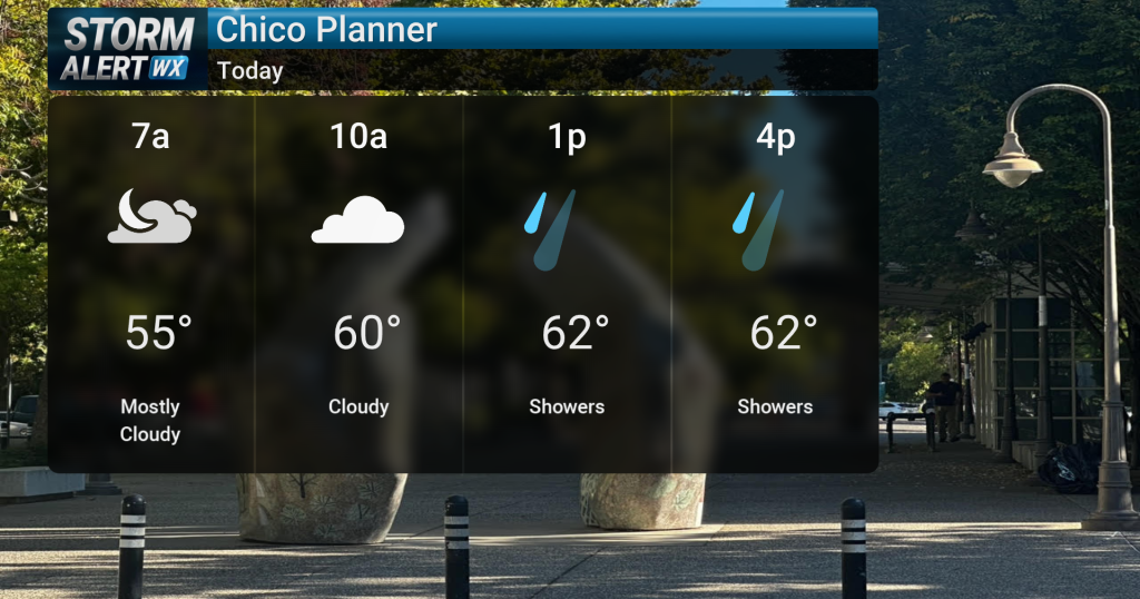 Showery conditions, possible thunderstorms impact Northern California today
Cloudy skies are expected across Northern California today, bringing periods of rain and a chance of thunderstorms later in the day. Highs will reach the mid-60s with winds from the south between 10 and 15 mph. Rain and…
- Air quality alert affecting Southern California Thursday
Sacramento Bee The creation of this content included the use of AI based on templates created, reviewed and edited by journalists in the newsroom. Read more on our AI policy here. On Thursday at 7:36 a.m. the NWS…
-
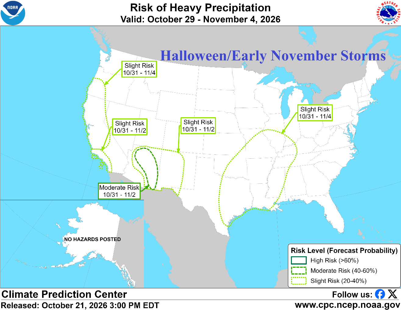 Prohibitive U.S. Storm Track; California/Southwest U.S. Primary Target
Early Season Advancing Snow Cover Climate Impact Company North America Medium Range Report Issued: Thursday October 22, 2026 Chart of the day: NOAA/CPC project prohibitive storm track for early November. Discussion…
-
 Ventura County sees steady rain as storm moves into Southern California
VENTURA, Calif. (KABC) -- Ventura County was among the first areas in Southern California to see rainfall Wednesday, with rain beginning around 8:30 a.m. The rain was visible along the northbound 101 Freeway in…
-
 New storm moves into Southern California: What to expect
A new storm is moving into Southern California Wednesday. Here is what to expect: Moderate rain is in the forecast from Wednesday late morning to Thursday afternoon, according to the National Weather Service. The…
- California and National Drought Summary for October 20, 2026, 10 Day Weather Outlook, and California Drought Statistics: 72% of State Abnormally Dry, A 0% Increase Week-Over-Week
The remaining abnormal dryness (D0) was removed from Southeast Alaska following substantial rainfall and improving moisture conditions. However, moderate drought (D1) persisted in the upper Tanana Valley of eastern…
- UPDATE: Weather alert for strong thunderstorms in Central California Thursday morning
An updated weather alert was issued by the NWS Los Angeles/Oxnard CA on Thursday at 7:22 a.m. for strong thunderstorms until 8 a.m. The alert is for Ventura County Beaches, Ventura County Inland Coast and Central…
- UPDATE: Wind advisory in place for Southern California until Thursday evening
On Thursday at 5:53 a.m. the NWS San Diego CA issued an updated wind advisory valid between 6 a.m. and 6 p.m. The advisory is for Riverside County Mountains, San Diego County Mountains, San Diego County Deserts and San…
-
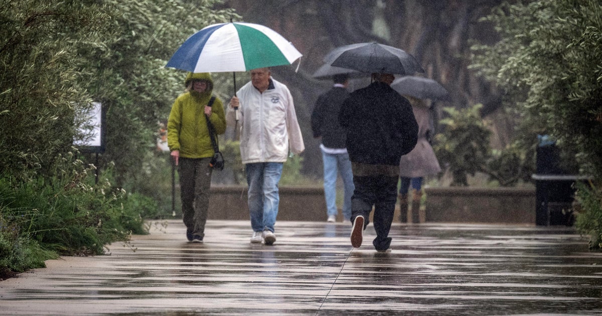 Widespread rain expected to drench parts of Southern California as storm moves into region
October 21, 2026 / 6:42 AM PDT / CBS LA A low-pressure system from the Pacific Northwest is moving south and it is expected to bring widespread rain to Southern California on Wednesday afternoon. The rain will continue…
Air quality
Air quality is satisfactory, and air pollution poses little or no risk.
Forecast
- ThuGood
- FriGood
- SatGood
King City, CA reporting area · 1 hr ago. Data from AirNow (EPA and its state, local and tribal partners); preliminary and subject to change.
Sun & moon
Almanac
MonthlyKing City, records since 1926. Normals 1991–2020. Data from NOAA's Regional Climate Centers (ACIS).
Nearby
- Soledad 30 km
- Greenfield 17 km
- Gonzales 44 km
- Lake Nacimiento 57 km
Forecasters' discussion
From the National Weather Service office in MTR, issued 9 hrs ago
Key Messages
Updated at 1202 AM PDT Thu Oct 22 2026
- Rain showers continue through this afternoon
- A warming and drying trend expected for the upcoming weekend into early next week
Short Term
Issued at 1202 AM PDT Thu Oct 22 2026 (Today and tonight)
Primary concern in the short term remains rainfall from the upper level low just offshore of the Central Coast into early this morning. The window for a chance of low-top supercells and the accompanying severe threat has closed with just light rain expected for spots that see any rainfall over the next 24hrs or so. The slow moving upper level system is still expected to produce anywhere from 0.10"-0.50" for most spots over the course of the day today, with coastal areas assisted by upslope flow to see the highest totals. The rainfall on the back side of the system should taper off entirely by sunset tonight and drier conditions filling in amid subsidence on the backside of the exiting wave.
Long Term
Issued at 1202 AM PDT Thu Oct 22 2026 (Friday through Wednesday)
PWATs begin to drop more considerably later in the day and evening Friday indicating further drying conditions and warmer temperatures for the weekend into the beginning of next week. However, temperatures for the weekend into the beginning of the work week will hover right around normal for this time of year, with no big warmup indicated under relatively low amplitude, progressive ridging through the middle of next week when troughing begins to develop well offshore.
Aviation
(12Z TAFS) Issued at 433 AM PDT Thu Oct 22 2026
VFR with temporary drops in visibility and ceiling heights likely as stronger showers move through the Bay Area and Central Coast. More persistent MVFR conditions are expected at LVK this morning where showers are more consistently training over the airport. Showers are likely to continue through late this afternoon with a low potential (10-15%) of thunderstorms this afternoon. This is a more widespread risk compared to yesterday so we will need to keep an eye on the radar/amend if needed this afternoon. Moderate onshore winds are likely this afternoon with winds decreasing tonight into tomorrow morning. Confidence is low on the cloud cover forecast for tonight/tomorrow morning. Current thinking is that MVFR CIGs will become more likely early tomorrow morning after showers end and mid-level clouds start to clear out.
Vicinity of SFO...VFR. Scattered showers will continue to impact SFO through this afternoon with a low potential for thunderstorms. Expect temporary reductions in visibility/ceiling heights and gusty winds if a stronger shower or thunderstorm moves over the airport. Shower activity decreases by late this evening and mid/upper level clouds will start to clear out. MVFR CIGs look likely to develop overnight but confidence is low to moderate in the current CIG forecast.
SFO Bridge Approach...Similar to SFO.
Monterey Bay Terminals...VFR. Showers return by mid to late morning and persist through the rest of the day. There is a low potential for thunderstorms this afternoon/evening which may reach MRY and SNS. Temporary reductions in visibility and ceiling heights are possible if a stronger shower moves over the airports. Shower activity prevails longer over the Central Coast than the Bay Area so have kept vicinity showers in through the overnight hours as guidance shows occasional showers continuing overnight.
Forecasts, observations and alerts in the United States come from the National Weather Service (NOAA); radar from NOAA's Multi-Radar Multi-Sensor system; satellite imagery from NASA's Global Imagery Browse Services (GIBS) and NOAA's GOES satellites; the map from the U.S. Geological Survey's National Map; air quality from AirNow (EPA and its partners); hurricane information from the National Hurricane Center; climate normals and records from NOAA's Regional Climate Centers (ACIS). Forecasts outside the United States and the UV index: MET Norway (CC BY 4.0); observations outside the U.S.: airport reports via NOAA's Aviation Weather Center. Place names: GeoNames (CC BY 4.0). Data are copied on a schedule and may lag the sources; for warnings that affect your safety, follow your local National Weather Service office and emergency officials. Weather news is drawn from the 4Search index and reflects what the press published. Terms of use.