Install
Albuquerque, NM 87121 Weather
Current conditions
Observed at Albuquerque, Double Eagle II Airport · 54 min ago
Forecast
10-day-
Friday
A chance of showers and thunderstorms. Partly sunny, with a high near 73. South wind 5 to 15 mph. Chance of precipitation is 30%.
-
Friday Night
A chance of showers and thunderstorms before 9pm, then showers and thunderstorms likely. Mostly cloudy, with a low around 52. South wind 5 to 15 mph. Chance of precipitation is 60%.
-
Saturday
A chance of showers and thunderstorms before noon, then a chance of showers and thunderstorms. Mostly cloudy, with a high near 67. Chance of precipitation is 50%.
National Weather Service forecast updated 1 day ago.
Hourly
Hourly forecast- Now56°18%
- 7 AM56°18%
- 8 AM57°18%
- 9 AM59°18%
- 10 AM62°18%
- 11 AM66°18%
- 12 PM69°26%
- 1 PM70°26%
- 2 PM71°26%
- 3 PM72°26%
- 4 PM71°26%
- 5 PM69°26%
- 6 PM68°48%
- 7 PM65°48%
- 8 PM62°48%
- 9 PM59°48%
- 10 PM58°48%
- 11 PM57°48%
- Sat12 AM56°58%
- 1 AM55°58%
- 2 AM54°58%
- 3 AM53°58%
- 4 AM53°58%
- 5 AM53°58%
10-day forecast
Details- TonightOct 21Mostly Cloudy56°
- ThuOct 22Partly Sunny then Chance Showers And Thunderstorms58%55°73°
- TodayOct 23Chance Showers And Thunderstorms58%52°73°
- SatOct 24Chance Showers And Thunderstorms63%48°67°
- SunOct 25Slight Chance Rain Showers24%45°66°
- MonOct 26Mostly Sunny44°66°
- TueOct 27Mostly Sunny45°66°
- WedOct 28Partly Sunny67°
- ThuOct 29Cloudy46°64°
- FriOct 30Showers0.19 in49°62°
Days after the National Weather Service's seven are MET Norway's outlook, a computer model with no forecaster's review.
Radar
Full mapWeather news near Albuquerque
More weather news-
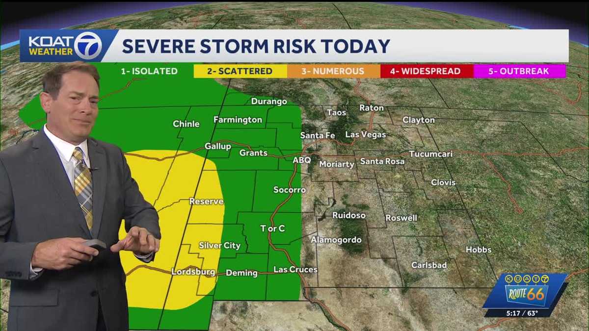 Flood Watches in effect for Western New Mexico, active Severe Thunderstorm Watch for Northeast Arizona
KOAT Flood Watches in effect for Western New Mexico, active Severe Thunderstorm Watch for Northeast Arizona Tropical moisture surge making a slow push eastward over next few days drenching the state, flood threat and…
-
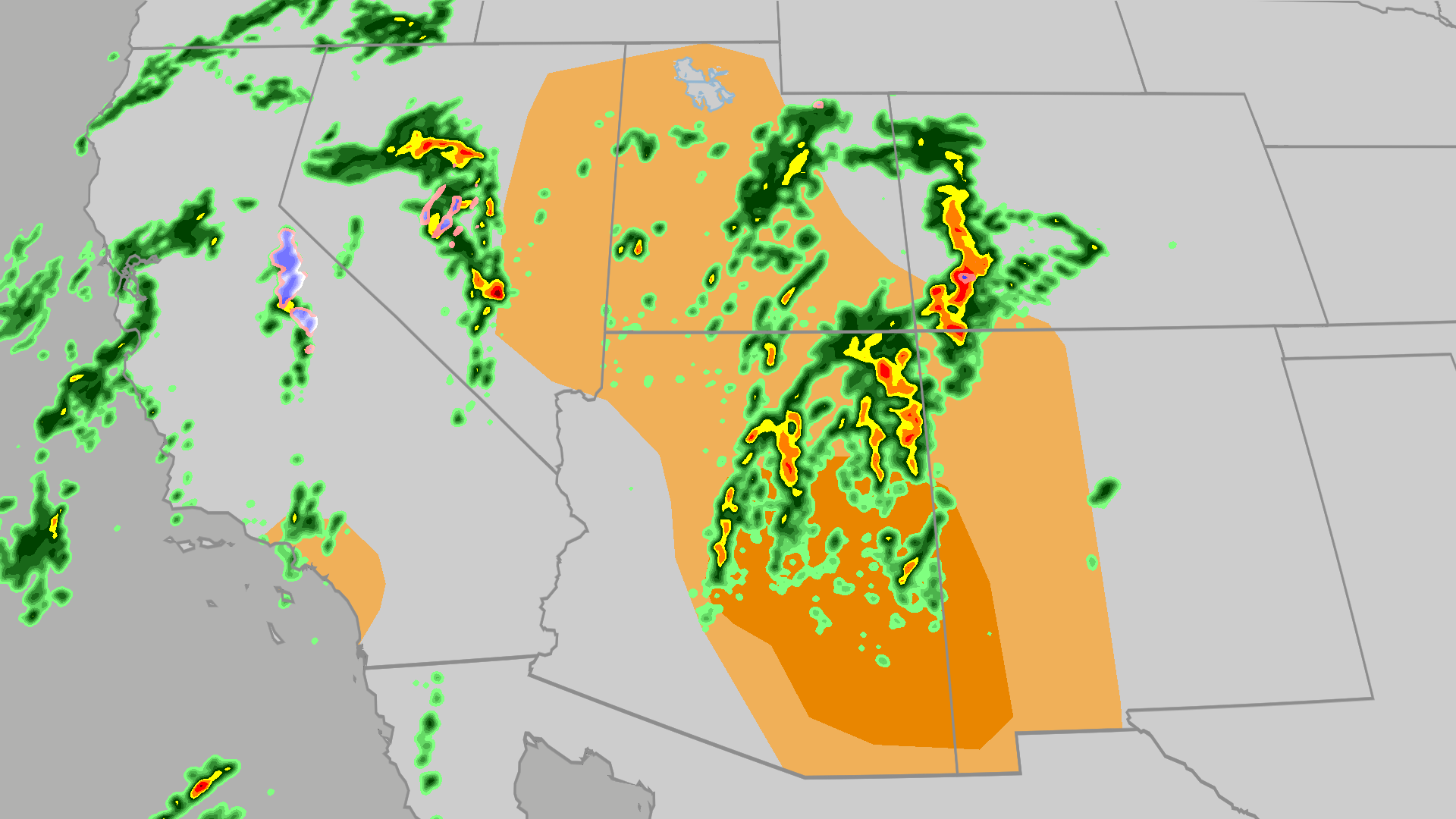 Severe weather, flood risk across Four Corners, California
The Weather Channel Tornadoes, flooding, large hail possible in Four Corners, California Parts of the Four Corners and Southern California face an elevated risk of severe weather on Thursday, which includes the…
-
 Heavy rain could bring flash flooding to New Mexico, southwest Colorado through Friday
KRQE A strong storm system will bring widespread rain to New Mexico and southwest Colorado starting Wednesday, with several inches of rain possible in some areas through Friday Heavy rainfall could lead to flash…
-
 Active weather pattern in New Mexico takes a slight lull Tuesday
ALBUQUERQUE, N.M. — An active stretch of weather in New Mexico continued Tuesday morning but the afternoon and evening will see it take a slight lull. The Albuquerque metro saw some rain overnight. However, drier air is…
-
 Rain, river rises expected in New Mexico this week
Star Ligon makes adjustments to bunches of ceramic red chile ristras while enjoying warm weather in the Rainbow Man’s historic courtyard Friday. The Rainbow Man keeps the courtyard open through good weather and…
-
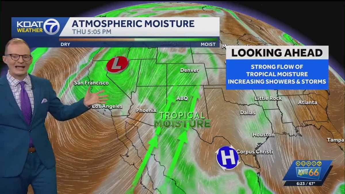 Tropical moisture, rain, & flooding threats
A solid flow of tropical moisture into New Mexico continues through the week brining increasing chances for scattered showers and thunderstorms along with a threat for flooding. Western New Mexico will be most favored…
-
 Monday evening forecast: Heavy rain coming later this week
ALBUQUERQUE, N.M. – Thursday currently looks like New Mexico’s main heavy rain day, with flash flood concerns increasing across the western half to western two-thirds of the state. Scattered showers and thunderstorms…
-
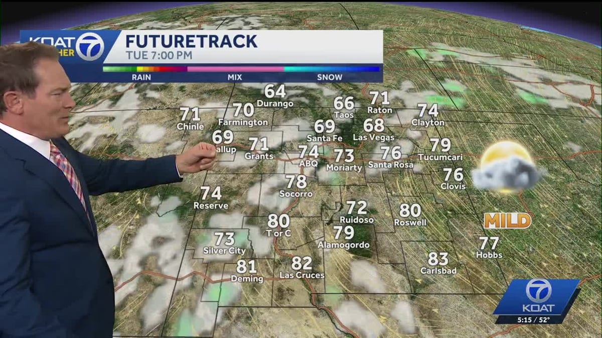 Milder Temps Today, But Slight Chance of Showers Returns
Albuquerque-area forecasters say temperatures will trend milder today, offering a bit of relief after recent conditions. A slight chance of showers is also in the forecast, so residents may want to keep an umbrella…
-
 'The signal is there': Returning rainfall heightens expectations for El Niño snowfall in the Southwest
For months now, meteorologists have been eyeing a potentially historic El Niño weather pattern brewing over the equatorial Pacific. But they’ve been cautiously hedging their bets about what that means for winter…
- These Are the States With the Best Weather Year-round
California and Hawaii are strong contenders for the best weather in the U.S. year-round. Coastal California offers comfortable temperatures with limited seasonal swings; Hawaii delivers consistent coastal warmth. But…
Air quality
Air quality is satisfactory, and air pollution poses little or no risk.
Forecast
- FriGood
- SatGood
Albuquerque, NM reporting area · 1 hr ago. Data from AirNow (EPA and its state, local and tribal partners); preliminary and subject to change.
Sun & moon
Nearby
- Rio Rancho 21 km
- Enchanted Hills 34 km
- South Valley 6 km
- Los Lunas 27 km
- North Valley 17 km
- Bernalillo 32 km
- Corrales 23 km
- Belen 43 km
- Los Ranchos de Albuquerque 15 km
- Lee Acres 13 km
- Los Chavez 36 km
- Placitas 40 km
Forecasters' discussion
From the National Weather Service office in ABQ, issued 13 hrs ago
Key Messages
Issued at 521 PM MDT Thu Oct 22 2026
- Flash flood risk continues in western New Mexico today, spreading eastward into central New Mexico tonight through Saturday. Heavy rainfall looks increasingly likely over eastern and portions of New Mexico this weekend with a risk of flash flooding.
- There will be a risk of severe storms producing large hail and damaging winds over western New Mexico today, then over central areas Friday.
- Rainfall over northwest New Mexico this week will create rises on tributaries as well as main stem rivers such as the San Juan and Animas. River flooding is possible.
Short Term
(This evening through Friday night) Issued at 1219 PM MDT Thu Oct 22 2026
The upper low is currently moving into SoCal, steering a slug of rich Pacific moisture into AZ and NM. The 18Z KABQ upper air sounding showed a PWAT of 1.08", which is another calendar day record and supportive of torrential rainfall rates given sufficient instability and forcing from the approaching upper low. The Flood Watch will remain as is for now, although following shifts will be evaluating A Flash Flood Watch for Ruidoso and portions of the eastern plains for Friday night through Saturday night. In addition to the flood threat, a notable severe/tornado threat will continue into this evening across western NM and then shift east and focus across central NM Friday. A Tornado Watch is in effect for far western NM through 9PM MDT this evening, where there is sufficient low level shear in concert with 0-6km bulk shear of 40-50kts and muCAPE of 1000-1500J/kg. Although large hail and damaging wind probabilities are higher, tornadoes can not be ruled-out. Instability and shear trend up in central NM on Friday relative to today and the SPC has upgraded the marginal risk to a slight risk for severe storms on the day 2 convective outlook, which includes the Albuquerque and Santa Fe Metros. The higher probabilities for severe storms will be further south over Socorro County on Friday, where muCAPE values are forecast to reach 2000J/kg. A jet maxima diving down the backside of the mean upper trough will bring a 2nd upper low, forecast to close off and progress southeast across SoCal and into southwest AZ Friday night. This forecast evolution should bring sufficient widespread forcing back to keep convection going through Friday night, with a focus across central and eastern NM, although modeled instability is unimpressive.
Long Term
(Saturday through Wednesday) Issued at 1219 PM MDT Thu Oct 22 2026
The forecast for this weekend is trending even wetter across central and eastern NM due to the slow southerly track of the 2nd upper low across AZ, eventually lifting northeast toward the Four Corners late Sunday. The latest NAM is notably slower to lift the upper low out of south central AZ, so unlike the GFS it allows a backdoor front to slide into northeast NM late Saturday, which helps to force more precipitation across north central and northeast areas through Sunday. Both PWATs and instability trend down over the weekend relative to today/Friday, and so should the flood threat. However, we still may need a watch for the Ruidoso area for Sat/Sun due to burn scar sensitivity and possibly the eastern plains due to the potential for training storms and interaction with a potential backdoor cold front. Daytime temperatures will trend down over the weekend and be below average areawide by Sunday. The upper low is forecast to eject east out of the southern Rockies on Monday, bringing some drying to much of the area. However, sufficient PWATs and low level moisture convergence will remain across the eastern plains for a few more showers and storms. Some warming/drying is forecast early to mid next week behind the departing upper low, but there is some model spread of note. The subtropical jetstream is forecast to get active over the region by late week, bringing back moisture and chances for showers and storms.
Aviation
(00Z TAFS) Issued at 521 PM MDT Thu Oct 22 2026
Widespread impacts to the airspace are ongoing over central and western NM with heavy storms, frequent lightning, hail, strong winds, and torrential rainfall. Lcl IFR/MVFR cigs and vsbys are likely in the heaviest storm cells. This large area of storms will move east into the RGV thru tonight while dissipating to more showery type precip. Low cigs will continue overnight in many areas of northern and western NM as precip tapers off. Another round of widespread SHRA/TS will develop Friday after 11AM but focused more within central and eastern NM. Activity will be strong again with more severe storms and heavy rainfall likely.
Forecasts, observations and alerts in the United States come from the National Weather Service (NOAA); radar from NOAA's Multi-Radar Multi-Sensor system; satellite imagery from NASA's Global Imagery Browse Services (GIBS) and NOAA's GOES satellites; the map from the U.S. Geological Survey's National Map; air quality from AirNow (EPA and its partners); hurricane information from the National Hurricane Center; climate normals and records from NOAA's Regional Climate Centers (ACIS). Forecasts outside the United States and the UV index: MET Norway (CC BY 4.0); observations outside the U.S.: airport reports via NOAA's Aviation Weather Center. Place names: GeoNames (CC BY 4.0). Data are copied on a schedule and may lag the sources; for warnings that affect your safety, follow your local National Weather Service office and emergency officials. Weather news is drawn from the 4Search index and reflects what the press published. Terms of use.