Install
Price, UT 84501 Weather
Current conditions
Observed at Price - Carbon County Regional Airport · 33 min ago
Forecast
10-day-
Overnight
Showers and thunderstorms. Mostly cloudy. Low around 44, with temperatures rising to around 46 overnight. Southeast wind around 13 mph. Chance of precipitation is 100%. New rainfall amounts between a tenth and quarter of an inch possible.
-
Friday
Mostly sunny, with a high near 54. Southeast wind around 7 mph.
-
Friday Night
Partly cloudy. Low around 36, with temperatures rising to around 38 overnight. Northwest wind 3 to 8 mph.
National Weather Service forecast updated 3 hrs ago.
Hourly
Hourly forecast- Now50°49%
- 4 AM48°49%
- 5 AM46°49%
- 6 AM46°10%
- 7 AM44°10%
- 8 AM44°10%
- 9 AM45°
- 10 AM47°
- 11 AM49°
- 12 PM50°
- 1 PM51°
- 2 PM53°
- 3 PM53°11%
- 4 PM54°11%
- 5 PM53°11%
- 6 PM52°
- 7 PM49°
- 8 PM45°
- 9 PM44°
- 10 PM43°
- 11 PM43°
- Sat12 AM43°
- 1 AM41°
- 2 AM41°
10-day forecast
Details- TonightOct 22Showers And Thunderstorms95%44°
- TodayOct 23Mostly Sunny11%36°54°
- SatOct 24Mostly Sunny66%41°56°
- SunOct 25Scattered Rain Showers51%39°53°
- MonOct 26Mostly Sunny39°54°
- TueOct 27Mostly Sunny37°54°
- WedOct 28Mostly Sunny37°53°
- ThuOct 29Partly Sunny53°
- FriOct 30Mostly sunny32°54°
- SatOct 31Cloudy36°55°
Days after the National Weather Service's seven are MET Norway's outlook, a computer model with no forecaster's review.
Radar
Full mapWeather news near Price
More weather news-
 Heavy rain lashes Chennai, schools shut in 4 districts
The Times of India CHENNAI: Heavy rain lashed Chennai and neighbouring districts overnight, prompting authorities to declare a holiday for schools in Chennai, Tiruvallur, Kancheepuram and Chengalpattu on…
-
 Near-average temperatures this week
KSAT Near-average temperatures this week Any rain chance is going to hold off until next week. Father who died in ICE detention was a lawful resident Frost Bank Center adds color-coded parking, new dining options for…
-
 First Alert Weather: Dry and pleasant conditions persist
Dillon Gaudet has your First Alert Weather forecast from Joan C. Edwards Stadium on this Tuesday morning. HUNTINGTON, W.Va. (WSAZ) - Dillon Gaudet has your First Alert Weather forecast from Joan C. Edwards Stadium on…
-
 Storm Austen set to batter Sussex coast this week
A storm set to batter parts of the Sussex coast later this week has been named. Storm Austen is forecast to bring gusts of 50-60mph to southern areas of the UK at the end of the week, with 70mph possible along exposed…
-
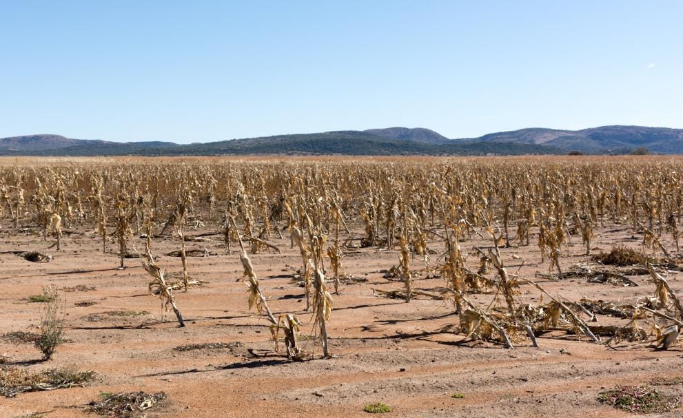 SA Weather Service tells us once more that we have a challenge ahead
We have been saying for some time that the 2026-27 season will be challenging for agriculture in South Africa and the Southern Africa region because of the expected drought. A note that just came into my email from the…
-
 Temperate, wet winter expected for Northwest Oklahoma
People fish at Meadowlake Park on a warm autumn day on Monday, Oct. 19, 2026. ENID, Okla. — Summer has been over for about a month now, and what a summer it was. There were several series of 100-degree temperatures, and…
- Chennai Rains to Intensify from Evening as Northeast Monsoon Picks Up - Tamil Nadu Weatherman
LiveChennai Chennai Rains to Intensify from Evening as Northeast Monsoon Picks Up - Tamil Nadu Weatherman The Northeast Monsoon is becoming more active over Chennai and its surrounding areas, bringing a rainy welcome…
-
 Light rain likely in Indore for 3 days, 14 districts on alert
Indore may see light, isolated rain for 3 days; IMD issues alert for 14 western MP districts with 30–40 kmph winds, thunderstorms and lightning. Indore: Sudden brief rain was witnessed in parts of Indore and nearby…
- First Alert Forecast: Pleasant days and nights ahead
No more frosty nights for at least the next week! FORT WAYNE, Ind. (WPTA) - I call the weather pattern we’ve been in since the weekend “expensive,” because it’s about as perfect as it gets all year long, and if it had a…
- Chicago, IL Tonight: Coldest Air Arrives Before Tuesday Oct 20
Chicago, IL – Residents heading outdoors late Monday night and early Tuesday morning should prepare for a chilly start as temperatures across the Chicago area drop into the low to mid-40s overnight, despite an unusually…
Air quality
Air quality is satisfactory, and air pollution poses little or no risk.
Forecast
- FriGood
- SatGood
Price, UT reporting area · 1 hr ago. Data from AirNow (EPA and its state, local and tribal partners); preliminary and subject to change.
Sun & moon
Almanac
MonthlyScofield Dam, records since 1948. Normals 1991–2020. Data from NOAA's Regional Climate Centers (ACIS).
Nearby
- Mount Pleasant 56 km
- Helper 10 km
- Huntington 33 km
Forecasters' discussion
From the National Weather Service office in SLC, issued 4 hrs ago
Key Messages
- Heavy rain has mostly ended over southern Utah, but Areal Flood Warnings remain in effect for areas that continue to have elevated flows.
- Precipitation will continue to become increasingly focused over northern portions of the area tonight into Friday morning. This will bring accumulating snow to the higher terrain, with accumulations of 1 to 4 inches likely above 9000 feet. There is a chance of locally higher amounts for favored locations.
- Cool and somewhat unsettled conditions will continue this weekend, with the best chance of precipitation over southern Utah. A more active pattern is expected to persist into the upcoming week.
Discussion
An unusually moisture rich southerly flow persists over Utah and southwest Wyoming this evening ahead of a splitting Pacific low centered over the Great Basin. The northern portion of this split is nosing into western Utah and will move northeast across the area through Friday morning. Earlier rain, heavy at times, was focused over central and southern Utah, where the best jet support was located. However, the movement of the northern branch of the trough is moving the best instability over northern Utah and southwest Wyoming, which will be the focus of precipitation during the overnight hours. While there will be some embedded heavier rates, the precipitation will overall be more stratiform in nature, leading to less of a risk of flooding. With the risk of rain primarily leaving central and southern Utah tonight, have canceled the going Flood Watch. Areal Flood Warnings remain in effect for areas that continue to see higher flows.
Most precipitation will end across the area Friday morning, with some lingering moisture and instability over northern portions of the area, particularly near the Utah/Idaho border, keeping a threat of showers in the forecast through the afternoon. Highs, which have been on the mild side all week, will tend to run 5-10F across the area, with the greatest departure from normal over southern Utah.
As the northern branch of the splitting low exits into Montana and beyond, the southern branch of the trough is expected to slowly track across the Desert Southwest over the weekend. This will keep things relatively cool with continued unsettled weather. Scattered showers will primarily be focused over southeast Utah on Saturday, with the threat spreading into the higher terrain of northern Utah by Sunday with the low expected to make a northeastward jog.
By Monday, high temperatures are expected to return to near seasonal normals as weak ridging moves overhead, most likely bring a dry day to the area. However, with no blocking ridge along the Pacific coast, the storm track will remain open for much of the upcoming week, most likely resulting in a wetter than normal period for Utah and southwest Wyoming. There is still considerable ensemble spread with regard to the potential timing, track, and strength of any individual systems, however, so while confidence is high in an active pattern continuing, confidence remains low on the potential impacts for the area.
Aviation
KSLC...Another band of moderate rainfall will traverse the terminal between 06-09z, with potential to produce a period of MVFR CIGS/VIS. Rain showers become more isolated behind this line, with less than a 30% chance to impact the terminal through 12z. Dry conditions prevail through the remainder of the morning with CIGS gradually increasing above 6kft. There is a 30% chance for isolated showers and thunderstorms between 21-06z Friday. Southerly winds continue to prevail at the terminal, though showers may produce periods of gusty and variable winds.
REST OF UTAH AND SOUTHWEST WYOMING...Conditions continue to dry out across the southern half of Utah this evening. A broad area of moderate to heavy rain will continue to track through northern Utah and southwest Wyoming overnight into early Friday morning, bringing periods of MVFR to IFR CIGS/VIS through this period. Dry conditions develop across the airspace by mid-morning, before more isolated showers and thunderstorms develop across northern Utah Friday afternoon and evening. Southerly winds prevail for most regional terminals into Friday, with periods gusty and variable winds in and around thunderstorms.
Slc Watches
UT...None.
WY...None.
Forecasts, observations and alerts in the United States come from the National Weather Service (NOAA); radar from NOAA's Multi-Radar Multi-Sensor system; satellite imagery from NASA's Global Imagery Browse Services (GIBS) and NOAA's GOES satellites; the map from the U.S. Geological Survey's National Map; air quality from AirNow (EPA and its partners); hurricane information from the National Hurricane Center; climate normals and records from NOAA's Regional Climate Centers (ACIS). Forecasts outside the United States and the UV index: MET Norway (CC BY 4.0); observations outside the U.S.: airport reports via NOAA's Aviation Weather Center. Place names: GeoNames (CC BY 4.0). Data are copied on a schedule and may lag the sources; for warnings that affect your safety, follow your local National Weather Service office and emergency officials. Weather news is drawn from the 4Search index and reflects what the press published. Terms of use.