Install
Lyman, WY 82937 Weather
Current conditions
Observed at Evanston-Uinta County Airport - Burns Field · 43 min ago
Forecast
10-day-
Wednesday
Mostly sunny. High near 68, with temperatures falling to around 66 in the afternoon. North northwest wind around 3 mph.
-
Wednesday Night
Mostly cloudy. Low around 40, with temperatures rising to around 42 overnight. South wind 1 to 6 mph.
-
Thursday
A slight chance of rain before noon, then a chance of showers and thunderstorms. Cloudy, with a high near 64. East southeast wind 1 to 13 mph. Chance of precipitation is 40%. New rainfall amounts between a tenth and quarter of an inch possible.
National Weather Service forecast updated 5 hrs ago.
Hourly
Hourly forecast- Now38°
- 7 AM37°
- 8 AM37°
- 9 AM41°
- 10 AM47°
- 11 AM53°
- 12 PM58°
- 1 PM62°
- 2 PM65°
- 3 PM66°
- 4 PM68°
- 5 PM66°
- 6 PM63°
- 7 PM60°
- 8 PM54°
- 9 PM51°
- 10 PM49°
- 11 PM48°
- Thu12 AM47°
- 1 AM46°
- 2 AM45°
- 3 AM44°
- 4 AM42°
- 5 AM42°
10-day forecast
Details- TonightOct 20Partly Cloudy37°
- TodayOct 21Mostly Sunny40°68°
- ThuOct 22Slight Chance Light Rain then Chance Showers And Thunderstorms49%39°64°
- FriOct 23Chance Showers And Thunderstorms then Chance Light Rain53%32°55°
- SatOct 24Mostly Sunny28°50°
- SunOct 25Mostly Sunny29°52°
- MonOct 26Sunny28°56°
- TueOct 27Sunny56°
- WedOct 28Sunny27°51°
- ThuOct 29Cloudy30°54°
Days after the National Weather Service's seven are MET Norway's outlook, a computer model with no forecaster's review.
Radar
Full mapWeather news in Wyoming
More weather news-
 Don Day's Wyoming Weather Forecast: Wednesday, October 21, 2026
Mostly sunny to sunny in Wyoming on Wednesday. Mix of clear and cloudy skies overnight. Highs in the 60s and 70s. Lows mainly in the 30s and 40s. Casper: Gradually becoming sunny today with a high near 73 and wind gusts…
-
 Don Day's Wyoming Weather Forecast: Tuesday, October 20, 2026
Mostly sunny to sunny in Wyoming on Tuesday. Partly cloudy to mostly clear overnight. Highs from the upper 50s to low 70s. Lows from the low 30s to mid-40s. Casper: Sunny and breezy today with a high near 69 and wind…
-
 Balmy SE Wyoming Temperatures Expected, Rain Possible Friday
Breezy conditions expected across Cheyenne and Laramie as autumn weather settles in. KGAB Balmy SE Wyoming Temperatures Expected, Rain Possible Friday The Cheyenne Office of the National Weather Service is predicting…
-
 Don Day's Wyoming Weather Forecast: Monday, October 19, 2026
Mostly sunny to sunny in Wyoming on Monday and mostly clear overnight. Highs from the mid 50s to near 70. Lows mainly in the 30s and low 40s. Shoshoni: Sunny today with a high near 66 and clear overnight with a low near…
-
 Don Day's Wyoming Weather Forecast: Sunday, October 18, 2026
Sunny in Wyoming on Sunday and partly cloudy to mostly clear overnight. Highs from the upper 50s to low 70s. Lows from the mid 20s to low 40s. Riverton: Sunny today with a high near 61 and mostly clear overnight with a…
-
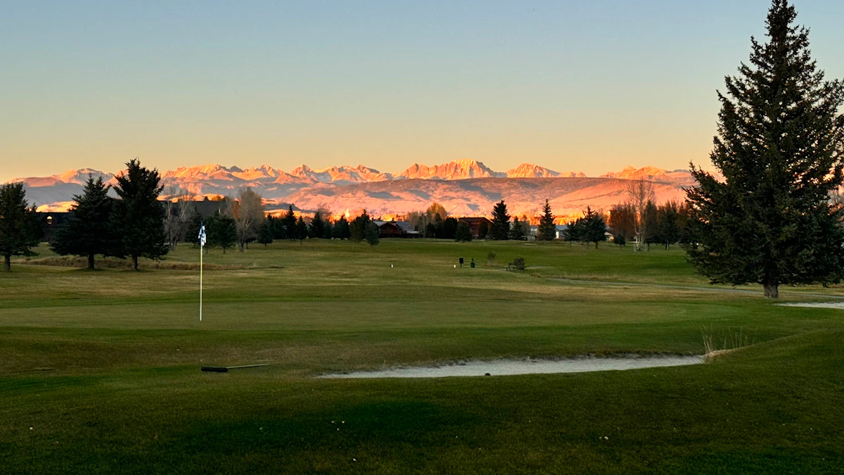 Don Day's Wyoming Weather Forecast: Saturday, October 17, 2026
Sunny in Wyoming on Saturday and mostly clear overnight. Highs from near 60 to the upper 70s. Lows from the mid 20s to mid 40s. Jeffrey City: Sunny and windy today with a high near 65 and wind gusts as high as 40 mph…
-
 High wind watch issued for southeast Wyoming after freeze today
CHEYENNE, Wyo. — A high wind watch takes effect Saturday morning for wind-prone areas of southeast Wyoming as meteorologists expect wind gusts reaching 60 mph. The National Weather Service in Cheyenne issued the watch…
-
 Former SE Wyoming Freeze Watch Now A Warning
Freezing temps in southeast Wyoming prompt reminders for outdoor plumbing precautions this week. KGAB Former SE Wyoming Freeze Watch Now A Warning What had been a Freeze Watch for Southeast Wyoming at one point has now…
-
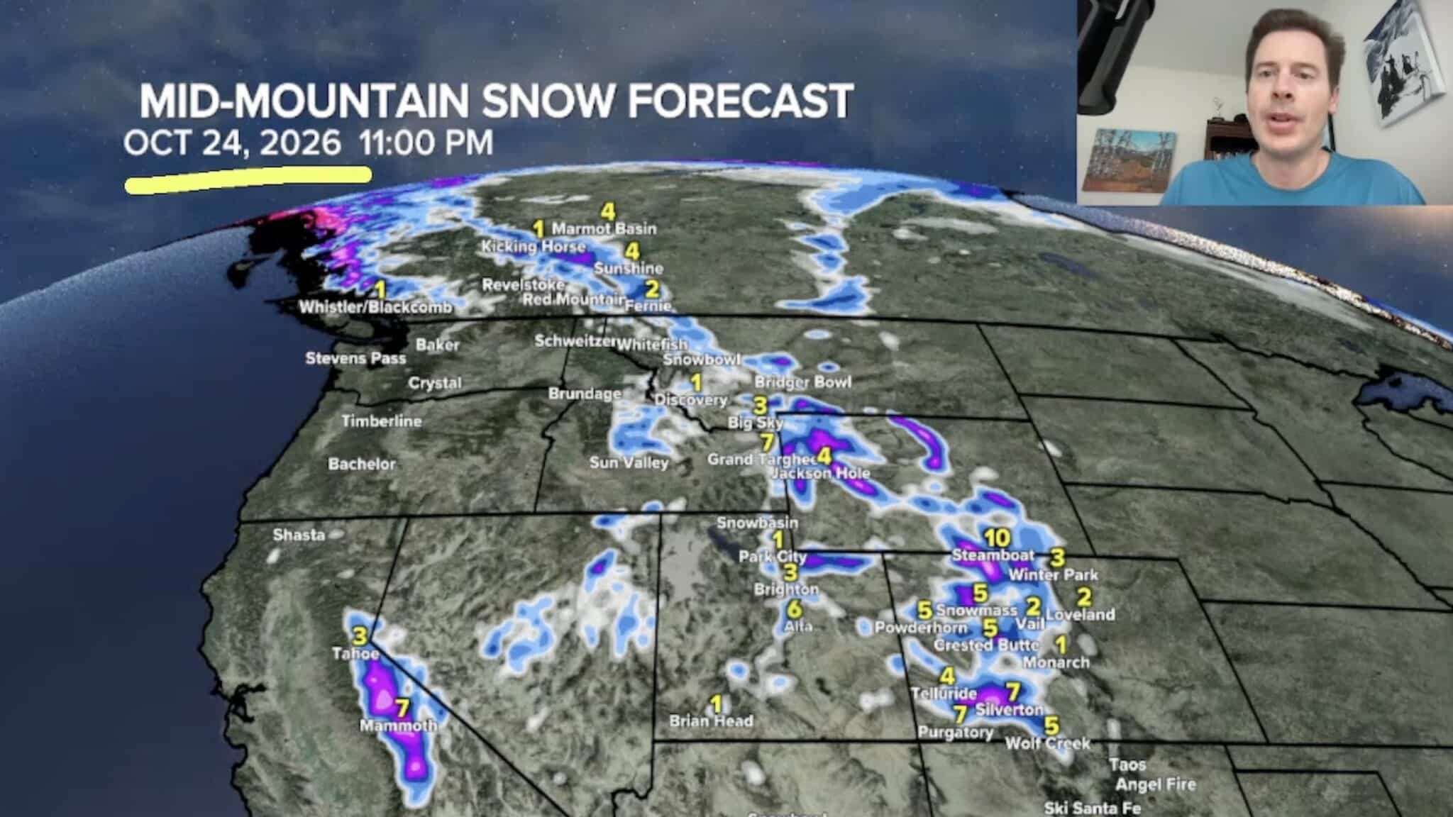 Sierra Nevada, Colorado, and Wyoming Could See A Lot More Snow Next Week
The Sierra Nevada is positioned to receive some of the highest snowfall totals in Tomer’s latest forecast. The incoming storm is expected to dig south into California, generating snowfall across the High Sierra. Tomer…
-
 Freeze Warning issued for Gillette, northeast Wyoming as temps drop into low 20s
GILLETTE, Wyo. — A Freeze Warning will take effect tonight across Campbell County as overnight temperatures drop to around 23 degrees, according to the National Weather Service in Rapid City. The warning begins at 9…
Air quality
Air quality is satisfactory, and air pollution poses little or no risk.
Moxa Arch, WY reporting area · 1 hr ago. Data from AirNow (EPA and its state, local and tribal partners); preliminary and subject to change.
Sun & moon
Almanac
MonthlyMountain View, records since 1966. Normals 1991–2020. Data from NOAA's Regional Climate Centers (ACIS).
Nearby
Forecasters' discussion
From the National Weather Service office in SLC, issued 7 hrs ago
Key Messages
- Widespread precipitation returns Wednesday morning across southern Utah, with coverage expanding northward through Friday. Many areas will see precipitation accumulations between 0.5-2" through this period, with local totals in excess of 3" possible.
- The heavy rain will bring a threat of flash flooding to southern and central Utah, and there is a Slight Risk of Excessive Rainfall across southern Utah Wednesday and across southern through east-central Utah Thursday.
- A few strong to severe thunderstorms may be capable of producing gusty winds and hail across southern Utah on Wednesday and statewide on Thursday, with a 2% chance of a tornado. A Marginal Risk for severe thunderstorms is in place on Wednesday across far southern Utah, southern through west-central Utah on Thursday.
- The late week storm will also bring accumulating snowfall to the high terrain across northern and central Utah on Friday, with 2-6" possible mainly above 9000 feet. Locally higher amounts are possible in favored locations.
Discussion
The large-scale pattern this evening consists of a closed low spinning off the central California coast while Utah remains under a southerly flow ahead of it. An upper jet rounding the base of the low and punching through Arizona this evening is helping to spread tropical moisture northward. Across Utah, PWATs currently range from 0.6-0.9 inches, which is already close to the 99th percentile of climatology. Increased moisture advection will only push these values higher over the next couple of days.
As the jet arrives over Utah, increasing upper diffluence may lead to some isolated shower activity tonight, mainly over northwest Utah. As the deeper moisture arrives after 10z, expect precipitation activity to start increasing across southern Utah. This precipitation will become more widespread across southern and central Utah through the day Wednesday. Models indicate a brief decrease in precipitation Wednesday night before increasing again areawide for Thursday. Areas of moderate to heavy precipitation is expected Wednesday and Thursday, and will be aided in part by potentially strong to severe convection as suggested by hi-res models. If instability does not become inhibited too much by cloud cover, there will be plenty of shear (40-55+ kt of 0-6km shear) and low-level helicity to work with across southern Utah on Wednesday and across a significant portion of the forecast area on Thursday for a few of the stronger storms to produce strong winds, hail, and even an outside chance of a tornado. There is currently a Marginal Risk for Severe Storms across southern Utah on Wednesday and across southern through weest-central Utah on Thursday. Additionally, with the heavy rain, there is also a Slight Risk of Excessive Rainfall across southern Utah on Wednesday and across southern through east-central Utah on Thursday. Also on Thursday, a Marginal Risk for Excessive Rainfall extends through the remainder of Utah. A Flood Watch is in effect across southern through east-central Utah Wednesday through Thursday as a result. Latest NBM continues to indicate widespread 1 to greater than 2.5 inches of QPF across southern through east-central Utah Wednesday through Thursday, with 75th percentile amounts exceeding 3 inches near Brian Head and Boulder Mountain.
On Friday, the upper low is expected to lift across northern Utah while a trailing wave rotating around the low swings across the desert southwest. The track of the low across northern Utah will keep precipitation confined more to the north on Friday, while cooler air arrives into the area (H7 temperatures down to around -3C Friday through Saturday night). This will bring snow levels as low as 7000-7500 feet, with accumulating snow of around 2-6 inches forecast above around 9000 feet, mainly across the Wasatch and Uinta Mountains.
The trailing wave swinging around Arizona now looks to redevelop into a closed low which will then linger over the area. As such, there is now increasing likelihood for cool and unsettled weather to remain in place through the weekend. Thereafter, high pressure looks to build into the area early next week.
Aviation
KSLC...The SLC terminal will see VFR conditions through the overnight hours. Winds are expected to remain southerly tonight and through the day tomorrow, becoming occasionally gusty during the afternoon. There is a 30 percent chance that showers will impact the terminal during the late afternoon and early evening, with the most likely impact being gusty and erratic winds.
REST OF UTAH AND SOUTHWEST WYOMING...The airspace will see VFR conditions through the evening with increasing clouds over southern Utah overnight. Showers and thunderstorms will increase in coverage over southern Utah throughout the morning, spreading into some northern portions of the airspace during the afternoon. Any storms that develop will have the potential of producing gusty and erratic winds, lightning, and brief mountain obscurations.
Slc Watches
UT...Flood Watch from 6 AM MDT Wednesday through Thursday evening for UTZ117-123>131.
Flood Watch from Wednesday afternoon through Thursday evening for UTZ120-121.
WY...None.
Forecasts, observations and alerts in the United States come from the National Weather Service (NOAA); radar from NOAA's Multi-Radar Multi-Sensor system; satellite imagery from NASA's Global Imagery Browse Services (GIBS) and NOAA's GOES satellites; the map from the U.S. Geological Survey's National Map; air quality from AirNow (EPA and its partners); hurricane information from the National Hurricane Center; climate normals and records from NOAA's Regional Climate Centers (ACIS). Forecasts outside the United States and the UV index: MET Norway (CC BY 4.0); observations outside the U.S.: airport reports via NOAA's Aviation Weather Center. Place names: GeoNames (CC BY 4.0). Data are copied on a schedule and may lag the sources; for warnings that affect your safety, follow your local National Weather Service office and emergency officials. Weather news is drawn from the 4Search index and reflects what the press published. Terms of use.