Install
Midland, TX 79712 Weather
Current conditions
Observed at Midland, Midland International Airport · 31 min ago
Forecast
10-day-
Wednesday
Sunny, with a high near 82. Southeast wind 5 to 10 mph.
-
Wednesday Night
Partly cloudy, with a low around 57. Southeast wind 5 to 10 mph.
-
Thursday
Mostly sunny, with a high near 82. Southeast wind 5 to 15 mph.
National Weather Service forecast updated 4 hrs ago.
Hourly
Hourly forecast- Now58°
- 7 AM57°
- 8 AM56°
- 9 AM59°
- 10 AM65°
- 11 AM69°
- 12 PM72°
- 1 PM77°
- 2 PM79°
- 3 PM80°
- 4 PM82°
- 5 PM80°
- 6 PM80°
- 7 PM77°
- 8 PM73°
- 9 PM71°
- 10 PM69°
- 11 PM68°
- Thu12 AM66°
- 1 AM65°
- 2 AM63°
- 3 AM61°
- 4 AM60°
- 5 AM59°
10-day forecast
Details- TonightOct 20Mostly Clear56°
- TodayOct 21Sunny57°82°
- ThuOct 22Mostly Sunny62°82°
- FriOct 23Partly Sunny61°80°
- SatOct 24Partly Sunny27%62°76°
- SunOct 25Showers And Thunderstorms Likely58%59°72°
- MonOct 26Chance Rain Showers45%53°71°
- TueOct 27Chance Rain Showers33%66°
- WedOct 28Sunny43°60°
- ThuOct 29Sunny41°62°
Days after the National Weather Service's seven are MET Norway's outlook, a computer model with no forecaster's review.
Radar
Full mapWeather news near Midland
More weather news-
 Kieran Hunter, Meteorologist
newswest9.com MIDLAND, Texas — Kieran's bio coming soon. More in Team bios Before You Leave, Check This Out
-
 FIRST ALERT 7 Forecast for Sunday, October 18th, 2026
CBS7 ODESSA, Texas (KOSA) - FIRST ALERT 7 Forecast for Sunday, October 18th, 2026: Chilly temperatures to start off Sunday morning, coming ahead of a warmer and mostly dry workweek. Sunday will feature unseasonably cool…
-
 Severe Tornado and Thunderstorm Warnings Issued in Texas as Conditions Intensify
A Tornado Warning is in effect until 3:15 p.m. CDT Wednesday for north central Pecos County near Fort Stockton, Texas, as severe thunderstorms with wind gusts up to 70 mph and quarter-size hail move across West Texas…
-
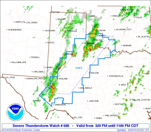 Severe thunderstorm watch issued for West Texas until 11 p.m.
A severe thunderstorm watch has been issued for West Texas until 11 p.m. on Wednesday, October 14. The National Weather Service Storm Prediction Center has issued a Severe Thunderstorm Watch for parts of southwest…
-
 Permian Basin showers, cold front bring cooler weekend temps
More showers and storms are expected in the Permian Basin before a cold front brings cooler temperatures and drier weekend weather. Isolated showers and thunderstorms will continue to develop in the Permian Basin, but…
-
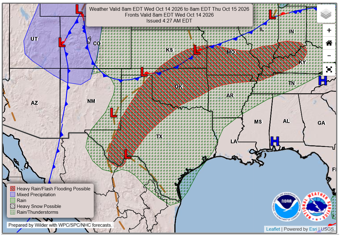 Austin weather: How big will the temperature swing be this week?
A strong cold front will arrive later this week, but until then, expect muggy air and warm temperatures in Central Texas and possible flooding rains in West Texas. By Wednesday, many Texans may be wondering whether it’s…
-
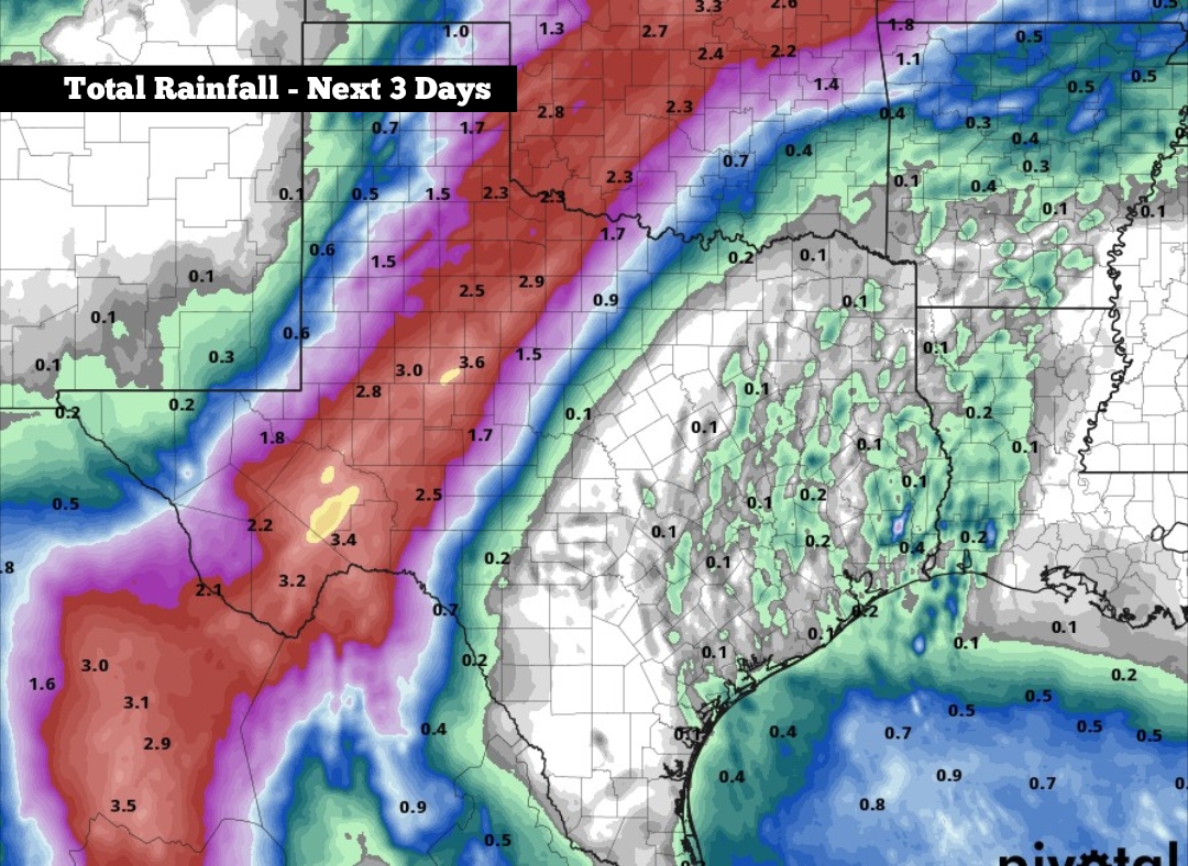 Moisture from Hurricane Simon brings flood risk to parts of Texas
Shown are the potential cumulative rainfall totals across Texas through Friday, according to the National Blend of Models, a composite weather forecast model. Hurricane Simon – a Category 1 hurricane with sustained…
-
 Severe weather and hail to hit Texas before near-freezing cold front-here's when
Severe storms could hit parts of Texas midweek before a cold front sweeps across much of the state, bringing lows near freezing in some areas. Isolated strong to severe storms could bring hail and damaging winds to the…
-
 FIRST ALERT 7 Forecast for Tuesday, October 13th, 2026
CBS7 ODESSA, Texas (KOSA) - FIRST ALERT 7 Forecast for Tuesday, October 13th, 2026: Another hot day is ahead across West Texas and southeast New Mexico, but changes start to take place today and will continue through…
-
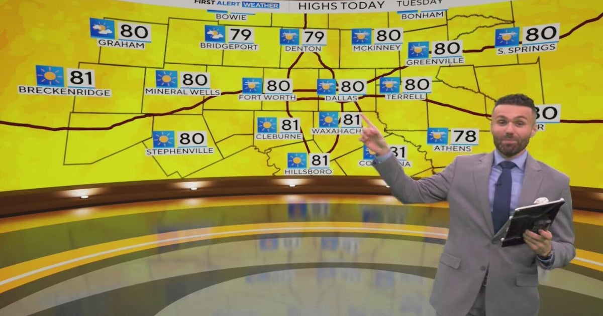 Great weather in North Texas this week
CBS News Baltimore 8am CBS News Boston 8am CBS News Chicago 7am CBS News Colorado This Morning 6am CBS News Los Angeles Mornings 5am CBS News Miami 8am CBS News New York 8am CBS News Texas 7am
Air quality
Air quality is satisfactory, and air pollution poses little or no risk.
Forecast
- WedModerate
- ThuModerate
- FriGood
Midland-Odessa, TX reporting area · 1 hr ago. Data from AirNow (EPA and its state, local and tribal partners); preliminary and subject to change.
Sun & moon
Almanac
MonthlyMidland-Odessa Area, records since 1930. Normals 1991–2020. Data from NOAA's Regional Climate Centers (ACIS).
Nearby
- Odessa 32 km
- West Odessa 44 km
- Stanton 37 km
Forecasters' discussion
From the National Weather Service office in MAF, issued 39 min ago
Key Messages
Updated at 547 AM CDT Wed Oct 21 2026
- Above normal temperatures and dry conditions continue through Thursday.
- Rain chances (35% to 45%) increase from west to east Friday through the weekend, with highest rain chances Saturday and Sunday.
Short Term
(Today through Thursday afternoon) Issued at 155 AM CDT Wed Oct 21 2026
Mid level ridging peaks over the region today and Thursday helping to keep the region precipitation-free and very warm. High temperatures will climb into the 80s each afternoon with mild lows in the 50s.
Long Term
(Thursday night through Tuesday) Issued at 155 AM CDT Wed Oct 21 2026
Our weather pattern becomes much more active Friday and beyond as the ridge finally breaks down. Southwesterly flow aloft will increase Friday, especially across the western half of our region. Increasing lift and moisture will lead to the development of showers and thunderstorms along and west of the Pecos River. As convection spreads east overnight Friday into Saturday, it will be met with plenty of resistance as the upper dynamics fade. As troughing remains to our west much of the weekend, several disturbances will cross the region withing southwesterly flow aloft. Expect multiple rounds of rain, especially over the higher terrain and SE NM where flash flooding will be possible.
Temperatures will remain above normal until this weekend when clouds and showers arrive. Models show a cold front arriving early next week, but differ on the strength.
Aviation
(12Z TAFS) Issued at 547 AM CDT Wed Oct 21 2026
VFR prevails through the period.
Forecasts, observations and alerts in the United States come from the National Weather Service (NOAA); radar from NOAA's Multi-Radar Multi-Sensor system; satellite imagery from NASA's Global Imagery Browse Services (GIBS) and NOAA's GOES satellites; the map from the U.S. Geological Survey's National Map; air quality from AirNow (EPA and its partners); hurricane information from the National Hurricane Center; climate normals and records from NOAA's Regional Climate Centers (ACIS). Forecasts outside the United States and the UV index: MET Norway (CC BY 4.0); observations outside the U.S.: airport reports via NOAA's Aviation Weather Center. Place names: GeoNames (CC BY 4.0). Data are copied on a schedule and may lag the sources; for warnings that affect your safety, follow your local National Weather Service office and emergency officials. Weather news is drawn from the 4Search index and reflects what the press published. Terms of use.