Install
San Antonio, TX 78256 Weather
Current conditions
Observed at San Antonio Boerne Stage Field · 38 min ago
Forecast
10-day-
Tonight
Mostly clear, with a low around 54. North northeast wind 0 to 5 mph.
-
Wednesday
Sunny, with a high near 82. Northeast wind around 5 mph.
-
Wednesday Night
Mostly clear, with a low around 59. Northeast wind 0 to 5 mph.
National Weather Service forecast updated 5 hrs ago.
Hourly
Hourly forecast- Now62°
- 1 AM60°
- 2 AM58°
- 3 AM57°
- 4 AM56°
- 5 AM55°
- 6 AM54°
- 7 AM54°
- 8 AM55°
- 9 AM60°
- 10 AM68°
- 11 AM72°
- 12 PM76°
- 1 PM79°
- 2 PM80°
- 3 PM81°
- 4 PM82°
- 5 PM81°
- 6 PM80°
- 7 PM76°
- 8 PM72°
- 9 PM69°
- 10 PM67°
- 11 PM66°
10-day forecast
Details- TonightOct 20Mostly Clear54°
- TodayOct 21Sunny59°82°
- ThuOct 22Sunny58°82°
- FriOct 23Sunny60°81°
- SatOct 24Mostly Sunny62°80°
- SunOct 25Partly Sunny59°78°
- MonOct 26Partly Sunny then Slight Chance Rain Showers17%60°78°
- TueOct 27Slight Chance Rain Showers16%74°
- WedOct 28Mostly sunny52°67°
- ThuOct 29Sunny46°65°
Days after the National Weather Service's seven are MET Norway's outlook, a computer model with no forecaster's review.
Radar
Full mapWeather news near San Antonio
More weather news-
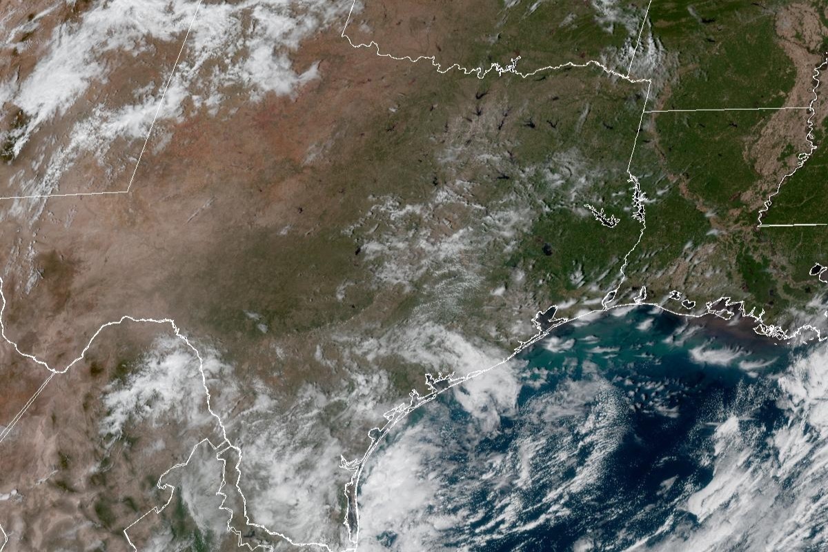 Was San Antonio fooled by 'false fall'? Temps could flirt with 90.
Enjoy the fall weather while you can, San Antonio. Tuesday’s mild temperatures could even be considered part of a “false fall” in South Texas, given how close the temperatures will flirt once again with 90 degrees for…
- San Antonio Weather Swings From Crisp Mornings To Summer Heat
The National Weather Service's Austin/San Antonio office says Tuesday will be sunny and warmer, with a high near 84, and the rest of the workweek keeps climbing. That marks a modest update from Hoodline's earlier…
-
 Summer recap: The Big Country’s summer of relentless triple-digit heat
BIG COUNTRY, Texas (KTAB/KRBC) – The summer of 2026 is one the Big Country won't soon forget, thanks to relentless heat that baked the region, especially from August through mid-September. Abilene recorded its first…
-
 NWS: Here's when Central Texas will finally cool down for the year
A cold front hit Texas last weekend, bringing a boon for those San Antonio temperatures that make fall feel more like summer part two. But when can residents in South Central Texas expect for the weather to actually…
-
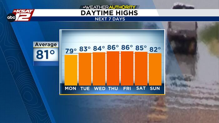 Cool mornings, warm afternoons
The latest in news, weather and sports for San Antonio and Central and South Texas. Justin Horne, KSAT Weather Authority Meteorologist Air Force identifies service member who died after fall during UTSA pregame ceremony…
-
 Old Farmer's Almanac predicts warm Thanksgiving, rain chances for South Texas
If you were hoping to pull out the cute winter boots and Fall-inspired sweaters this Thanksgiving holiday, you may be disappointed. The Old Farmer's Almanac has released its long-range forecast for Thanksgiving 2026…
-
 Old Farmer's Almanac's Thanksgiving 2026 weather forecast
Scenic views of the Riverwalk on a rainy day in San Antonio If you were hoping to pull out the cute winter boots and Fall-inspired sweaters this Thanksgiving holiday, you may be disappointed. The Old Farmer's Almanac…
-
 After cool Sunday, big changes expected for South Texas weather. Here's what's next.
If you're a fall-weather fan, then Sunday will be the absolute perfect day to get outside. A chilly, crisp morning will be followed by a cool, sunny afternoon with very little wind throughout the region. After making it…
-
 Chilly Sunday morning gives way to a beautiful fall afternoon
KSAT Chilly Sunday morning gives way to a beautiful fall afternoon Enjoy the cool, fall-like weather Sunday morning. Sunshine and comfortable temperatures take over by afternoon, followed by a steady warming trend that…
-
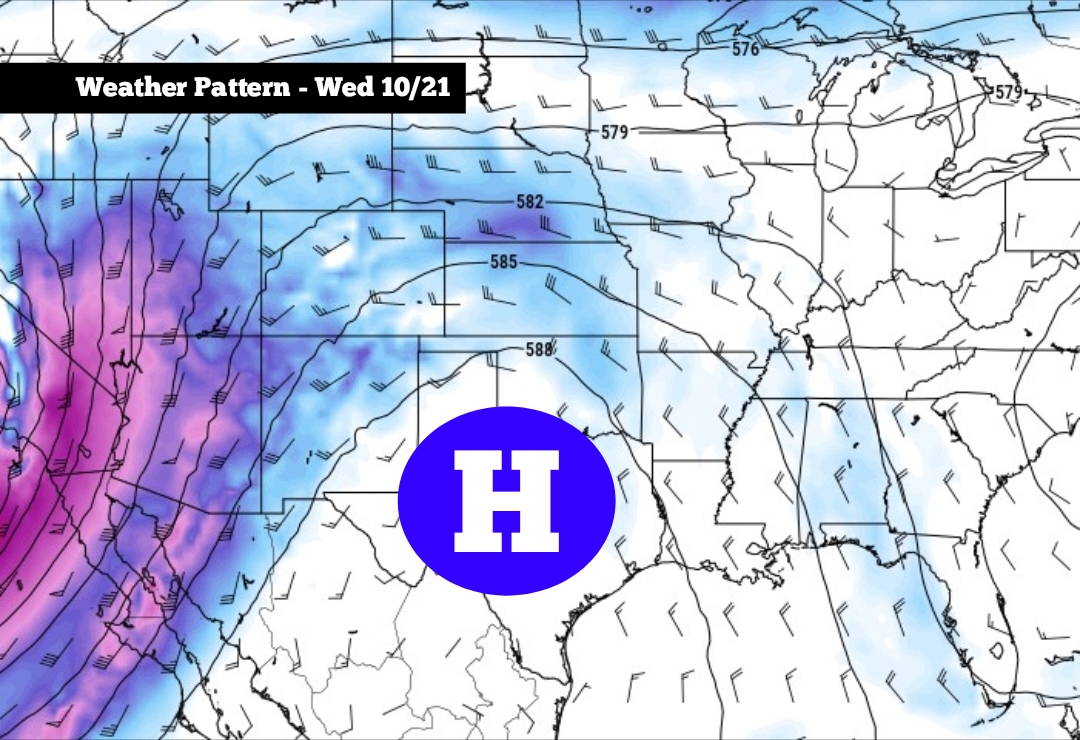 After cool Sunday, big changes expected for South Texas weather
High pressure is expected to develop across Texas this week, especially by Wednesday and Thursday If you’re a fall-weather fan, then Sunday will be the absolute perfect day to get outside. A chilly, crisp morning will…
Air quality
Acceptable. Unusually sensitive people should consider limiting prolonged outdoor exertion.
Forecast
- WedModerate
- ThuUnhealthy for Sensitive Groups
- FriModerate
San Antonio, TX reporting area · 1 hr ago. Data from AirNow (EPA and its state, local and tribal partners); preliminary and subject to change.
Sun & moon
Almanac
MonthlySan Antonio Area, records since 1885. Normals 1991–2020. Data from NOAA's Regional Climate Centers (ACIS).
Nearby
- New Braunfels 49 km
- Schertz 35 km
- Cibolo 39 km
- Converse 32 km
- Canyon Lake 45 km
- Universal City 33 km
- Live Oak 29 km
- Boerne 22 km
- Timberwood Park 15 km
- Hondo 58 km
- Selma 31 km
- Helotes 8 km
Forecasters' discussion
From the National Weather Service office in EWX, issued 6 hrs ago
Key Messages
Updated at 604 PM CDT Tue Oct 20 2026
- Warm and rain-free conditions persist through Saturday
- Low rain chances (20-30%) return early next week, mainly over the Rio Grande Plains and Southern Edwards Plateau
Discussion
A ridge over Mexico will be the main driver in our weather through this week, amplifying and elongating its axis over Texas through Saturday, leading to warm, rain-free, and mostly clear to partly cloudy conditions. High temperatures will generally stay in the 80s with low temperatures well into the 50s tonight, creeping back into the lower 60s by this weekend.
Shortwave disturbances from a mid-level low over the Four Corners region moving northeast will bring our next low rain chances (20- 30%) early next week, mainly over the Rio Grande Plains and Southern Edwards Plateau. We'll also see an increase in our cloud cover, reducing our high temperatures across South-Central Texas by a couple degrees.
Aviation
(00Z TAFS) Issued at 604 PM CDT Tue Oct 20 2026
VFR conditions are expected through the period. Light and variable wind persists overnight across all of South Central Texas, increasing only slightly in the afternoon from the northeast at I-35 terminals and from the southeast along the Rio Grande.
Preliminary Point Temps
Austin Camp Mabry 56 85 58 86 / 0 0 0 0 Austin Bergstrom Intl Airport 55 85 58 86 / 0 0 0 0 New Braunfels Muni Airport 56 84 59 85 / 0 0 0 0 Burnet Muni Airport 53 82 56 82 / 0 0 0 0 Del Rio Intl Airport 57 85 61 84 / 0 0 0 10 Georgetown Muni Airport 53 83 56 84 / 0 0 0 0 Hondo Muni Airport 55 86 60 85 / 0 0 0 10 San Marcos Muni Airport 54 85 58 86 / 0 0 0 0 La Grange - Fayette Regional 58 85 59 86 / 0 0 0 0 San Antonio Intl Airport 57 84 61 84 / 0 0 0 0 Stinson Muni Airport 59 85 63 85 / 0 0 0 0
Forecasts, observations and alerts in the United States come from the National Weather Service (NOAA); radar from NOAA's Multi-Radar Multi-Sensor system; satellite imagery from NASA's Global Imagery Browse Services (GIBS) and NOAA's GOES satellites; the map from the U.S. Geological Survey's National Map; air quality from AirNow (EPA and its partners); hurricane information from the National Hurricane Center; climate normals and records from NOAA's Regional Climate Centers (ACIS). Forecasts outside the United States and the UV index: MET Norway (CC BY 4.0); observations outside the U.S.: airport reports via NOAA's Aviation Weather Center. Place names: GeoNames (CC BY 4.0). Data are copied on a schedule and may lag the sources; for warnings that affect your safety, follow your local National Weather Service office and emergency officials. Weather news is drawn from the 4Search index and reflects what the press published. Terms of use.