Install
Springdale, AR 72766 Weather
Current conditions
Observed at Springdale Municipal · 1 hr ago
Forecast
10-day-
Today
A slight chance of rain showers before 1pm. Mostly sunny, with a high near 76. South wind around 0 mph. Chance of precipitation is 20%.
-
Tonight
Mostly clear, with a low around 51. East wind around 0 mph.
-
Thursday
Sunny, with a high near 78. East wind around 0 mph.
National Weather Service forecast updated 1 hr ago.
Hourly
Hourly forecast- Now57°21%
- 9 AM60°21%
- 10 AM63°21%
- 11 AM66°21%
- 12 PM69°21%
- 1 PM73°
- 2 PM74°
- 3 PM75°
- 4 PM75°
- 5 PM75°
- 6 PM73°
- 7 PM68°
- 8 PM63°
- 9 PM61°
- 10 PM59°
- 11 PM58°
- Thu12 AM57°
- 1 AM56°
- 2 AM55°
- 3 AM54°
- 4 AM53°
- 5 AM52°
- 6 AM52°
- 7 AM51°
Daily forecast
Details- TodayOct 21Slight Chance Rain Showers21%51°76°
- ThuOct 22Sunny53°78°
- FriOct 23Sunny56°78°
- SatOct 24Mostly Sunny55°77°
- SunOct 25Partly Sunny53°76°
- MonOct 26Partly Sunny54°74°
- TueOct 27Slight Chance Rain Showers23%48°67°
- WedOct 28Cloudy0.09 in46°51°
- ThuOct 29Sunny42°60°
Days after the National Weather Service's seven are MET Norway's outlook, a computer model with no forecaster's review.
Radar
Full mapWeather news in Arkansas
More weather news-
 Arkansas Storm Team Forecast: Still no rain in sight
While temperatures will steadily return to the 80s this week in Arkansas, rain chances won’t return in this forecast. That means the wildfire danger persists. Tuesday, October 20, expect partly to mostly sunny skies…
-
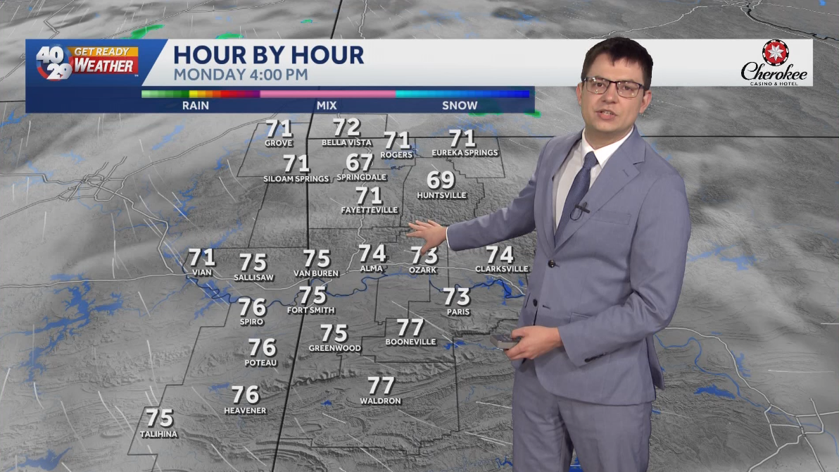 Seasonally warm to start the work week in Arkansas
Morning lows will remain in the 40s over the next few days. Afternoon highs will start to warm back into the 70s early in the work week. High temperatures will warm back into the 80s later in the week. Watch the…
-
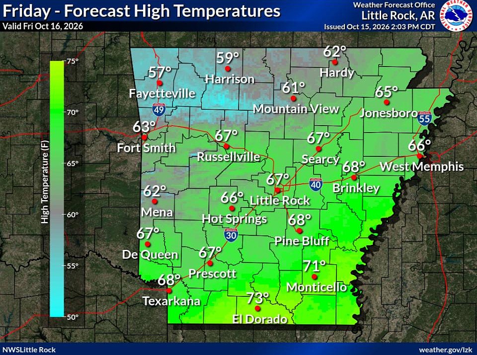 Cold front brings fall temperatures to Arkansas; forecasters warn of continued wildfire risk
The forecast holds good news for those ready for fall in Arkansas. Arkansans should feel some relief from warm temperatures Friday through next week as a cold front has brought cooler temperatures to the state. This…
-
 Northeast Arkansas Weather Update for October 16
| Live Stream | kjnbtv.com kjnbtv.com Cool and breezy Friday with a high of 66° and a low of 46°. A nice weekend is ahead. - Delta Symphony Orchestra to perform Pirates of the Caribbean live in Jonesboro - Jonesboro…
-
 Northeast Arkansas Weather Update for October 15
| Weather | kjnbtv.com kjnbtv.com Mostly clear with a high of 91° and a low of 62°.
-
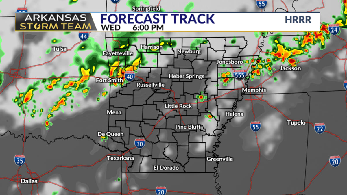 Arkansas Storm Team Forecast: Rain chances trend down Wednesday
While Wednesday was thought to be central Arkansas's best chance of rain in the next week, even those rain chances are trending down. Northern and western Arkansas have the best rain chances on Wednesday. There's still…
Air quality
Acceptable. Unusually sensitive people should consider limiting prolonged outdoor exertion.
Forecast
- WedModerate (55)
Springdale (Springdale-Fayetteville-Bentonville), AR reporting area · 56 min ago. Data from AirNow (EPA and its state, local and tribal partners); preliminary and subject to change.
Sun & moon
Almanac
MonthlyFayetteville Exp Sta, records since 1892. Normals 1991–2020. Data from NOAA's Regional Climate Centers (ACIS).
Nearby
- Fayetteville 14 km
- Rogers 16 km
- Bentonville 22 km
- Bella Vista 35 km
- Siloam Springs 37 km
- Centerton 24 km
- Lowell 8 km
- Farmington 19 km
- Berryville 54 km
- Pea Ridge 30 km
- Prairie Grove 29 km
- Johnson 7 km
Forecasters' discussion
From the National Weather Service office in TSA, issued 2 hrs ago
Key Messages
Updated at 1118 PM CDT Tue Oct 20 2026
- Low rain and isolated thunder chances were added late tonight into Wednesday morning across NE OK in association with a passing upper wave.
- Above average highs and dry weather will be the rule for the remainder of this week.
- Rain chances return during the first half of next week as an upper storm system approaches from the west and interacts with a passing cold front.
Short Term
(Through Wednesday) Issued at 1118 PM CDT Tue Oct 20 2026
An upper wave is clearly evident on WV imagery and in the 500mb RAP analysis over SW KS this evening. CAMs show increasing coverage of spotty showers across south-central KS/north-central OK tonight into Wednesday as lift from the wave overspreads the region, spreading east and southeast into NE OK into Wednesday morning. Activity has indeed been increasing on radar recently, with lightning observed in some of it. Mid level lapse rates are steep enough to yield some instability aloft. Due to prevailing surface ridging over much of the central and eastern CONUS, the lower levels of the atmosphere remain relatively dry, with the bulk of the moisture above 700mb. Nevertheless, precip coverage and intensity should be sufficient to increase confidence in hydrometeors making it to the ground across portions of NE OK through Wednesday morning. The forcing is expected to weaken as the wave tracks southeast Wednesday afternoon. Some mention of sprinkles was left in the forecast however.
High temperatures should be fairly similar or slightly warmer than today and above average for this time of year.
Lacy
Long Term
(Wednesday Night through Tuesday) Issued at 1118 PM CDT Tue Oct 20 2026
An amplifying ridge aloft is forecast to prevail over the Plains, downstream from troughing in the West. Above average temps and dry weather will be the rule into the weekend.
Changes in the weather pattern occur by early next week. Energy in the Southwest will move east toward the Plains, while a trough in the northern stream dives down into the country from Canada. The latter system will force a stronger cold front south into the region Monday night into Tuesday. Models have some precip over the region as the wave and front interact. Temps should drop to near or slightly below average behind this front.
Aviation
(12Z TAFS) Issued at 632 AM CDT Wed Oct 21 2026
Ongoing high-based showers across portions of northeast Oklahoma will continue to impact, or at least be in the vicinity of, KBVO, KTUL, and KRVS over the next few hours. Guidance suggests these showers will gradually dissipate by or just before noontime, but will likely be too isolated to mention in the TAFs after 15z/10 AM CT. Otherwise and elsewhere, VFR is expected to prevail through the TAF period, with SCT/BKN mid and high clouds. Winds remain light from the south to southeast through the period.
Mejia
Forecasts, observations and alerts in the United States come from the National Weather Service (NOAA); radar from NOAA's Multi-Radar Multi-Sensor system; satellite imagery from NASA's Global Imagery Browse Services (GIBS) and NOAA's GOES satellites; the map from the U.S. Geological Survey's National Map; air quality from AirNow (EPA and its partners); hurricane information from the National Hurricane Center; climate normals and records from NOAA's Regional Climate Centers (ACIS). Forecasts outside the United States and the UV index: MET Norway (CC BY 4.0); observations outside the U.S.: airport reports via NOAA's Aviation Weather Center. Place names: GeoNames (CC BY 4.0). Data are copied on a schedule and may lag the sources; for warnings that affect your safety, follow your local National Weather Service office and emergency officials. Weather news is drawn from the 4Search index and reflects what the press published. Terms of use.