Install
Sidney, NE 69160 Weather
Current conditions
Forecast for this hour (no station report in the last two hours)
Forecast
10-day-
Today
Mostly sunny, with a high near 76. South southeast wind 5 to 10 mph.
-
Tonight
A slight chance of rain showers. Mostly cloudy. Low around 55, with temperatures rising to around 58 overnight. South southeast wind 5 to 15 mph. Chance of precipitation is 20%.
-
Friday
Sunny. High near 82, with temperatures falling to around 80 in the afternoon. South wind around 15 mph.
National Weather Service forecast updated 14 hrs ago.
Hourly
Hourly forecast- Now75°
- 3 PM76°
- 4 PM76°
- 5 PM75°
- 6 PM71°15%
- 7 PM66°15%
- 8 PM64°15%
- 9 PM63°13%
- 10 PM62°13%
- 11 PM61°13%
- Fri12 AM60°15%
- 1 AM59°15%
- 2 AM60°15%
- 3 AM60°15%
- 4 AM59°15%
- 5 AM58°15%
- 6 AM57°
- 7 AM56°
- 8 AM59°
- 9 AM63°
- 10 AM71°
- 11 AM77°
- 12 PM78°
- 1 PM81°
10-day forecast
Details- TodayOct 22Mostly Sunny15%55°76°
- FriOct 23Sunny19%46°82°
- SatOct 24Partly Sunny79%35°56°
- SunOct 25Rain Showers Likely74%33°50°
- MonOct 26Chance Rain Showers33%29°50°
- TueOct 27Mostly Sunny11%33°58°
- WedOct 28Sunny34°62°
- ThuOct 29Sunny32°49°
- FriOct 30Sunny33°62°
- SatOct 31Sunny42°58°
Days after the National Weather Service's seven are MET Norway's outlook, a computer model with no forecaster's review.
Radar
Full mapWeather news near Sidney
More weather news-
 Dangerous Freeze Watch Warning Issued for Massive Area of Nebraska, Wyoming and Colorado
A Freeze Watch is in effect from late Thursday night through Friday morning for the Denver metro area, Colorado’s eastern plains, southeast and central Wyoming, and the Nebraska Panhandle, with lows in the 20s possible…
- Fall at its finest in Nebraska: enjoy it while it lasts before more wind and weekend rain chances
LINCOLN, Neb. (KOLN) - A weak weather system passing south of the region will bring a small chance for spotty showers and sprinkles across southern Nebraska tonight, but don’t let that dampen your plans. The rain chance…
-
 Warming trend through the work week across Nebraska ends with more wind, fire danger
LINCOLN, Neb. (KOLN) - The pleasant pattern continues through the week. Highs will reach the mid 60s to low 70s Monday and Tuesday, with similar conditions Wednesday. By Thursday and Friday, temperatures will push into…
- Nebraska Winter Weather: First Snow Before Thanksgiving, Nov. 26?
Omaha, NE – Nebraska residents preparing for Thanksgiving travel have a historical snowfall date to watch this fall. Omaha typically records its first measurable snow nearly two weeks before the holiday, while freezing…
- First freeze of the season expected tonight for much of Nebraska
LINCOLN, Neb. (KOLN) - Grab your jackets and protect your plants. Nebraska is bracing for its coldest night of the season Friday into Saturday morning, with Freeze Warnings in place across most of the state as fall’s…
-
 First Hard Freeze and Frost Warnings Threaten Kansas and Southeast Nebraska
The Sunflower State Radio Network First Hard Freeze and Frost Warnings Threaten Kansas and Southeast Nebraska The first widespread autumn freeze is knocking on the door. The National Weather Service has issued a cascade…
-
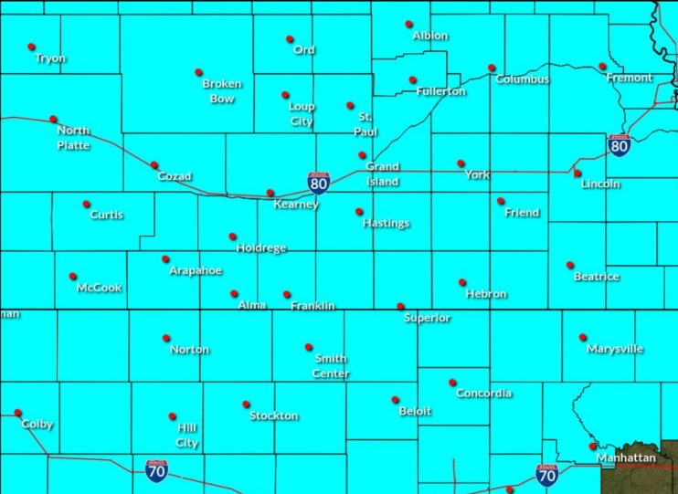 Freeze Watch in effect for central Nebraska for Saturday morning
A Freeze Watch has been issued for central Nebraska through the morning of Saturday, Oct. 17, (NWS Hastings, Courtesy) HASTINGS — A Freeze Watch has been issued for all of central Nebraska from the evening of Friday…
-
 How Rocky Mountain snow impacts Nebraska, and what this winter may look like for the snowpack
The Rocky Mountain snowpack plays a direct role in Nebraska's water supply, and last winter's record low levels had severe consequences across the state. As snowpack in Colorado and Wyoming melts each spring, the water…
Sun & moon
Almanac
MonthlySidney Municipal Ap, records since 1948. Normals 1991–2020. Data from NOAA's Regional Climate Centers (ACIS).
Nearby
- Kimball 56 km
Forecasters' discussion
From the National Weather Service office in CYS, issued 2 hrs ago
Key Messages
- Above average temperatures will continue through the end of the week, but a weekend system will drop temperatures towards near- to below-average temperatures.
- Precipitation is possible this afternoon through Sunday, with the potential for frozen precipitation outside of the mountains Sunday morning.
- An active week is expected next week with multiple clipper systems moving through the region.
Short Term
Issued at 254 AM MDT Thu Oct 22 2026
Mostly quiet again tonight with some mid-level clouds drifting across much of southeast Wyoming and western Nebraska. GOES Nighttime Microphysics show some lower clouds beginning to blanket wester Nebraska, with limited lower-level coverage across southeast Wyoming. This cloud bank should help keep portions of western Nebraska warmer than previously expected. Temperatures are currently in the mid-40s to low-60s across the region, with Laramie being the coldest at 45F as of 07Z. Winds are light and variable across southeast Wyoming and should remain that way for a few more hours. A low-level jet developed over western Nebraska, so many sites are windy and gusty.
A more active pattern will begin today and continue through much of the upcoming work week as an upper-level low over western California pushes inland towards the Intermountain West. This low should be positioned over northern Nevada by early Friday morning. The upper- level ridge that has been keeping the region warmer will be old news as the upper-level trough pushes eastward. Southwesterly flow aloft will strengthen and turn more southerly throughout the day today with a nearly 100kt jet developing overnight tonight. However, the jet will not be in a favorable location for significant enhancement of the synoptic ascent, with the right entrance and left exit region of the jet off to the west. Multiple lobes of 500mb vorticity will eject to the northeast ahead of the incoming system this afternoon, increasing the synoptic forcing for western portions of the region, mainly Carbon and Albany counties west of the Laramie Range. A diffuse 700mb shortwave trough will move through early this morning, increasing wind speeds across western Carbon County. Southwesterly 700mb flow will continue this morning before swapping more southerly later this afternoon. Models have slowed down the arrival of the 700mb, southerly jet across western Carbon County, with this jet not anticipated to develop until early Friday morning. Despite this, throughout the day today 700mb temperatures will warm into the 6 to 9C range, leading to surface temperatures warming back into the mid- 60s and mid-70s. As the best forcing pushes northeastward towards Carbon County, precipitable water values are progged to be above the maximum percentile for this time of year per the NAEFS. Therefore, precipitation today, while sparse, should have a decent amount of water with it for October. Precipitation will remain confined to west of the Laramie Range, where the best ascent and moisture will be located due to the southwesterly flow advecting in Pacific moisture and getting trapped along the Laramie Range. There will be meager CAPE across this region, so a rumble or two or thunder cannot be completely ruled out, though widespread storms are not expected. Overnight lows will drop into the mid-30s for the Sierra Madre and Snowy Ranges, so precipitation is anticipated to change over to snow flurries by early Friday morning.
The upper-level low continues to push eastward out of northern Nevada on Friday, but starts to weaken Friday morning into the early afternoon. 500mb cyclonic vorticity advection kicks up across Idaho and western Montana Friday afternoon, leading to split flow with the northern branch becoming the strongest and the southern branch remaining weaker. While it does look like the weaker, southern branch will impact southeast Wyoming and western Nebraska, with the transition into split flow, a strong 250mb jet develops across Wyoming with portions of the CWA within the left exit region of the jet. This will increase synoptic forcing for the region, despite the southern branch remaining weaker than the northern branch. Recent model runs are pushing the 700mb low further north, remaining over southern Canada rather than dipping into the northern CONUS. As a result, strong wind potential has decreased some, but brief period of elevated winds will be possible for western portions of the CWA. With the most recent evolution of this system, precipitation chances would become less widespread than previously forecast, though precipitable water values still remain maxed out for this time of year so any shower could be quite heavy. A strong cold front will accompany this system and will drop 700mb temperatures into the 0 to 4C range by early Saturday morning. With cooling temperatures at 700mb, rain across the Sierra Madre and Snowy ranges should change over to mostly snow overnight Friday into Saturday morning. Snow accumulation is not anticipated to be significant, due to the weakening southern branch of the system. Temperatures will max out in the upper-50s to low-80s Friday afternoon, with the warmest temperatures across the western Nebraska Panhandle due to very strong southerly flow. Overnight lows will be much cooler, thanks to the cold front, dropping into the mid-30s to low-50s everywhere.
Long Term
Issued at 254 AM MDT Thu Oct 22 2026
Upper-level flow on Saturday will remain fairly strong out of the southwest as the low responsible for the rainier weather marches eastward across the Four Corners region after elongating southward on Friday. This low will slowly turn northeastward Saturday night into early Sunday morning, looking to impact the CWA a second time on Sunday. 500mb CVA will increase across the upper-level low, increasing its advection northeastward, while also ejecting multiple lobes of vorticity into the CWA. 700mb flow will be weaker as the 700mb low over southern Canada move far enough away to not longer influence the region. Mostly light and variable flow is expected throughout the day Saturday. Saturday night into early Sunday morning, 700mb flow turns southeasterly with surface flow flipping around to the east. The surface low that was progged to develop in yesterday's model suite no longer exists, with northerly surface flow prevailing across eastern Colorado due to the strong cold front. This will not stop precipitation from developing with multiple 500mb vorticity maxima moving across the region. The NAEFS model suggests increased precipitable water values around the 90th percentile for southeastern portions of the CWA, where the best forcing looks to set up. A rain/snow mix could develop west of the Laramie Range with mostly rain and, maybe, a few flurries east of the Laramie Range. The I-80 Summit may see a prolonged period of rain and snow due to easterly, upslope flow ongoing through the afternoon hours. 700mb temperatures cool into the 0 to 2C range behind the front, leading to a much cooler day across the region with surface temperatures in the mid-40s to mid-50s. Overnight lows Saturday night into Sunday morning will drop into the 30s everywhere, with 700mb temperatures between -2 and 0C. With precipitation likely continuing into the overnight hours, snow flurries will be possible for Sunday morning, though significant accumulation is not expected.
On Sunday, the upper-level low is progged to get absorbed into the upper-level flow and finally push the upper-level trough through the Intermountain West by Monday morning. Residual upper-level forcing will remain across the area as the low moves off to the east, therefore, keeping precipitation chances possible on Sunday. 700mb temperatures will remain in the -2 to 0C range throughout the day Sunday. Easterly flow will continue Sunday due to a secondary, backdoor cold front moving through the region, favoring upslope development along and east of the Laramie Range. While 700mb temperatures will be favorable for snow, rather than rain, daytime warming may prevent snow from falling with mostly a cold rain and flurries possible east of the Laramie Range. Once again, significant snowfall accumulation is not anticipated at this time, though things may change as this system moves into the shorter-term forecast periods.
Monday onwards favors an active period of weather with multiple Albert Clipper systems pushing out of Canada and into the CONUS. Temperatures will remain cooler throughout the weak, near normal for this time of year. Temperatures look to start warming Tuesday through the end of the week, with above average temperatures possible Tuesday through the end of the week. Multiple rounds of precipitation will be possible throughout the week, though confidence is lower in exactly how many places will see the precipitation.
Aviation
Issued at 1141 AM MDT Thu Oct 22 2026
Primarily VFR conditions expected over the next 24 hours. The exception will be with precipitation across WY TAF sites, with the most likely drop in VIS happening for KRWL. Rain showers should overspread both KRWL and KLAR this afternoon and evening, and may make it as far as KCYS. A rumble of thunder also possible near KRWL, but probs are low enough that they were left out of TAF for now. Prevailing CIGs will be generally mid level at BKN to OVC all sites as clouds build in this afternoon, with skies lifting and clearing into tomorrow morning. Winds breezy this afternoon with gusts around 20-25 knots, calming during the evening and nighttime hours and picking back up tomorrow morning into the afternoon at 20-30 knots.
Forecasts, observations and alerts in the United States come from the National Weather Service (NOAA); radar from NOAA's Multi-Radar Multi-Sensor system; satellite imagery from NASA's Global Imagery Browse Services (GIBS) and NOAA's GOES satellites; the map from the U.S. Geological Survey's National Map; air quality from AirNow (EPA and its partners); hurricane information from the National Hurricane Center; climate normals and records from NOAA's Regional Climate Centers (ACIS). Forecasts outside the United States and the UV index: MET Norway (CC BY 4.0); observations outside the U.S.: airport reports via NOAA's Aviation Weather Center. Place names: GeoNames (CC BY 4.0). Data are copied on a schedule and may lag the sources; for warnings that affect your safety, follow your local National Weather Service office and emergency officials. Weather news is drawn from the 4Search index and reflects what the press published. Terms of use.