Install
North Platte, NE 69103 Weather
Current conditions
Observed at North Platte, North Platte Regional Airport · 22 min ago
Forecast
10-day-
Wednesday
Areas of fog before 10am. Mostly sunny, with a high near 76. North wind 0 to 5 mph.
-
Wednesday Night
Mostly clear, with a low around 47. Southeast wind around 5 mph.
-
Thursday
Mostly sunny, with a high near 77. South southeast wind 5 to 20 mph, with gusts as high as 30 mph.
National Weather Service forecast updated 1 hr ago.
Hourly
Hourly forecast- Now47°
- 8 AM48°
- 9 AM49°
- 10 AM52°
- 11 AM58°
- 12 PM64°
- 1 PM70°
- 2 PM73°
- 3 PM75°
- 4 PM76°
- 5 PM75°
- 6 PM72°
- 7 PM69°
- 8 PM65°
- 9 PM61°
- 10 PM57°
- 11 PM55°
- Thu12 AM54°
- 1 AM53°
- 2 AM52°
- 3 AM52°
- 4 AM51°
- 5 AM50°
- 6 AM49°
10-day forecast
Details- TonightOct 20Mostly Clear45°
- TodayOct 21Areas Of Fog then Mostly Sunny47°76°
- ThuOct 22Mostly Sunny57°77°
- FriOct 23Mostly Sunny11%54°81°
- SatOct 24Chance Showers And Thunderstorms63%39°63°
- SunOct 25Rain Showers Likely63%37°54°
- MonOct 26Rain Showers Likely57%33°51°
- TueOct 27Chance Rain Showers then Partly Sunny27%54°
- WedOct 28Sunny29°54°
- ThuOct 29Sunny35°61°
Days after the National Weather Service's seven are MET Norway's outlook, a computer model with no forecaster's review.
Radar
Full mapWeather news near North Platte
More weather news-
 Above average temperatures for much of the work week before rain chances return next weekend
www.knopnews2.com Friday Through The Weekend: Temperatures stay in the upper 70’s to low 80’s Friday afternoon. Strong winds around 20 to 30 mph are expected with gusts up to 40 mph are possible. A cold front is…
-
 Warmer and dry weather expected as we head into next week
Dry and warmer weather expected into the new week. Rain chances return next weekend. HASTINGS, Neb. (KSNB) - Good evening! After some early morning frost and freeze temperatures warmed back into the low to mid 60’s…
- Nebraska Winter Weather: First Snow Before Thanksgiving, Nov. 26?
Omaha, NE – Nebraska residents preparing for Thanksgiving travel have a historical snowfall date to watch this fall. Omaha typically records its first measurable snow nearly two weeks before the holiday, while freezing…
-
 Strong winds of today will subside tonight, bringing most the first frost of the fall
NORTH PLATTE, Neb. (KNOP) - Blustery winds have kept most of us from seeing frost this morning, but that won’t be the case tonight. The frost will be followed by the return of warmer temperatures. Saturday and Sunday…
- Breezy Friday gives way to sunny weekend with frost concerns
NORTH PLATTE, Neb. (KNOP) - Clearing skies and a warming trend are setting up for Greater Nebraska, with breezy conditions Friday giving way to a pleasant and sunny weekend before temperatures climb into the upper 70s…
-
 Trudy strengthens to a hurricane as system nears Mexico’s coast with major storm expected
www.knopnews2.com Trudy was located about 300 miles (480 kilometers) southwest of Acapulco, Mexico, with maximum sustained winds of 75 mph (120 kph), according to the U.S. National Hurricane Center in Miami. The…
-
 Rain continues today, but stronger winds and frost become our weather stories soon
Rain continues today, but stronger winds and frost become out weather stories soon KNOP NORTH PLATTE, Neb. (KNOP) - We’ll continue to see some scattered showers today, becoming less prevalent as the day goes on. By…
- Fall Weather Whiplash: Rain, Gusty Winds and a Sunny Rebound
NORTH PLATTE, Neb. (KNOP) - A rainy and breezy end to the workweek is setting up for Greater Nebraska, with cooler temperatures and gusty winds dominating through Friday before conditions improve significantly over the…
-
 Dangerous Freeze Watch Warning Issued for Massive Area of Nebraska, Wyoming and Colorado
A Freeze Watch is in effect from late Thursday night through Friday morning for the Denver metro area, Colorado’s eastern plains, southeast and central Wyoming, and the Nebraska Panhandle, with lows in the 20s possible…
-
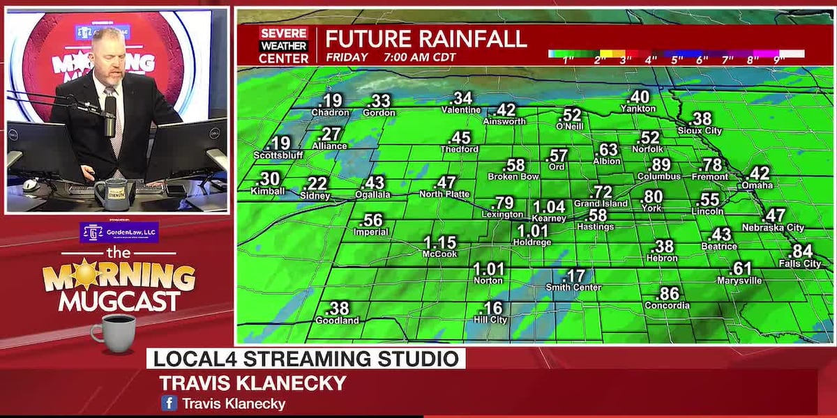 Rain returns to the area, followed by the coldest air of the fall so far
NORTH PLATTE, Neb. (KNOP) - Forecast discussion coming soon. Refer to the video forecast for more information. Bridge on South McPheeters Road closed effective immediately in Lincoln County $50,000 donation advances…
Sun & moon
Almanac
MonthlyNorth Platte Area, records since 1874. Normals 1991–2020. Data from NOAA's Regional Climate Centers (ACIS).
Nearby
- Gothenburg 51 km
Forecasters' discussion
From the National Weather Service office in LBF, issued 52 min ago
Key Messages
- Patchy fog is expected Wednesday and Thursday mornings, especially across southwest Nebraska. Any fog that develops should dissipate by late morning.
- Above-normal temperatures are expected through Thursday, with highs in the 70s to lower 80s. Gusty southerly winds develop Thursday afternoon, with unusually mild temperatures expected Thursday night.
- Showers and thunderstorms return for this weekend and persist into early next week, leading to the potential for widespread rainfall accumulations.
Short Term
Issued at 330 AM CDT Wed Oct 21 2026
This morning, increasing low-level moisture across southwestern portions of the area, combined with weak southeasterly flow and associated moisture advection, will support the development of patchy fog. The greatest potential for fog development once again appears to favor southwestern portions of the area, generally along a Curtis-North Platte line and points west. Looking at model and BUFKIT soundings, a nearly saturated layer extending through the lowest 50 to 150 mb, which is deeper than what was observed yesterday morning, along with a low-level inversion and light winds, further supports the potential for fog development. Similar to yesterday, any fog that develops should dissipate by late morning as daytime heating promotes boundary-layer mixing. Into the afternoon and evening hours, the upper-level ridge will continue to amplify across the central United States, supporting clearing skies, relatively light winds, and warmer temperatures. With 850-mb temperatures forecast in the 15 to 20C range, have trended toward the warmer MAV guidance for afternoon highs, with middle to upper 70s expected, particularly across southern and eastern portions of the area. Farther northwest, highs should remain in the upper 60s to lower 70s. Wednesday night lows should remain relatively mild, generally in the middle to upper 40s, as increased low-level moisture remains across the region.
Thursday morning, a similar setup to Wednesday morning may support another round of fog development across portions of southwest and potentially central Nebraska. Increasing southeasterly low-level flow ahead of an approaching western United States trough should promote additional moisture advection into the region, maintaining favorable conditions for low-level saturation. Some uncertainty remains regarding the coverage and extent of fog development, and trends will be monitored over the next several forecast cycles. By Thursday afternoon, the surface pressure gradient will strengthen across the region as lee-side surface low pressure develops ahead of the approaching western trough. This will result in increasing southerly winds, with sustained speeds of 15 to 25 mph and gusts up to 35 mph possible, particularly across portions of the Sandhills. Meanwhile, upper-level ridging across the central United States will remain amplified, supporting continued warm air advection within the lower to middle levels. With 850-mb temperatures remaining in the 15 to 20C range, increasing southerly flow and sufficient boundary- layer mixing should allow temperatures to warm into the middle 70s to lower 80s, with the warmest readings expected across southwest Nebraska. Despite continued moisture advection, the stronger upper- level forcing associated with the approaching trough will remain displaced west of the region, while upper-level ridging maintains generally unfavorable conditions for widespread ascent. As a result, dry conditions are expected through Thursday night.
Thursday night, strengthening southerly flow and a developing low- level jet will maintain warm air advection and limit nocturnal cooling across the region. The combination of persistent low-level mixing and increased moisture should allow overnight temperatures to remain unusually mild, with lows generally in the middle 50s across much of the area. These temperatures would be more than 20 degrees above average for late October, highlighting the anomalously warm air mass in place ahead of the approaching western trough.
Long Term
Issued at 330 AM CDT Wed Oct 21 2026
For Friday, deep upper low pressure will begin to move east towards the Four Corners, with broad southwesterly flow developing aloft across the Plains by Friday morning. At the surface, increasing lee cyclogenesis across eastern Colorado and Wyoming will lead to strengthening south winds across the area by Friday afternoon. This is in response to diurnal mixing tapping into higher momentum flow aloft, and promote wind gusts as high as 35 to 45 miles per hour. Luckily this will also coincide with increasing moisture advection, and this is expected to offset any greater fire weather concerns. The aforementioned surface low pressure will begin to eject east across the area Friday night, with an associated cold front pushing through the area from northwest to southeast by early Saturday afternoon. This front won't drift too far away from the area however, and should stall from northwest Kansas into portions of eastern Nebraska by Saturday night. Some threat for precipitation may arrive with this initial cold frontal passage, though NBM probabilities of >0.10" only increasing to as high as 10-20% across the western Sandhills through early Saturday morning.
The greater threat for precipitation looks to arrive Saturday night and persist through the weekend and potentially into early next week. By Saturday afternoon, the aforementioned surface front will be positioned from far southwest Nebraska to northeastern Nebraska, and will begin to slowly lift back northwards into the area Sunday morning. The broad moisture advection will push PWAT values above 1" by Friday, and these will linger into Sunday night before a second cold front begins to push through by Monday morning. PWAT values this high will approach the 99th percentile climo for late October, with the most anomalous moisture along and ahead of the surface frontal boundary. This is also where at least non-zero MUCAPE is expected to overspread the area Sunday afternoon. Showers and embedded thunderstorms should increase in coverage by Sunday morning and persist through much of the day. Deterministic guidance remain in good agreement with respect to a swath of beneficial rain amounts (~0.5-1.5") though still differ greatly on where exactly this occurs. This, combined with uncertainty on frontal boundary placement, lends uncertainty to the exact location of heaviest rainfall accumulation across the area. As of now, NBM probabilities remain highest (~50-70% of >0.50") from roughly Imperial to O'Neill and points to the east. Should any further eastward trend occur in the placement of deeper moisture (due to a more progressive surface front), the greater accumulations could also trend off to the east of the area. This will continue to be monitored closely.
Surface low pressure then begins to eject east across northern Kansas late Sunday night, reaching eastern Nebraska Monday morning. This drags a stronger cold front through the area by sunrise Monday, quickly ending any lingering precipitation from northwest to southeast. Guidance has begun to come into better agreement with this quick cessation of lingering precipitation, leading to increasing confidence in no mixed or wintry precipitation Monday morning. This brings a return of much cooler highs as well, with temperatures struggling to leave the upper 40s to low 50s Monday afternoon. Zonal flow briefly returns aloft Tuesday, before a northern stream trough begins to cross the northern Plains into Wednesday. This will lead to slightly moderating temperatures and briefly drier conditions, with highs moderating back to the lower 60s for Wednesday.
Aviation
Issued at 610 AM CDT Wed Oct 21 2026
Low stratus and patchy fog will persist through mid-morning across portions of southwestern and central Nebraska, leading to periods of IFR/LIFR CIGs and visibilities. This fog quickly ends by late morning, with VFR conditions then expected to prevail into tonight across all of western and north central Nebraska.
Winds become northerly this afternoon, at 5 to 10kts. Wind then become southeasterly overnight, at 5 to 10kts.
Forecasts, observations and alerts in the United States come from the National Weather Service (NOAA); radar from NOAA's Multi-Radar Multi-Sensor system; satellite imagery from NASA's Global Imagery Browse Services (GIBS) and NOAA's GOES satellites; the map from the U.S. Geological Survey's National Map; air quality from AirNow (EPA and its partners); hurricane information from the National Hurricane Center; climate normals and records from NOAA's Regional Climate Centers (ACIS). Forecasts outside the United States and the UV index: MET Norway (CC BY 4.0); observations outside the U.S.: airport reports via NOAA's Aviation Weather Center. Place names: GeoNames (CC BY 4.0). Data are copied on a schedule and may lag the sources; for warnings that affect your safety, follow your local National Weather Service office and emergency officials. Weather news is drawn from the 4Search index and reflects what the press published. Terms of use.