Install
Cheney, KS 67025 Weather
Current conditions
Observed at Wichita - Wichita Dwight D. Eisenhower National Airport · 31 min ago
Forecast
10-day-
Sunday
Partly sunny, with a high near 76.
-
Sunday Night
Mostly cloudy, with a low around 56.
-
Monday
A slight chance of rain showers after 7am. Mostly cloudy, with a high near 71. Chance of precipitation is 20%.
National Weather Service forecast updated 2 days ago.
Hourly
Hourly forecast- Now76°
- 4 PM75°
- 5 PM74°
- 6 PM72°
- 7 PM70°
- 8 PM68°
- 9 PM66°
- 10 PM64°
- 11 PM62°
- Mon12 AM62°
- 1 AM61°
- 2 AM60°
- 3 AM59°
- 4 AM58°
- 5 AM57°
- 6 AM56°
- 7 AM56°19%
- 8 AM58°19%
- 9 AM60°19%
- 10 AM62°19%
- 11 AM64°19%
- 12 PM66°19%
- 1 PM68°23%
- 2 PM70°23%
10-day forecast
Details- TonightOct 22Partly Cloudy55°
- FriOct 23Mostly Sunny57°77°
- SatOct 24Mostly Sunny56°76°
- TodayOct 25Partly Sunny56°76°
- MonOct 26Slight Chance Rain Showers30%53°71°
- TueOct 27Chance Rain Showers30%52°66°
- WedOct 28Mostly Sunny13%51°69°
- ThuOct 29Slight Chance Rain Showers17%68°
- FriOct 30Cloudy49°58°
- SatOct 31Heavy rain0.41 in52°59°
Days after the National Weather Service's seven are MET Norway's outlook, a computer model with no forecaster's review.
Radar
Full mapWeather news near Cheney
More weather news-
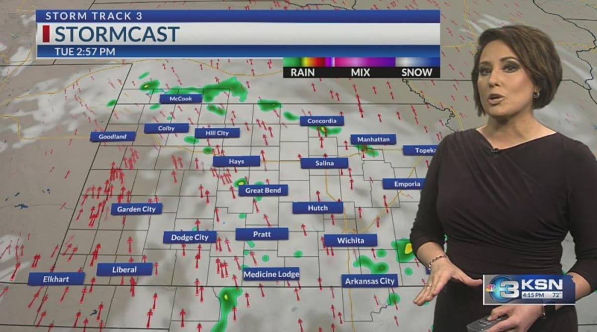 Storm Track 3 Forecast: Sprinkles Tuesday, cold front brings rain this weekend
A mix of clouds and sunshine today will keep partly cloudy skies around overnight. A spotty sprinkle or shower is possible overnight into the morning across southern Kansas. With a weak disturbance tracking through the…
-
 Another East Pacific storm brewing, eyeing the southern Mexican shoreline
AccuWeather hurricane experts are once again monitoring a high risk for tropical development southwest of Mexico in the wake of Trudy. Over the very warm waters south of Mexico, forecasters are watching the cluster of…
-
 Warming up this week
WICHITA, Kan. (KWCH) - Warmer temperatures are on the way for the week ahead as a stretch of quiet weather continues. It will be a cool start to the day on Monday with morning low temperatures in the mid to upper 40s…
-
 Fantastic fall Sunday, warmer days ahead
KCTV KANSAS CITY, Mo. (KCTV) - Chilly temperatures blanket the region for the start of your Sunday. SUNDAY: Sunshine is expected all day, so that will help our crisp fall conditions feel a bit more pleasant. We have a…
-
 Another cold night tonight with a warmer afternoon tomorrow
News Channel 6 | Wichita Falls, TX WICHITA FALLS, Texas (KAUZ) - Temperatures this afternoon were well below the normal for this time of year in the low 60s. Those numbers as we head into tonight will cool down into the…
-
 Mild end to the weekend.
KTEN Here is your Saturday evening forecast from Meteorologist Parker Schroeder. - Decorated veteran finds new best friend through veteran nonprofit - 2 killed, multiple injured after vehicle drives onto field during…
-
 SUN Morning Weather
KTEN - Decorated veteran finds new best friend through veteran nonprofit - 2 killed, multiple injured after vehicle drives onto field during soccer game at Wichita sports complex - Indiana's 22-game win streak ends…
-
 Severe Weather Alert: Heavy Rain and Flooding Expected Across Kansas
Home » Trending » Severe Weather Alert: Heavy Rain and Flooding Expected Across Kansas WICHITA, Kan. – Residents in south central and southeast Kansas are bracing for an ongoing weather pattern characterized by…
-
 Rodney's Friday Midday weather
KWCH Rodney's Friday Midday weather Wichita woman thankful after letter carrier saves her life Group planning to protest President Trump's Wichita rally
-
 First Freeze of the Season Tonight in the Texas Panhandle
The first freeze of the fall season hits the Texas Panhandle and South Plains tonight, with 28 in Dalhart. Crashy the Cold Front has arrived, bringing gusty north winds and Extreme fire danger to East Texas today. Texas…
Air quality
Acceptable. Unusually sensitive people should consider limiting prolonged outdoor exertion.
Wichita, KS reporting area · 1 hr ago. Data from AirNow (EPA and its state, local and tribal partners); preliminary and subject to change.
Sun & moon
Almanac
MonthlyWichita Area, records since 1888. Normals 1991–2020. Data from NOAA's Regional Climate Centers (ACIS).
Nearby
- Wichita 38 km
- Hutchinson 49 km
- Derby 45 km
- Newton 59 km
- Andover 56 km
- Haysville 38 km
- Wellington 54 km
- Park City 44 km
- Valley Center 41 km
- Mulvane 50 km
- Goddard 17 km
- Maize 31 km
Forecasters' discussion
From the National Weather Service office in ICT, issued 12 hrs ago
Key Messages
- Near to above average temperatures over the upcoming week
- Rain chances increase this afternoon across central KS; chances spread into south-central KS by Monday night
- More rain chances by late next week into next weekend
Discussion
Issued at 315 AM CDT Sun Oct 25 2026
As of 230 AM Sunday morning, a slow-moving midlevel trough remains across the southwest US with ridging across the central and eastern CONUS. A northern stream midlevel shortwave trough was advancing across Ontario with an attendant surface trough bisecting KS from southwest to northeast. Widely scattered showers continue to reside across far western KS and CO within a broad zone of midlevel WAA and gentle height falls. The midlevel height falls will gradually spread eastward this afternoon and tonight. This will spread rain chances into portions of central KS late this afternoon into the evening. These widely scattered showers will continue tonight and into Monday with the best chances remaining across central and western KS. More- widespread rain shower activity is anticipated Monday afternoon as the main shortwave trough ejects into the central high Plains. Rain chances will extend to the I-135 corridor Monday afternoon and even towards southeast KS late Monday night into Tuesday morning a secondary weak shortwave trough lifts from west TX into the Ozarks. As far as rain amounts are concerns, areas generally along and southeast of the KS Turnpike will see the lightest amounts with totals near or less than 0.10". As we progress westward and into central KS, amounts up to 0.50" are possible, especially across Barton and Russell counties.
Transitioning into midweek, broad southwesterly midlevel flow will remain as another western CONUS trough deepens. Broad low and midlevel WAA may continue to yield isolated to scattered showers especially at night. By weeks-end and into next week, a series of weak perturbations may eject across the area, resulting in intermittent rain chances.
Aviation
Issued at 1028 PM CDT Sat Oct 24 2026
A frontal boundary will stall over central Kansas tonight then gradually lift back northward on Sunday with north winds behind the front switching back to the south. High clouds will stream across the region with VFR conditions expected over the next 24hrs.
Ict Watches
None.
Forecasts, observations and alerts in the United States come from the National Weather Service (NOAA); radar from NOAA's Multi-Radar Multi-Sensor system; satellite imagery from NASA's Global Imagery Browse Services (GIBS) and NOAA's GOES satellites; the map from the U.S. Geological Survey's National Map; air quality from AirNow (EPA and its partners); hurricane information from the National Hurricane Center; climate normals and records from NOAA's Regional Climate Centers (ACIS). Forecasts outside the United States and the UV index: MET Norway (CC BY 4.0); observations outside the U.S.: airport reports via NOAA's Aviation Weather Center. Place names: GeoNames (CC BY 4.0). Data are copied on a schedule and may lag the sources; for warnings that affect your safety, follow your local National Weather Service office and emergency officials. Weather news is drawn from the 4Search index and reflects what the press published. Terms of use. How to use Weather