Install
Prairie Village, KS 66208 Weather
Current conditions
Observed at Kansas City, Kansas City Downtown Airport · 25 min ago
Forecast
10-day-
Today
Sunny, with a high near 77. South southwest wind 5 to 8 mph.
-
Tonight
Mostly cloudy, with a low around 57. South wind around 6 mph.
-
Tuesday
A slight chance of rain showers between 10am and 11am. Cloudy, with a high near 72. South wind around 9 mph. Chance of precipitation is 20%.
National Weather Service forecast updated 7 hrs ago.
Hourly
Hourly forecast- Now75°
- 6 PM74°
- 7 PM71°
- 8 PM66°
- 9 PM64°
- 10 PM63°
- 11 PM62°
- Tue12 AM61°
- 1 AM61°
- 2 AM60°
- 3 AM60°
- 4 AM59°
- 5 AM59°
- 6 AM59°
- 7 AM58°
- 8 AM58°
- 9 AM59°13%
- 10 AM63°15%
- 11 AM66°
- 12 PM68°
- 1 PM70°
- 2 PM71°
- 3 PM71°
- 4 PM72°
10-day forecast
Details- TodayOct 26Sunny57°77°
- TueOct 27Slight Chance Rain Showers then Cloudy33%58°72°
- WedOct 28Chance Rain Showers33%61°77°
- ThuOct 29Chance Showers And Thunderstorms30%60°79°
- FriOct 30Chance Showers And Thunderstorms44%57°75°
- SatOct 31Chance Rain Showers40%56°71°
- SunNov 1Slight Chance Rain Showers34%55°72°
- MonNov 2Heavy rain0.77 in56°73°
- TueNov 3Cloudy46°57°
- WedNov 4Sunny41°60°
Days after the National Weather Service's seven are MET Norway's outlook, a computer model with no forecaster's review.
Radar
Full mapWeather news in Kansas
More weather news-
 A week of warmth ahead of looming Halloween rain
KANSAS CITY, Mo. (KCTV) - A NEW FIRST WARN is in place on Halloween as confidence in rain grows. While rain is not a guarantee at this time, it’s a good idea to plan ahead for a potentially soggy day. In the meantime…
- Staying unseasonably warm. Potentially soggy Halloween
KANSAS CITY, Mo. (KCTV) - Morning lows and highs continue to stay above normal for this time of the year. Low-impact rain chances begin Tuesday, with the best chance on Halloween Saturday. Temps dip to the 60s by 7 pm &…
-
 Tracking A Sunny & Warm Sunday
Our warmer-than-normal weather will stick around for a while longer. The normal high is 65 and we will stay well above that for the next several days. After a low Saturday night of 57 (normal low is 40), Sunday will be…
-
 A spectacularly warm late October weekend
KANSAS CITY, Mo. (KCTV) - Fall is on hiatus, resulting in a warm and spring-like late October weekend! A few clouds may move over the area tonight. Low temperatures only fall to the upper 50s, around 57 degrees. No…
-
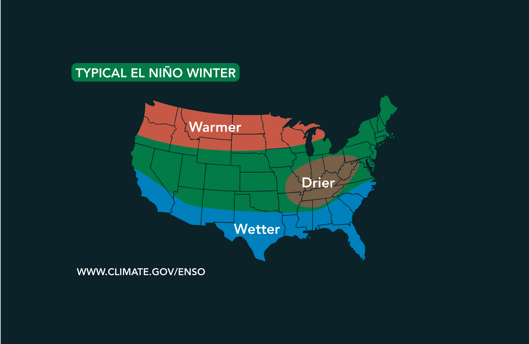 Potential El Niño to affect Kansas agriculture
Student critically injured after falling 70 feet in effort to avoid incoming vehicle • 2338 views College of Arts and Sciences to face future budget cuts • 2090 views K-State President Richard Linton to leave Wildcats…
-
 Tracking a mostly sunny and toasty October weekend
Jared Shelton is the weekend Storm Tracker Meteorologist and Weather Wise reporter at KQ2 News. Jump to comments ↓ Jared Shelton is the weekend Storm Tracker Meteorologist and Weather Wise reporter at KQ2 News. KQ2 is…
-
 Tracking a warm & mostly dry weekend ahead
Abigail McCluskey is the Hometown This Morning Storm Tracker Meteorologist at KQ2 News. Good morning and happy Friday! We are wrapping up the workweek with another beautiful, unseasonably warm day across northwest…
-
 No tricks, just treats! Great weather through the weekend
KANSAS CITY, Mo. (KCTV) - With Halloween just around the corner, you could say this forecast is a real treat! Warm, dry and pleasant conditions last through the weekend. Friday: Another Great Day! Warm Weekend with…
-
 #Drought news October 22, 2026: Improvements occurred across portions of #Kansas, #Nebraska, #Colorado, #Wyoming, #Utah, #Arizona and #NewMexico
Drought news October 22, 2026: Improvements occurred across portions of #Kansas, #Nebraska, #Colorado, #Wyoming, #Utah, #Arizona and #NewMexico coyotegulch.blog Click on a thumbnail graphic to view a gallery of drought…
-
 30 years since ‘October Surprise’ snowstorm hit Kansas City
KANSAS CITY, Mo. -- The thought of snow this October seems far away with the first part of the month still feeling like summer with temperatures reaching 90 degrees and severe weather last week. Thursday marks 30 years…
Air quality
Acceptable. Unusually sensitive people should consider limiting prolonged outdoor exertion.
Forecast
- MonModerate (58)
- TueGood (44)
Kansas City, MO reporting area · 1 hr ago. Data from AirNow (EPA and its state, local and tribal partners); preliminary and subject to change.
Sun & moon
Almanac
MonthlyKansas City Downtown Ap, records since 1934. Normals 1991–2020. Data from NOAA's Regional Climate Centers (ACIS).
Nearby
- Kansas City 13 km
- Overland Park 3 km
- Kansas City 14 km
- Olathe 20 km
- Independence 22 km
- Lee's Summit 24 km
- Lawrence 52 km
- Shawnee 9 km
- Blue Springs 31 km
- Lenexa 10 km
- Leavenworth 43 km
- Leawood 3 km
Forecasters' discussion
From the National Weather Service office in EAX, issued 2 hrs ago
Key Messages
- Above normal temperatures forecast through the next week.
- Isolated - scattered (15-30%) showers tonight - tomorrow morning for portions of northeastern Kansas and northwestern Missouri.
- Scattered to widespread (30-70%) showers and a few storms, mainly for northern Missouri Wednesday into the weekend.
Discussion
Issued at 221 PM CDT Mon Oct 26 2026
Water vapor imagery with 500mb heights plotted shows the upper ridge axis shifting east and weakening as it does, and a shortwave trough lifting northeastward out of Mexico and southwestern Texas. As that shortwave moves into Oklahoma and Kansas tonight into tomorrow, forcing associated with it will lead to isolated to scattered showers, and possibly a few thunderstorms, across eastern/ northeastern Kansas and northwestern Missouri. Instability is very weak to nonexistent across the area so the chances for any storms is quite low. So the general expectation is for be just showers. This system will also lead to a brief cool down (though still above normal) in temperatures Tuesday.
Temperatures rebound Wednesday through Friday as persistent southerly flow allows temperatures to climb back into the upper 70s to potentially near 80 degrees. With normal highs in the lower 60s for the Kansas City area, we should be 15 to as much as 20 degrees above normal. There is some uncertainty regarding this, however. A frontal boundary may slide south through the area leading to increased precipitation chances and cooler (though still above normal) temperatures. For now, the most probable scenario is for precipitation to occur across northern Missouri, in the vicinity of the boundary, with areas south of that boundary to climb one again into the upper 70s to near 80 degrees. A similar scenario plays out Friday, with the most likely areas to see precipitation across northern Missouri/ northeastern Kansas, and south of that climb into the upper 70s. If precipitation occurs further south, that would limit just how warm much of the forecast area gets. That's a possibility (~<25% of occurrence), just not as probable as what's already been mentioned. For Saturday, the best chances for precipitation look earlier than in previous forecasts as the shortwave moves over the area earlier. This results in decreasing PoPs by the early evening hours across eastern Kansas and western Missouri. While temperatures trend cooler for the weekend, we may still be 10 degrees above normal Saturday - Monday.
Aviation
Issued at 1208 PM CDT Mon Oct 26 2026
VFR conditions are expected through the forecast. High-level clouds will increase tonight with skies becoming overcast and ceilings as low as 15K ft. Have added a PROB30 group tomorrow morning for STJ for some -SHRA and lower VFR ceilings. The best chances for precipitation look just to the west-northwest of the STJ terminal but there's enough of a chance to include some mention of it. Winds will be from the south through the forecast at 5-10kts.
Eax Watches
MO...None. KS...None.
Forecasts, observations and alerts in the United States come from the National Weather Service (NOAA); radar from NOAA's Multi-Radar Multi-Sensor system; satellite imagery from NASA's Global Imagery Browse Services (GIBS) and NOAA's GOES satellites; the map from the U.S. Geological Survey's National Map; air quality from AirNow (EPA and its partners); hurricane information from the National Hurricane Center; climate normals and records from NOAA's Regional Climate Centers (ACIS). Forecasts outside the United States and the UV index: MET Norway (CC BY 4.0); observations outside the U.S.: airport reports via NOAA's Aviation Weather Center. Place names: GeoNames (CC BY 4.0). Data are copied on a schedule and may lag the sources; for warnings that affect your safety, follow your local National Weather Service office and emergency officials. Weather news is drawn from the 4Search index and reflects what the press published. Terms of use. How to use Weather