Install
Kansas City, MO 64101 Weather
Current conditions
Observed at Kansas City, Kansas City Downtown Airport · 36 min ago
Forecast
10-day-
Friday
Sunny, with a high near 78. South southeast wind 5 to 9 mph.
-
Friday Night
Partly cloudy, with a low around 58. South southeast wind around 8 mph.
-
Saturday
Mostly sunny, with a high near 78. South wind around 7 mph.
National Weather Service forecast updated 12 hrs ago.
Hourly
Hourly forecast- Now77°
- 3 PM78°
- 4 PM77°
- 5 PM76°
- 6 PM75°
- 7 PM71°
- 8 PM68°
- 9 PM66°
- 10 PM65°
- 11 PM64°
- Sat12 AM63°
- 1 AM62°
- 2 AM61°
- 3 AM61°
- 4 AM60°
- 5 AM59°
- 6 AM58°
- 7 AM58°
- 8 AM58°
- 9 AM60°
- 10 AM64°
- 11 AM68°
- 12 PM72°
- 1 PM75°
10-day forecast
Details- TonightOct 22Mostly Clear54°
- TodayOct 23Sunny58°78°
- SatOct 24Mostly Sunny56°78°
- SunOct 25Partly Sunny57°78°
- MonOct 26Partly Sunny56°75°
- TueOct 27Mostly Cloudy55°71°
- WedOct 28Slight Chance Rain Showers32%55°74°
- ThuOct 29Chance Rain Showers32%71°
- FriOct 30Sunny37°54°
- SatOct 31Partly cloudy49°66°
Days after the National Weather Service's seven are MET Norway's outlook, a computer model with no forecaster's review.
Radar
Full mapWeather news near Kansas City
More weather news-
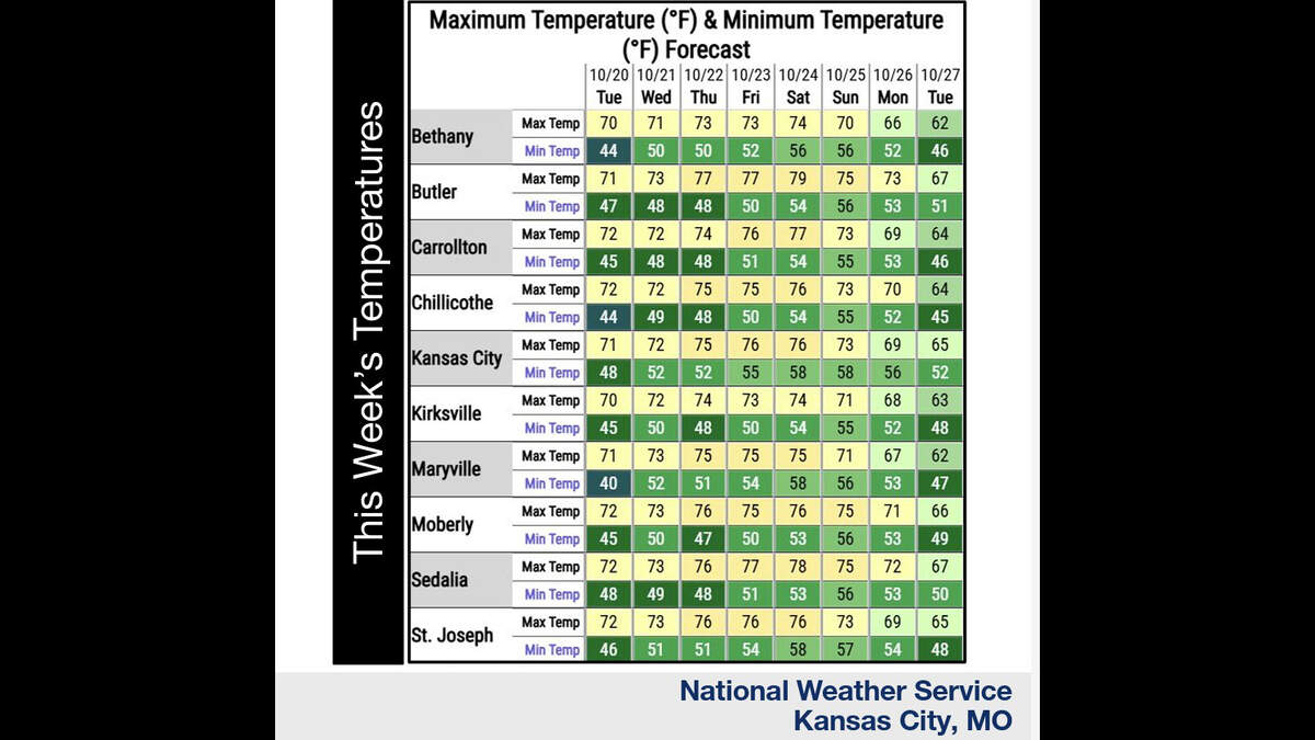 Kansas City’s warm, mostly dry stretch lasts through Sunday. What comes next?
Fall temperatures are climbing in Kansas City again Tuesday, with warmer-than-normal weather expected through the weekend, the National Weather Service says. Skies will become increasingly cloudy as metro temperatures…
-
 KSHB 41 Weather | Sunshine and highs in the 60s Sunday in Kansas City
KSHB 41 Weather | Sunshine and highs in the 60s Sunday KSHB 41 Kansas City KSHB 41 Weather | Sunshine and highs in the 60s Sunday in Kansas City KANSAS CITY, Mo. — Hosting an event or gathering? Send your weather…
-
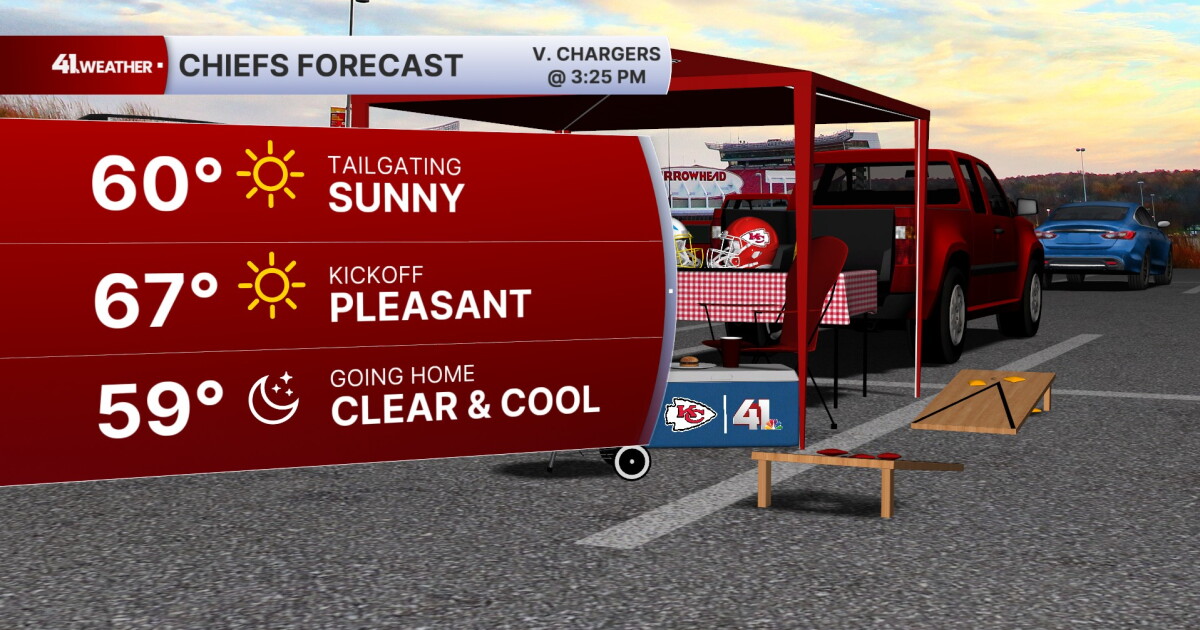 KSHB 41 Weather Blog | Pleasant stretch of weather in store for Kansas City
KANSAS CITY, Mo. — Pleasant, fall weather is sticking around for the next few days, before highs reach near 80° by the end of the week. Sunday is going to be the ideal fall day. Chilly in the morning, then reaching the…
-
 KSHB 41 Weather Blog | Freeze and frost potential Saturday morning
KANSAS CITY, Mo. — Lows are expected to drop into the 30s Saturday morning — the coldest Kansas City has been since early May. Temperatures on Friday will struggle to make it out of the low 50s. Strong, chilly winds out…
-
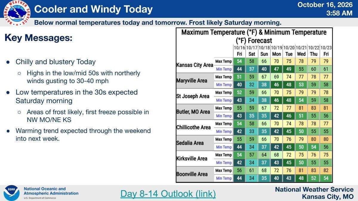 Cold night ahead: Season’s first frost likely, freeze possible in Kansas City area
A cool, cloudy and windy day is expected in the Kansas City area Friday, with frost and maybe the season’s first freeze overnight, according to the National Weather Service. Temperatures across the region will likely…
- WEATHER BLOG: Chilly temperatures for Friday night football; frost likely Saturday
Fall is in the air this weekend, and a little bit of winter's chill will sneak in as well! Strong north winds this afternoon will average 20 mph, with gusts up to 35 mph. Combined with a mostly cloudy sky, temperatures…
-
 Significantly cooler Friday, first frost possible tonight
KANSAS CITY, Mo. (KCTV) - A sharp cooldown with weekend frost will give way to a warming trend by next week. FRIDAY: Extra layers are the name of the game today! It is significantly cooler out the door for the morning…
-
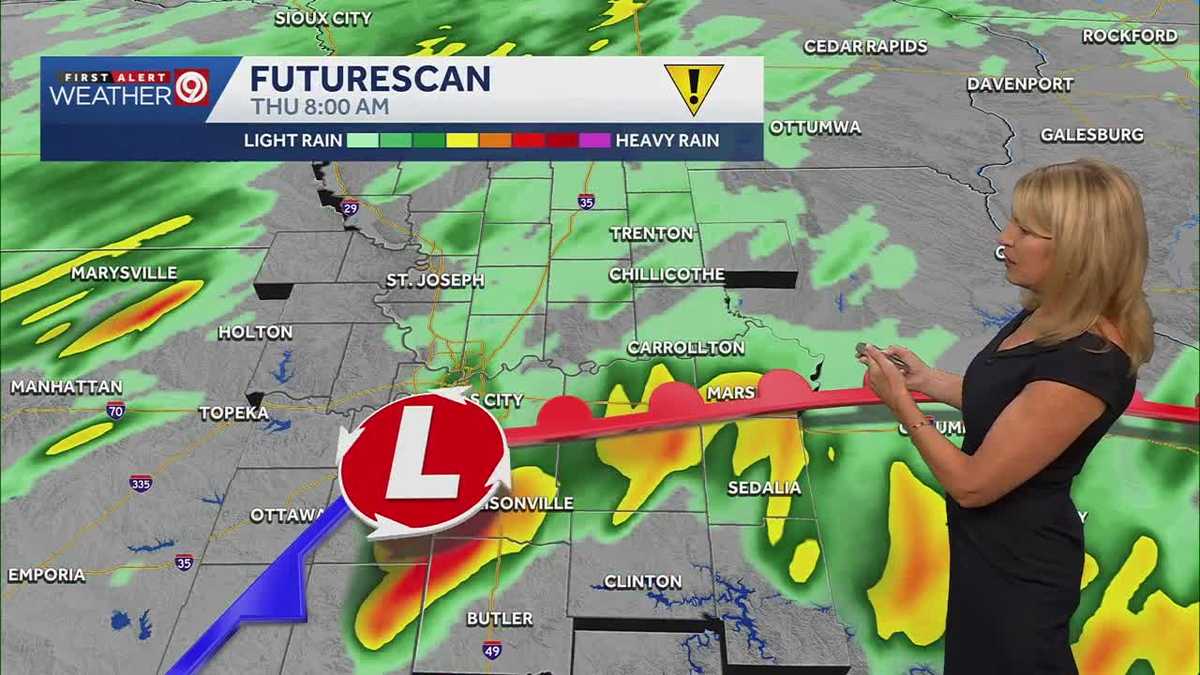 Rainy morning in the Kansas City metro ahead of a cold weekend ahead
Today is a First Alert Weather Impact Day due to rain that will impact your plans throughout the morning into the early afternoon. The high today is 72 degrees. After the rain, colder weather will blow across Kansas and…
-
 First Warn for widespread rain, rumbles during the Thursday morning commute
KCTV First Warn for widespread rain, rumbles during the Thursday morning commute Missouri AG Catherine Hanaway announces investigation into TikTok’s impact on children Kansas City firefighters prepare for overlapping…
-
 Spotty rain this evening becomes widespread Thursday morning
KCTV Spotty rain this evening becomes widespread Thursday morning Community rallies around historic Mt. Zion Christian Church after fire Missouri Supreme Court challenge could overturn public safety laws Move-ins begin…
Air quality
Acceptable. Unusually sensitive people should consider limiting prolonged outdoor exertion.
Forecast
- FriModerate (51)
- SatModerate (54)
Kansas City, MO reporting area · 1 hr ago. Data from AirNow (EPA and its state, local and tribal partners); preliminary and subject to change.
Sun & moon
Almanac
MonthlyKansas City Downtown Ap, records since 1934. Normals 1991–2020. Data from NOAA's Regional Climate Centers (ACIS).
Nearby
- Overland Park 15 km
- Kansas City 3 km
- Olathe 31 km
- Independence 16 km
- Lee's Summit 28 km
- Lawrence 57 km
- Shawnee 12 km
- Blue Springs 29 km
- Lenexa 20 km
- Leavenworth 36 km
- Leawood 15 km
- Liberty 22 km
Forecasters' discussion
From the National Weather Service office in EAX, issued 1 hr ago
Key Messages
- Seasonally warm temperatures continue through the weekend and early next week. Broader cool down through the week.
- Widespread precipitation chances difficult to come by until at least the middle of next week.
- Far far NW Missouri / NE Kansas may see chances (10-25 percent) Monday afternoon and evening.
Discussion
Issued at 307 AM CDT Fri Oct 23 2026
There really just is not much sensible weather, at least changes, to speak of. Fortunately, that tends to mean pleasant overall conditions across the area...
The large scale mid-upper level pattern has a good amount of activity within it over the coming days, just not likely to affect the immediate area. Currently the pattern is highlighted by a trough- ridge-trough pattern across CONUS with the ridge axis just a hair west of the Missouri. The western CONUS trough remains expected to split with a piece riding inland and NE around the stout ridge and another piece digging into southern California and becoming a cutoff low. The aforementioned northeastward moving piece will yield a developing surface low and attendant cold front by Saturday, but its rapid movement into Canada leaves little support for the front to push much across the Central Plains. This too is bolstered by the lagging cutoff low beginning to move further inland, preventing any trailing surface high support to develop. With broad surface high pressure remaining over the eastern CONUS, all of this is to say that dry conditions and southerly winds remain through the weekend. With little change in mixing depth, wind speeds, or 925-850mb temps, expect highs to be quite similar to yesterday... mid to upper 70s for most and a few touching 80. Of which would be upwards of 10-15+ deg above normal.
To start the work week, confidence in the broad pattern evolution remains high within GEFS/ECMWF ENS. This can be gleaned a few ways, including within temp spreads. Both ensemble systems tend to suggest 25th/75th spreads of ~5 deg F or less, with that strongest within the ECMWF ENS through Tuesday/Wednesday. The existing mid-level ridge will continue to keep conditions on the dry side as it deflects western CONUS cutoff low (becoming an open wave). The more southerly path of this trough will more substantially flatten the ridge and bring about an outside shot at some light precipitation over far W/NW areas of the CWA as early as Monday evening. Given the pre-existing very dry air mass, it would likely take a notable southerly/easterly trend in the trough path to see measurable precipitation chances. Generally expect temperatures to remain above normal but likely a few degrees cooler than the weekend, in the low to mid 70s, with an uptick in cloud cover and slightly cooler 925- 850mb temps.
Deterministic and ensemble guidance both begin to diverge more significantly mid-late week, primarily differing in their handling of a series of northern stream shortwaves and larger troughs/cutoff lows. Difficult to pin down much in the way of confidence in any frontal or precipitation timing. The 'strongest' takeaways over the latter half of the work week would be best chances for cooling temperatures, and increasing precipitation chances.
Aviation
Issued at 100 PM CDT Fri Oct 23 2026
VFR conditions are expected for the duration of the forecast period. South winds around 10-12 knots with gusts up to 15-20 knots possible mainly north of and including STJ. Gusts curtail after sunset.
Eax Watches
MO...None. KS...None.
Forecasts, observations and alerts in the United States come from the National Weather Service (NOAA); radar from NOAA's Multi-Radar Multi-Sensor system; satellite imagery from NASA's Global Imagery Browse Services (GIBS) and NOAA's GOES satellites; the map from the U.S. Geological Survey's National Map; air quality from AirNow (EPA and its partners); hurricane information from the National Hurricane Center; climate normals and records from NOAA's Regional Climate Centers (ACIS). Forecasts outside the United States and the UV index: MET Norway (CC BY 4.0); observations outside the U.S.: airport reports via NOAA's Aviation Weather Center. Place names: GeoNames (CC BY 4.0). Data are copied on a schedule and may lag the sources; for warnings that affect your safety, follow your local National Weather Service office and emergency officials. Weather news is drawn from the 4Search index and reflects what the press published. Terms of use.