Install
Lansing, MI 48909 Weather
Current conditions
Forecast for this hour (no station report in the last two hours)
Forecast
10-day-
This Afternoon
Sunny, with a high near 68. North wind around 3 mph.
-
Tonight
Patchy fog after 4am. Partly cloudy, with a low around 43. East northeast wind around 2 mph.
-
Friday
Areas of fog before 10am. Mostly sunny, with a high near 66. East southeast wind around 3 mph.
National Weather Service forecast updated 1 hr ago.
Hourly
Hourly forecast- Now67°
- 4 PM68°
- 5 PM67°
- 6 PM66°
- 7 PM62°
- 8 PM56°
- 9 PM54°
- 10 PM52°
- 11 PM50°
- Fri12 AM49°
- 1 AM47°
- 2 AM46°
- 3 AM46°
- 4 AM44°
- 5 AM44°
- 6 AM44°
- 7 AM43°
- 8 AM43°
- 9 AM45°
- 10 AM49°
- 11 AM54°
- 12 PM58°
- 1 PM61°
- 2 PM64°
10-day forecast
Details- TodayOct 22Sunny43°68°
- FriOct 23Areas Of Fog then Mostly Sunny43°66°
- SatOct 24Sunny45°67°
- SunOct 25Mostly Sunny47°70°
- MonOct 26Partly Sunny44°65°
- TueOct 27Mostly Cloudy12%41°61°
- WedOct 28Partly Sunny13%43°59°
- ThuOct 29Rain0.14 in39°56°
- FriOct 30Cloudy35°47°
- SatOct 31Sunny33°52°
Days after the National Weather Service's seven are MET Norway's outlook, a computer model with no forecaster's review.
Radar
Full mapWeather news near Lansing
More weather news-
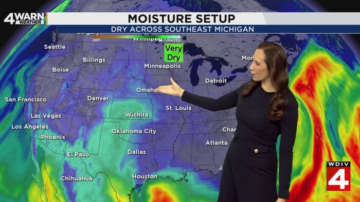 Metro Detroit weather forecast, Oct. 20, 2026 -- 4 p.m. Update
ClickOnDetroit | WDIV Local 4 Metro Detroit weather forecast, Oct. 20, 2026 -- 4 p.m. Update Go 4 It: Dispose of unused medications safely at Detroit police 7th Precinct Local 4 News at 4 -- Oct. 20, 2026 Michigan U.S…
-
 How El Niño could impact the coming Michigan winter
The National Oceanic and Atmospheric Administration's seasonal weather outlook for winter 2026-27 is here, and it suggests the current El Niño could have a significant impact on Michigan. The NOAA predicts…
- NOAA: El Niño will bring milder, drier late fall, winter for Michigan
Subfreezing morning temperatures and gusty conditions gave way to a calm, quiet weekend across Lower Michigan, while long-range forecasters point to a warmer and drier late autumn and winter ahead across the Great Lakes…
-
 Lansing, MI Weather Forecast – Hourly & 15-Day
Now · 10:17 AM United States · Michigan · 48911 ✓Air quality is favorable for outdoor activities. Microscopic particles that can penetrate deep into the lungs. Elevated concentrations can especially affect children…
- Mid-Michigan’s First Widespread Frost Arrives Tonight
Well, it was a good run while it lasted. It was nice knowing you, warm weather. Don't let the door hit you on the way out. Actually, could you leave it open? I'm not ready for this. Lansing and Mid-Michigan are facing…
-
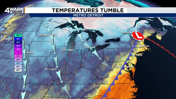 From wind and rain to frost and sunshine in Metro Detroit this weekend
4Warn Weather – Metro Detroit is getting a sharp reminder Friday that fall is firmly in control, but the payoff arrives just in time for a busy weekend filled with football and the Detroit Free Press Marathon. Southeast…
-
 First Alert Weather 10/14/2026
WILX First Alert Weather 10/14/2026 Medical examiner rules indeterminate cause of death for man found on Lansing River Trail Summer cyclosporiasis outbreak had a wide economic impact, MSU researcher says Cow euthanized…
-
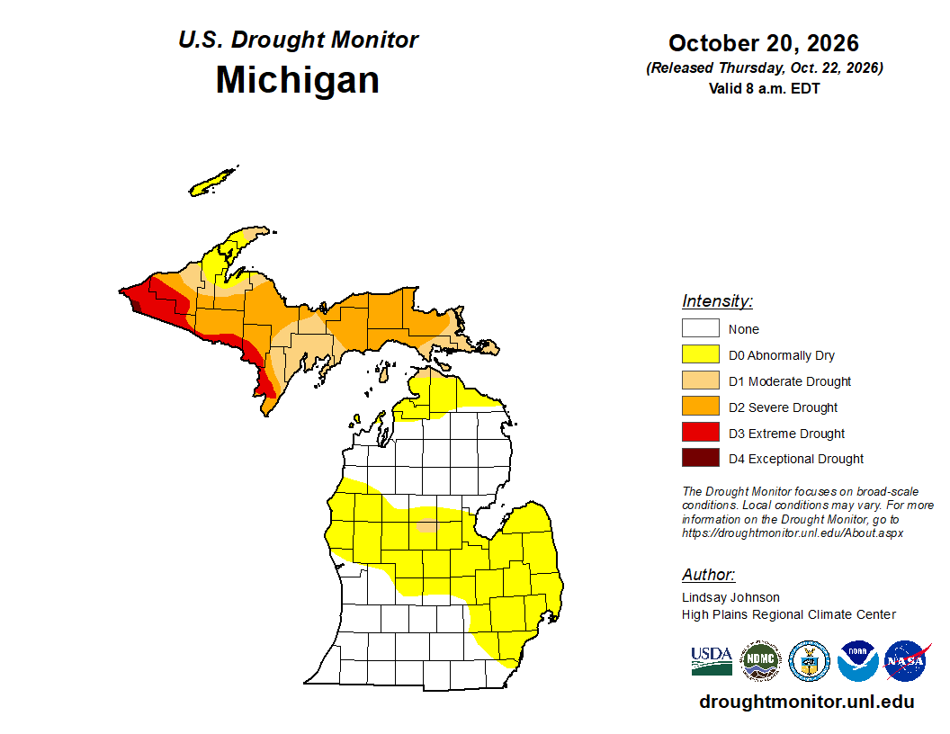 Mid-Michigan turns abnormally dry after a relatively dry October
Minor drought conditions are being observed in Mid-Michigan after a dry month. Minor drought conditions have been noted across the Mid-Michigan area as October has been notably dry. Currently, much of the Lower…
-
 Sunshine and Mild Temperatures Continue Across Southeast Michigan
ClickOnDetroit | WDIV Local 4 Trader Joe’s is expanding nationwide, including new Metro Detroit store Sunshine and Mild Temperatures Continue Across Southeast Michigan Oakland County Little League umpire shared child…
-
 Your WTOL 11 weather impact forecast: What to expect in northwest Ohio, southeast Michigan
WTOL Your WTOL 11 weather impact forecast: What to expect in northwest Ohio, southeast Michigan To stream WTOL on your phone, you need the WTOL app. Download the WTOL app Next up in 5 Example video title will go here…
Air quality
Air quality is satisfactory, and air pollution poses little or no risk.
Forecast
- ThuModerate
- FriModerate
Lansing, MI reporting area · 1 hr ago. Data from AirNow (EPA and its state, local and tribal partners); preliminary and subject to change.
Sun & moon
Almanac
MonthlyLansing Area, records since 1863. Normals 1991–2020. Data from NOAA's Regional Climate Centers (ACIS).
Nearby
Forecasters' discussion
From the National Weather Service office in GRR, issued 2 hrs ago
Key Messages
- Dry and Mild with Morning Fog
- Chances for Rain Return Next Week
Discussion
Issued at 330 AM EDT Thu Oct 22 2026
- Dry and Mild with Morning Fog
Ensembles continue to lend high confidence in tranquil and warmer than normal conditions through the weekend. A sharpening upper level ridge over the central CONUS will reinforce a sprawling high pressure anticyclone in the low levels across the Great Lakes, migrating toward the Northeast. There is increasing ensemble spread and thus lower confidence in high temperatures starting on Monday and extending through the week, and highs may plausibly be anywhere in the 50s or 60s. This will depend on the magnitude of northern stream troughing that occurs over south-central Canada and the Great Lakes, and the southward extent which cooler air may reach. Ensemble members also diverge into clusters regarding the the potential for a recovery of warmer air around the middle of the week. So, next week is relatively unsettled.
Areas of fog are likely to develop each of the next few mornings, as they have the past couple mornings. The REFS handled the general location of the Wednesday morning fog threat in Mid Michigan fairly well. For this Thursday morning it has been suggesting areas of overnight fog mainly between Muskegon and Ludington, which has so far been the case, and patchy fog may develop elsewhere around daybreak. Tonight into Friday morning, with the surface high centered north of Lake Huron, a flow of relatively moist air off Lake Huron will spread into Mid Michigan during the late evening, setting up fog potential first near US-127 and spreading west toward US-131 areas around daybreak Friday.
- Chances for Rain Return Next Week
The chance for precipitation is basically nil until about Tuesday or Wednesday next week, and even so is far from settled. Any individual model solutions producing heavy rain or strong winds the middle of next week are outliers. The potential for a significant autumn storm system -- even with the unsettled evolution of the northern stream -- is remarkably low for this point in the season.
Aviation
Issued at 100 PM EDT Thu Oct 22 2026
Clear and quiet through the rest of the day. Expecting fog to develop across the middle of the Lower Peninsula in the predawn hours. Given the position of the surface high overnight, there will be an increased chance of LIFR fog - with tempos down to a 1/4SM and JXN/LAN/GRR around sunrise and a couple hours thereafter. Fog should lift and thin during the mid-morning hours.
Marine
Issued at 330 AM EDT Thu Oct 22 2026
Light winds and a rather calm lake can be expected today. Southeast winds on Friday will be a touch stronger but only about 10 knots. South winds on Saturday 15 to 20 knots may build waves to 2 to 4 feet north of Whitehall.
Forecasts, observations and alerts in the United States come from the National Weather Service (NOAA); radar from NOAA's Multi-Radar Multi-Sensor system; satellite imagery from NASA's Global Imagery Browse Services (GIBS) and NOAA's GOES satellites; the map from the U.S. Geological Survey's National Map; air quality from AirNow (EPA and its partners); hurricane information from the National Hurricane Center; climate normals and records from NOAA's Regional Climate Centers (ACIS). Forecasts outside the United States and the UV index: MET Norway (CC BY 4.0); observations outside the U.S.: airport reports via NOAA's Aviation Weather Center. Place names: GeoNames (CC BY 4.0). Data are copied on a schedule and may lag the sources; for warnings that affect your safety, follow your local National Weather Service office and emergency officials. Weather news is drawn from the 4Search index and reflects what the press published. Terms of use.