Install
Peru, IN 46970 Weather
Current conditions
Forecast for this hour (no station report in the last two hours)
Forecast
10-day-
This Afternoon
Sunny, with a high near 70. East wind around 0 mph.
-
Tonight
Clear, with a low around 41. East wind 0 to 5 mph.
-
Wednesday
Sunny, with a high near 71. Wind around 0 mph.
National Weather Service forecast updated 4 hrs ago.
Hourly
Hourly forecast- Now68°
- 6 PM65°
- 7 PM61°
- 8 PM57°
- 9 PM54°
- 10 PM52°
- 11 PM51°
- Wed12 AM49°
- 1 AM48°
- 2 AM46°
- 3 AM45°
- 4 AM44°
- 5 AM43°
- 6 AM42°
- 7 AM41°
- 8 AM41°
- 9 AM43°
- 10 AM49°
- 11 AM54°
- 12 PM59°
- 1 PM64°
- 2 PM67°
- 3 PM69°
- 4 PM69°
10-day forecast
Details- TodayOct 20Sunny41°70°
- WedOct 21Sunny43°71°
- ThuOct 22Sunny44°71°
- FriOct 23Sunny41°67°
- SatOct 24Sunny46°68°
- SunOct 25Mostly Sunny48°72°
- MonOct 26Mostly Sunny44°67°
- TueOct 27Partly cloudy43°56°
- WedOct 28Light rain0.07 in43°49°
- ThuOct 29Sunny44°60°
Days after the National Weather Service's seven are MET Norway's outlook, a computer model with no forecaster's review.
Radar
Full mapWeather news near Peru
More weather news-
 LatAm Expat & Nomad Daily Guide for Tuesday, October 20, 2026
LatAm Expat & Nomad Daily Guide — Tuesday, October 20, 2026 As of 12:30 a.m. US Eastern Time (ET) · 1:30 a.m. Brasília, Tuesday 20 October 2026 · storm bulletin to Monday night, rates to the latest published fixing…
-
 LatAm Expat & Nomad Daily Guide for Monday, October 19, 2026
LatAm Expat & Nomad Daily Guide — Monday, October 19, 2026 As of 12:30 a.m. US Eastern Time (ET) · 1:30 a.m. Brasília, Monday 19 October 2026 · storm bulletins to Sunday night, rates to the latest published fixing…
- Japan Declares Latest El Niño the Strongest on Record as Global Experts Debate Pacific Warming Metrics
Japan Meteorological Agency (JMA) recently confirmed that the current El Niño warming phenomenon is the most severe one in the history of monitoring dating back to 1949. According to JMA statistics, water temperatures…
-
 Dangerous Freeze Warnings for 38 Counties in Indiana as Temperatures Plummet
Freeze Warnings are in effect for 38 counties in Indiana from early Sunday morning, with lows as cold as 30 degrees expected. The warnings cover central, northern, east central and southeast Indiana. Three National…
-
 El Niño grows ‘second arm’ as California braces for impacts of rapidly expanding super system
California’s looming El Niño nightmare is already here — and as the coastline continues to take a beating, meteorologists are warning the massive weather system has gone mutant. The potentially historic weather system…
-
 Serious touch of cold weather arrived Friday night
Mother Nature is giving our area another reminder about cold weather. A frost advisory was in effect overnight into Saturday with temperatures dipping down to the middle 30's Saturday morning. Drivers were scrapping car…
-
 ‘Danger zone’: These 5 US states are about to be hit hardest by El Niño, experts warn
Expect wildfires, floods and storms The world is entering a “danger zone of extreme weather” as the El Niño weather phenomenon starts to be felt, UN chief António Guterres recently said. His warnings have been echoed by…
-
 Dangerous Freeze Watch for Parts of Indiana and Michigan as Temperatures Drop
A Freeze Watch is in effect for northern, east central and southeast Indiana from late Saturday night through Sunday morning, with lows as cold as 31 degrees possible. A Frost Advisory comes first, for parts of northern…
-
 Terrifying new images show Super El Nino developing into 'strongest weather event for 1,000 years'
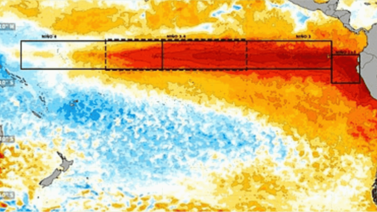
'El Nino is one of a number of large-scale atmospheric drivers that influence weather patterns in the UK and Europe,' the Met Office says A huge area of unusually warm water appears to be spreading across the Pacific…
-
 Super El Niño 'grows second arm' as Brits warned to stock up ahead of severe weather
New weather maps show the ongoing 'Super El Niño' event appears to have developed a second extension, suggesting a significant expansion of unusually warm waters across the Pacific Ocean — as Brits are urged to prepare…
Air quality
Air quality is satisfactory, and air pollution poses little or no risk.
Kokomo, IN reporting area · 1 hr ago. Data from AirNow (EPA and its state, local and tribal partners); preliminary and subject to change.
Sun & moon
Almanac
MonthlyKokomo 3 Wsw, records since 1901. Normals 1991–2020. Data from NOAA's Regional Climate Centers (ACIS).
Nearby
- Kokomo 30 km
- Marion 40 km
- Logansport 24 km
- Huntington 50 km
- Warsaw 57 km
- Wabash 22 km
- Elwood 56 km
- Mount Vernon 22 km
- Rochester 37 km
- North Manchester 38 km
- Gas City 48 km
- Grissom Air Force Base 12 km
Forecasters' discussion
From the National Weather Service office in IWX, issued 5 hrs ago
Key Messages
- Dry and pleasant weather persists through the entire week with highs either side of 70, lows in the 40s, and no rain until next week at the earliest.
Discussion
Issued at 126 AM EDT Tue Oct 20 2026
Upper flow across area east of the Rockies is relatively weak as mid level ridging and a couple surface high pressure centers pair to keep the area dry. As the first high pressure center moves into southeast Canada from the Northern Great Lakes, a backdoor cold front sets up east of MI and north of OH, which may be able to advect marine air into our east potentially setting them up for morning fog Wed AM. Another northern stream wave and trailing surface high pass by to the north of the area Wed through Thu time frame. Because the front washes out across the area Wed night, minimal lowering of temps occurs for Friday (from mid 60s to low 70s Thu to low to upper 60s Fri). With the mid level ridging still staunchly in place across the Plains States and Mississippi Valley, troughing in the west struggles to advance eastward and surface lows take a north-northeasterly track into Southcentral Canada. So, it could be until the first part of the next work week before we get our next rain into the area. There are hints that the mid level ridge finally pushes eastward at this time and this helps some combination of a diving wave within the northern stream and some southern stream moisture to make it up this way to provide rain.
Aviation
Issued at 1152 AM EDT Tue Oct 20 2026
Continuation of VFR conditions and light winds as high pressure dominates.
Iwx Watches
IN...None. OH...None. MI...None. MARINE...None.
Forecasts, observations and alerts in the United States come from the National Weather Service (NOAA); radar from NOAA's Multi-Radar Multi-Sensor system; satellite imagery from NASA's Global Imagery Browse Services (GIBS) and NOAA's GOES satellites; the map from the U.S. Geological Survey's National Map; air quality from AirNow (EPA and its partners); hurricane information from the National Hurricane Center; climate normals and records from NOAA's Regional Climate Centers (ACIS). Forecasts outside the United States and the UV index: MET Norway (CC BY 4.0); observations outside the U.S.: airport reports via NOAA's Aviation Weather Center. Place names: GeoNames (CC BY 4.0). Data are copied on a schedule and may lag the sources; for warnings that affect your safety, follow your local National Weather Service office and emergency officials. Weather news is drawn from the 4Search index and reflects what the press published. Terms of use.