Install
Newport, KY 41072 Weather
Current conditions
Observed at Cincinnati, Cincinnati Municipal Airport Lunken Field · 26 min ago
Forecast
10-day-
This Afternoon
Sunny, with a high near 70. North wind around 3 mph.
-
Tonight
Clear, with a low around 41. North wind around 2 mph.
-
Thursday
Sunny, with a high near 69. North wind 1 to 6 mph.
National Weather Service forecast updated 1 hr ago.
Hourly
Hourly forecast- Now70°
- 5 PM69°
- 6 PM67°
- 7 PM64°
- 8 PM57°
- 9 PM53°
- 10 PM51°
- 11 PM50°
- Thu12 AM49°
- 1 AM46°
- 2 AM45°
- 3 AM43°
- 4 AM43°
- 5 AM43°
- 6 AM42°
- 7 AM41°
- 8 AM41°
- 9 AM44°
- 10 AM52°
- 11 AM58°
- 12 PM62°
- 1 PM64°
- 2 PM67°
- 3 PM68°
10-day forecast
Details- TodayOct 21Sunny41°70°
- ThuOct 22Sunny42°69°
- FriOct 23Sunny43°69°
- SatOct 24Sunny43°71°
- SunOct 25Sunny44°72°
- MonOct 26Mostly Sunny46°73°
- TueOct 27Partly Sunny46°70°
- WedOct 28Sunny49°76°
- ThuOct 29Partly cloudy52°76°
- FriOct 30Partly cloudy0.10 in50°62°
Days after the National Weather Service's seven are MET Norway's outlook, a computer model with no forecaster's review.
Radar
Full mapWeather news near Newport
More weather news- From Freeze to Ease: Cincinnati Shakes Off Frost, Basks in Sunny 60s All Week
Fog and a sharp early chill greeted Cincinnati on Sunday morning, with a Freeze Warning in effect until 9 a.m. The payoff comes later: sunshine should take over, sending temperatures toward a comfortable high near 64…
-
 Freeze warning issued through Sunday morning ahead of sunny Tri-State warm-up
FOX19 | Cincinnati Freeze warning issued through Sunday morning ahead of sunny Tri-State warm-up Protester removed from President Trump rally in Northern Kentucky Monroe Sheriff: One dead, ‘several’ others hurt during…
-
 OH WFO CINCINNATI Warnings, Watches, and Advisories
WFO CINCINNATI Warnings, Watches and Advisories for Sunday, October 18, 2026 URGENT - WEATHER MESSAGE National Weather Service Wilmington OH 130 PM EDT Fri Oct 16 2026 and northern Kentucky, and central, south central…
-
 Dangerous Freeze Watch for Parts of Indiana and Michigan as Temperatures Drop
A Freeze Watch is in effect for northern, east central and southeast Indiana from late Saturday night through Sunday morning, with lows as cold as 31 degrees possible. A Frost Advisory comes first, for parts of northern…
-
 Tri-State ties 1928 heat record before storms bring sharp weekend chill
CINCINNATI (WKRC) — Cincinnati tied a 98-year-old temperature record Tuesday as the Tri-State reached 88 degrees at Cincinnati/Northern Kentucky International Airport. The temperature matched the Oct. 13 record set in…
- A meteor shower from Halley’s Comet peaks over Kentucky tonight. When to see it
A full “hunter’s moon” will soon peak over Kentucky, along with an upcoming meteor shower from Halley’s Comet. The Orionid meteor shower will peak Wednesday night into Thursday morning, according to NASA. “The Orionids…
- Here’s what the Super El Niño has in store for Kentucky this winter
Lexington Herald Leader Forecasters are pointing to a colder-than-normal winter for Kentucky, with a strengthening El Niño potentially sharpening the chill. Here’s a quick look at what Lexington and the broader region…
- Kentucky Winter 2026-27: Louisville, 13.89-Inch Snow History
NOAA's historical El Niño snowfall analysis from 1950–2009 shows mixed snowfall departures across Kentucky and neighboring states, without establishing a consistent statewide increase or decrease. Why El Niño Doesn't…
-
 Farmer’s Almanac Drops Thanksgiving Forecast and If It’s Correct, Folks in Indiana & Kentucky Should Get Their Snow Shovels Ready
In the past several years, Thanksgiving weather has been pretty warm. I don't recall the last time I saw snow on Thanksgiving in the Tri-State. We even spent Thanksgiving outside like a picnic a few years ago because it…
-
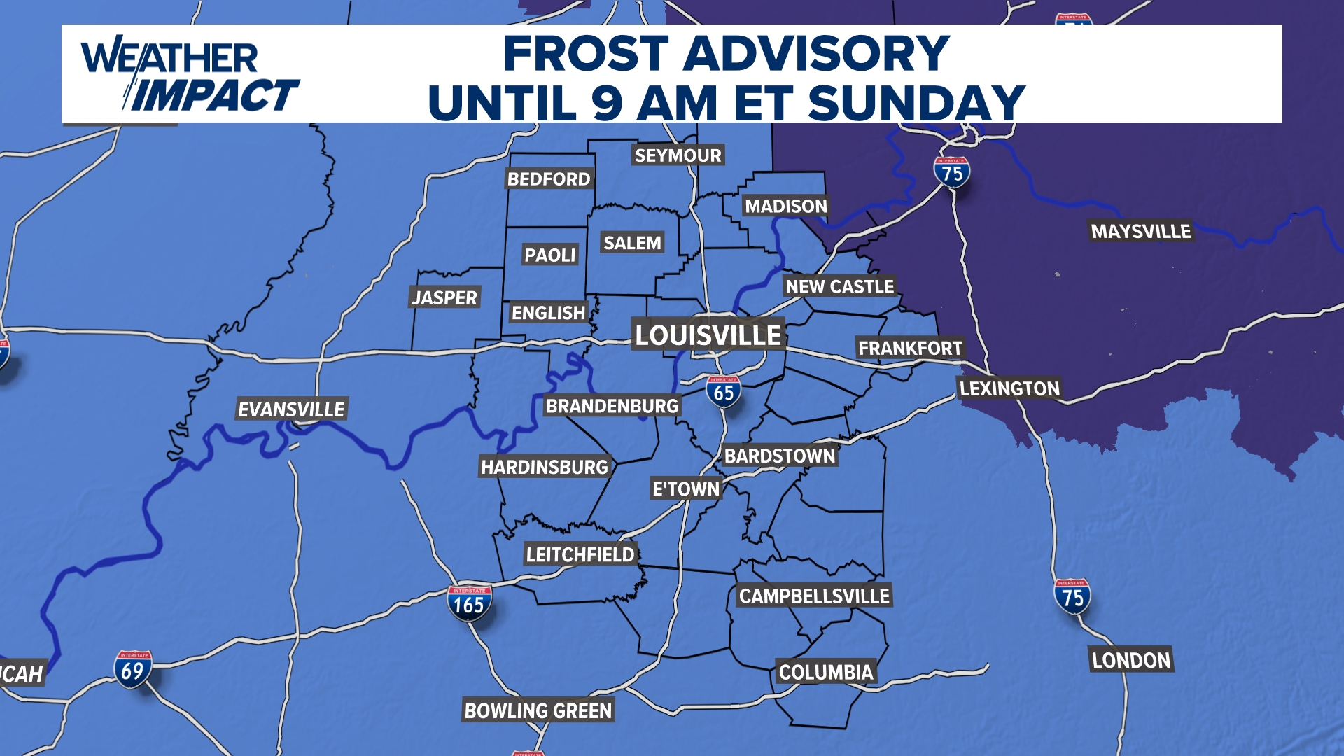 Frost Advisory Saturday night for Kentucky, southern Indiana
WHAS11 Frost Advisory Saturday night for Kentucky, southern Indiana Cover any sensitive vegetation in a cloth and bring in potted plants. The last time Louisville has a freeze was March 18, 2026. The normal first frost…
Air quality
Acceptable. Unusually sensitive people should consider limiting prolonged outdoor exertion.
Forecast
- WedModerate (60)
- ThuModerate (65)
Cincinnati, OH reporting area · 2 hrs ago. Data from AirNow (EPA and its state, local and tribal partners); preliminary and subject to change.
Sun & moon
Almanac
MonthlyCincinnati Municipal Ap Lunken Field, records since 1949. Normals 1991–2020. Data from NOAA's Regional Climate Centers (ACIS).
Nearby
- Cincinnati 22 km
- Hamilton 51 km
- Fairfield 46 km
- Covington 18 km
- Mason 44 km
- Florence 23 km
- Independence 15 km
- Lebanon 54 km
- Norwood 23 km
- White Oak 34 km
- Erlanger 21 km
- Forest Park 38 km
Forecasters' discussion
From the National Weather Service office in ILN, issued 6 hrs ago
What Has Changed
Dense fog advisory has been cancelled, patchy dense fog will still be present this morning.
Key Messages
1) Dense fog is occurring across portions of the region this morning.
2) High pressure will persist over the region through the week and into the weekend, bringing dry and seasonable conditions.
Discussion
Key Message 1)
Patchy dense fog is still present this morning. While widespread dense fog has started to improve, patchy dense fog is still present across northern portions of the region near and north of Interstate 70.
Otherwise, some pockets of fog are expected elsewhere, along with local rivers and valleys.
A similar situation may occur tomorrow and Friday, with fog occurring across portions of west-central and central Ohio.
Key Message 2)
High pressure remains in place across the eastern CONUS through the end of the week, reinforced by another ridge into the weekend. High temperatures are few degrees above normal, and dry conditions will persist. Some occasions of frost, primarily across central and south- central Ohio are possible with temperatures dropping into the mid 30s Wednesday night and Friday night.
Aviation
Other than the valley fog occurring around LUK, the dense fog is currently remaining north of the TAF sites. This is expected to continue as the fog lifts later this morning. Persistence forecast again for this after with light northerly winds. Will once again mention the potential for BR at ILN and LUK.
For Thursday, winds increase a little and are more out of the northeast.
OUTLOOK...No significant weather expected.
Forecasts, observations and alerts in the United States come from the National Weather Service (NOAA); radar from NOAA's Multi-Radar Multi-Sensor system; satellite imagery from NASA's Global Imagery Browse Services (GIBS) and NOAA's GOES satellites; the map from the U.S. Geological Survey's National Map; air quality from AirNow (EPA and its partners); hurricane information from the National Hurricane Center; climate normals and records from NOAA's Regional Climate Centers (ACIS). Forecasts outside the United States and the UV index: MET Norway (CC BY 4.0); observations outside the U.S.: airport reports via NOAA's Aviation Weather Center. Place names: GeoNames (CC BY 4.0). Data are copied on a schedule and may lag the sources; for warnings that affect your safety, follow your local National Weather Service office and emergency officials. Weather news is drawn from the 4Search index and reflects what the press published. Terms of use.