Install
Fort Lauderdale, FL 33309 Weather
Current conditions
Observed at Fort Lauderdale, Fort Lauderdale Executive Airport · 36 min ago
Forecast
10-day-
Saturday Night
Showers and thunderstorms likely. Partly cloudy, with a low around 72. Northeast wind 13 to 16 mph, with gusts as high as 28 mph. Chance of precipitation is 70%.
-
Sunday
Showers and thunderstorms. Partly sunny, with a high near 82. Northeast wind 17 to 22 mph, with gusts as high as 37 mph. Chance of precipitation is 80%.
-
Sunday Night
Showers and thunderstorms. Partly cloudy, with a low around 74. Northeast wind 16 to 22 mph, with gusts as high as 35 mph. Chance of precipitation is 80%.
National Weather Service forecast updated 2 days ago.
Hourly
Hourly forecast- Now77°62%
- 8 PM76°65%
- 9 PM75°65%
- 10 PM75°65%
- 11 PM74°65%
- Sun12 AM74°65%
- 1 AM74°65%
- 2 AM74°69%
- 3 AM73°69%
- 4 AM73°69%
- 5 AM73°69%
- 6 AM73°69%
- 7 AM74°69%
- 8 AM74°80%
- 9 AM76°80%
- 10 AM77°80%
- 11 AM79°80%
- 12 PM79°80%
- 1 PM79°80%
- 2 PM80°82%
- 3 PM79°82%
- 4 PM79°82%
- 5 PM79°82%
- 6 PM78°82%
10-day forecast
Details- ThuOct 22Chance Showers And Thunderstorms42%71°82°
- FriOct 23Chance Rain Showers48%72°82°
- TodayOct 24Chance Showers And Thunderstorms then Showers And Thunderstorms Likely69%72°82°
- SunOct 25Showers And Thunderstorms82%74°82°
- MonOct 26Showers And Thunderstorms Likely72%73°83°
- TueOct 27Chance Showers And Thunderstorms48%73°83°
- WedOct 28Chance Showers And Thunderstorms51%73°83°
- ThuOct 29Rain0.13 in72°84°
- FriOct 30Light showers0.05 in70°83°
- SatOct 31Cloudy0.02 in68°83°
Days after the National Weather Service's seven are MET Norway's outlook, a computer model with no forecaster's review.
Radar
Full mapWeather news near Fort Lauderdale
More weather news-
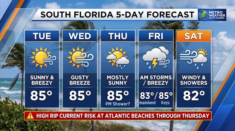 South Florida Forecast: Breezy Sun, Mid-80s Warmth, and Dangerous Atlantic Rip Currents
Donna Thomas has studied hurricanes for two decades. She holds a PhD in history when her experience with Hurricane Andrew ultimately led her to earn a degree in broadcast meteorology from Mississippi State University…
-
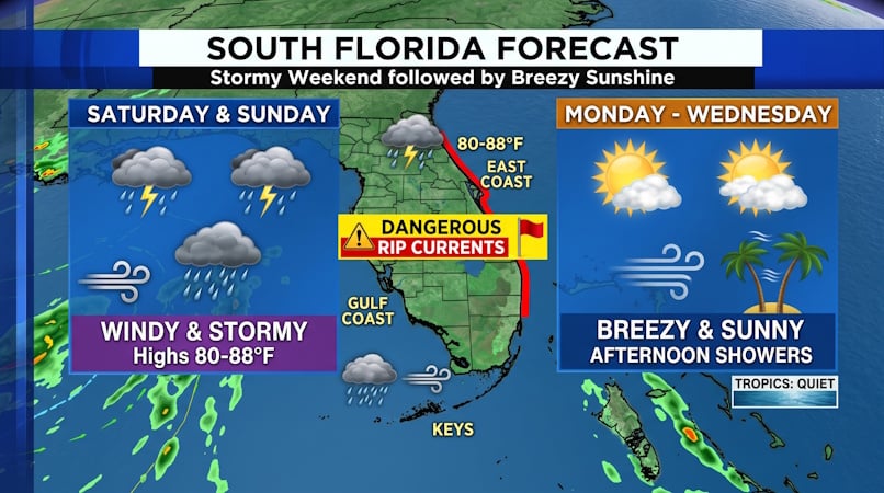 South Florida Weather: Weekend Storms and Gusty Winds Give Way to Brisk, Sunny Days
Donna Thomas has studied hurricanes for two decades. She holds a PhD in history when her experience with Hurricane Andrew ultimately led her to earn a degree in broadcast meteorology from Mississippi State University…
-
 First Alert Weather: Scattered rain Thursday ahead of strong cold front
Dillon Gaudet has your First Alert Weather forecast on this Thursday morning. HUNTINGTON, W.Va. (WSAZ) - Dillon Gaudet has your First Alert Weather forecast on this Thursday morning. Here’s how much more Social Security…
-
 New flight to Fort Lauderdale coming in 2027
WSAZ New flight to Fort Lauderdale coming in 2027 Rain & Wind Wednesday Evening - John 4 PM 10-14-26 PM Rain & Storms Wednesday - John 12 PM 10-14-26
-
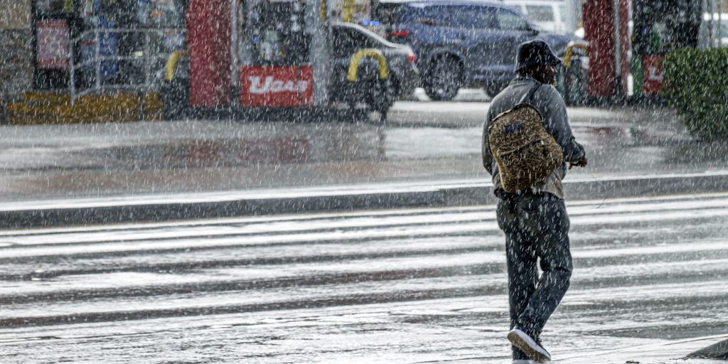 Weekend of miserable severe storms to drench Southern Florida with heavy rain and flooding
🌧️ ☔ FLORIDA SOAKER: A weekend of severe storms will ruin any chances of getting outdoors in South Florida as heavy rain, strong winds and a flood threat will plague the region until Monday. FLORIDA – Wet weather…
-
 WSAZ+ | First Alert Weather Day due to later storms
First Alert Weather Day due to later storms WSAZ WSAZ+ | First Alert Weather Day due to later storms PM Rain & Storms Wednesday - John 12 PM 10-14-26 New flight to Fort Lauderdale coming in 2027
-
 Studio 3 - Living Well
WSAZ Studio 3 - Living Well PM Rain & Storms Wednesday - John 12 PM 10-14-26 New flight to Fort Lauderdale coming in 2027 WSAZ+ | First Alert Weather Day due to later storms
-
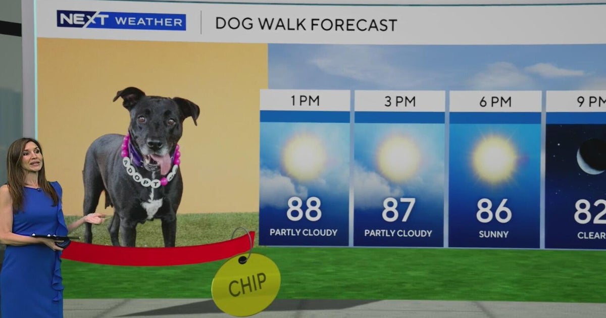 Comfortable conditions spread across South Florida before storm chances return later this week
It was a comfortable start to the day across South Florida, and we'll continue to enjoy cooler temperatures and lower humidity until storm changes return later this week. CBS News Miami NEXT Weather meteorologist…
-
 Low-pressure center brings strong winds and rain to central Florida
The wind today could gust to more than 30 mph across central Florida and up to 45 mph along the coast. These numbers will only increase on Sunday and Monday, when Orlando could have winds around 45 mph, and we could see…
-
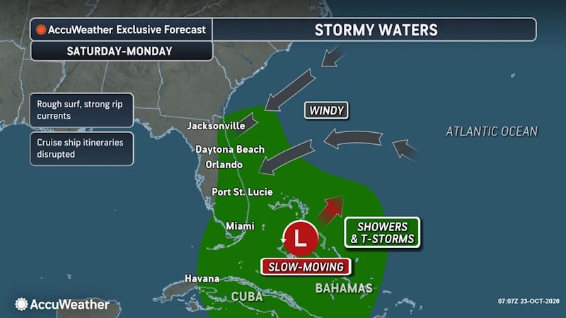 Rough Seas and Tropical Threats Loom Over Florida’s Atlantic Coast
Florida’s East Coast is already dealing with coastal flooding, gusty winds and dangerous surf, and a new area of potential tropical development could prolong or worsen those conditions early next week. Higher tides…
Air quality
Air quality is satisfactory, and air pollution poses little or no risk.
Forecast
- SatGood
- SunGood
- MonGood
Broward County, FL reporting area · 1 hr ago. Data from AirNow (EPA and its state, local and tribal partners); preliminary and subject to change.
Sun & moon
Almanac
MonthlyFort Lauderdale Area, records since 1912. Normals 1991–2020. Data from NOAA's Regional Climate Centers (ACIS).
Nearby
- Miami 45 km
- Hialeah 37 km
- Pembroke Pines 20 km
- Hollywood 19 km
- Miramar 22 km
- Coral Springs 14 km
- Miami Gardens 28 km
- Pompano Beach 8 km
- Davie 14 km
- Boca Raton 22 km
- Plantation 8 km
- Miami Beach 44 km
Forecasters' discussion
From the National Weather Service office in MFL, issued 12 hrs ago
Key Messages
Updated at 726 AM EDT Sat Oct 24 2026
- Moderate coastal flooding is expected with each high tide cycle. Major coastal flooding is possible late this weekend into early next week.
- Heavy rain and isolated flash flooding is possible across the east coast metros Sunday through Monday.
- Strong winds, with gusts over 35 mph are possible Sunday through Monday.
- Dangerous marine and beach conditions are expected through early next week.
Short Term
(Today through Sunday) Issued at 307 AM EDT Sat Oct 24 2026
South Florida finds itself at the base of a positively tilted mid-level longwave trough. Water vapor imagery and upper air sounding observations from around the state indicate that deep layer dry air is currently in place across most of Florida, keeping conditions more dry and stable through the region. As the main trough axis swings across the state through tomorrow, unsettled weather will remain across the more unstable Gulf Stream waters. A few isolated showers may hug the Atlantic coastline during the day, but most activity will remain offshore. Deeper moisture remains further southeast over the Bahamas and closer to a stalled boundary near eastern Cuba, where a complex of thunderstorms is currently ongoing. However, here in South Florida, model soundings seem to indicate that moisture content will actually trend drier on Saturday. Precipitable water values will drop from a near average 1.6 inches, to a bottom tenth percentile of 0.8 to 0.9 inches. Models hint at the drier air reaching the surface this time, with dewpoints dropping into the lower 60s through the middle of the day. As a result, PoPs will be very low across most of South Florida, less than 10% for most areas. In addition to the dry air, subsidence aloft should keep any showers from being able to mature or develop. Coastal convergence may be possible, but there is very low confidence for rain amounts to be anything greater than half an inch through tomorrow afternoon.
Forecast confidence for the Saturday night through Sunday period has quite honestly decreased. Ensemble and deterministic guidance continues to struggle with a solution for the shortwave feature coming off of the Carolina coast. There is less agreement among guidance as to weather this feature develops into a closed mid-level low as it tracks southward along the Florida coastline, or whether it stays an open wave and join the overall longwave troughing pattern. Solutions also differ as to how fast and how far east and south this feature will move over the next two days. This has major implications on the amount of rainfall South Florida may get. A deeper, slower, and more westerly tracking system would increase chances of precipitation areawide. However, most model guidance has continued to trend lower with precipitation amounts. WPC QPF ensemble clusters show that 1 to 1.5 inches through Monday would be the highest confidence scenario to play out. Yet, there is one cluster of solutions that shows a scenario of 3 to 4 inches possible (but this is a lower confidence scenario). Overall, better dynamics aloft and increased streams of vorticity across the region will favor greater shower and storm activity. PoPs will climb into the 70% to 80% range over the eastern metro. Coastal convergence may allow for several storms to focus along the coastline for several hours, so a Slight Risk of excessive rainfall exits for minor urban flooding along low lying and poor drainage locations.
Breezy northeasterly winds will continue to strengthen through the weekend for all areas. Breezy winds may combine with high surf and unusually high tides over the weekend. This may result in moderate to potentially major tidal flooding for coastal areas along Dade, Broward, and Palm Beach counties. Remember to never drive, walk, or wade across flooded roads.
Long Term
(Sunday night through Friday) Issued at 307 AM EDT Sat Oct 24 2026
By the time Sunday night rolls around, strong surface high pressure over the mid-Atlantic states and deepening surface troughing over the northern Caribbean will create a tightening pressure gradient across the Florida coastline. As a result, winds will continue to strengthen into Monday and Tuesday. Sustained winds over the waters will already be howling at 30 mph starting on Sunday, but the strongest overall winds inland look to be moreso on Monday. Some areas will be flirting with Wind Advisory criteria, with gusts of 35 to 40 mph possible. There is pretty high confidence that winds will at least reach 25 mph for many locations, but probabilities for winds greater than 30 mph area only around 30%. Nevertheless, these conditions have the potential to break weak tree branches and blow around loose objects and debris.
Strong winds and high surf will combine with the highest King Tides of the year early next week. This will result in the potential for moderate and major tidal flooding. This tidal flooding may also be exacerbated by coastal showers and rainfall, which could lead to significant water rises along the far eastern metro areas. While the peak tides will be during the beginning of the week, moderate coastal flooding may persist through the end of the week as we come out of this full moon phase.
Deeper moisture, with increased PWATs of around 1.6 to 1.8 inches, will persist over South Florida through at least Tuesday. This will keep the potential of scattered showers and storms moving along the eastern half of South Florida. A few localized stronger storms and coastal convergence may create some minor urban flooding concerns. However, the threat of rainfall will generally be on the downtrend after Monday as the mid-level troughing pattern finally ejects out into the Atlantic. Ridging from the Gulf and drier air from the north will begin to exert more influence over Florida for the middle to end of the week. This will likely result in decreasing coverage of showers and storms areawide. But with persistent northeast flow continuing, pesky onshore showers from the Gulf Stream will continue to be a nuisance each day through the end of the week.
Aviation
(12Z TAFS) Issued at 726 AM EDT Sat Oct 24 2026
Mainly VFR conditions will prevail across South Florida today. Light NNW winds across all east coast terminals this morning will shift out of the NNE between 13Z and 15Z, with gusts throughout the afternoon of around 20 kts. Will keep VCSH through the entire day today and into Sunday for aforementioned terminals with isolated to scattered SHRA expected. Winds lighten to a degree overnight with another developing land breeze across the east coast, before increasing out of the NNE again after daybreak Sunday. Steady NNE winds at KAPF remaining gusty.
Forecasts, observations and alerts in the United States come from the National Weather Service (NOAA); radar from NOAA's Multi-Radar Multi-Sensor system; satellite imagery from NASA's Global Imagery Browse Services (GIBS) and NOAA's GOES satellites; the map from the U.S. Geological Survey's National Map; air quality from AirNow (EPA and its partners); hurricane information from the National Hurricane Center; climate normals and records from NOAA's Regional Climate Centers (ACIS). Forecasts outside the United States and the UV index: MET Norway (CC BY 4.0); observations outside the U.S.: airport reports via NOAA's Aviation Weather Center. Place names: GeoNames (CC BY 4.0). Data are copied on a schedule and may lag the sources; for warnings that affect your safety, follow your local National Weather Service office and emergency officials. Weather news is drawn from the 4Search index and reflects what the press published. Terms of use.