Install
Green Cove Springs, FL 32043 Weather
Current conditions
Observed at Jacksonville Naval Air Station · 1 hr ago
Forecast
10-day-
Tonight
A chance of rain showers before 7pm, then showers and thunderstorms likely. Some of the storms could produce heavy rain. Mostly cloudy. Low around 65, with temperatures rising to around 67 overnight. Northeast wind 15 to 23 mph, with gusts as high as 35 mph. Chance of precipitation is 70%. New rainfall amounts between a tenth and quarter of an inch possible.
-
Sunday
A chance of rain showers. Partly sunny. High near 76, with temperatures falling to around 73 in the afternoon. North wind 16 to 24 mph, with gusts as high as 36 mph. Chance of precipitation is 30%. New rainfall amounts less than a tenth of an inch possible.
-
Sunday Night
Rain showers likely. Mostly cloudy. Low around 66, with temperatures rising to around 68 overnight. Northeast wind 15 to 24 mph, with gusts as high as 36 mph. Chance of precipitation is 70%. New rainfall amounts less than a tenth of an inch possible.
National Weather Service forecast updated 13 hrs ago.
Hourly
Hourly forecast- Now67°21%
- 5 AM67°18%
- 6 AM66°16%
- 7 AM66°18%
- 8 AM65°18%
- 9 AM68°18%
- 10 AM72°13%
- 11 AM74°17%
- 12 PM76°10%
- 1 PM76°12%
- 2 PM75°
- 3 PM74°
- 4 PM74°20%
- 5 PM73°29%
- 6 PM73°28%
- 7 PM71°33%
- 8 PM70°19%
- 9 PM68°20%
- 10 PM68°55%
- 11 PM68°58%
- Mon12 AM68°69%
- 1 AM68°27%
- 2 AM68°27%
- 3 AM68°17%
10-day forecast
Details- TonightOct 24Showers And Thunderstorms Likely65%65°
- TodayOct 25Chance Rain Showers69%66°76°
- MonOct 26Slight Chance Rain Showers20%63°77°
- TueOct 27Mostly Sunny11%64°79°
- WedOct 28Mostly Sunny then Slight Chance Rain Showers15%66°79°
- ThuOct 29Chance Rain Showers26%65°79°
- FriOct 30Slight Chance Rain Showers21%65°80°
- SatOct 31Slight Chance Rain Showers22%81°
- SunNov 1Showers0.13 in68°81°
- MonNov 2Partly cloudy66°84°
Days after the National Weather Service's seven are MET Norway's outlook, a computer model with no forecaster's review.
Radar
Full mapWeather news near Green Cove Springs
More weather news-
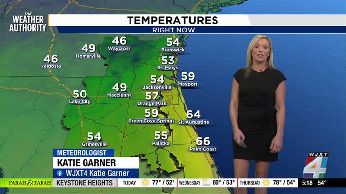 Breezy, beautiful day ahead as early voting begins in Duval County
The main weather story today is the continued contrast between pleasant conditions inland and hazardous conditions along the coast. Jacksonville will see sunshine and an afternoon high near 74°, with northeast winds…
-
 First Alert Weather: Onshore winds continue, sunny start to the week
104.5 WOKV First Alert Weather: Onshore winds continue, sunny start to the week JACKSONVILLE, Fla. â Hereâs what the First Alert Weather Team said you can expect for the forecast: - This evening will be dry and…
-
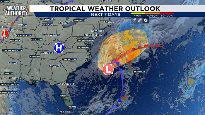 Monitoring the Tropics as Hurricane Season continues
Breaking news in Jacksonville, Florida from News4Jax and WJXT Channel 4. Jacksonville breaking news, headlines, weather, and sports. Local Jacksonville news and more from The Local Station in Jacksonville, Florida, WJXT…
-
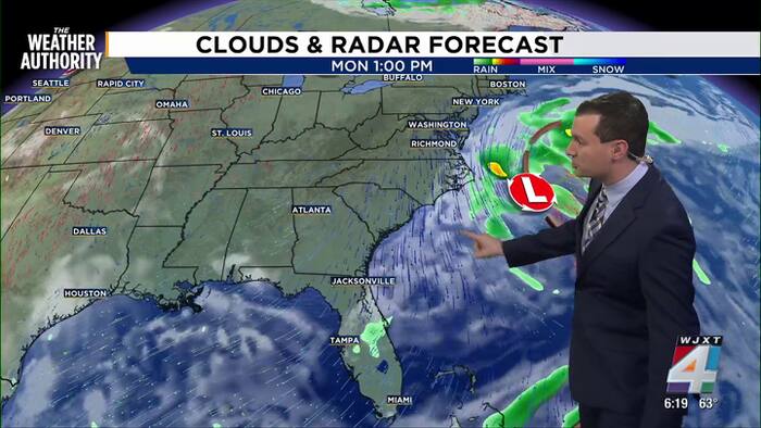 Meteorologist Chris Holtzman has your Sunday evening forecast
News4JAX Meteorologist Chris Holtzman has your Sunday evening forecast Meteorologist Chris Holtzman has your Sunday evening forecast. This Week In Jacksonville: Secretary of State Cord Byrd on how Florida is preparing…
- Wind-Whipped Jacksonville Beaches Face 11-Foot Surf, Rip Current Danger
Jacksonville is getting a sharp taste of fall Sunday, with mostly cloudy skies, a low of 57 early and a high near 70. North winds will stay strong through the day, making the city feel cooler than the thermometer…
-
 Talking the Tropics w/Mike: Western Atlantic strong low pressure
Action News Jax Talking the Tropics w/Mike: Western Atlantic strong low pressure Talking the Tropics with Mike Buresh Jacksonville, Fl. — THE TROPICS: Tropics threats/impacts for Jacksonville/NE Florida/SE Georgia…
-
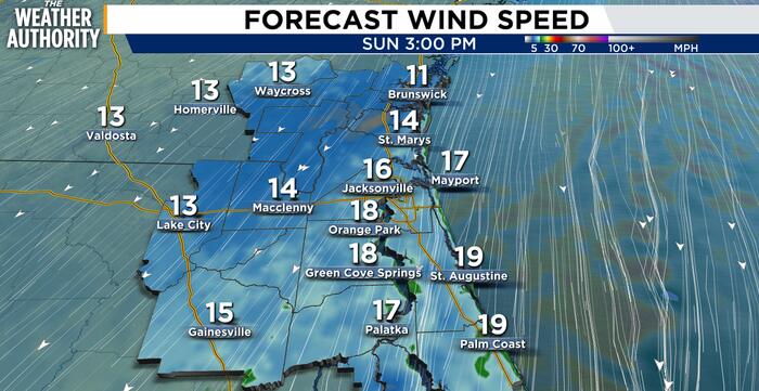 Windy, cool weather and dangerous surf expected Sunday for Northeast Florida, Southeast Georgia
JACKSONVILLE, Fla. – A cool, breezy day is expected across Northeast Florida and Southeast Georgia, with the strongest winds and most significant hazards near the coast. North to northeast winds of 15 to 25 mph could…
- Jacksonville Weather: Windy Weekend, High Surf And Rip Currents
Jacksonville is heading into a blustery Saturday, with cooler-than-usual temperatures, gusty north winds and a serious warning for anyone planning beach time. The city’s high should reach about 74 degrees before…
-
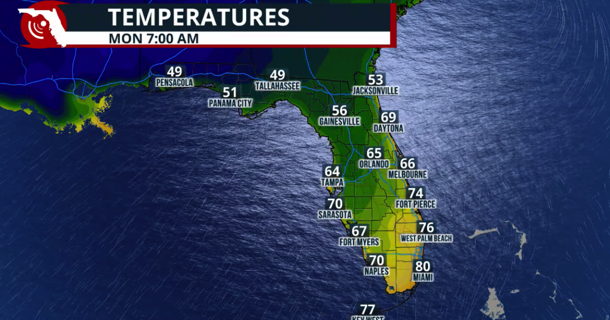 Fall arrives in Florida this weekend
WUSF Fall arrives in Florida this weekend The cold front marks the leading edge of a cooler and drier air mass moving southward across the eastern United States. Behind the boundary, winds shift more northerly, helping…
-
 Warm Friday ahead of a cooler, windier weekend in Northeast Florida, Southeast Georgia
News4JAX Michelle McCormick, News4JAX Meteorologist, Jacksonville Warm Friday ahead of a cooler, windier weekend in Northeast Florida, Southeast Georgia Attorney says ‘all of the lies’ led to a Putnam County jury…
Air quality
Forecast
- SunGood
- MonGood
- TueGood
Clay County, FL reporting area. Data from AirNow (EPA and its state, local and tribal partners); preliminary and subject to change.
Sun & moon
Almanac
MonthlyJacksonville Nas, records since 1945. Normals 1991–2020. Data from NOAA's Regional Climate Centers (ACIS).
Nearby
- Jacksonville 39 km
- Ponte Vedra Beach 45 km
- Lakeside 15 km
- Fruit Cove 17 km
- Fleming Island 11 km
- Jacksonville Beach 49 km
- Oakleaf Plantation 20 km
- Palm Valley 41 km
- Bellair-Meadowbrook Terrace 20 km
- Atlantic Beach 51 km
- Middleburg 12 km
- Saint Augustine 45 km
Forecasters' discussion
From the National Weather Service office in JAX, issued 8 hrs ago
Key Messages
For the latest NE FL and SE GA Daily Key Messages please visit: https:/www.weather.gov/media/jax/briefings/nws-jax-briefing.pdf
- Extended Duration of Coastal and Marine Hazards. Coastal Flood Warning - Moderate to Potentially Major Tidal and Coastal Flooding around Times of High Tide Along the Atlantic Coast and Within the Intracoastal Waterway and the Entirety of the St. Johns River Basin. Wind Advisory for the Atlantic Coastal Counties this Afternoon & Tonight. Windy Conditions Continue at Coastal Locations on Sunday and Monday. Gale Warning for the Atlantic Waters Saturday Afternoon through Monday. High Surf Advisory & High Risk for Rip Currents through most of Next Week. Major Beach Erosion around Times of High Tide through most of Next Week. Locally Heavy Rainfall Possible for Coastal Northeast FL this Afternoon through this evening
Near Term
Main Highlights: Through Tonight
- Moderate Coastal/Tidal Flooding Atlantic Coast/St. Johns River
- Wind Advisory Atlantic Coast/St. Johns River gusts to 45 mph
- Locally heavy rainfall at times NE FL Atlantic Coast/I-95
The local pressure gradient continues to tighten this afternoon as strong high pressure centered over New England wedges down the eastern seaboard and an area of low pressure develops northeast of the Bahamas. This will develop and sharpen coastal troughing over the nearshore Atlantic waters bringing gusty north-northeasterly winds. A Wind Advisory is in effect for this afternoon into evening where gusts could reach up to 40-45 mph along the SE GA and NE FL coasts. Breezy conditions linger overnight with the continued tight pressure gradient. Waves of numerous coastal showers and a few embedded thunderstorms will shift onshore through the evening hours mainly for coastal NE FL and then into the St Johns River basin. A few convergent bands may form along the northeast FL coast bringing heavier downpours and localized flooding. If these bands coincide with this evening's high tide cycle, this could exacerbate the already significant tidal flooding expected. Shower activity wanes overnight and shifts to the NE FL coastal areas, mainly south of St. Augustine. Overnight lows will range from the mid 50s in SE GA to the upper 60s along the NE FL coast.
Short Term
Main Highlights This Period:
- Coastal and Marine Hazards Peak on Sunday and Monday, with Coastal Flood Warnings in Effect Along the Atlantic Coast, Intracoastal Waterway and St. Johns River Basin. Moderate to Possibly Major Tidal Flooding Will Continue Around Times of High Tide.
- Wind Advisory Conditions Likely to Continue at Coastal Locations.
- Gale Warnings Continue for the Atlantic Waters.
- Dangerous and High Surf Conditions Continue, with High Surf Advisories and a High Risk for Deadly Rip Currents at All Area Beaches. Pounding Surf During High Tide Cycles Will Cause Major Beach Erosion.
- Locally Heavy Downpours Possible on Sunday and Sunday Night.
Long Term
Main Highlights This Period:
- Coastal and Marine Hazards Continue, with Moderate Tidal Flooding Likely Around Times of High Tide on Tuesday Along the Atlantic Coast, Intracoastal Waterway, and St. Johns River Basin. Minor to Moderate Tidal Flooding May Continue for Much of the Upcoming Week Within the St. Johns River Basin.
- Dangerous and High Surf Conditions Persist, with a High Risk for Deadly Rip Currents and Significant Beach Erosion Possible at Area Beaches throughout the Upcoming Week.
Northeasterly flow will persist through the week into Friday which, along with coastal troughing and astronomical high tides, will result in a continuance of coastal and marine impacts through the week. Drier air over the region will reduce the amount of precipitation for the beginning of the period with chances for showers increasing later in the week as more moist air advects in over the forecast area. Temperatures are expected to rise to be near or slightly above the seasonal average by the end of the week.
Forecasts, observations and alerts in the United States come from the National Weather Service (NOAA); radar from NOAA's Multi-Radar Multi-Sensor system; satellite imagery from NASA's Global Imagery Browse Services (GIBS) and NOAA's GOES satellites; the map from the U.S. Geological Survey's National Map; air quality from AirNow (EPA and its partners); hurricane information from the National Hurricane Center; climate normals and records from NOAA's Regional Climate Centers (ACIS). Forecasts outside the United States and the UV index: MET Norway (CC BY 4.0); observations outside the U.S.: airport reports via NOAA's Aviation Weather Center. Place names: GeoNames (CC BY 4.0). Data are copied on a schedule and may lag the sources; for warnings that affect your safety, follow your local National Weather Service office and emergency officials. Weather news is drawn from the 4Search index and reflects what the press published. Terms of use.