Install
Roxboro, NC 27573 Weather
Current conditions
Forecast for this hour (no station report in the last two hours)
Forecast
10-day-
Today
Sunny, with a high near 70. North wind around 7 mph.
-
Tonight
Clear, with a low around 39. Northeast wind 0 to 5 mph.
-
Friday
Sunny, with a high near 66. Northeast wind 2 to 9 mph.
National Weather Service forecast updated 7 hrs ago.
Hourly
Hourly forecast- Now66°
- 2 PM68°
- 3 PM68°
- 4 PM69°
- 5 PM69°
- 6 PM65°
- 7 PM58°
- 8 PM53°
- 9 PM51°
- 10 PM49°
- 11 PM47°
- Fri12 AM45°
- 1 AM44°
- 2 AM43°
- 3 AM42°
- 4 AM41°
- 5 AM41°
- 6 AM40°
- 7 AM40°
- 8 AM40°
- 9 AM46°
- 10 AM52°
- 11 AM57°
- 12 PM60°
10-day forecast
Details- TodayOct 22Sunny39°70°
- FriOct 23Sunny40°66°
- SatOct 24Sunny40°63°
- SunOct 25Sunny39°67°
- MonOct 26Sunny40°68°
- TueOct 27Sunny45°71°
- WedOct 28Mostly Sunny47°70°
- ThuOct 29Cloudy50°72°
- FriOct 30Sunny48°68°
- SatOct 31Cloudy43°62°
Days after the National Weather Service's seven are MET Norway's outlook, a computer model with no forecaster's review.
Radar
Full mapWeather news in North Carolina
More weather news-
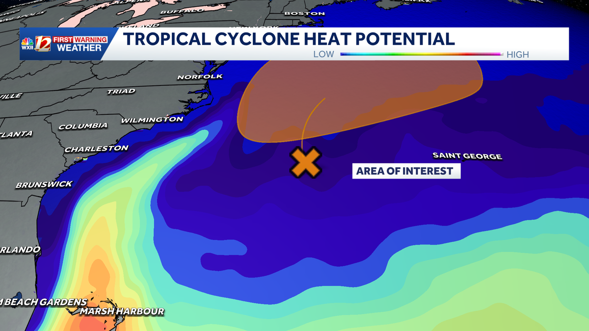
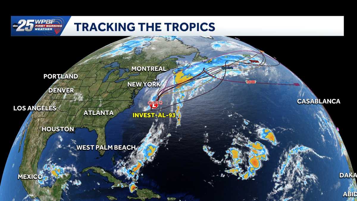 Low pressure off North Carolina could briefly turn subtropical while sending rough surf up the East Coast
A storm-force non-tropical low-pressure system located a few hundred miles off the North Carolina coast is producing shower and thunderstorm activity primarily west of its center. According to the National Hurricane…
-
-
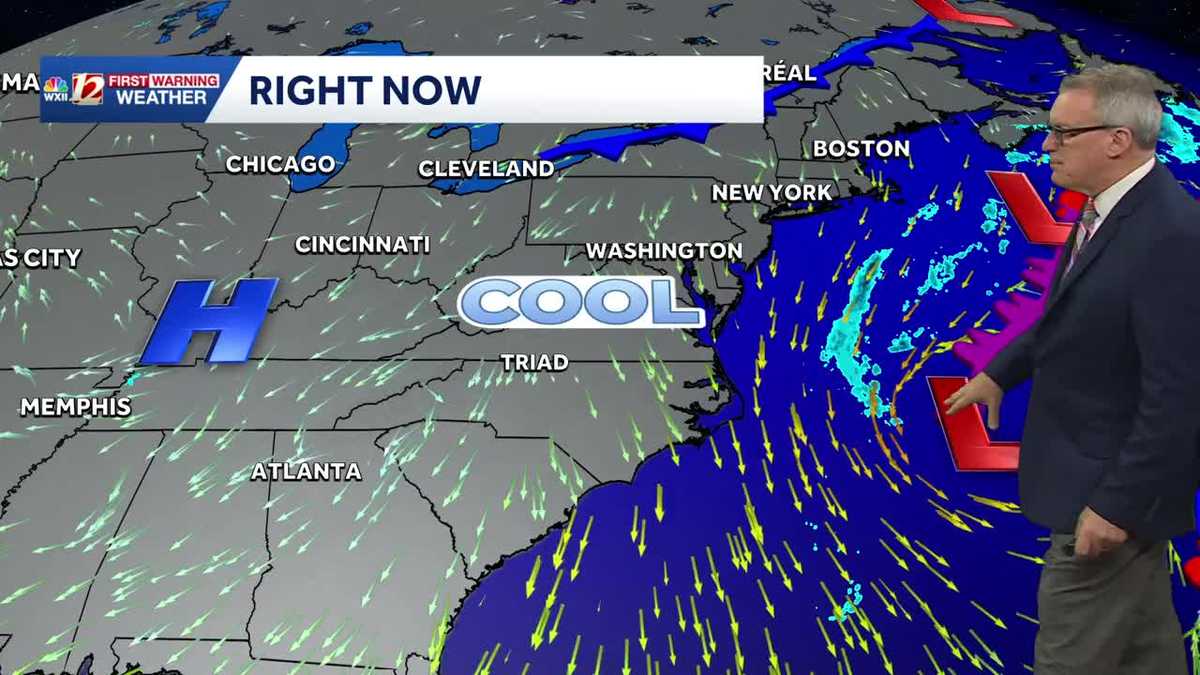 Sunny and seasonably cool weather across North Carolina this week
WXII Cold mornings will lead to seasonable, sunny afternoons in North Carolina this week Dress for 30s and 40s in the mornings Sunny weather will warm temperatures into the 60s and 70s in the afternoons Dry weather will…
-
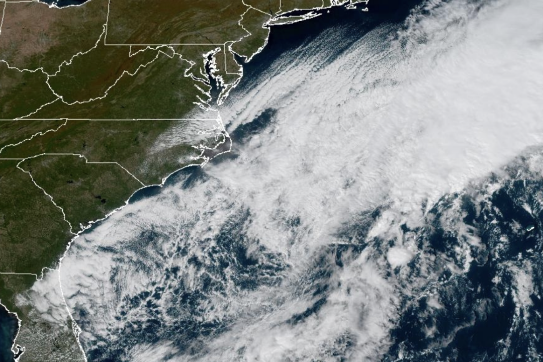 Weather System Off North Carolina Could Become Nor’Easter or Tropical Storm: What to Know
The National Weather Service and its National Hurricane Center are tracking a storm system sitting off the coast of North Carolina that has the opportunity to become either a proper Nor’easter or a Tropical Storm and is…
-
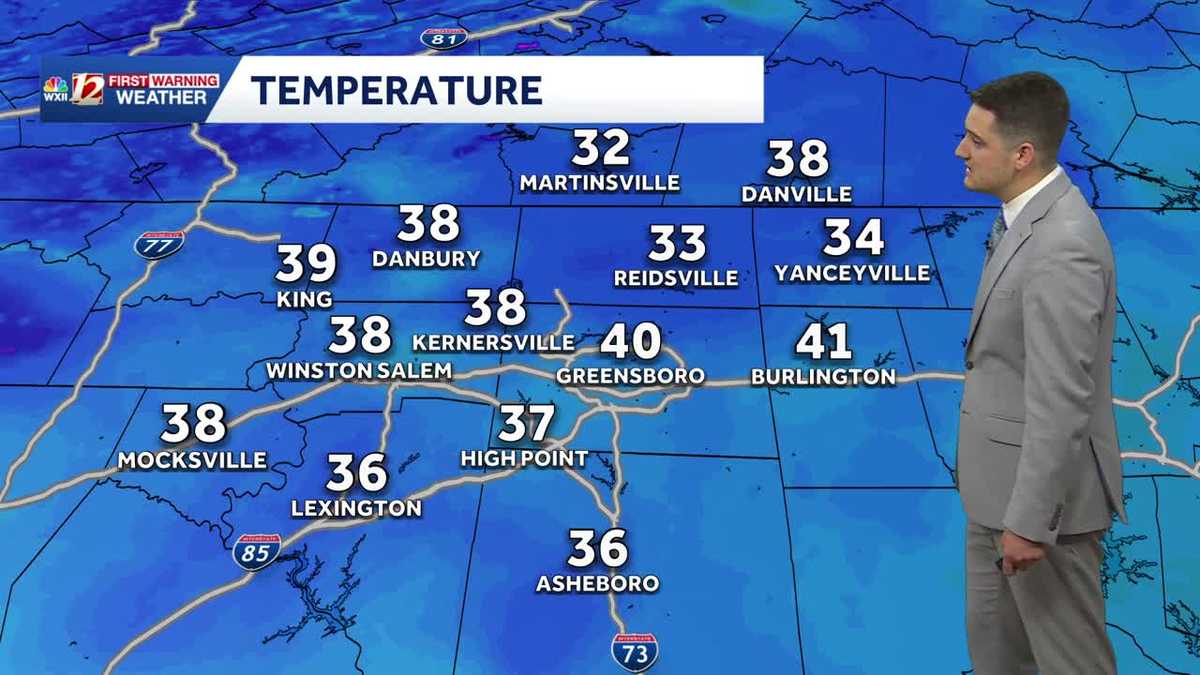 Cold Sunday morning in North Carolina, beautiful fall weather this week
WXII Cold Sunday morning in North Carolina, beautiful fall weather this week Meteorologist Dylan Hudler has your Sunday forecast Brrrr! Cold fall air is here! Sunday morning is the first time in the 30s for many…
-
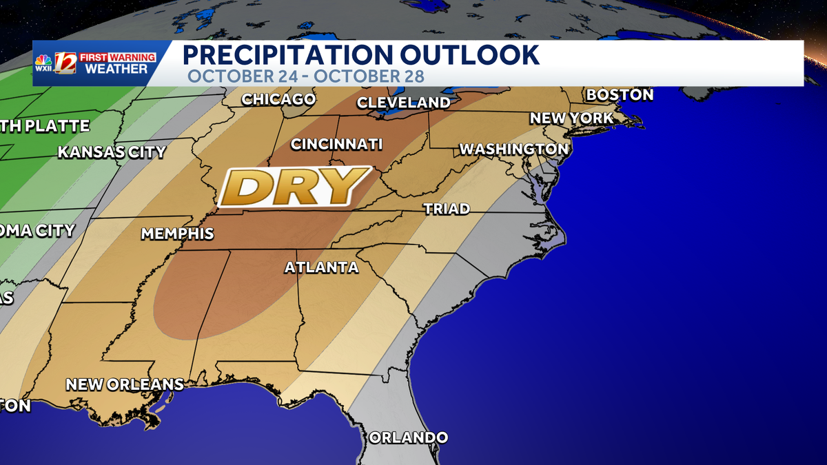 Seasonable highs ahead for the workweek in North Carolina | Cold mornings, tracking a coastal low
A dry pattern is developing for the coming workweek. Mostly sunny days will become seasonable through midweek, with highs in the 70s. A powerful cold front brought in a much colder air mass this weekend, but after two…
- UPDATE: Frost advisory for Western North Carolina for Sunday, says the NWS
On Saturday at 9 p.m. the NWS Greenville-Spartanburg SC released an updated frost advisory valid for Sunday between 1 a.m. and 9 a.m. The advisory is for Caldwell Mountains, Greater Caldwell, Burke Mountains, Greater…
-
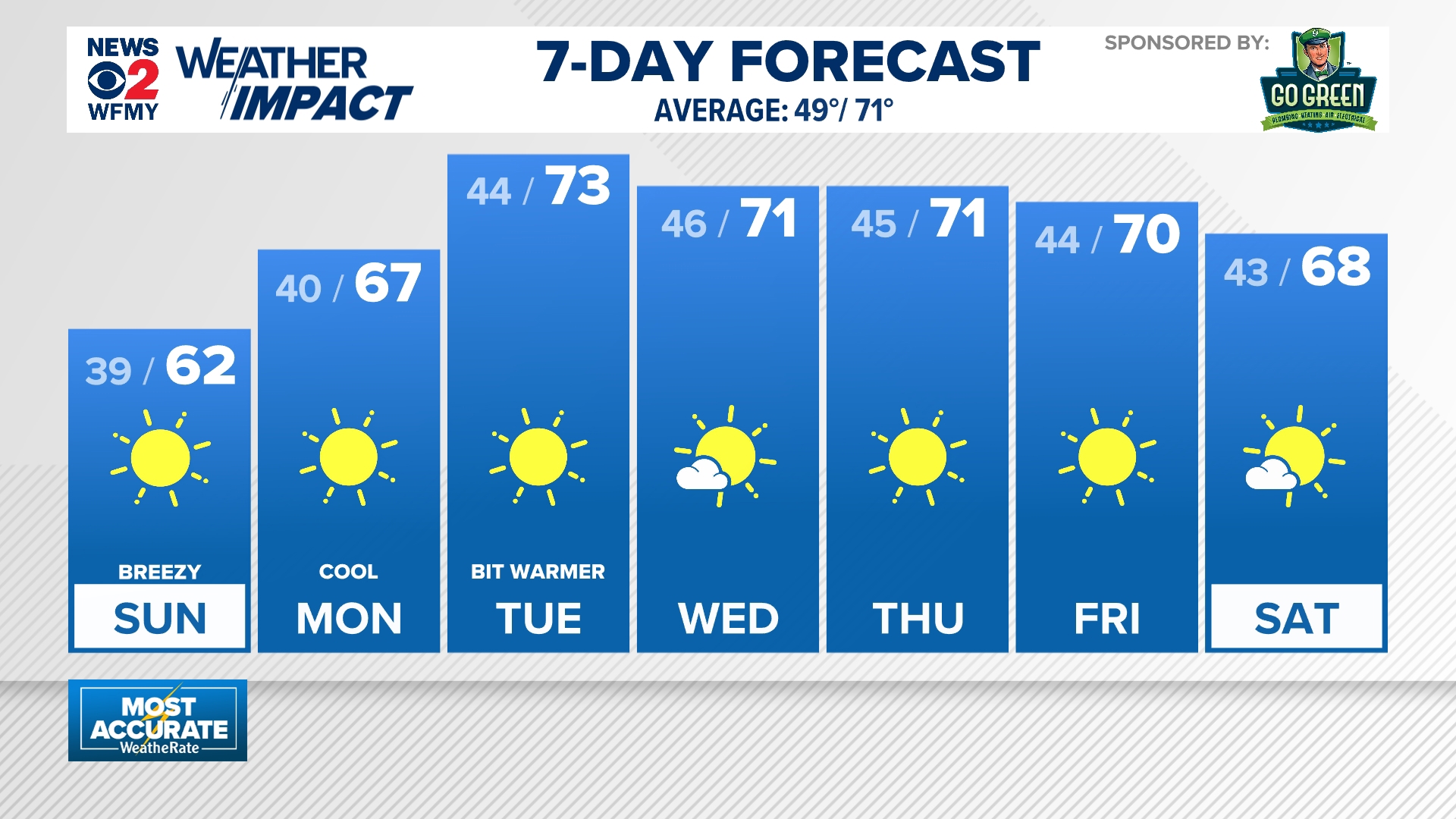 Cold mornings ahead for North Carolina
wfmynews2.com Cold mornings ahead for North Carolina To stream WFMY News 2 on your phone, you need the WFMY News 2 app. Download the WFMY News 2 app Next up in 5 Example video title will go here for this video Before…
-
 NWS: Snow spotted in North Carolina
FOX Carolina News NWS: Snow spotted in North Carolina Dabo Swinney's opening statement after Clemson shuts out Charleston Southern 37-0 Deputies search for missing, endangered woman with dementia last seen in…
-
 WATCH: Snow spotted in Yancey County, North Carolina
Forty- to thirty-degree temperatures are expected across the Carolinas. YANCEY COUNTY, N.C. (FOX Carolina) - Officials with the National Weather Service said snow has been spotted in North Carolina. A video provided by…
Air quality
Air quality is satisfactory, and air pollution poses little or no risk.
Forecast
- ThuGood (42)
- FriGood (40)
- SatGood (38)
Person County, NC reporting area · 1 hr ago. Data from AirNow (EPA and its state, local and tribal partners); preliminary and subject to change.
Sun & moon
Almanac
MonthlySouth Boston, records since 1977. Normals 1991–2020. Data from NOAA's Regional Climate Centers (ACIS).
Nearby
- Durham 46 km
- Chapel Hill 55 km
- Burlington 54 km
- Danville 43 km
- Carrboro 56 km
- Henderson 52 km
- Graham 54 km
- Mebane 43 km
- Elon 58 km
- Oxford 36 km
- South Boston 33 km
- Butner 36 km
Forecasters' discussion
From the National Weather Service office in RAH, issued 7 hrs ago
What Has Changed
* Nothing appreciable
Key Messages
As of 255 AM Thursday...
1) A continuation of dry and seasonable conditions is expected through the middle of next week.
Discussion
As of 255 AM Thursday...
KEY MESSAGE 1... A continuation of dry and seasonable conditions is expected through the middle of next week.
An initially high amplitude mid and upr-level ridge over the cntl Plains will progress slowly ewd and across the OH Valley and Middle Atlantic through early to mid next week, while gradually weakening. To the east of the slowly progressive and dampening ridge, a couple of moisture-starved shortwave troughs will dig across the Middle Atlantic and into a mean trough off the East Coast, with passages across cntl NC early tonight and again on Sun.
At the surface, Subtropical Storm Josephine will accelerate northeastward and away from the coast of the Middle Atlantic and New England later today and tonight. A series of reinforcing, Canadian surface highs will progress across the Great Lakes and Middle Atlantic and extend across cntl NC through the middle of next week. A ~1025 mb one now centered over srn ON will gradually strengthen to near 1035 mb while progressing across the lwr Great Lakes and nrn Middle Atlantic through the first half of the weekend. Its leading edge will be marked by a weak frontal zone now stretching from srn QC to the cntl Plains and which will progress swd and across the srn Middle Atlantic on Fri. Following, maritime-influenced nely flow will both increase the risk for mostly a scattering of stratocumulus Fri through the weekend, within otherwise deeply dry and clear skies, and also contribute to slightly cooler and below average high temperatures Fri-Sun.
Aviation
As of 610 AM Thursday...
Canadian surface high pressure and related dry, continental air will favor VFR conditions in cntl NC through the 12Z TAF period. There may be a few lingering wind gusts in the teens kts from late morning through early this afternoon especially at FAY and RWI, in a weakening pressure gradient between the Canadian high and Subtropical Storm Josephine off the nrn Middle Atlantic coast.
Outlook: While VFR conditions are likely to continue through early next week, low VFR to MVFR-based stratocumulus will be possible in nely flow, behind a backdoor cold front, this weekend. The relative highest probability of associated sub-VFR ceilings will be over the VA and NC Tidewater Sat morning and in the mountains and Foothills Sun and Mon morning.
Forecasts, observations and alerts in the United States come from the National Weather Service (NOAA); radar from NOAA's Multi-Radar Multi-Sensor system; satellite imagery from NASA's Global Imagery Browse Services (GIBS) and NOAA's GOES satellites; the map from the U.S. Geological Survey's National Map; air quality from AirNow (EPA and its partners); hurricane information from the National Hurricane Center; climate normals and records from NOAA's Regional Climate Centers (ACIS). Forecasts outside the United States and the UV index: MET Norway (CC BY 4.0); observations outside the U.S.: airport reports via NOAA's Aviation Weather Center. Place names: GeoNames (CC BY 4.0). Data are copied on a schedule and may lag the sources; for warnings that affect your safety, follow your local National Weather Service office and emergency officials. Weather news is drawn from the 4Search index and reflects what the press published. Terms of use.