Install
Mechanicsville, VA 23116 Weather
Current conditions
Observed at Ashland, Hanover County Municipal Airport · 24 min ago
Forecast
10-day-
Friday
Sunny, with a high near 65. Northeast wind around 9 mph.
-
Friday Night
Mostly clear, with a low around 40. Northeast wind 2 to 8 mph.
-
Saturday
Sunny, with a high near 65. Northeast wind 3 to 8 mph.
National Weather Service forecast updated 14 hrs ago.
Hourly
Hourly forecast- Now59°
- 1 PM61°
- 2 PM63°
- 3 PM63°
- 4 PM65°
- 5 PM62°
- 6 PM60°
- 7 PM55°
- 8 PM52°
- 9 PM50°
- 10 PM48°
- 11 PM47°
- Sat12 AM46°
- 1 AM45°
- 2 AM45°
- 3 AM44°
- 4 AM43°
- 5 AM43°
- 6 AM42°
- 7 AM41°
- 8 AM43°
- 9 AM47°
- 10 AM51°
- 11 AM55°
10-day forecast
Details- TonightOct 22Clear41°
- TodayOct 23Sunny40°65°
- SatOct 24Sunny43°65°
- SunOct 25Sunny43°68°
- MonOct 26Sunny46°69°
- TueOct 27Sunny49°70°
- WedOct 28Partly Sunny50°66°
- ThuOct 29Mostly Sunny69°
- FriOct 30Partly cloudy51°75°
- SatOct 31Mostly sunny55°70°
Days after the National Weather Service's seven are MET Norway's outlook, a computer model with no forecaster's review.
Radar
Full mapWeather news near Mechanicsville
More weather news- Crisp Start, Toasty Finish: Richmond Set for Weeklong Warmup
Sunday night stays clear as temperatures fall to around 43 degrees in the city. The breeze should keep frost from forming, even as areas west of Interstate 95 turn colder, according to the National Weather Service…
-
 Breezy with abundant sunshine Sunday
RICHMOND, Va. -- Skies will be sunny today, with a few clouds across southeastern Virginia. It will be breezy with some gusts over 20 mph in central Virginia, and over 30 mph at the coast. Highs will be in the upper 50s…
-
 A soggy start to Saturday
RICHMOND, Va. -- There will be periods of steady rain the first half of today. Temperatures will fall into the upper 40s and lower 50s as the morning wears on. Winds will gust over 30 mph in spots. Rain will turn more…
- Fog, 88 Degrees, Then a 30-Degree Plunge: Richmond Braces for Wild Weather Whiplash
Richmond is starting Friday in fog and mild air, but the city is headed for a summer-like afternoon near 88 degrees. Then comes the weather whiplash: showers and thunderstorms arrive after dark, followed by a windy…
-
 Richmond District weekly traffic alert: October 16, 2026
Virginia Department of Transportation (.gov) Richmond District weekly traffic alert: October 16, 2026 All work is scheduled weather permitting. Updated information on work zones and lane closures is available on…
-

- Record tornadoes, record temps, then maybe frost? Here are today’s top N&O stories
From a record-tying tornado outbreak to a $550 million federal rail investment, here’s a quick look at the stories making headlines from The News & Observer on Thursday, Oct. 15, 2026. Earlier-than-usual frost…
- Richmond Weather: 91 Degrees Wednesday, Cold Weekend Ahead
Richmond gets a sunny, unusually warm Tuesday after early fog, with temperatures climbing from the upper 50s to around 84 degrees. Wednesday turns even hotter near 91 before a sharp Friday night cold front sends weekend…
-
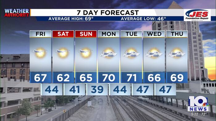 Southwest, Central Virginia Weather | 5 p.m. - Oct. 22, 2026
WSLS Southwest, Central Virginia Weather | 5 p.m. - Oct. 22, 2026 Here is a look at your Thursday evening forecast. Roanoke City Council Race Preview Washington & Lee Student released from ICE Custody ‘Home is not home…
-
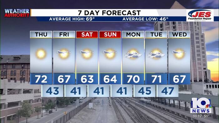 Southwest, Central Virginia Weather | 11 p.m. - Oct. 21, 2026
WSLS Southwest, Central Virginia Weather | 11 p.m. - Oct. 21, 2026 Here's a look at your forecast! Franklin County holds informational panel on data center development Roanoke County Career and Technology Center opens…
Air quality
Air quality is satisfactory, and air pollution poses little or no risk.
Forecast
- FriGood (28)
Richmond, VA reporting area · 1 hr ago. Data from AirNow (EPA and its state, local and tribal partners); preliminary and subject to change.
Sun & moon
Almanac
MonthlyRichmond Area, records since 1897. Normals 1991–2020. Data from NOAA's Regional Climate Centers (ACIS).
Nearby
- Richmond 17 km
- Tuckahoe 22 km
- Petersburg 49 km
- Short Pump 25 km
- Hopewell 41 km
- Chester 36 km
- Midlothian 34 km
- Meadowbrook 28 km
- Colonial Heights 45 km
- Laurel 16 km
- Bon Air 26 km
- Highland Springs 14 km
Forecasters' discussion
From the National Weather Service office in AKQ, issued 6 hrs ago
What Has Changed
- Josephine has weakened and is no longer a Subtropical cyclone.
- Coastal Flood Advisories have been extended through tonight's high tide cycle for most of the area.
Key Messages
1) Continued dry with seasonable temperatures through the middle of next week.
2) Elevated tidal anomalies persist through tonight with minor tidal flooding forecast.
Discussion
As of 345 AM EDT Friday...
KEY MESSAGE 1...Continued dry with seasonable temperatures through the middle of next week.
As Josephine interacted with a cold front last evening, the circulation has weakened considerably while pushing E to Atlantic Canada and is now no longer a subtropical storm. The upper level flow depicts an amplified pattern, with anomalous ridging over the central CONUS, and the downstream low spinning off the coast of Maine and into Atlantic Canada. The sfc cold front is diving south into the local area early this morning, and is expected to weaken into a trough as it crosses the region later today. Ahead of the boundary, the sky is clear and with light winds, decoupling has allowed temperatures to drop mostly into the 40-45F range, but ranging from as as low as the mid 30s over much of interior southern VA and NE NC to the lower 50s at the immediate coast. Patchy frost is likely in the most sheltered areas of southern VA through ~8 AM, but coverage is not enough to warrant any Advisories.
Otherwise, ~1030mb sfc high pressure centered over Ontario and Quebec, will build SE into eastern NY/interior New England by tonight. This setup will lead to increasing N to NE winds later this morning, and an increase in low level moisture later today, especially for areas closer to the coast. Model soundings show enough moisture underneath the subsidence inversion to support SCT-BKN stratocumulus by late morning/aftn for most of the CWA (highest cloud cover for SE VA and NE NC). In addition, it will become a bit breezy with gusts to 15-20 mph inland and 20-30 mph near the coast in SE VA and NE NC. Highs will be a little cooler compared to Thursday, ranging from the low-mid 60s north to near 70F over NE NC. The high continues to build south and into the local area later tonight through the weekend, with a developing sfc trough of low pressure off the SE US coast. The compressed pressure gradient will tend to keep the airmass mixed with milder temperatures for at least the SE 1/2 of the CWA tonight but northern and NW sections should see lows back into the 30s, potentially leading to patchy frost by sunrise Saturday.
High pressure will dominate the local weather pattern this weekend and likely well into next week. Not much change in the forecast with seasonal temperatures and near zero indications for much needed rainfall returning to the region. At this time, both Saturday night/Sunday AM and Sunday night/Monday AM have the potential for at least patchy frost over much of the interior, with the greatest potential in the piedmont. Have continued to undercut NBM values by several degrees except at the immediate coast.
KEY MESSAGE 2...Elevated tidal anomalies continue through Friday with minor tidal flooding forecast.
Aviation
As of 700 AM EDT Friday...
Clear skies and VFR conditions with N winds starting to increase to start the 12z TAF period. Winds continue to increase, and become elevated from the NE later this morning in the wake of a cold frontal passage. This should allow for an increase in low level moisture, with some lower clouds moving onshore by the late morning and persisting through the afternoon, mainly at ORF/PHF/ECG. While there is some chance for MVFR CIGs across SE VA/NE NC, will keep any CIGs at VFR (CIGs >3000 ft). Winds by late morning/aftn are expected to gust to 15-20 kt inland, but to 20-25 kt at ORF. Winds remain elevated at ORF/ECG tonight, but diminish to ~5 kt or less inland.
Outlook: SCT/BKN lower cloud cover may return Saturday, but CIGs should primarily be VFR. VFR then prevails Sunday-early next week. Forecast winds are out of the E-NE through this period, with a typical diurnal max/min expected.
Forecasts, observations and alerts in the United States come from the National Weather Service (NOAA); radar from NOAA's Multi-Radar Multi-Sensor system; satellite imagery from NASA's Global Imagery Browse Services (GIBS) and NOAA's GOES satellites; the map from the U.S. Geological Survey's National Map; air quality from AirNow (EPA and its partners); hurricane information from the National Hurricane Center; climate normals and records from NOAA's Regional Climate Centers (ACIS). Forecasts outside the United States and the UV index: MET Norway (CC BY 4.0); observations outside the U.S.: airport reports via NOAA's Aviation Weather Center. Place names: GeoNames (CC BY 4.0). Data are copied on a schedule and may lag the sources; for warnings that affect your safety, follow your local National Weather Service office and emergency officials. Weather news is drawn from the 4Search index and reflects what the press published. Terms of use.