Install
York, PA 17407 Weather
Current conditions
Forecast for this hour (no station report in the last two hours)
Forecast
10-day-
Today
Sunny, with a high near 63. Northwest wind 7 to 13 mph, with gusts as high as 21 mph.
-
Tonight
Mostly clear, with a low around 40. North wind 5 to 8 mph.
-
Friday
Sunny, with a high near 61. Northeast wind 3 to 7 mph.
National Weather Service forecast updated 6 hrs ago.
Hourly
Hourly forecast- Now62°
- 5 PM63°
- 6 PM59°
- 7 PM57°
- 8 PM54°
- 9 PM53°
- 10 PM51°
- 11 PM50°
- Fri12 AM49°
- 1 AM47°
- 2 AM46°
- 3 AM45°
- 4 AM44°
- 5 AM43°
- 6 AM42°
- 7 AM41°
- 8 AM41°
- 9 AM45°
- 10 AM49°
- 11 AM54°
- 12 PM56°
- 1 PM58°
- 2 PM59°
- 3 PM60°
10-day forecast
Details- TodayOct 22Sunny40°63°
- FriOct 23Sunny31°61°
- SatOct 24Widespread Frost then Sunny34°61°
- SunOct 25Areas Of Frost then Sunny37°64°
- MonOct 26Sunny44°68°
- TueOct 27Mostly Sunny45°66°
- WedOct 28Partly Sunny45°64°
- ThuOct 29Cloudy47°66°
- FriOct 30Sunny40°58°
- SatOct 31Partly cloudy37°57°
Days after the National Weather Service's seven are MET Norway's outlook, a computer model with no forecaster's review.
Radar
Full mapWeather news near York
More weather news-
 Thanksgiving Weather Forecast 2026: What to Expect Across the U.S.
Thanksgiving is a time for family, food, gratitude—and for many Americans, travel. Whether you’re driving across town or flying across the country, the weather can shape your plans in a big way. So what does the…
-
 Temperatures Drastically Plunge (as Low as 34°F) and Frost Warnings Issued in Three U.S. States
Home » Travel » Temperatures Drastically Plunge (as Low as 34°F) and Frost Warnings Issued in Three U.S. States It’s time to rummage your cupboards for scarves and boots! We all knew fall was around the corner, but many…
-
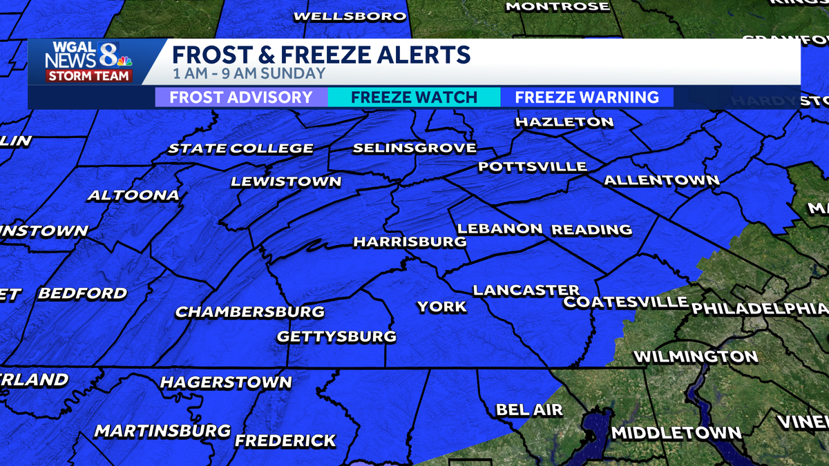 Impact Night | Freeze warning in effect; first freeze of the season
Impact Night WGAL The first freeze warning of the season is in effect for South-Central Pennsylvania A freeze warning is in effect for all counties from 1 a.m The average first freeze for most counties is October 21 For…
- South Philadelphia Gets a Cold Sunday After Friday’s Storm Watch
South Philadelphia residents heading to the Eagles game at 1 p.m. Sunday should expect sunshine and temperatures in the 50s, with the 40s possible for morning tailgaters, FOX 29 Philadelphia reported. The chill follows…
-
 Autumn's Forecast: Cool Saturday and more seasonable Sunday
BUFFALO, N.Y. (WKBW) — Saturday will definitely feel like fall across Western New York, with highs only reaching the upper 40s. The coldest temperatures arrive Saturday night into early Sunday morning. A Freeze WARNING…
-
 Life of Shamokin native and baseball legend featured in new book, "The Giant Killer"
Clouds breaking for sun, blustery, and unseasonably chilly; highs only in the low 50s, with north winds gusting near 30mph.. Mostly clear with diminishing wind; a widespread frost is likely for most, with a freeze…
-
 Dangerous Freeze Watches Issued for Ohio, Pennsylvania and New York as Temperatures Plummet
Freeze Watches are in effect from late Saturday night through Sunday morning across Ohio, Pennsylvania, western New York, West Virginia, Maryland and Virginia, with lows as cold as 25 degrees possible. A strong cold…
-
 Joe Veres' 10.16.26 Evening Forecast
WENY News Wind: NNW @ 9 mph UV Index: 0 Low Wind: NW @ 9 mph Wind: NNW @ 10 mph Joe Veres' 10.16.26 Evening Forecast New York State Expands HEAP Benefits to more Residents Senate Democrats to Deploy Election Observers…
-
 69 News at 6:00 - Severe thunderstorm watches and GIANT disruption
Mostly cloudy with scattered thunderstorms (some with damaging wind gust potential) through early evening, then brisk and drier as it turns much cooler the rest of the night. . headline: Severe Thunderstorm Warning…
-
 Presidential adviser says Ukraine is in talks to lift speed limit on military satellite network
Mostly cloudy with scattered thunderstorms (some with damaging wind gust potential) through early evening, then brisk and drier as it turns much cooler the rest of the night. . Bulletin: SEVERE THUNDERSTORM WATCH 686…
Air quality
Air quality is satisfactory, and air pollution poses little or no risk.
Forecast
- ThuGood (45)
- FriModerate (51)
- SatModerate (55)
Susquehanna Valley, PA reporting area · 1 hr ago. Data from AirNow (EPA and its state, local and tribal partners); preliminary and subject to change.
Sun & moon
Almanac
MonthlyMillers 4 Ne, records since 1988. Normals 1991–2020. Data from NOAA's Regional Climate Centers (ACIS).
Nearby
- Lancaster 39 km
- Towson 54 km
- Harrisburg 46 km
- Bel Air South 54 km
- Randallstown 58 km
- Pikesville 57 km
- Parkville 58 km
- Owings Mills 52 km
- Bel Air North 47 km
- Eldersburg 57 km
- Carney 57 km
- Milford Mill 60 km
Forecasts, observations and alerts in the United States come from the National Weather Service (NOAA); radar from NOAA's Multi-Radar Multi-Sensor system; satellite imagery from NASA's Global Imagery Browse Services (GIBS) and NOAA's GOES satellites; the map from the U.S. Geological Survey's National Map; air quality from AirNow (EPA and its partners); hurricane information from the National Hurricane Center; climate normals and records from NOAA's Regional Climate Centers (ACIS). Forecasts outside the United States and the UV index: MET Norway (CC BY 4.0); observations outside the U.S.: airport reports via NOAA's Aviation Weather Center. Place names: GeoNames (CC BY 4.0). Data are copied on a schedule and may lag the sources; for warnings that affect your safety, follow your local National Weather Service office and emergency officials. Weather news is drawn from the 4Search index and reflects what the press published. Terms of use.