Install
Saint Albans, VT 05478 Weather
Current conditions
Observed at Plattsburgh International Airport · 22 min ago
Forecast
10-day-
Tonight
Mostly clear, with a low around 28. North wind 5 to 10 mph.
-
Friday
Sunny, with a high near 49. North wind around 6 mph.
-
Friday Night
Mostly clear, with a low around 28. East wind around 3 mph.
National Weather Service forecast updated 18 hrs ago.
Hourly
Hourly forecast- Now42°
- 10 PM40°
- 11 PM39°
- Fri12 AM37°
- 1 AM36°
- 2 AM35°
- 3 AM34°
- 4 AM34°
- 5 AM33°
- 6 AM32°
- 7 AM32°
- 8 AM30°
- 9 AM35°
- 10 AM41°
- 11 AM44°
- 12 PM46°
- 1 PM48°
- 2 PM49°
- 3 PM49°
- 4 PM49°
- 5 PM48°
- 6 PM45°
- 7 PM42°
- 8 PM38°
10-day forecast
Details- TodayOct 22Mostly Sunny28°54°
- FriOct 23Sunny28°49°
- SatOct 24Sunny32°54°
- SunOct 25Sunny40°59°
- MonOct 26Mostly Sunny35°58°
- TueOct 27Mostly Sunny32°49°
- WedOct 28Mostly Sunny16%37°51°
- ThuOct 29Cloudy0.04 in45°58°
- FriOct 30Mostly sunny0.31 in42°52°
- SatOct 31Partly cloudy39°51°
Days after the National Weather Service's seven are MET Norway's outlook, a computer model with no forecaster's review.
Radar
Full mapWeather news in Vermont
More weather news-
 NOAA’s Winter Outlook Predicts Warmer Temperatures and Less Snow for Vermont
At SSBCrack News, our dedicated editorial team brings you the latest and most reliable updates on Defence, Geopolitics, Military Affairs, Science, and Technology. Driven by a passion for national security and strategic…
- Vermont Woolly Bear Points to Mild Winter in Predicting A Harsh Winter Using Wildlife
A Vermont woolly bear crossing a patch of pine needles on an access road this week is feeding the old habit of predicting a harsh winter using wildlife, and this one pointed toward a mild season. Its black ends and wide…
-
 PHOTOS: First snowflakes fly around Vermont
VTDigger Member-supported journalism. Informing and engaging Vermont. This year, VTDigger is teaming up with Henry’s Weather Channel to help answer the annual question of when and where peak foliage will make its…
-
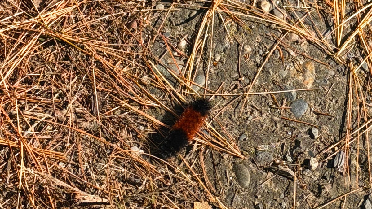 A Vermont Woolly Bear Calls for a Mild Winter. NOAA Mostly Agrees.
The federal government released its official winter forecast on Thursday. Compass Vermont got a second opinion from a caterpillar. We found him crossing a patch of pine needles on a Vermont access road this week. He’s a…
-
 Amber warning in place as Storm Austen hits parts of UK
An amber weather warning has come into force in parts of the UK as Storm Austen brings a swathe of powerful winds and heavy rain on Friday. South West England is forecast to be worst hit by the storm which the Met…
-
 Heavy rain warning as Storm Austen sweeps across Scotland
Scotland is braced for a wet and windy weekend as two named storms hit in two days. Storm Austen is the first to sweep across the country, with the Met Office issuing a a yellow warning for rain, external in central and…
-
 First Alert Weather: Mild afternoons before weekend local nor’easter
Here's what the First Alert Weather Team said you can expect in the forecast: This evening will be dry and clear. Tomorrow morning, temperatures will drop to the lower to mid-50s around Jacksonville and upper 60s along…
-
 Flooding rain, severe thunderstorms shift to interior West into Friday
A storm responsible for areas of rain and thunderstorms and severe weather through midweek over the Southwest will focus its efforts farther inland over the western United States into Friday. Published Oct 20, 2026…
-
 South East prepares for impact of Storm Austen
Seafront closures, cancelled events and travel disruption are expected as the first named storm of the season approaches south-east England. The Met Office has issued a yellow weather warning for wind across the region…
-
 Subtropical Storm Josephine forms in the Atlantic
Strong winds are expected to continue affecting offshore waters and coastal regions, with numerous gale warnings remaining in effect through at least Friday afternoon, especially across coastal New England. Winds will…
Air quality
Air quality is satisfactory, and air pollution poses little or no risk.
Forecast
- ThuGood (45)
- FriGood (30)
Burlington, VT reporting area · 2 hrs ago. Data from AirNow (EPA and its state, local and tribal partners); preliminary and subject to change.
Sun & moon
Nearby
- Saint-Jean-sur-Richelieu 57 km
- Burlington 39 km
- Plattsburgh 31 km
- South Burlington 39 km
- Colchester 30 km
- Farnham 53 km
- Cowansville 51 km
- Essex Junction 36 km
- Williston 42 km
- Winooski 36 km
- Morristown 46 km
- Hinesburg 54 km
Forecasters' discussion
From the National Weather Service office in BTV, issued 13 hrs ago
What Has Changed
As of 209 AM EDT Thursday...
No significant changes have been made with this forecast package.
Key Messages
As of 209 AM EDT Thursday...
1. Dry and seasonable weather will continue through the weekend.
2. Quiet and dry weather is expected to continue into early next week.
Discussion
As of 209 AM EDT Thursday...
KEY MESSAGE 1: Another seasonal day is on tap today with highs in the mid 50s this afternoon. A cold front will bring another shot of below normal temperatures to the region tonight through Saturday with temperatures moderating a bit on Sunday. Gusty north winds will be seen behind the cold front this evening with gusts in the 20-30 mph range. The strongest gusts will be across the Champlain Valley and generally occur between 6 PM and midnight. We will likely see a few hours of 25 kt sustained winds on Lake Champlain this evening and may need to issue a Lake Wind Advisory with the afternoon forecast package. Otherwise, a strong 1034 mb surface high pressure system will settle into the region this weekend with continued dry weather and clear skies expected.
KEY MESSAGE 2: Our continued dry spell does not look to let up even into next week. Ridging will continue well into early next week with generally high confidence in dry and seasonable conditions by Monday and Tuesday. As the center of the ridge axis shifts slightly east late Sunday into Monday, southwest flow will keep temperatures in the upper 50s to low 60s areawide, with some locations in southeastern Vermont pushing the mid 60s. A moisture starved cold front will move through late Monday into Monday night, and while a brief sprinkle in the mountains may be possible, most areas will remain dry. Given how dominating our dry our antecedent conditions will be by Monday, a strong front will be needed to dislodge our dry air and overcome the surface low relative humidities. This front will not be that case, and most precipitation, should any occur, likely will be virga. While precipitation will be lacking, temperatures will cool slightly behind the front with cooler north winds lowering high temperatures Tuesday to the upper 40s to low 50s. While a prolonged stretch of dry weather will continue with some days of low relative humidity values, winds look to be too light to note any serious fire weather concerns right now.
Aviation
Through 12Z Friday...Despite a prolonged detachment from rain, and anticipated persistence forecasting, area of localized fog has developed around MPV/SLK this morning, with VCFG at RUT. Any lingering IFR vis/cig reductions are expected to trend to VFR by 13Z. Beyond 13Z, a weak frontal boundary will pass through generally between 15-17Z as light and variable winds turn prevailing from the north. As the front moves through, increasing clouds will lower scattered cigs towards 3000-4000ft agl. Winds will increase slightly behind the front through the rest of the day with north winds around 10 knots across Vermont, and occasional gusts between 15-20 knots. In northern New York, any gusts should remain below 15 knots. Winds weaken after 00Z towards light and terrain driven. Another clear and calm night is expected for all terminals tonight, with some hints at repeat fog at MSS/SLK/MPV, though it will be tied to the later portion of tonight, with some subtle flow aloft in the beginning portion of the night limiting early fog development. Given low confidence at this time, have left out any fog or terminal reductions in this TAF package.
Outlook...
Friday: VFR. NO SIG WX. Friday Night: VFR. NO SIG WX. Saturday: VFR. NO SIG WX. Saturday Night: VFR. NO SIG WX. Sunday: VFR. NO SIG WX. Sunday Night: VFR. NO SIG WX. Monday: Mainly VFR, with local MVFR possible. NO SIG WX.
Forecasts, observations and alerts in the United States come from the National Weather Service (NOAA); radar from NOAA's Multi-Radar Multi-Sensor system; satellite imagery from NASA's Global Imagery Browse Services (GIBS) and NOAA's GOES satellites; the map from the U.S. Geological Survey's National Map; air quality from AirNow (EPA and its partners); hurricane information from the National Hurricane Center; climate normals and records from NOAA's Regional Climate Centers (ACIS). Forecasts outside the United States and the UV index: MET Norway (CC BY 4.0); observations outside the U.S.: airport reports via NOAA's Aviation Weather Center. Place names: GeoNames (CC BY 4.0). Data are copied on a schedule and may lag the sources; for warnings that affect your safety, follow your local National Weather Service office and emergency officials. Weather news is drawn from the 4Search index and reflects what the press published. Terms of use.