Install
South Portland, ME 04116 Weather
Current conditions
Observed at Portland, Portland International Jetport · 41 min ago
Forecast
10-day-
Monday
Sunny, with a high near 65. Southwest wind 0 to 5 mph.
-
Monday Night
Mostly clear, with a low around 38. North wind 0 to 10 mph.
-
Tuesday
Sunny, with a high near 52. Northwest wind 5 to 10 mph.
National Weather Service forecast updated 13 hrs ago.
Hourly
Hourly forecast- Now64°
- 4 PM62°
- 5 PM61°
- 6 PM59°
- 7 PM57°
- 8 PM55°
- 9 PM53°
- 10 PM51°
- 11 PM51°
- Tue12 AM51°
- 1 AM49°
- 2 AM47°
- 3 AM45°
- 4 AM43°
- 5 AM41°
- 6 AM40°
- 7 AM38°
- 8 AM38°
- 9 AM40°
- 10 AM42°
- 11 AM44°
- 12 PM47°
- 1 PM49°
- 2 PM49°
10-day forecast
Details- TonightOct 25Mostly Clear37°
- TodayOct 26Sunny38°65°
- TueOct 27Sunny35°52°
- WedOct 28Sunny39°53°
- ThuOct 29Mostly Sunny49°64°
- FriOct 30Sunny44°68°
- SatOct 31Sunny42°58°
- SunNov 1Mostly Sunny58°
- MonNov 2Cloudy48°60°
- TueNov 3Cloudy0.05 in36°54°
Days after the National Weather Service's seven are MET Norway's outlook, a computer model with no forecaster's review.
Radar
Full mapWeather news in Maine
More weather news-
 Fantastic fall weather continues
WABI Fantastic fall weather continues The sunshine parade continues through most of next week Maine Snowmobile Association hosts 29th Snowmobile and Powersports Show Beloved Bangor gift shop changes hands after 40 years…
-
 Drought lowers well levels in northern Maine
AROOSTOOK COUNTY, Maine (WAGM) - About half the country relies on private wells for everyday water use. An ongoing drought is leaving some wells with record low levels, and with winter approaching, local officials say…
-
 More Clouds & Breezy Conditions Thursday
BANGOR, Maine (WABI) - High pressure parked over the Northeast has kept us dry and sunny for the first half of the week. That changes some Wednesday night into Thursday as a strong low to our south slides farther north…
- More Clouds & Breezy Today... Sunshine, Breezy & Cooler Friday
Today: Partly to mostly cloudy and becoming breezy. Highs in the 50s. North/northwest wind 10-20 MPH with gusts to 25-30 MPH possible this afternoon. Tonight: Clear and breezy. Lows in the upper 20s to mid-30s. North…
-
 Storm Josephine brings high winds and possible coastal flooding to Eastern Seaboard
The storm had maximum sustained winds of 65 mph (100 kph) and was centered about 265 miles (425 kilometers) south of Nantucket, Massachusetts, and about 585 miles (940 kilometers) southwest of Halifax, Nova Scotia. The…
- Birders flock to southern Maine to see rare gray heron, documented in state for first time ever
NewsBreak: Local News & Alerts Local news from Maine Birders flock to southern Maine to see rare gray heron, documented in state for first time ever YOU MAY ALSO LIKE Iconic Frozen Pizza Discontinued Forever, After More…
-
 Today's 5AM Forecast Update
WMTW Today's 5AM Forecast Update How’s the weather looking for your Wednesday? Get your latest Maine’s Total Weather video forecast from Meteorologist Ted McInerney. Spotify says it's removed 70 million 'spammy' tracks…
-
 Sunshine & Pleasant Today... More Clouds & Breezy Thursday
Rest of Today: Mostly sunny. Highs in the mid-50s. Northeast wind 5-10 MPH. Thursday: Partly to mostly cloudy and breezy. Highs in the 50s. North/northwest wind 10-15 MPH with gusts to 25-30 MPH possible. Friday: Mostly…
-
 WABI AM Weather 10/21/26
WABI WABI AM Weather 10/21/26 A nice fall day, then a quiet weather week Breezy Saturday, nicer Sunday and a pleasant week
-
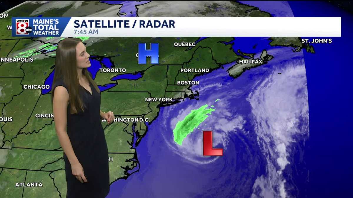 Offshore storm bringing breezy conditions
Wednesday will start off sunny, but cloud cover will start to increase a bit this afternoon. We have a cooler day in store with high temperatures in the mid-50s. Wednesday will also feel cool because conditions will be…
Air quality
Air quality is satisfactory, and air pollution poses little or no risk.
Forecast
- MonGood
- TueGood
- WedGood
Southwest Coast, ME reporting area · 1 hr ago. Data from AirNow (EPA and its state, local and tribal partners); preliminary and subject to change.
Sun & moon
Almanac
MonthlyPortland Area, records since 1874. Normals 1991–2020. Data from NOAA's Regional Climate Centers (ACIS).
Nearby
- Portland 2 km
- Lewiston 51 km
- West Scarborough 14 km
- South Portland Gardens 6 km
- Auburn 51 km
- Biddeford 24 km
- Sanford 49 km
- Saco 23 km
- Westbrook 11 km
- Brunswick 38 km
- Wells Beach Station 45 km
- Lisbon 45 km
Forecasters' discussion
From the National Weather Service office in GYX, issued 1 hr ago
What Has Changed
No significant changes to the forecast with this update.
Key Messages
1. High pressure will dominate the weather for the next week. Expect dry conditions and no significant weather impacts.
Discussion
KEY MESSAGE 1 DESCRIPTION...
High pressure remains the dominating force behind our local weather for the foreseeable future. That will bring largely fair weather, dry conditions, and on average warmer than normal temps.
It is fall however, and those temps will experience some dips here and there. One of those dips will be following the passage of a mostly dry cold front tonight. Temps will struggle to creep out of the 40s for even southern parts of the forecast area, and remain in the mid 40s north of the mtns. There should be enough dry advection and gradient wind to prevent significant radiation fog tonight.
Then we just recycle the forecast pattern. High pressure will build into the region. This provides us with perhaps the coldest night of the season so far Tue night. I did continue to blend in some MOS guidance in order to bring the cold spots down into the teens and lower 20s, but otherwise the NBM bias corrected guidance is pretty locked onto the radiational cooling pattern.
That high pressure will move off the coast and allow return flow to develop late in the week. This will bring warmer than normal temps back into the forecast area and give us a couple more chances as some readings near 70 across southern NH and coastal western Maine.
Another largely dry frontal passage is expected heading into Sat, but that just returns temps to near normal. So trick or treating conditions will be classically crisp.
Aviation
Through Tuesday: VFR conditions anticipated. There should be enough breeze behind the cold front and dry advection to prevent valley fog from forming.
Outlook...
Wednesday-Thursday...VFR conditions expected. There may be brief period of IFR or lower in valley fog at LEB, CON, and MHT prior to sunrise.
Friday: Another front approaches the region and some MVFR CIGs may be possible north of the mtns, including HIE.
Saturday: VFR conditions expected.
Forecasts, observations and alerts in the United States come from the National Weather Service (NOAA); radar from NOAA's Multi-Radar Multi-Sensor system; satellite imagery from NASA's Global Imagery Browse Services (GIBS) and NOAA's GOES satellites; the map from the U.S. Geological Survey's National Map; air quality from AirNow (EPA and its partners); hurricane information from the National Hurricane Center; climate normals and records from NOAA's Regional Climate Centers (ACIS). Forecasts outside the United States and the UV index: MET Norway (CC BY 4.0); observations outside the U.S.: airport reports via NOAA's Aviation Weather Center. Place names: GeoNames (CC BY 4.0). Data are copied on a schedule and may lag the sources; for warnings that affect your safety, follow your local National Weather Service office and emergency officials. Weather news is drawn from the 4Search index and reflects what the press published. Terms of use. How to use Weather