Install
New Bedford, MA 02745 Weather
Current conditions
Observed at New Bedford, New Bedford Regional Airport · 1 hr ago
Forecast
10-day-
Today
Mostly sunny, with a high near 59. Northeast wind 13 to 16 mph, with gusts as high as 31 mph.
-
Tonight
Partly cloudy, with a low around 46. Northeast wind 9 to 13 mph, with gusts as high as 25 mph.
-
Wednesday
Mostly cloudy, with a high near 55. Northeast wind 13 to 16 mph, with gusts as high as 30 mph.
National Weather Service forecast updated 50 min ago.
Hourly
Hourly forecast- Now57°
- 12 PM57°
- 1 PM58°
- 2 PM59°
- 3 PM59°
- 4 PM58°
- 5 PM59°
- 6 PM55°
- 7 PM53°
- 8 PM54°
- 9 PM51°
- 10 PM51°
- 11 PM51°
- Wed12 AM50°
- 1 AM50°
- 2 AM49°
- 3 AM49°
- 4 AM48°
- 5 AM47°
- 6 AM47°
- 7 AM46°
- 8 AM48°
- 9 AM50°
- 10 AM52°
10-day forecast
Details- TodayOct 20Mostly Sunny46°59°
- WedOct 21Mostly Cloudy17%43°55°
- ThuOct 22Mostly Sunny10%39°60°
- FriOct 23Sunny36°52°
- SatOct 24Sunny37°57°
- SunOct 25Sunny43°61°
- MonOct 26Sunny44°65°
- TueOct 27Partly cloudy39°58°
- WedOct 28Partly cloudy36°52°
- ThuOct 29Cloudy49°60°
Days after the National Weather Service's seven are MET Norway's outlook, a computer model with no forecaster's review.
Radar
Full mapWeather news in Massachusetts
More weather news-
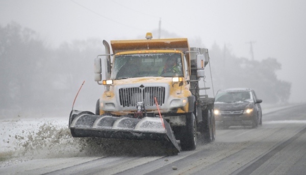 NOAA Outlook predicts wet winter for Massachusetts, Rhode Island, Connecticut, southern states
Fall River Reporter Winter Outlook has been released and it shows how El Nino will likely influence the upcoming winter months (December 2026 to February 2027), with warmer-than-average temperatures expected across the…
-
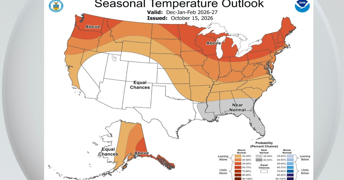 El Niño a major factor in NOAA's winter outlook. Maps show how it could affect Massachusetts.
October 15, 2026 / 1:30 PM EDT / CBS Boston NOAA's National Weather Service announced its winter outlook for the United States Thursday and there were no big surprises for Massachusetts. El Niño is ruling the roost. As…
-
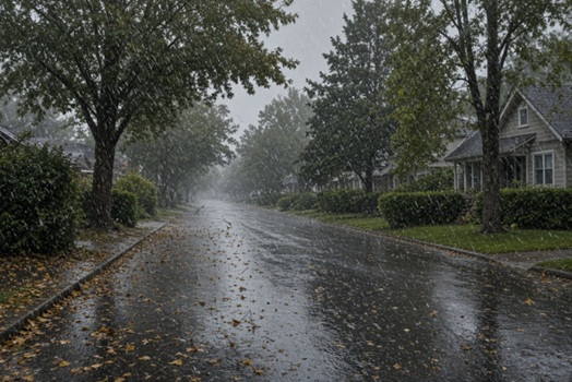 Parts of Massachusetts, Rhode Island, Connecticut to see up to 1+” of rain, strong winds, temps near freezing
Massachusetts, Rhode Island, and Connecticut are expected to see heavy rains, strong winds, and in some areas, temperatures near freezing. According to the National Weather Service, a low-pressure system is expected to…
-
 Rain and wind could disrupt your weekend plans in Massachusetts. See forecast
Rain showers, gusty winds, and temperatures dipping into the 40s and 30s could put a damper on outdoor weekend plans across Massachusetts. A low-pressure system is expected to bring rain Friday, Oct. 16, into early…
-
 Massachusetts futurecast: Big weather-maker is headed our way
DEDHAM, Mass. — A significant forecast change is coming, with a Weather Alert in effect Friday and Saturday as rain, stronger winds, and much colder air move into New England. Rain will be the biggest concern as the…
Air quality
Air quality is satisfactory, and air pollution poses little or no risk.
Forecast
- TueGood (35)
- WedGood
- ThuGood
South Bristol-Plymouth, MA reporting area · 1 hr ago. Data from AirNow (EPA and its state, local and tribal partners); preliminary and subject to change.
Sun & moon
Almanac
MonthlyRochester, records since 1900. Normals 1991–2020. Data from NOAA's Regional Climate Centers (ACIS).
Nearby
- Providence 42 km
- Brockton 44 km
- Fall River 18 km
- Warwick 40 km
- Cranston 43 km
- Pawtucket 43 km
- Taunton 27 km
- Weymouth 59 km
- Barnstable 53 km
- East Providence 39 km
- Attleboro 40 km
- Woonsocket 59 km
Forecasters' discussion
From the National Weather Service office in BOX, issued 4 hrs ago
What Has Changed
Confidence continues to increase that a nor'easter will remain offshore. While impacts to land will be minimal, hazardous conditions are expected for the marine and boating community due to large waves and gale-force winds.
Key Messages
- A nor'easter passes offshore late Wednesday into Thursday, bringing a few showers to areas east of I-95. Otherwise, dry and breezy conditions prevail through the middle part of the week.
- Fairly cool on Friday with a very low chance of an early morning shower. Otherwise, moderating temperatures and dry conditions are expected for the weekend into early next week.
Discussion
KEY MESSAGE 1...A nor'easter passes offshore late Wednesday into Thursday, bringing a few showers to areas east of I-95. Otherwise, dry and breezy conditions prevail through the middle part of the week.
There were no notable changes to the near and short-term forecast during the overnight update. A broad 1030+ mb high pressure system situated northwest of southern New England will provide yet another dry day across the region. However, there will likely be more filtered sunshine today, especially across eastern portions of southern New England, while areas farther west are treated to another mainly clear day. 925 mb temperatures this afternoon are expected to range from +8C to +10C, and anticipate highs reaching well into the lower to middle 60s across interior areas, while the coastal plain remains in the upper 50s to lower 60s. In addition, winds increase due to a tightening pressure gradient between the aforementioned area of high pressure and a developing nor'easter off the North Carolina coast. There is good confidence that breezy to gusty northeast winds will be most prevalent east of I-95, with gusts of 20 to 30 mph. The strongest gusts, 30 to 40 mph, are expected along the east-facing Massachusetts coastline, Cape Cod, and the Islands. While previous guidance suggested a few gusts exceeding 45 mph across Nantucket, confidence in these stronger gusts has decreased as the latest guidance favors a farther offshore track.
These winds continue overnight and into Wednesday as the nor'easter strengthens and tracks northeast, while rain chances remain fairly low during this time frame. Clouds increase overnight into Wednesday, with the added cloud cover helping to moderate overnight lows. Temperatures across Cape Cod and the Islands remain in the upper 40s to lower 50s, while interior locations experience some clearing early in the night before clouds increase later. This should allow temperatures to fall into the upper 30s to lower 40s. Predominantly dry conditions continue into Wednesday, with temperatures slightly cooler than today, mainly due to increased cloud cover limiting diurnal heating. Wind conditions will be nearly identical to today. During this time frame, we can utilize high- resolution guidance, including the CAMs, to get a better sense of how things may play out. There is a low chance for a few showers, mainly after 18z/2 PM Wednesday, across Nantucket, Martha's Vineyard, and outer Cape Cod, including Chatham.
Confidence remains high that a slow-moving nor'easter will track up the coast but remain far enough offshore to limit significant impacts to land. However, dangerous marine conditions are anticipated. As previous forecasters have mentioned, the NAM has shown the westernmost solution. The 20/00z run indicates that the NAM is coming more in line with the deterministic GFS, while the ECMWF remains somewhat farther east. Global ensembles also continue to indicate that this nor'easter will make its closest approach late Wednesday night into early Thursday morning before accelerating northeast into the northern Atlantic. Rain chances remain fairly low for most of southern New England, with the greatest chance for showers across the Cape and Islands from Wednesday afternoon into early Thursday morning. A few showers may also reach portions of eastern MA and RI, though most locations will remain dry. Even then, any rainfall is not expected to produce notable impacts. Nevertheless, while this will not be the quintessential nor'easter for those on land, it certainly will be for the marine community. Large waves of 7 to 13 feet are expected to build offshore, accompanied by gale-force winds out of the north-northeast to northeast. While astronomical tides are low, persistent wind and wave action may lead to beach erosion. Additional details on the hazardous marine conditions can be found in the marine discussion.
KEY MESSAGE 2...Fairly cool on Friday with a very low chance of an early morning shower. Otherwise, moderating temperatures and dry conditions are expected for the weekend into early next week.
As the nor'easter peels out to sea, strong high pressure settles in for the upcoming weekend. There is one interesting feature worth watching, although it is unlikely to cause more than a slight inconvenience. A mid-level cold pool associated with a robust northern-stream shortwave passes through early Friday. While PWATs will be limited by this time, a spot shower early Friday morning cannot be ruled out, with areas east of I-95 having the greatest chance. Otherwise, high pressure promotes sinking air and generally quiet weather this weekend into Monday of next week. With the cold pool aloft, Friday will be the coolest day, with highs in the lower 50s. Depending on how quickly winds decouple, Saturday morning could feature a frosty start, with lows in the upper 20s to middle 30s. From Saturday through Monday, temperatures slowly moderate, increasing a few degrees each day for both highs and lows as high pressure allows for WAA aloft.
Aviation
Forecaster Confidence Levels...
Low - less than 30 percent. Moderate - 30 to 60 percent. High - greater than 60 percent.
12z TAF Update:
Today and Tonight...High confidence.
VFR today and for most of tonight. However, MVFR ceilings return after 08z Wednesday for terminals across eastern MA and RI. North- northeast winds gust to 20 to 25 knots across the interior and 30 to 35 knots at coastal terminals.
Wednesday...High confidence.
Forecasts, observations and alerts in the United States come from the National Weather Service (NOAA); radar from NOAA's Multi-Radar Multi-Sensor system; satellite imagery from NASA's Global Imagery Browse Services (GIBS) and NOAA's GOES satellites; the map from the U.S. Geological Survey's National Map; air quality from AirNow (EPA and its partners); hurricane information from the National Hurricane Center; climate normals and records from NOAA's Regional Climate Centers (ACIS). Forecasts outside the United States and the UV index: MET Norway (CC BY 4.0); observations outside the U.S.: airport reports via NOAA's Aviation Weather Center. Place names: GeoNames (CC BY 4.0). Data are copied on a schedule and may lag the sources; for warnings that affect your safety, follow your local National Weather Service office and emergency officials. Weather news is drawn from the 4Search index and reflects what the press published. Terms of use.