Install
Am Dam, Sila, Chad Weather
Current conditions
Forecast for this hour (no station report in the last two hours)
Forecast
10-day-
Friday
Mostly sunny. High 39°.
-
Friday Night
Mostly clear. Low 24°.
-
Saturday
Partly cloudy. High 39°.
MET Norway forecast updated 15 hrs ago.
Hourly
Hourly forecast- Now33°
- 19:0033°
- 20:0032°
- 21:0031°
- 22:0030°
- 23:0029°
- Sat00:0028°
- 01:0027°
- 02:0026°
- 03:0026°
- 04:0025°
- 05:0025°
- 06:0025°
- 07:0027°
- 08:0030°
- 09:0033°
- 10:0036°
- 11:0038°
- 12:0039°
- 13:0039°
- 14:0039°
- 15:0039°
- 16:0039°
- 17:0036°
Daily forecast
DetailsRadar
Full mapWeather news in Chad
More weather news-
 Brace for darker evenings as the annual seasonal clock change approaches
Fox News Chief Congressional Correspondent Chad Pergram joins FOX Weather to talk about the latest from the vote on Capitol Hill As fall comes to a close and winter approaches, cooler temperatures and shorter days are…
-
 UN: El Nino could be ‘literally off the monitoring charts’
GENEVA, Switzerland: The El Nino weather phenomenon gripping the planet could be off the charts, the United Nations warned Wednesday, saying countries should take urgent action to prepare for the worst. “The current El…
-
 AccuWeather's Pittsburgh Winter Forecast Revealed: Warm/Wet
With October already over halfway over, the colder weather will soon be here. For the next week or so, Pittsburgh is expecting sunshine and highs in the low to mid 60s through at least this weekend. But how is winter…
-
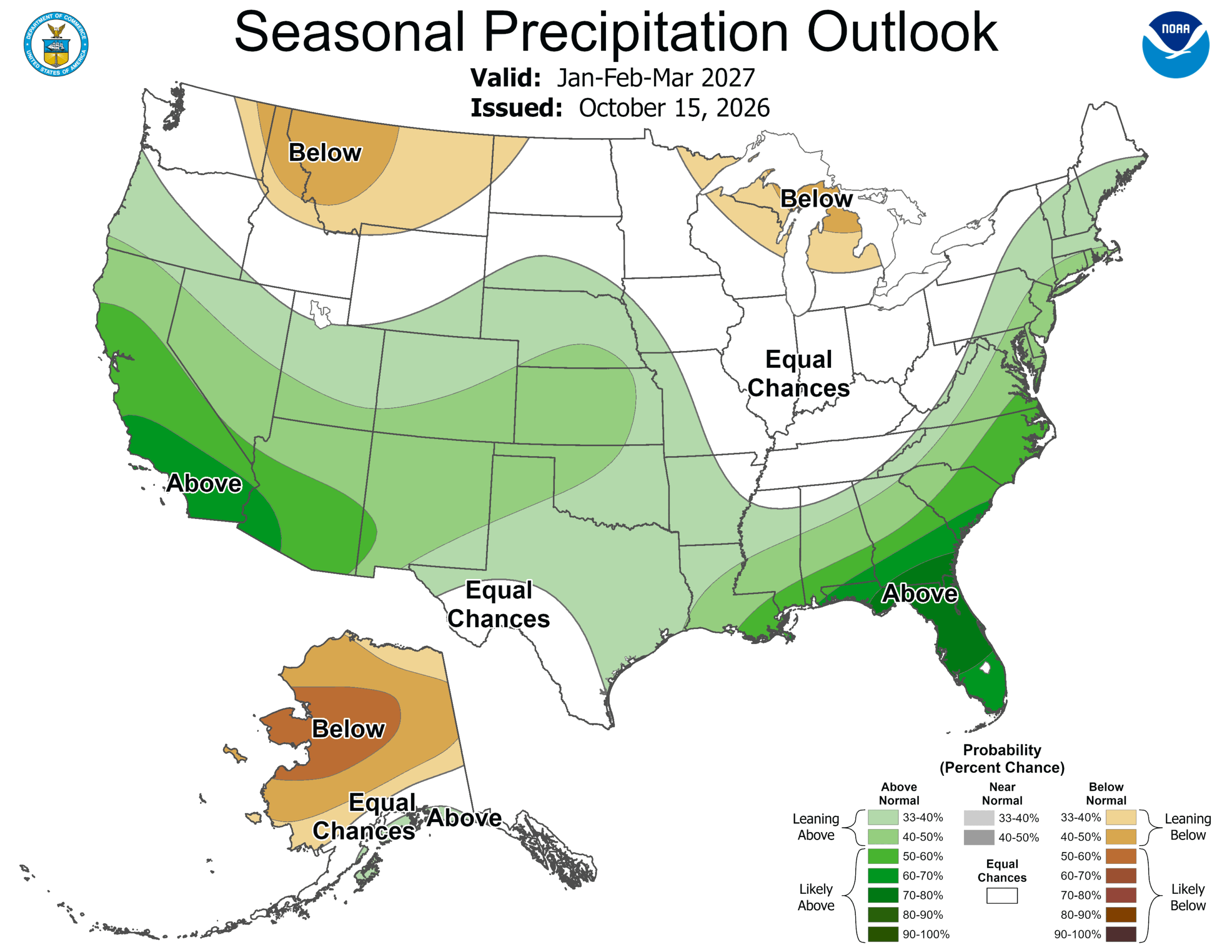 ‘Weather Whiplash’ Bringing Back Rain and Snow to California
A “weather whiplash” will continue taking Californians for a ride this week, as last week’s high temperatures and blustery winds give way to clouds, rain and snow in the mountains. This week, the stormy weather returns…
-
 New winter forecast reveals complete shift in snow predictions for 2027
By CHRIS MELORE, US DEPUTY SCIENCE EDITOR A new forecast model predicts that the impact of a historic El Niño will completely flip America's winter, bringing snow to some areas that saw next to none last year…
-
 Freeze warning issued for Northern Ohio Sunday morning
The National Weather Service has issued a freeze warning for Sunday from 1 a.m. to 9 a.m. across northern Ohio and northwest Pennsylvania, with temperatures dropping as low as 30 degrees CLEVELAND, OH (CRAWFORD COUNTY…
-
 Tracking the Tropics: Friday, October 16
Action News Jax Action News Jax Now Action News Jax Weather 24/7 Action Sports Jax 24/7 Action News Jax 24/7 News First Alert Forecast: Friday, Oct. 16 Fletcher High volleyball coach removed NAS Jax Air Show returns…
-
 Avita Weekend Weather: Sunny, cool weather expected for Saturday and Sunday
BUCYRUS, OH (CRAWFORD COUNTY NOW)—Crawford County is expected to see sunny skies and cool fall weather Saturday and Sunday, Oct. 17-18, with daytime temperatures near 60 degrees. According to the National Weather…
-
 Winter forecast 2026-2027: El Niño to reshape snow, cold across the US
Snow shovels, winter coats and heating systems will be put to work in the coming months, but the upcoming winter season could look very different across the United States compared with recent years. A potentially…
Sun & moon
Forecasts, observations and alerts in the United States come from the National Weather Service (NOAA); radar from NOAA's Multi-Radar Multi-Sensor system; satellite imagery from NASA's Global Imagery Browse Services (GIBS) and NOAA's GOES satellites; the map from the U.S. Geological Survey's National Map; air quality from AirNow (EPA and its partners); hurricane information from the National Hurricane Center; climate normals and records from NOAA's Regional Climate Centers (ACIS). Forecasts outside the United States and the UV index: MET Norway (CC BY 4.0); observations outside the U.S.: airport reports via NOAA's Aviation Weather Center. Place names: GeoNames (CC BY 4.0). Data are copied on a schedule and may lag the sources; for warnings that affect your safety, follow your local National Weather Service office and emergency officials. Weather news is drawn from the 4Search index and reflects what the press published. Terms of use.