Install
Ruhuha, Eastern Province, Rwanda Weather
Current conditions
Forecast for this hour (no station report in the last two hours)
Forecast
10-day-
Saturday
Heavy showers. High 26°. Precipitation 9.9 mm for the day.
-
Saturday Night
Heavy showers. Low 17°. Precipitation 9.9 mm for the day.
-
Sunday
Showers. High 27°. Precipitation 2.6 mm for the day.
MET Norway forecast updated 1 day ago.
Hourly
Hourly forecast- Now26°
- 15:0026°
- 16:0025°0.3
- 17:0024°
- 18:0022°4.5
- 19:0018°2.9
- 20:0019°0.3
- 21:0019°
- 22:0018°
- 23:0018°
- Sun00:0018°
- 01:0018°
- 02:0017°
- 03:0017°
- 04:0017°
- 05:0016°
- 06:0016°
- 07:0018°
Daily forecast
DetailsRadar
Full mapWeather news near Ruhuha
More weather news-
 Gauteng to swelter in 32°C heat, Cape Town braces for 50km/h gusts on Thursday
14 October 2026 17:58 Dairy farmers facing 'industry crisis' over milk price cuts, warns industry body 14 October 2026 17:06 PFL Africa lands in Casablanca as high-stakes semifinals set stage for Kigali finals 14…
-
 As El Niño Returns, East Africa’s Urban Poor Brace for Heavy Rains
Tuesday, October 20, 2026 Tanzania’s vice-president inspects a drainage channel in Dar es Salaam as authorities step up preparations for heavy El Niño rains expected during the October–December rainy season. Credit…
-
 Severe weather possible Tuesday in Southeast Michigan. Here's the timing and what to look for.
Updated on: April 14, 2026 / 11:50 PM EDT / CBS Detroit A severe weather threat exists for Tuesday, and Southeast Michigan is squarely in the path. A potent weather system is dragging unseasonably warm, humid air into…
-
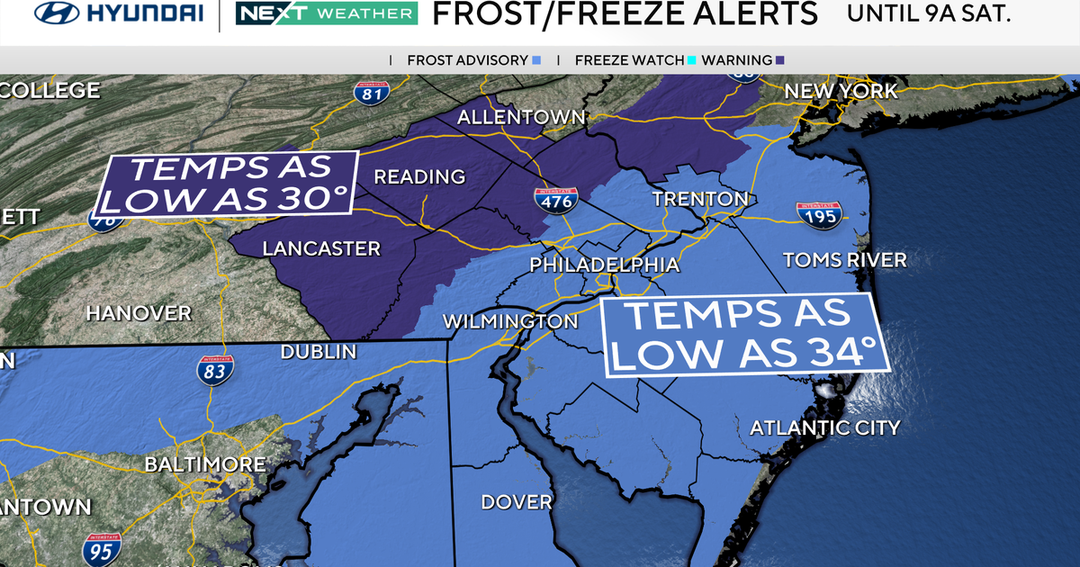 Freeze warning in effect for parts of Philadelphia region as chilly air moves in. Here's the weather forecast.
October 23, 2026 / 11:57 PM EDT / CBS Philadelphia With fall comes some frosty mornings, and that's exactly what's on tap this weekend in the Philadelphia region. Temperatures Saturday morning along the I-95 corridor…
-
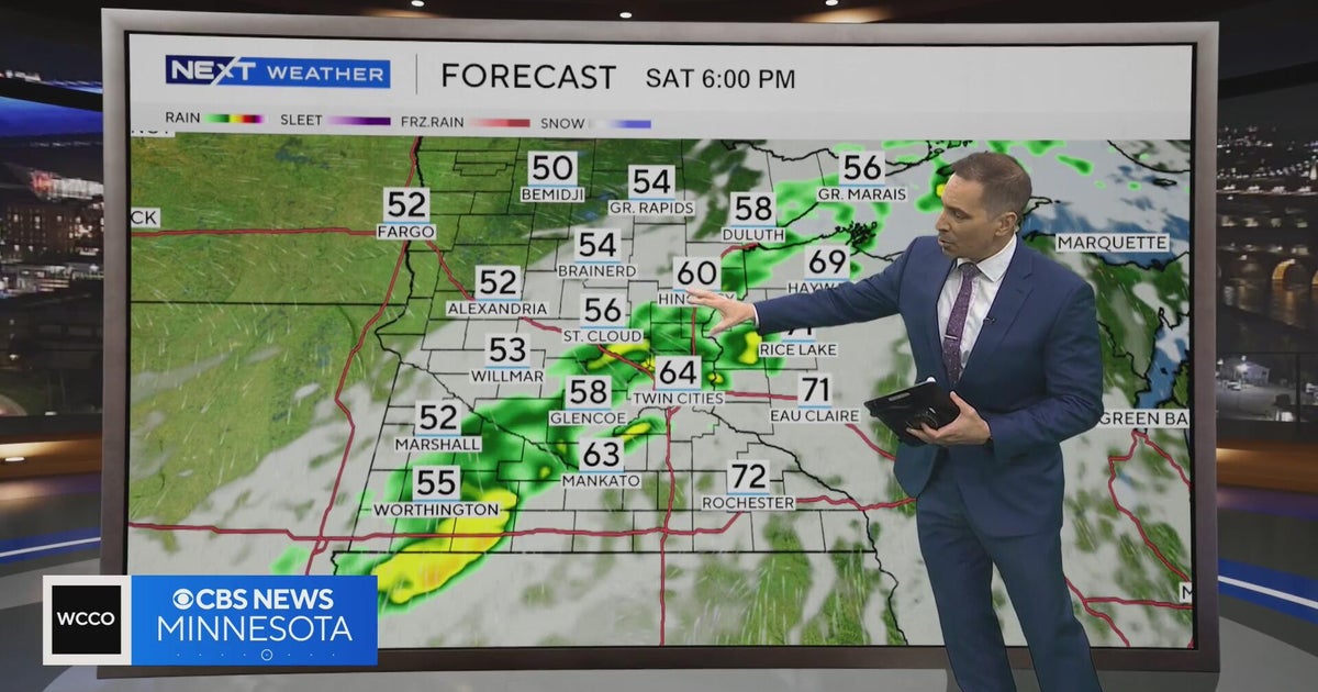 Minnesota weather to feature warm temps Saturday before cooldown | Oct. 23, 2026
CBS News Minnesota is a local news organization that is part of CBS News and Stations. Also referred to as WCCO-TV and channel 4, CBS News Minnesota offers local breaking news, weather coverage and investigative…
-
 Second storm to hit UK with more wind and rain as thousands remain without power
Rough sea along the Dorset coastline on Friday A second storm in as many days is set to batter parts of the UK, as thousands remain without power following powerful winds and heavy rain on Friday. Storm Boelo is…
-
 Thousands without power after Austen batters UK as second storm nears
Thousands of homes are without power in south-west England after Storm Austen hit the region, as the north of the country braces for a second storm. Strong winds and heavy, frequent showers are set to batter northern…
-
 Before you crank up the thermostat, try these tips to keep your house warmer for longer
As the UK braces for a chilly weekend, with powerful winds and heavy rain hitting parts of the country, people are looking for ways to bring some warmth to their homes without cranking up the heating just yet. It is…
-
 Thunderstorms, heavy rain and flash flooding predicted for much of Australia
Parts of Queensland, Victoria and South Australia can expect severe storms on Saturday, moving into NSW and Tasmania by Sunday Severe thunderstorms and heavy rain will sweep across most Australian states this weekend…
-
 Storm Boelo expected to bring more disruption as hundreds still grapple with Austen power cuts
Storm Boelo is expected to bring wet and windy weather across large swathes of the country on Saturday, with Scotland being hit the hardest Yellow and amber warnings have been given for Scotland, northern England and…
Sun & moon
Nearby
Forecasts, observations and alerts in the United States come from the National Weather Service (NOAA); radar from NOAA's Multi-Radar Multi-Sensor system; satellite imagery from NASA's Global Imagery Browse Services (GIBS) and NOAA's GOES satellites; the map from the U.S. Geological Survey's National Map; air quality from AirNow (EPA and its partners); hurricane information from the National Hurricane Center; climate normals and records from NOAA's Regional Climate Centers (ACIS). Forecasts outside the United States and the UV index: MET Norway (CC BY 4.0); observations outside the U.S.: airport reports via NOAA's Aviation Weather Center. Place names: GeoNames (CC BY 4.0). Data are copied on a schedule and may lag the sources; for warnings that affect your safety, follow your local National Weather Service office and emergency officials. Weather news is drawn from the 4Search index and reflects what the press published. Terms of use.