Install
Ondangwa East, Oshikoto Region, Namibia Weather
Current conditions
Forecast for this hour (no station report in the last two hours)
Forecast
10-day-
Monday
Cloudy. High 34°.
-
Monday Night
Cloudy. Low 22°.
-
Tuesday
Partly cloudy. High 36°.
MET Norway forecast updated 19 hrs ago.
Hourly
Hourly forecast- Now26°
- 23:0024°
- Tue00:0024°
- 01:0024°
- 02:0023°
- 03:0023°
- 04:0022°
- 05:0021°
- 06:0021°
- 07:0022°
- 08:0024°
- 09:0026°
- 10:0029°
- 11:0031°
- 12:0034°
- 13:0035°
- 14:0036°
- 15:0036°
- 16:0036°
- 17:0035°
- 18:0035°
- 19:0033°
- 20:0031°
- 21:0029°
Daily forecast
DetailsRadar
Full mapWeather news in Namibia
More weather news-
 Weather: KZN set for afternoon thundershowers and fresh winds on Saturday
Home » News » Weather » Weather: KZN set for afternoon thundershowers and fresh winds on Saturday Planning a Saturday outing? Here is what to expect from the weather across KZN, Free State and North West this weekend…
-
 WEATHER TODAY: Heat wave for Lephalale and Thabazimbi, Rustenburg up to 34°C
Home » News » Weather » WEATHER TODAY: Heat wave for Lephalale and Thabazimbi, Rustenburg up to 34°C Weather for Friday: Slight rain and drizzle for Durban, Gqeberha and Mthatha, while Cape Town stays dry under high…
-
 Olympia Swimming Pool closes for two days as heatwave hits Windhoek
The City of Windhoek has announced the temporary closure of the Olympia Swimming Pool for two days. The swimming pool will be closed on Friday and Saturday due to an event taking place at the facility. In a public…
-
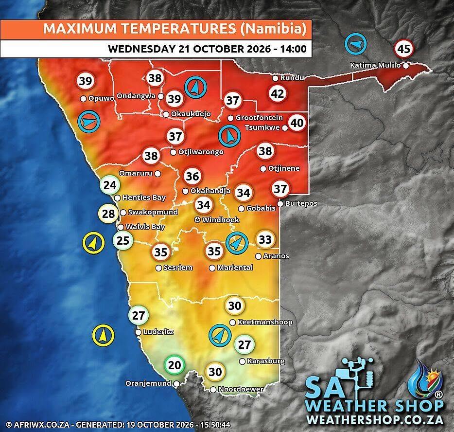 Heatwave to hit Namibia until weekend
Namibians have been warned to prepare for temperatures of up to 42°C as a heatwave continues across the country until the weekend. The Namibia Meteorological Service says temperatures are expected to range between 36°C…
-
 Farmers’ Almanac Predicts Thanksgiving Weather Forecast
Oct 26, 2026 at 12:16 PM EDT The Farmers’ Almanac has predicted that weather across the U.S. will be fairly typical of late November over Thanksgiving week, with a mix of cool and mild conditions, snow possible in some…
-
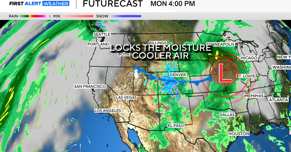 Colorado's dry week could end with a big storm bringing heavy rain and mountain snow
October 26, 2026 / 12:52 PM MDT / CBS Colorado Another storm is looming in Colorado's extended forecast, and we've seen this play out before. The script remains familiar: A surge of Pacific moisture moves into the…
-
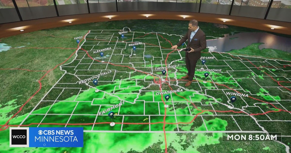 This October is on track to be one of the warmest on record in the Twin Cities | Oct. 26, 2026
CBS News Minnesota is a local news organization that is part of CBS News and Stations. Also referred to as WCCO-TV and channel 4, CBS News Minnesota offers local breaking news, weather coverage and investigative…
-
 Halloween eye safety dos and don’ts: Skip store-bought costume contacts, go easy on glitter
CBS News Minnesota is a local news organization that is part of CBS News and Stations. Also referred to as WCCO-TV and channel 4, CBS News Minnesota offers local breaking news, weather coverage and investigative…
-
 Eyeball olives and a marshmallow spiderweb: How to make a scary snack board
CBS News Minnesota is a local news organization that is part of CBS News and Stations. Also referred to as WCCO-TV and channel 4, CBS News Minnesota offers local breaking news, weather coverage and investigative…
-
 Get your flu shot now, as it may take about 2 weeks to take full effect
Scott Swanson, vice president of Cub Pharmacy, says flu season typically peaks in December and January, so a shot at the end of October protects you by mid-November, ahead of holiday gatherings. Walk-ins and…
Forecasts, observations and alerts in the United States come from the National Weather Service (NOAA); radar from NOAA's Multi-Radar Multi-Sensor system; satellite imagery from NASA's Global Imagery Browse Services (GIBS) and NOAA's GOES satellites; the map from the U.S. Geological Survey's National Map; air quality from AirNow (EPA and its partners); hurricane information from the National Hurricane Center; climate normals and records from NOAA's Regional Climate Centers (ACIS). Forecasts outside the United States and the UV index: MET Norway (CC BY 4.0); observations outside the U.S.: airport reports via NOAA's Aviation Weather Center. Place names: GeoNames (CC BY 4.0). Data are copied on a schedule and may lag the sources; for warnings that affect your safety, follow your local National Weather Service office and emergency officials. Weather news is drawn from the 4Search index and reflects what the press published. Terms of use. How to use Weather