Install
Masan, Gwangju, South Korea Weather
Current conditions
Forecast for this hour (no station report in the last two hours)
Forecast
10-day-
Wednesday
Rain. High 19°. Precipitation 1.0 mm for the day.
-
Wednesday Night
Cloudy. Low 12°. Precipitation 1.0 mm for the day.
-
Thursday
Partly cloudy. High 15°.
MET Norway forecast updated 9 hrs ago.
Hourly
Hourly forecast- Now14°
- 08:0016°
- 09:0018°0.4
- 10:0018°0.4
- 11:0019°0.2
- 12:0018°
- 13:0018°
- 14:0018°
- 15:0017°
- 16:0016°
- 17:0015°
- 18:0014°
- 19:0013°
- 20:0013°
- 21:0012°
- 22:0012°
- 23:0012°
- Thu00:0011°
- 01:0011°
- 02:0010°
- 03:0010°
- 04:0010°
- 05:0010°
- 06:009°
Daily forecast
DetailsRadar
Full mapWeather news near Masan
More weather news-
 Heavy rain, strong winds set to sweep Korea on Sunday
Downpours of up to 80 millimeters (3.15 inches), thunderstorms and strong gusts are forecast through Monday, with the heaviest rain expected in the Seoul area Sunday afternoon. Heavy autumn rain, thunderstorms and gusty…
-
 [Tomorrow's Weather] Strong Gusts Make It Hard to Use an Umbrella on Monday... Heavy Rain in Southern Regions
Published 18 Oct.2026 11:04(KST) On Monday, October 19, strong winds are expected in most parts of the country, with gusts reaching 55 km/h and up to 70 km/h in mountainous areas. Heavy rain accompanied by gusty winds…
-
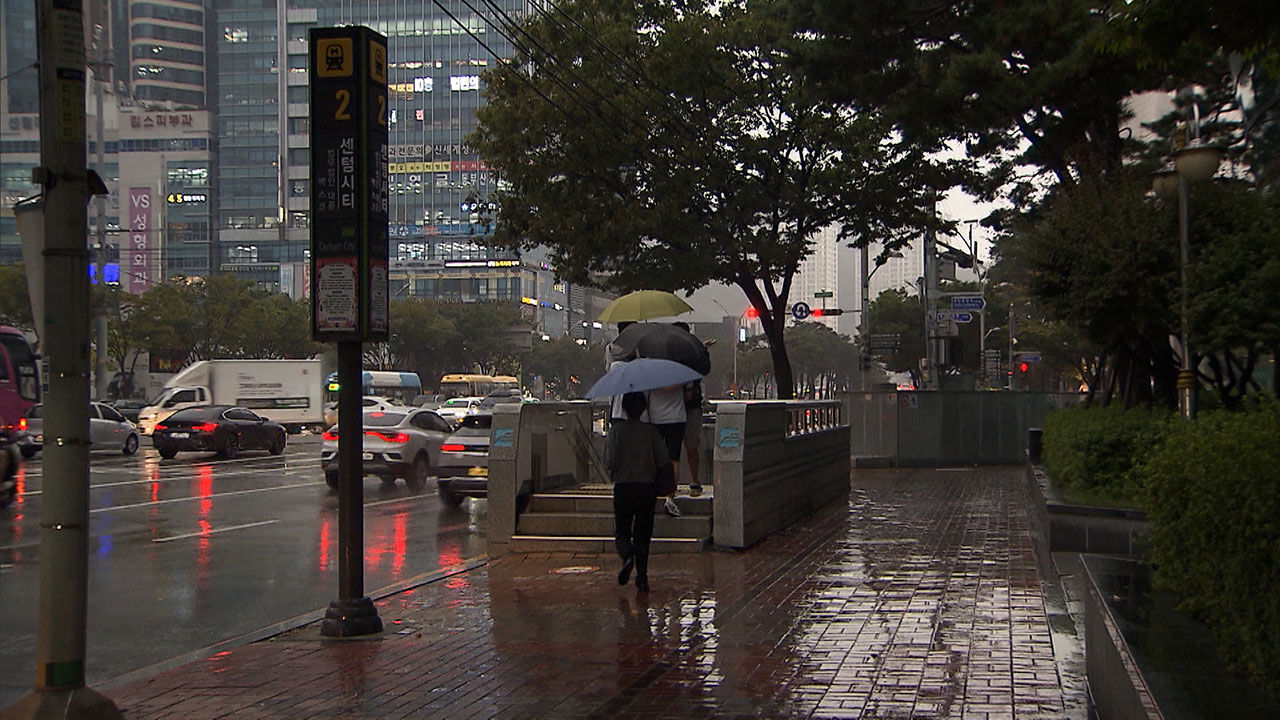 Enjoying Autumn Foliage and Reading Under Warm Weather... Heavy Rain Expected Nationwide Tomorrow
Next, we have another story. With the warm weather, it was a day filled with citizens heading outdoors to enjoy the autumn atmosphere. However, the weather is set to change again tomorrow (October 18). Rain accompanied…
-
 Mercury to fall further on Thursday morning
Commuters bundle up against the cold as they make their way to work in Seoul on Wednesday. Yonhap Temperatures will drop on Thursday morning compared to Wednesday, with a significant daily temperature gap. According to…
-
 [Weather] Chilly Mornings, 20-Degree Days... Wide Temperature Swings in Fall
Published 14 Oct.2026 17:33(KST) Morning temperatures in Gwangju and South Jeolla Province will fall to single digits on Thursday, the 15th, making for a chilly start to the day. Temperatures will rise above 20 degrees…
-
 Chilly Morning Nationwide, Lows of 5-14 C with Wide Daily Temperature Swings
Morning Lows of 5 to 14 C Daytime Highs of 18 to 22 C Cold air flowing in from the northwest is pushing temperatures lower. Wide day-to-night temperature swings are expected for the time being, requiring care for…
- Signs point to intense El Nino in Asia-Pacific region
The temperature of a key Pacific Ocean region used to monitor El Nino conditions reached an all-time high in September, underscoring the exceptional intensity of the current weather pattern. Experts in the Asia-Pacific…
-
 Seoul, South Korea, hits 86 degrees in October, breaking century-old record before plunge
The drop can create another sudden strain on health and safety. Seoul just logged 86.2 degrees Fahrenheit (30.1 degrees Celsius), setting a new all-time October high and surpassing the previous mark from over a century…
- Guam Under Typhoon Warning as Champi Threatens Airport Flights This Weekend
Guam has been placed under a Typhoon Warning as Tropical Storm Champi approaches the western Pacific island, threatening destructive winds, dangerous seas and significant travel disruption over the weekend. Airport…
-
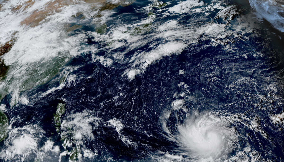 Typhoon Champi heads toward Okinawa, not Korea, for now
Typhoon Champi, the 30th storm of the year, is forecast to rapidly strengthen over the western Pacific and approach waters south of Okinawa next week. The Korea Meteorological Administration's (KMA) forecast track does…
Sun & moon
Nearby
Forecasts, observations and alerts in the United States come from the National Weather Service (NOAA); radar from NOAA's Multi-Radar Multi-Sensor system; satellite imagery from NASA's Global Imagery Browse Services (GIBS) and NOAA's GOES satellites; the map from the U.S. Geological Survey's National Map; air quality from AirNow (EPA and its partners); hurricane information from the National Hurricane Center; climate normals and records from NOAA's Regional Climate Centers (ACIS). Forecasts outside the United States and the UV index: MET Norway (CC BY 4.0); observations outside the U.S.: airport reports via NOAA's Aviation Weather Center. Place names: GeoNames (CC BY 4.0). Data are copied on a schedule and may lag the sources; for warnings that affect your safety, follow your local National Weather Service office and emergency officials. Weather news is drawn from the 4Search index and reflects what the press published. Terms of use.