Install
Al Jubayhah, Amman, Jordan Weather
Current conditions
Forecast for this hour (no station report in the last two hours)
Forecast
10-day-
Monday
Light showers. High 28°. Precipitation 0.9 mm for the day.
-
Monday Night
Showers. Low 19°. Precipitation 0.9 mm for the day.
-
Tuesday
Light showers. High 24°. Precipitation 1.1 mm for the day.
MET Norway forecast updated 12 hrs ago.
Hourly
Hourly forecast- Now26°
- 18:0024°
- 19:0024°
- 20:0023°
- 21:0022°
- 22:0021°0.8
- 23:0019°
- Tue00:0019°
- 01:0019°
- 02:0019°
- 03:0018°
- 04:0018°
- 05:0018°
- 06:0017°
- 07:0017°
- 08:0018°
- 09:0020°
- 10:0022°0.2
- 11:0023°
- 12:0024°
- 13:0024°0.4
- 14:0023°0.4
- 15:0022°
- 16:0023°
Daily forecast
DetailsRadar
Full mapWeather news near Al Jubayhah
More weather news-
 Mild Autumn Weather Sunday, Chance of Light Rain in North
PM: Aqaba port system operates at high efficiency Amman, Oct. 18 (Petra) -- Mild autumn weather will prevail across most of Jordan on Sunday, with a slight chance of light rain in northern areas and morning fog expected…
-
 Mild Autumn Weather Expected Across Kingdom With Light Showers In North
AMMAN, Oct. 17 (Petra) – Daytime temperatures on Saturday will remain below seasonal averages for this time of year, bringing mild and partly cloudy conditions across northern and central Jordan, according to the Jordan…
-
 Kingdom to see mild weather through Monday
Home - Kingdom to see mild weather through Monday China and North Korea Open New Yalu River Bridge After 12-Year Delay Oman to Host 6th Session of International Dates Council Asian Currencies Slide as US Rate-Hike…
- Utah officials anticipate strong El Niño for 2026-2027 after poor water year
Utah’s water year begins in October. Utah Snow Survey Data Collection Officer Jordan Clayton said starting in the fall better encapsulates when the state receives water and when it flows into reservoirs. “We obviously…
-
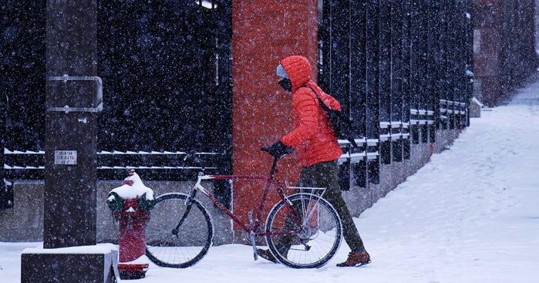 The cold never lasts as long as the winter dread
As another Minnesota winter approaches, remember that we’re better at adapting than we are at predicting how we’ll feel. Oct 22, 2026, 10:27 AM CT Every October, Minnesota starts the same conversation. The first real…
-
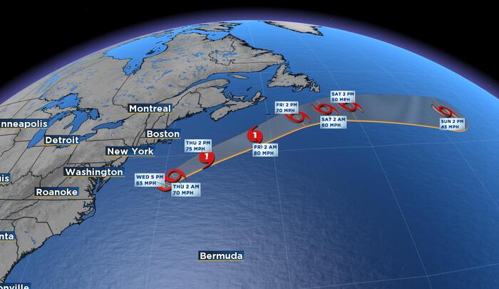 Subtropical Storm Josephine Forms in Atlantic, Expected to Move Away From U.S. Coast
Julie Broughton, Anchor & Meteorologist ORLANDO, Fla. – The National Hurricane Center has classified the area of low pressure off the east coast of the U.S. as Subtropical Storm Josephine. As of 5:00 P.M. Wednesday, the…
- U.S. Issues Warning For Two States Bracing For 'Massive' Hail Tonight
The U.S. is warning them. The U.S. has warned three states. The U.S. issued a warning. Five states could get hit. Driving through Lone Star State corridors? Discover how TxDOT gives drivers a final courtesy warning by…
-
 Mild Weather, Limited Chance of Rain Showers
Jordan will experience mild weather on Wednesday across most areas, while conditions will be moderate in the Jordan Valley, the Dead Sea and Aqaba. Mild Weather, Limited Chance of Rain Showers
-
 Autumn heat wave to sweep Israel as temperatures climb through the weekend | Weather forecast
Ynetnews Temperatures will begin rising across Israel on Wednesday ahead of an autumn heat wave expected over the weekend, although isolated showers are still possible along the Mediterranean coastal plain during the…
- Wednesday .. Pleasant autumn weather to prevail across most regions
Pleasant autumn weather will prevail across most of Jordan on Wednesday, with brief, light showers possible in parts of the northeastern Badia around midday, potentially accompanied by thunder, the Jordan Meteorological…
Sun & moon
Nearby
- Amman 8 km
- Zarqa 19 km
- Russeifa 14 km
- Khuraybat as Sūq 15 km
- Wādī as Sīr 10 km
- Ṣuwayliḥ 5 km
- ‘Ajlūn 38 km
- As Salţ 16 km
- Marj Al Hamam 13 km
- Mādabā 34 km
- Mafraq 47 km
- Az̧ Z̧ulayl 38 km
Forecasts, observations and alerts in the United States come from the National Weather Service (NOAA); radar from NOAA's Multi-Radar Multi-Sensor system; satellite imagery from NASA's Global Imagery Browse Services (GIBS) and NOAA's GOES satellites; the map from the U.S. Geological Survey's National Map; air quality from AirNow (EPA and its partners); hurricane information from the National Hurricane Center; climate normals and records from NOAA's Regional Climate Centers (ACIS). Forecasts outside the United States and the UV index: MET Norway (CC BY 4.0); observations outside the U.S.: airport reports via NOAA's Aviation Weather Center. Place names: GeoNames (CC BY 4.0). Data are copied on a schedule and may lag the sources; for warnings that affect your safety, follow your local National Weather Service office and emergency officials. Weather news is drawn from the 4Search index and reflects what the press published. Terms of use. How to use Weather