Install
Lancaster, England, United Kingdom Weather
Current conditions
Forecast for this hour (no station report in the last two hours)
Forecast
10-day-
Thursday
Light showers. High 11°. Precipitation 0.2 mm for the day.
-
Thursday Night
Cloudy. Low 7°. Precipitation 0.2 mm for the day.
-
Friday
Heavy rain. High 9°. Precipitation 19.5 mm for the day.
MET Norway forecast updated 17 hrs ago.
Hourly
Hourly forecast- Now10°
- 12:0010°
- 13:0011°
- 14:0011°
- 15:0011°
- 16:0011°
- 17:0010°
- 18:009°
- 19:008°
- 20:007°
- 21:007°
- 22:007°
- 23:007°
- Fri00:007°
- 01:008°
- 02:008°
- 03:008°0.4
- 04:008°0.4
- 05:009°1.5
- 06:008°2.3
- 07:009°2.4
- 08:009°2.7
- 09:009°4.0
- 10:009°3.3
Daily forecast
DetailsRadar
Full mapWeather news near Lancaster
More weather news- Buffalo Goes From Freeze To Breeze In Weeklong Fall Warmup
The National Weather Service says the coldest readings will likely be in rural areas away from the immediate lakeshores, where frost and freeze conditions could damage cold-sensitive plants. The warning covers Buffalo…
-
 Work week weather: Sunny, dry autumn days ahead in Clarksville
CLARKSVILLE, TN (CLARKSVILLE NOW) – Sunny skies and warming temperatures are expected this week, with highs climbing into the upper 70s by Wednesday. Patchy morning fog is possible Monday and Tuesday, but otherwise dry…
-
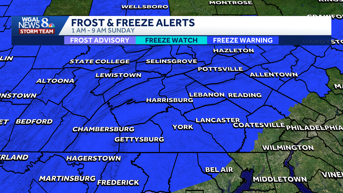 Impact Night | Freeze warning in effect; first freeze of the season
Impact Night WGAL The first freeze warning of the season is in effect for South-Central Pennsylvania A freeze warning is in effect for all counties from 1 a.m The average first freeze for most counties is October 21 For…
- South Philadelphia Gets a Cold Sunday After Friday’s Storm Watch
South Philadelphia residents heading to the Eagles game at 1 p.m. Sunday should expect sunshine and temperatures in the 50s, with the 40s possible for morning tailgaters, FOX 29 Philadelphia reported. The chill follows…
- UPDATE: Lake wind advisory for Midlands until Sunday evening - gusts to hit 35 mph
An updated lake wind advisory was issued by the NWS Columbia SC on Saturday at 12:28 p.m. in effect until Sunday at 8 p.m. The advisory is for Northern Lancaster, Southern Lancaster, Northwestern Orangeburg, Central…
- Buffalo Freeze Warning Before Sunny Mid-60s Warmup
Buffalo is starting Saturday with mostly cloudy conditions and a stiff northwest wind. A few rain showers may linger before 8 a.m., but skies should turn mostly sunny by afternoon as the high reaches about 49 degrees…
-
 First widespread frost of season expected in Lancaster County this weekend
The temperature could dip below 30 degrees early Sunday morning in parts of central Pennsylvania, including Lancaster County, according to the National Weather Service in State College. The weather service issued a…
-
 69 News at 6:00 - Severe thunderstorm watches and GIANT disruption
Mostly cloudy with scattered thunderstorms (some with damaging wind gust potential) through early evening, then brisk and drier as it turns much cooler the rest of the night. . headline: Severe Thunderstorm Warning…
-
 Presidential adviser says Ukraine is in talks to lift speed limit on military satellite network
Mostly cloudy with scattered thunderstorms (some with damaging wind gust potential) through early evening, then brisk and drier as it turns much cooler the rest of the night. . Bulletin: SEVERE THUNDERSTORM WATCH 686…
-
 Storm Austen: UK rail passengers warned of 80mph winds
Storm Austen is forecast to bring 80mph gusts, heavy rain and widespread disruption to rail services across southern and western UK on Thursday night and Friday. Rail passengers across parts of the United Kingdom are…
Sun & moon
Nearby
Forecasts, observations and alerts in the United States come from the National Weather Service (NOAA); radar from NOAA's Multi-Radar Multi-Sensor system; satellite imagery from NASA's Global Imagery Browse Services (GIBS) and NOAA's GOES satellites; the map from the U.S. Geological Survey's National Map; air quality from AirNow (EPA and its partners); hurricane information from the National Hurricane Center; climate normals and records from NOAA's Regional Climate Centers (ACIS). Forecasts outside the United States and the UV index: MET Norway (CC BY 4.0); observations outside the U.S.: airport reports via NOAA's Aviation Weather Center. Place names: GeoNames (CC BY 4.0). Data are copied on a schedule and may lag the sources; for warnings that affect your safety, follow your local National Weather Service office and emergency officials. Weather news is drawn from the 4Search index and reflects what the press published. Terms of use.