Install
Vernouillet, Centre-Val de Loire, France Weather
Current conditions
Forecast for this hour (no station report in the last two hours)
Forecast
10-day-
Saturday
Heavy rain. High 12°. Precipitation 9.2 mm for the day.
-
Saturday Night
Heavy rain. Low 8°. Precipitation 9.2 mm for the day.
-
Sunday
Heavy rain. High 15°. Precipitation 7.1 mm for the day.
MET Norway forecast updated 7 hrs ago.
Hourly
Hourly forecast- Now8°
- 10:009°
- 11:0010°
- 12:0010°0.2
- 13:0011°0.4
- 14:0010°0.4
- 15:0011°0.6
- 16:0010°0.9
- 17:0010°1.4
- 18:0010°1.5
- 19:0011°1.2
- 20:0011°0.7
- 21:0011°0.9
- 22:0012°0.6
- 23:0012°0.4
- Sun00:0013°
- 01:0013°
- 02:0013°
- 02:0014°
- 03:0014°1.2
- 04:0014°2.3
- 05:0015°2.1
- 06:0014°1.1
- 07:0012°0.2
Daily forecast
DetailsRadar
Full mapWeather news in France
More weather news- France issues orange alert in 15 departments ahead of Storm Austen
The warning covers parts of western and northern France, with winds forecast to reach 140 kilometres per hour. Heavy rain is also expected in Brittany and Normandy. France issued an orange alert on Thursday for 15…
-
 Storm Austen to batter northern France with winds of up to 140km/h
Trains have been cancelled across three northern regions and heightened alerts implemented The first major storm of autumn will bring powerful winds of well over 100 km/h to France’s northern coastline and winds of…
-
 Storm Boelo may cause ‘widespread travel disruption’ in north of UK over weekend
The north of the UK will face strong winds with gusts potentially exceeding 80mph, along with “widespread travel disruption” to ferries and trains, as a new storm hits the country, forecasters have said. An amber…
-
 Amber warning in place as Storm Austen hits parts of UK
An amber weather warning has come into force in parts of the UK as Storm Austen brings a swathe of powerful winds and heavy rain on Friday. South West England is forecast to be worst hit by the storm which the Met…
-
 Delhi Air Quality Remains 'Poor' As AQI Crosses 220; Rain Likely To Bring Relief Tomorrow
Delhi-NCR’s air quality remained in the poor category on Friday morning, with the city recording an Air Quality Index (AQI) of 222. Some areas reported significantly higher pollution levels, with Mundka’s AQI reaching…
-
 The spooky secret hiding inside Pacific Northwest Glaciers | CNN
Glacier ice worms look like monsters from a horror movie. But they could reveal clues to how life survives in extremes — if they survive human-made warming. An astronaut aboard SpaceX Dragon and a videographer beside a…
-
 South East prepares for impact of Storm Austen
Seafront closures, cancelled events and travel disruption are expected as the first named storm of the season approaches south-east England. The Met Office has issued a yellow weather warning for wind across the region…
-
 Two storms in two days as Austen and Boelo target UK
The Met Office have named a new storm, Boelo, which is set to bring another round of stormy weather to the UK over the weekend. Amber wind warnings have been issued by the Met Office with gusts expected to reach…
-
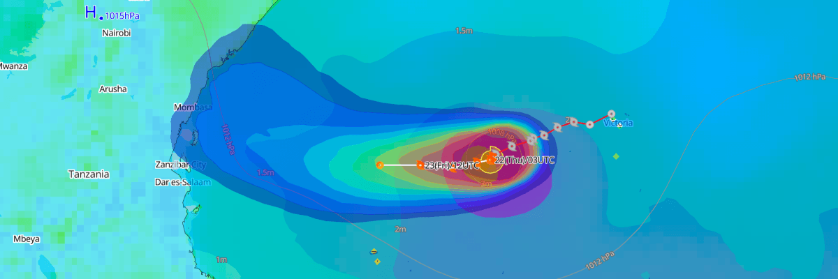 Tropical Storm Agueda Lingers North of Madagascar, Forecast to Weaken Over Open Water
The one-stop platform to enhance your offshore wind operations The all-in-one platform solution to optimize your maritime operations The one-stop platform to enhance youroffshore wind operations Weathernews API &…
-
 Fire whirl flares during French protests | CNN
A fire whirl was spotted briefly during anti-government protests in Clermont-Ferrand, a city in central France. An astronaut aboard SpaceX Dragon and a videographer beside a lake in Canada share two amazing views of…
Sun & moon
Nearby
- Saint-Quentin-en-Yvelines 48 km
- Versailles 57 km
- Évreux 37 km
- Mantes-la-Jolie 39 km
- Chartres 32 km
- Saint-Germain-en-Laye 56 km
- Montigny-le-Bretonneux 49 km
- Poissy 55 km
- Plaisir 44 km
- Les Mureaux 50 km
- Guyancourt 52 km
- Dreux 2 km
Forecasts, observations and alerts in the United States come from the National Weather Service (NOAA); radar from NOAA's Multi-Radar Multi-Sensor system; satellite imagery from NASA's Global Imagery Browse Services (GIBS) and NOAA's GOES satellites; the map from the U.S. Geological Survey's National Map; air quality from AirNow (EPA and its partners); hurricane information from the National Hurricane Center; climate normals and records from NOAA's Regional Climate Centers (ACIS). Forecasts outside the United States and the UV index: MET Norway (CC BY 4.0); observations outside the U.S.: airport reports via NOAA's Aviation Weather Center. Place names: GeoNames (CC BY 4.0). Data are copied on a schedule and may lag the sources; for warnings that affect your safety, follow your local National Weather Service office and emergency officials. Weather news is drawn from the 4Search index and reflects what the press published. Terms of use.