Install
Randers, Central Jutland, Denmark Weather
Current conditions
Forecast for this hour (no station report in the last two hours)
Forecast
10-day-
Tuesday Night
Light rain. Low 10°. Precipitation 0.3 mm for the day.
-
Wednesday
Rain. High 11°. Precipitation 8.2 mm for the day.
-
Wednesday Night
Heavy rain. Low 8°. Precipitation 8.2 mm for the day.
MET Norway forecast updated 3 hrs ago.
Hourly
Hourly forecast- Now10°22%
- 22:0010°33%
- 23:0010°34%
- Wed00:0010°27%
- 01:0011°35%
- 02:0011°73%
- 03:0011°63%
- 04:0010°35%
- 05:0010°16%
- 06:0010°
- 07:009°
- 08:008°
- 09:008°
- 10:009°
- 11:0011°
- 12:0011°
- 13:0011°17%
- 14:0011°35%
- 15:0011°43%
- 16:0011°51%
- 17:0011°74%
- 18:0011°80%
- 19:0011°79%
- 20:0011°94%
10-day forecast
DetailsRadar
Full mapWeather news near Randers
More weather news-
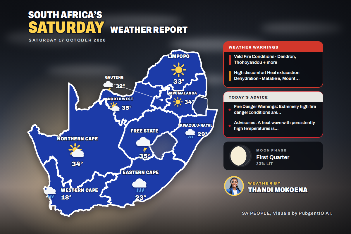 Here is today’s weather by province: Weather advisory issued for Queenstown and surrounding Eastern Cape towns
Home » Here is today’s weather by province: Weather advisory issued for Queenstown and surrounding Eastern Cape towns Kimberley takes the heat crown at 36°C, while Cape Town only reaches 18°C under a fresh SSE breeze…
-
 South Africa Weather Today: Saturday, 17 October 2026
It is Saturday, 17 October 2026, and Johannesburg wakes up to drizzle, with the mercury climbing from 18°C to a high of 30°C. Rain is the story of the day, with 4 of the nine provinces expecting showers or drizzle…
-
 SA Weather Service issues weekend heatwave warning for Gauteng
Residents must brace for extreme weather conditions, with a heatwave expected to persist until Monday in parts of Gauteng. According to the South African Weather Service (SAWS) website, temperatures will hover around…
-
 Out the door forecast - October 14, 2026
KOLD Out the door forecast - October 14, 2026 Jefferson County Sheriff’s Office conducts active shooter training Local Danish bakery feels impacts of war in Ukraine Tulsa Race Massacre leads to conversation about…
-
 Few more days of hot and humid before cold front at end of week (KXAN Weather Forecast 10.13.2026)
Cloudy but dry tonight before scattered to isolated showers begin later in the week. Warm and humid from the gulf moisture being brought into the area from gusty winds. Anger is mounting at the companies accused of…
Sun & moon
Nearby
Forecasts, observations and alerts in the United States come from the National Weather Service (NOAA); radar from NOAA's Multi-Radar Multi-Sensor system; satellite imagery from NASA's Global Imagery Browse Services (GIBS) and NOAA's GOES satellites; the map from the U.S. Geological Survey's National Map; air quality from AirNow (EPA and its partners); hurricane information from the National Hurricane Center; climate normals and records from NOAA's Regional Climate Centers (ACIS). Forecasts outside the United States and the UV index: MET Norway (CC BY 4.0); observations outside the U.S.: airport reports via NOAA's Aviation Weather Center. Place names: GeoNames (CC BY 4.0). Data are copied on a schedule and may lag the sources; for warnings that affect your safety, follow your local National Weather Service office and emergency officials. Weather news is drawn from the 4Search index and reflects what the press published. Terms of use.