Install
Give, South Denmark, Denmark Weather
Current conditions
Forecast for this hour (no station report in the last two hours)
Forecast
10-day-
Tuesday Night
Cloudy. Low 9°.
-
Wednesday
Heavy rain. High 10°. Precipitation 9.0 mm for the day.
-
Wednesday Night
Heavy rain. Low 7°. Precipitation 9.0 mm for the day.
MET Norway forecast updated 2 hrs ago.
Hourly
Hourly forecast- Now9°22%
- 21:009°34%
- 22:009°39%
- 23:009°27%
- Wed00:009°17%
- 01:009°12%
- 02:008°
- 03:008°
- 04:008°
- 05:007°
- 06:007°
- 07:007°
- 08:007°
- 09:007°
- 10:008°34%
- 11:009°45%
- 12:009°30%
- 13:009°28%
- 14:0010°45%
- 15:0010°49%
- 16:0010°42%
- 17:0010°64%
- 18:0010°76%
- 19:0010°79%
10-day forecast
DetailsRadar
Full mapWeather news near Give
More weather news-
 Chilly mornings will be giving way to warm, but comfortable afternoons all week long
KTRE EAST TEXAS (KTRE) - Our stretch of chilly mornings will continue all this week as dry air and low humidity days will remain in place due to our winds staying out of the east-northeast. Wake-up temperatures will be…
-
 Quakertown food pantry, police association to give out free turkeys at Memorial Park
WFMZ.com (1 of 7) Upper Bucks County: Frost Advisory from MON 1:00 AM EDT until MON 9:00 AM EDT (2 of 7) Western Montgomery County: Frost Advisory from MON 1:00 AM EDT until MON 9:00 AM EDT (3 of 7) Lower Bucks County…
-
 Forecast: Rain gives way to cooler weather, with temperatures set to rise later this week
Temperatures are expected to fall slightly today, while light drizzle may continue along the coastal plain; little change is forecast for Tuesday, but the cooler spell will be short-lived, with temperatures set to rise…
- Chilly Night Gives Way to Quiet October Warming Trend
Central Indiana woke up to another chilly night, but a quiet warming trend is on the way. WISH-TV reports that temperatures will gradually climb as the week goes on. The change brings a calmer, more pleasant feel to the…
- Sunny San Diego Sunday Gives Way To Surf Danger, Midweek Storms
Beachgoers should be especially cautious along San Diego County’s coast Sunday through Tuesday morning. The National Weather Service has issued a Beach Hazards Statement for dangerous rip currents and breaking waves…
-
 Sunny start to the week gives way to rain and storms later
IDAHO FALLS, Idaho (KIFI)- Expect a pleasant start to the week with sunny skies and mild temperatures. However, a significant weather shift arrives later, bringing a 40% chance of rain on Thursday and widespread…
-
 FL1 FORECAST: Frosty Sunday morning gives way to sunny, warmer week
October 18, 2026 3:38 AM / Staff Report A frosty and freezing start will give way to abundant sunshine and a sharp warmup across the Finger Lakes and Central New York on Sunday, beginning an extended stretch of dry and…
-
 Cool weekend in Phoenix gives way to warmer, then stormy week
AZ Family PHOENIX (AZFamily) — Fall is finally settling in across the Valley after a cool, cloudy Saturday with light showers and a high of 80 degrees, 9 degrees below average for this time of year. Sunday will bring…
-
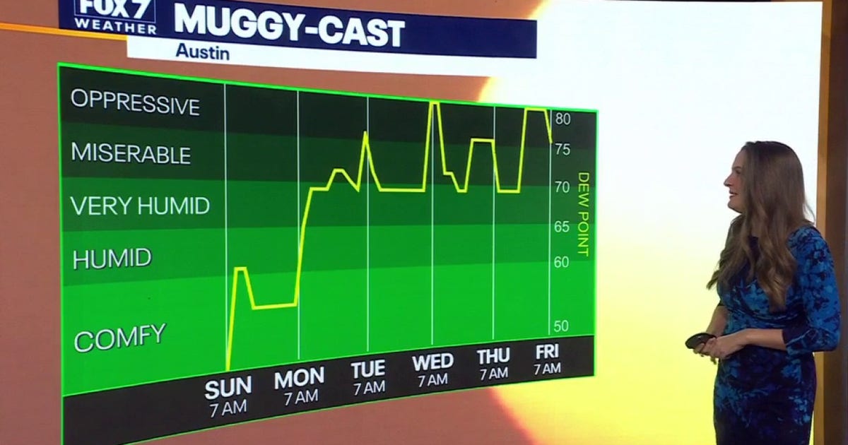 Austin weather: Cool spell to give way to near-90-degree heat and rising humidity
Austin will enjoy mostly sunny, pleasant fall weather today with light winds, comfortable high temperatures around mid-70s, and a low near 48 degrees overnight. AUSTIN - Unseasonably cool fall weather will linger across…
-
 Coldest morning since spring gives way to warmer, dry week
Once the sun rises, weâll warm up in a hurry with highs pushing into the low 60s. Coldest morning since spring gives way to warmer, dry week PITTSBURGH â Itâs the coldest morning since spring with temperatures…
Sun & moon
Nearby
- Kolding 42 km
- Horsens 38 km
- Vejle 24 km
- Herning 36 km
- Silkeborg 41 km
- Hedensted 30 km
- Fredericia 45 km
- Middelfart 49 km
- Ikast 33 km
- Varde 54 km
- Skanderborg 48 km
- Odder 59 km
Forecasts, observations and alerts in the United States come from the National Weather Service (NOAA); radar from NOAA's Multi-Radar Multi-Sensor system; satellite imagery from NASA's Global Imagery Browse Services (GIBS) and NOAA's GOES satellites; the map from the U.S. Geological Survey's National Map; air quality from AirNow (EPA and its partners); hurricane information from the National Hurricane Center; climate normals and records from NOAA's Regional Climate Centers (ACIS). Forecasts outside the United States and the UV index: MET Norway (CC BY 4.0); observations outside the U.S.: airport reports via NOAA's Aviation Weather Center. Place names: GeoNames (CC BY 4.0). Data are copied on a schedule and may lag the sources; for warnings that affect your safety, follow your local National Weather Service office and emergency officials. Weather news is drawn from the 4Search index and reflects what the press published. Terms of use.