Install
Saint-Apollinaire, Quebec, Canada Weather
Current conditions
Forecast for this hour (no station report in the last two hours)
Forecast
10-day-
Sunday
Mostly sunny. High 13°.
-
Sunday Night
Cloudy. Low 1°.
-
Monday
Rain. High 11°. Precipitation 1.5 mm for the day.
MET Norway forecast updated 1 day ago.
Hourly
Hourly forecast- Now12°
- 14:0013°
- 15:0013°
- 16:0013°
- 17:0012°
- 18:0010°
- 19:0010°
- 20:009°
- 21:009°
- 22:009°
- 23:009°
- Mon00:009°
- 01:009°
- 02:009°
- 03:009°
- 04:009°
- 05:009°0.2
- 06:009°0.4
- 07:008°0.4
- 08:008°
- 09:008°
- 10:009°
- 11:0010°
- 12:0011°
Daily forecast
DetailsRadar
Full mapWeather news near Saint-Apollinaire
More weather news- Subtropical Storm Josephine forms off U.S. East Coast, forecast to become a hurricane-force extratropical cyclone
Satellite image of subtropical storm Josephine at 11:40 UTC on October 22, 2026. Credit: NOAA/GOES-19, Zoom Earth, The Watchers Josephine formed at 17:00 AST (21:00 UTC) on October 21 from the non-tropical low…
-
 Subtropical Storm Josephine Forecast Discussion Number 3
Issued at 500 AM AST Thu Oct 22 2026000 WTNT45 KNHC 220848 TCDAT5 Subtropical Storm Josephine Discussion Number 3 NWS National Hurricane Center Miami FL AL102026 500 AM AST Thu Oct 22 2026 Satellite imagery indicates…
-
 Sunshine and Mild Temperatures Continue Before a Possible Pattern Change
ClickOnDetroit | WDIV Local 4 Highs will range from the mid-60s to low 70s today through Monday. A stronger area of high pressure building into Quebec could bring slightly cooler air into the eastern Great Lakes Friday…
- 10-Day Weather Forecast - Quebec, Quebec, CA
As of Oct 22, 2026 12:00 AM UTC Clear. Low temperature around 32F. Dew point will be around 25F with an average humidity of 70%. Winds will be 6 mph from the N. Sunny. High temperature around 46F. Dew point will be…
-
 Riley Laychuk's Manitoba forecast for Wednesday, Oct. 21, 2026
CBC Riley Laychuk's Manitoba forecast for Wednesday, Oct. 21, 2026 Sunshine and warm temperatures continue to dominate the province's weather pattern. A big change is incoming for next week. - Winnipeg in for dry…
-
 FL1 FORECAST: Sunny Wednesday extends dry spell before a colder Friday night
October 21, 2026 3:48 AM / Staff Report Sunshine and light winds will dominate Wednesday across the Finger Lakes and Central New York after patches of early fog clear from a few Southern Tier valleys, with afternoon…
-
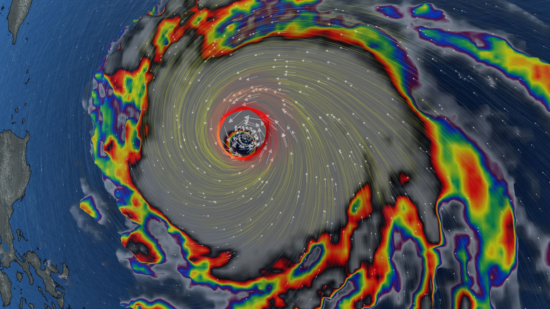 296 km/h: Super Typhoon Champi is now the strongest storm on Earth in 2026
In terms of wind speed, Super Typhoon Champi is the most powerful storm on Earth in 2026 so far, achieving the top storm spot with its peak winds of 296 km/h--the equivalent of a Category 5 storm Super Typhoon Champi…
-
 Montreal's November forecast is here and snow could show up sooner than you think
It's almost here. ❄️ November is expected to be milder and drier than usual in southern Quebec. It might still feel like fall outside, but winter is going to start dropping hints pretty soon. The Canadian edition of the…
-
 Offshore Nor'easter Update: Breezy midweek with coastal rain chances
WJAR We are still tracking this Nor'easter, currently situated east of Cape Hatteras This low-pressure system is set to continue moving northeastward and will continue to strengthen along the way As this system…
-
 What’s a yellow, orange or red weather alert? Explaining the new Environment Canada colour coding system
Snow squalls blew through parts of Ontario Thursday, with more snow expected throughout the weekend. Environment and Climate Change Canada has a new colour coding system. The Alert Colour Matrix launched Thursday, Nov…
Sun & moon
Nearby
- Québec 32 km
- Lévis 33 km
- Neufchâtel-Est–Lebourgneuf 30 km
- Thetford-Mines 60 km
- Saint-Augustin-de-Desmaures 15 km
- L'Ancienne-Lorette 24 km
- Sainte-Marie 43 km
- Saint Romuald 26 km
- Saint-Raymond 39 km
- Pont-Rouge 21 km
- Boischatel 42 km
- Donnacona 18 km
Forecasts, observations and alerts in the United States come from the National Weather Service (NOAA); radar from NOAA's Multi-Radar Multi-Sensor system; satellite imagery from NASA's Global Imagery Browse Services (GIBS) and NOAA's GOES satellites; the map from the U.S. Geological Survey's National Map; air quality from AirNow (EPA and its partners); hurricane information from the National Hurricane Center; climate normals and records from NOAA's Regional Climate Centers (ACIS). Forecasts outside the United States and the UV index: MET Norway (CC BY 4.0); observations outside the U.S.: airport reports via NOAA's Aviation Weather Center. Place names: GeoNames (CC BY 4.0). Data are copied on a schedule and may lag the sources; for warnings that affect your safety, follow your local National Weather Service office and emergency officials. Weather news is drawn from the 4Search index and reflects what the press published. Terms of use. How to use Weather