Install
Lower Sackville, Nova Scotia, Canada Weather
Current conditions
Forecast for this hour (no station report in the last two hours)
Forecast
10-day-
Thursday
Heavy rain. High 10°. Precipitation 18.4 mm for the day.
-
Thursday Night
Heavy rain. Low 7°. Precipitation 18.4 mm for the day.
-
Friday
Heavy rain. High 7°. Precipitation 6.1 mm for the day.
MET Norway forecast updated 1 day ago.
Hourly
Hourly forecast- Now9°0.2
- 17:009°
- 18:009°
- 19:009°0.8
- 20:008°2.4
- 21:007°2.7
- 22:007°1.7
- 23:007°1.0
- Fri00:007°0.8
- 01:006°0.5
- 02:006°0.2
- 03:006°
- 04:006°
- 05:006°
- 06:007°
- 07:007°
- 08:007°
- 09:006°0.3
- 10:006°0.7
- 11:006°0.6
- 12:006°0.9
- 13:005°1.0
- 14:005°0.9
Daily forecast
DetailsRadar
Full mapWeather news near Lower Sackville
More weather news-
 Royal Caribbean Sends Oasis of the Seas to Canada as East Coast Storm Builds
Severe weather continues to wreak havoc on cruise itineraries. The latest subject of a weather reroute is the October 18, 2026 sailing of Oasis of the Seas, scheduled to depart from Cape Liberty, New Jersey and…
-
 Todays weather for the Halifax area
Cloudy today with a chance of showers in the morning and breezy with a high of 8c after dropping in the morning Clearing tonight with a low of -3c (-5c windchill) News, weather, traffic, events and community stories…
-
 Halifax’s first below-zero night of the fall is coming Saturday, after a windy, wet stretch
by Haligonia October 15, 2026, 12:54 pm Halifax is heading for its first below-zero night of the fall, and it’s now a day earlier than first expected. Environment Canada’s forecast for the city calls for a low of minus…
- Latest drought monitor shows improving conditions for central, southwest Virginia
LYNCHBURG, Va. (WSET) — The latest drought map for Virginia was released on Thursday, and it shows some improvement across central and southwest Virginia. The improvement is thanks to the remnants of Hurricane Isaias…
-
 Subtropical storm bringing rain and wind to parts of Atlantic Canada
The Royal Caribbean Oasis of the Seas is seen docked in Halifax on Wednesday, Oct. 21, 2026. THE CANADIAN PRESS/Darren Calabrese Cruise-goers crowd an area on the Halifax Waterfront after a Royal Caribbean cruise ship…
-
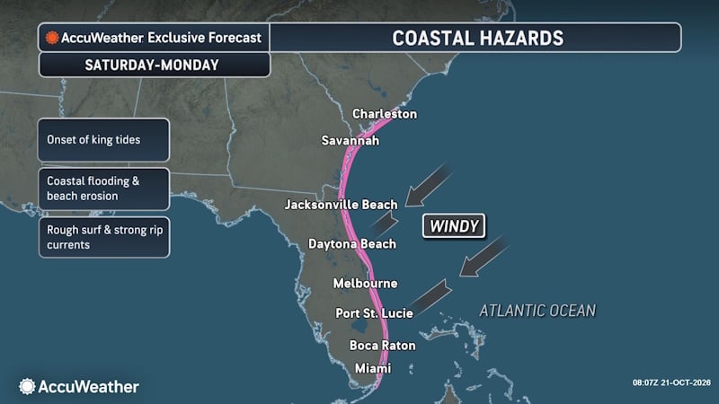 Offshore Nor’easter Strengthens into Subtropical Storm Josephine, Threatening Atlantic Canada
The window for Josephine to strengthen will close quickly as it encounters cooler water in the North Atlantic, but there is a small opportunity for intensification into Thursday and for it to strengthen into a hurricane…
-
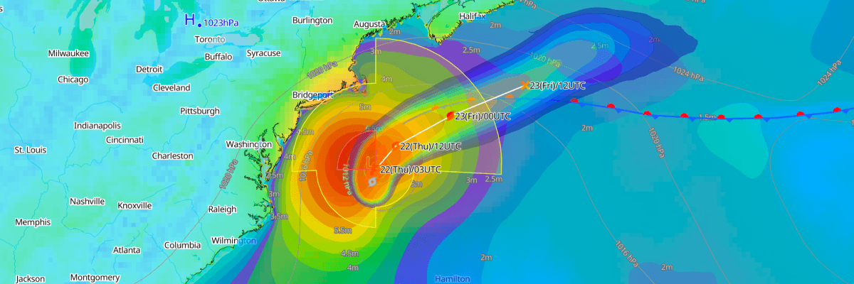 Josephine Set to Become Powerful Post-Tropical Cyclone off Atlantic Canada
The one-stop platform to enhance your offshore wind operations The all-in-one platform solution to optimize your maritime operations The one-stop platform to enhance youroffshore wind operations Weathernews API &…
-
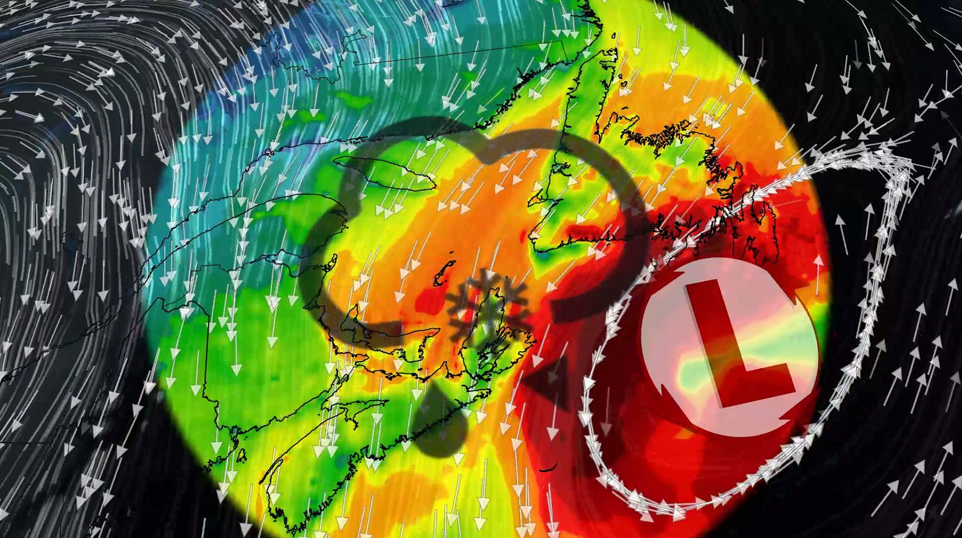 100+ km/h winds and snow: Nor'easter to clip Atlantic Canada this week
A comprehensive look at the developing nor'easter this week, including its potential for significant wind, rainfall, and possibly some snow for parts of Atlantic Canada Atlantic Canada may be in for a rough middle of…
-
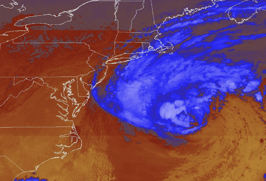 Nor'easter diverts cruise ships to chilly Canada instead of warm Bahamas and Bermuda
The difference in temperature between the original and new destinations is dramatic. Beautiful blue skies have dominated much of the eastern United States this week, without a drop of rain in many places. Yet that is…
-
 ‘Significant’ fall storm to hit northern Saskatchewan, 50 cm of snow possible
A significant fall storm is expected to hit northern Saskatchewan this weekend, according to Environment Canada. A significant fall storm is expected to hit northern Saskatchewan this weekend, according to Environment…
Sun & moon
Nearby
- Halifax 17 km
- Dartmouth 14 km
- Bedford 6 km
- Eastern Passage 24 km
- Fall River 7 km
- Spryfield 19 km
- Albro Lake 13 km
- Burnside 10 km
- Port Wallace 13 km
- Enfield 22 km
- Hammonds Plains 9 km
- Beaver Bank 5 km
Forecasts, observations and alerts in the United States come from the National Weather Service (NOAA); radar from NOAA's Multi-Radar Multi-Sensor system; satellite imagery from NASA's Global Imagery Browse Services (GIBS) and NOAA's GOES satellites; the map from the U.S. Geological Survey's National Map; air quality from AirNow (EPA and its partners); hurricane information from the National Hurricane Center; climate normals and records from NOAA's Regional Climate Centers (ACIS). Forecasts outside the United States and the UV index: MET Norway (CC BY 4.0); observations outside the U.S.: airport reports via NOAA's Aviation Weather Center. Place names: GeoNames (CC BY 4.0). Data are copied on a schedule and may lag the sources; for warnings that affect your safety, follow your local National Weather Service office and emergency officials. Weather news is drawn from the 4Search index and reflects what the press published. Terms of use.