Install
The Bottom, Saba, Caribbean Netherlands Weather
Current conditions
Forecast for this hour (no station report in the last two hours)
Forecast
10-day-
Wednesday
Mostly sunny. High 28°.
-
Wednesday Night
Mostly clear. Low 27°.
-
Thursday
Cloudy. High 28°. Precipitation 2.1 mm for the day.
MET Norway forecast updated 1 day ago.
Hourly
Hourly forecast- Now28°
- 18:0028°
- 19:0028°
- 20:0028°
- 21:0028°
- 22:0028°
- 23:0028°
- Thu00:0028°
- 01:0027°
- 02:0027°
- 03:0027°
- 04:0027°
- 05:0027°
- 06:0027°
- 07:0027°
- 08:0027°
- 09:0028°
- 10:0028°
- 11:0028°
- 12:0028°
- 13:0028°
- 14:0028°
- 15:0028°
- 16:0028°
Daily forecast
DetailsRadar
Full mapWeather news near The Bottom
More weather news-
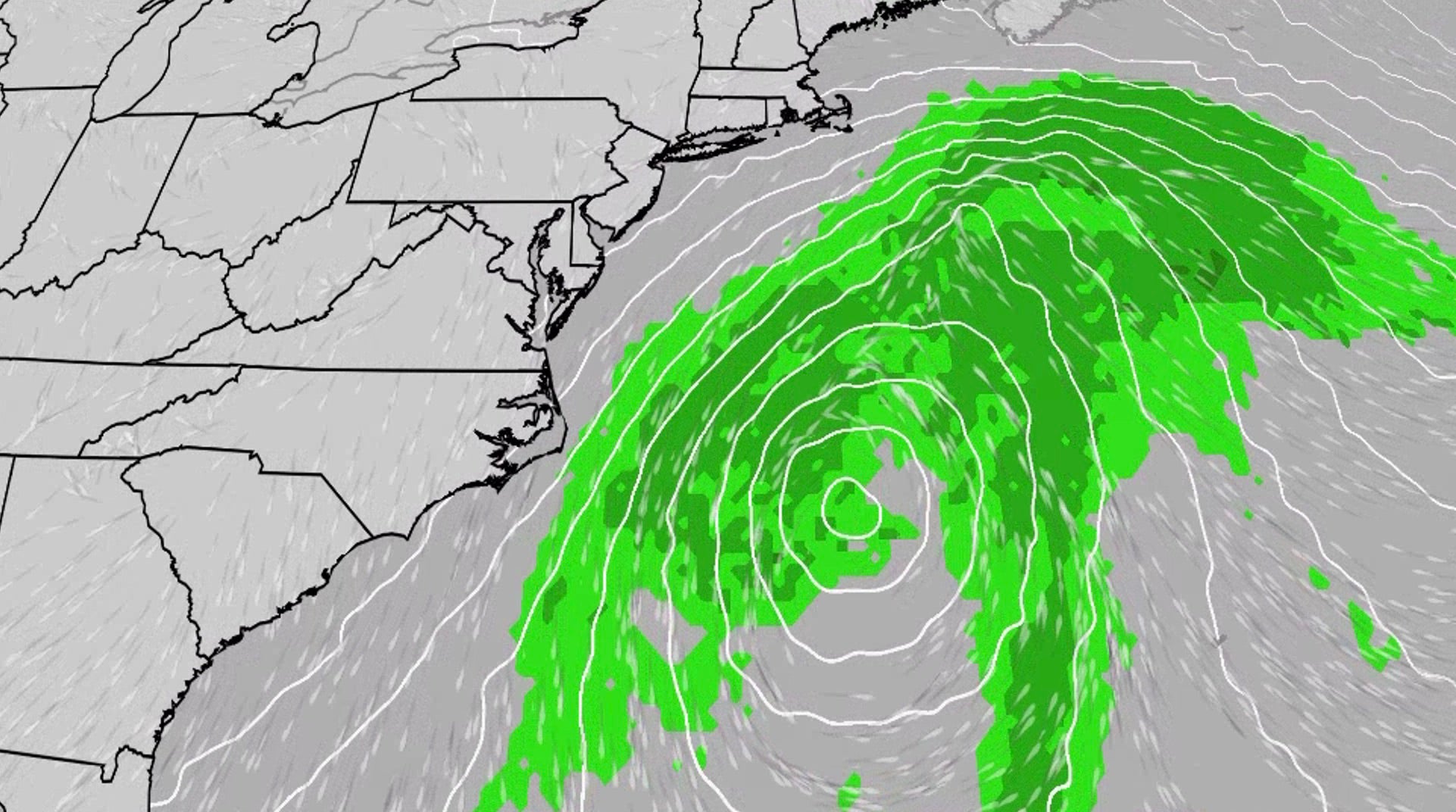 Nor'easter to churn up dangerous conditions for the East Coast
An October nor'easter is developing in the Atlantic, where it will bring high surf, rip currents, coastal flooding and winds to parts of the East Coast for several days this week. The National Hurricane Center has…
-
 Weather Forecast: Clear skies hold through a mild, dry stretch
Temperatures climb to the mid-60s this afternoon across most of the region, with Watkins Glen touching 67° and Auburn topping out near 63°. Winds stay light — mostly 4 mph or less — and skies stay clear through sunset…
-
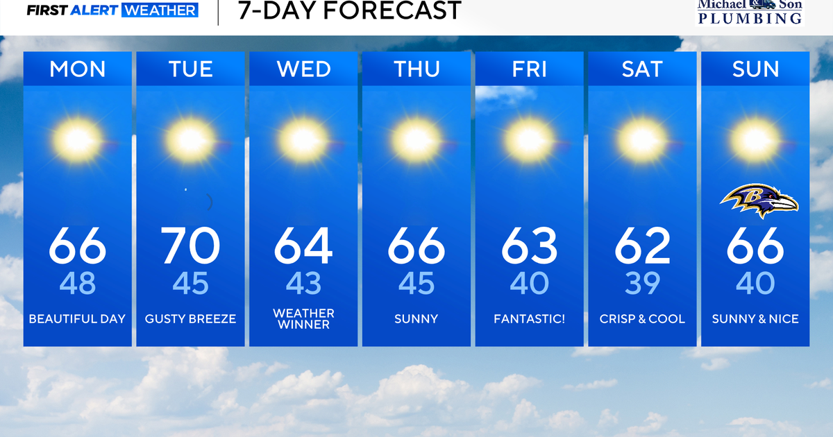 Classic fall weather and feel across Maryland this week
Updated on: October 19, 2026 / 8:36 AM EDT / CBS Baltimore A powerful offshore storm to our east and high pressure nearby will allow for a beautiful fall week ahead. This dry stretch of weather will be rather impressive…
- Monday PM Forecast: From jackets to T-shirts, riding a daily temperature seesaw
Very dry air will accomplish two things moving forward: keeping rain away and resulting in rather large temperature swings from morning to afternoon. The next week will be characterized by a daily back-and-forth from…
-
 After cool Sunday, big changes expected for South Texas weather. Here's what's next.
If you're a fall-weather fan, then Sunday will be the absolute perfect day to get outside. A chilly, crisp morning will be followed by a cool, sunny afternoon with very little wind throughout the region. After making it…
-
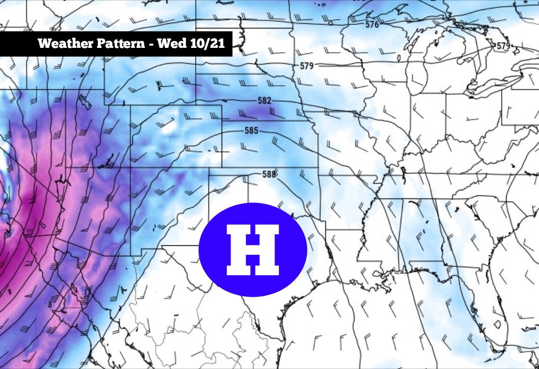 After cool Sunday, big changes expected for South Texas weather
High pressure is expected to develop across Texas this week, especially by Wednesday and Thursday If you’re a fall-weather fan, then Sunday will be the absolute perfect day to get outside. A chilly, crisp morning will…
-
 StormTeam3: Chilly, Breezy end to our weekend
SAVANNAH, Ga. (WSAV) — A chill is coming behind a strong cold front, dropping temperatures to their lowest areawide since May. Lows Sunday morning will fall into the mid to upper 40s, while coastal locations will bottom…
-
 Before Your Backyard Pond Freezes, Do These Things Now
Home » Home & Living Before Your Backyard Pond Freezes, Do These Things Now The first hard freeze can expose every fall pond chore you meant to get around to. Leaves that looked harmless on the surface are now…
-
 The National Weather Service issued a Sunday freeze warning for these Pa. counties
Upper Bucks, western Montgomery, and western Chester Counties could see temperatures as low as 31 degrees Fahrenheit Sunday, forecasters said. The National Weather Service issued a freeze warning for the early morning…
-
 NOT Tonight! Daylight Saving Time 2026: Clocks Fall Back Nov. 1 as Congress Weighs Permanent Change
Daylight saving time 2026 officially ends Sunday, Nov. 1, when most Americans will gain an extra hour as clocks return to standard time. The annual change happens at 2 a.m., when clocks move backward to 1 a.m. That…
Sun & moon
Nearby
- Cul de Sac 51 km
- Lower Prince’s Quarter 52 km
- Grand-Case 57 km
- Concordia 52 km
- Koolbaai 49 km
- Gustavia 52 km
- Marigot 52 km
- Little Bay 49 km
- Upper Prince’s Quarter 51 km
- Sandy Ground 51 km
- Quartier d’Orléans 54 km
- Colombier 53 km
Forecasts, observations and alerts in the United States come from the National Weather Service (NOAA); radar from NOAA's Multi-Radar Multi-Sensor system; satellite imagery from NASA's Global Imagery Browse Services (GIBS) and NOAA's GOES satellites; the map from the U.S. Geological Survey's National Map; air quality from AirNow (EPA and its partners); hurricane information from the National Hurricane Center; climate normals and records from NOAA's Regional Climate Centers (ACIS). Forecasts outside the United States and the UV index: MET Norway (CC BY 4.0); observations outside the U.S.: airport reports via NOAA's Aviation Weather Center. Place names: GeoNames (CC BY 4.0). Data are copied on a schedule and may lag the sources; for warnings that affect your safety, follow your local National Weather Service office and emergency officials. Weather news is drawn from the 4Search index and reflects what the press published. Terms of use.