Install
Elimbah, Queensland, Australia Weather
Current conditions
Forecast for this hour (no station report in the last two hours)
Forecast
10-day-
Saturday
Heavy rain. High 22°. Precipitation 39.1 mm for the day.
-
Saturday Night
Heavy rain. Low 17°. Precipitation 39.1 mm for the day.
-
Sunday
Heavy rain. High 25°. Precipitation 19.9 mm for the day.
MET Norway forecast updated 19 hrs ago.
Hourly
Hourly forecast- Now18°
- 01:0017°
- 02:0018°
- 03:0018°
- 04:0018°
- 05:0018°
- 06:0019°
- 07:0020°
- 08:0021°
- 09:0022°0.7
- 10:0022°0.8
- 11:0022°3.1
- 12:0021°2.8
- 13:0021°2.5
- 14:0021°2.1
- 15:0020°2.3
- 16:0020°2.8
- 17:0020°3.1
- 18:0019°3.7
- 19:0019°4.9
- 20:0019°4.2
- 21:0019°3.2
- 22:0019°2.1
- 23:0019°0.7
Daily forecast
DetailsRadar
Full mapWeather news near Elimbah
More weather news-
 South East Queensland warned to brace for severe storms and rainfall in coming days
Residents in South East Queensland are urged to keep the brolly close by, as the region prepares for more rain after already experiencing days of heavy showers. The Sunshine State has experienced steady rain over the…
- Millions warned to expect months’ worth of rain in just a few days
Updated October 19, 2026 - 9.51pm. First published at 9.41pm South-east Queensland is preparing for a wild week of storms, with some areas expected to receive more than two months’ worth of rain by the weekend. Today…
- Week-long soaking coming for millions
October 19, 2026 - 1.51am South-east Queensland is in for a soaking this week, as easterly winds and an inland trough push inland rain toward the coast. Weekly totals of up to 150mm for Brisbane, and up to 170mm on the…
-
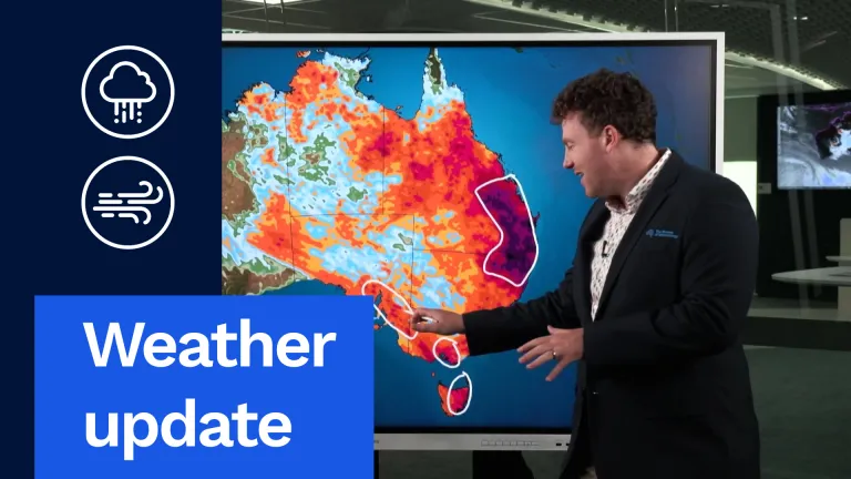 Weather update: Days of rain and storms across Australia
The Bureau of Meteorology Javascript is disabled. Information may not appear correctly. For the best website experience, activate Javascript. Weather update: Days of rain and storms across Australia Video current: 12:00…
-
 Wyndham’s Replacement Weather Radar Now Live
The Bureau of Meteorology’s replacement weather radar in Wyndham is now live, restoring weather radar services to the north-east Kimberley of Western Australia and north-west Gregory district of the Northern Territory…
- Severe storm outbreaks forecast for eastern states
The weather bureau is warning of severe thunderstorm outbreaks across multiple states on the weekend, including an already-drenched Queensland. Torrential rain in the state's southeast caused flash flooding, water…
- ‘Millions’ facing deluge as Queensland storms spread
Updated October 22, 2026 - 10.23pm. First published at 9.49pm South-east Queensland is braced for another deluge on Friday, after a heavy downpour saw school closures and flash floods in the region. Bureau of…
-
 Tree pollen levels are high in Pretoria: Here’s how other cities compare
Home » News » Weather » Tree pollen levels are high in Pretoria: Here’s how other cities compare Tree pollen remains high in Pretoria, while Kimberley records moderate grass pollen. Find out how other cities compare…
-
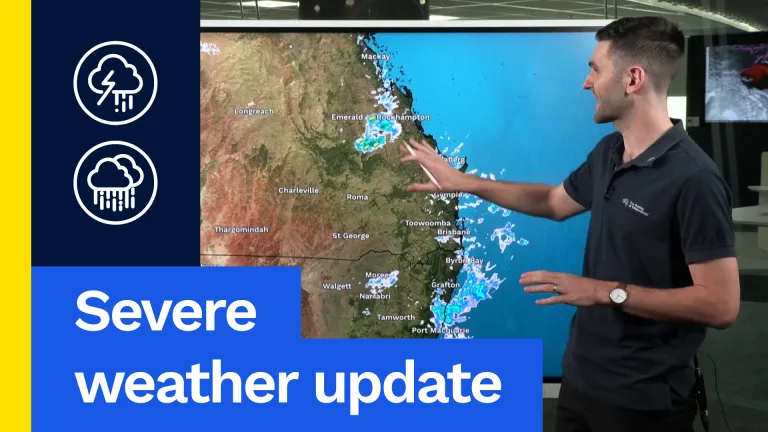 Severe weather forecast: Multi-state weekend severe storm outbreak
Now, what’s happening on the radar at the moment? Not nearly as much as what has been in the last few days. Scattered showers and the odd thunderstorm across central Queensland in particular, and down through south-east…
- Multi-State Severe Storms Forecast This Weekend
Now, what's happening on the radar at the moment? Not nearly as much as what has been in the last few days. Scattered showers and the odd thunderstorm across central Queensland in particular, and down through south-east…
Sun & moon
Nearby
- Brisbane 51 km
- Sunshine Coast 42 km
- Caloundra 29 km
- Narangba 21 km
- Mango Hill 26 km
- Kelvin Grove 48 km
- Alexandra Headland 41 km
- Mount Coolum 52 km
- Maleny 30 km
- Fernvale 57 km
- Wamuran 9 km
- Twin Waters 44 km
Forecasts, observations and alerts in the United States come from the National Weather Service (NOAA); radar from NOAA's Multi-Radar Multi-Sensor system; satellite imagery from NASA's Global Imagery Browse Services (GIBS) and NOAA's GOES satellites; the map from the U.S. Geological Survey's National Map; air quality from AirNow (EPA and its partners); hurricane information from the National Hurricane Center; climate normals and records from NOAA's Regional Climate Centers (ACIS). Forecasts outside the United States and the UV index: MET Norway (CC BY 4.0); observations outside the U.S.: airport reports via NOAA's Aviation Weather Center. Place names: GeoNames (CC BY 4.0). Data are copied on a schedule and may lag the sources; for warnings that affect your safety, follow your local National Weather Service office and emergency officials. Weather news is drawn from the 4Search index and reflects what the press published. Terms of use.