Install
Resistencia, Chaco, Argentina Weather
Current conditions
Forecast for this hour (no station report in the last two hours)
Forecast
10-day-
Wednesday
Light showers. High 26°. Precipitation 5.4 mm for the day.
-
Wednesday Night
Heavy showers. Low 17°. Precipitation 5.4 mm for the day.
-
Thursday
Heavy showers. High 29°. Precipitation 13.3 mm for the day.
MET Norway forecast updated 1 day ago.
Hourly
Hourly forecast- Now21°
- Thu00:0021°0.9
- 01:0020°1.5
- 02:0020°0.9
- 03:0020°1.1
- 04:0020°0.2
- 05:0020°0.7
- 06:0020°0.9
- 07:0020°2.1
- 08:0021°4.2
- 09:0022°0.3
- 10:0023°
- 11:0025°
- 12:0026°
- 13:0027°
- 14:0029°
- 15:0029°
- 16:0028°
- 17:0027°
- 18:0026°
- 19:0025°
- 20:0024°
- 21:0024°
- 22:0023°
Daily forecast
DetailsRadar
Full mapWeather news near Resistencia
More weather news-
 LatAm Expat & Nomad Daily Guide for Tuesday, October 20, 2026
LatAm Expat & Nomad Daily Guide — Tuesday, October 20, 2026 As of 12:30 a.m. US Eastern Time (ET) · 1:30 a.m. Brasília, Tuesday 20 October 2026 · storm bulletin to Monday night, rates to the latest published fixing…
-
 LatAm Expat & Nomad Daily Guide for Monday, October 19, 2026
LatAm Expat & Nomad Daily Guide — Monday, October 19, 2026 As of 12:30 a.m. US Eastern Time (ET) · 1:30 a.m. Brasília, Monday 19 October 2026 · storm bulletins to Sunday night, rates to the latest published fixing…
-
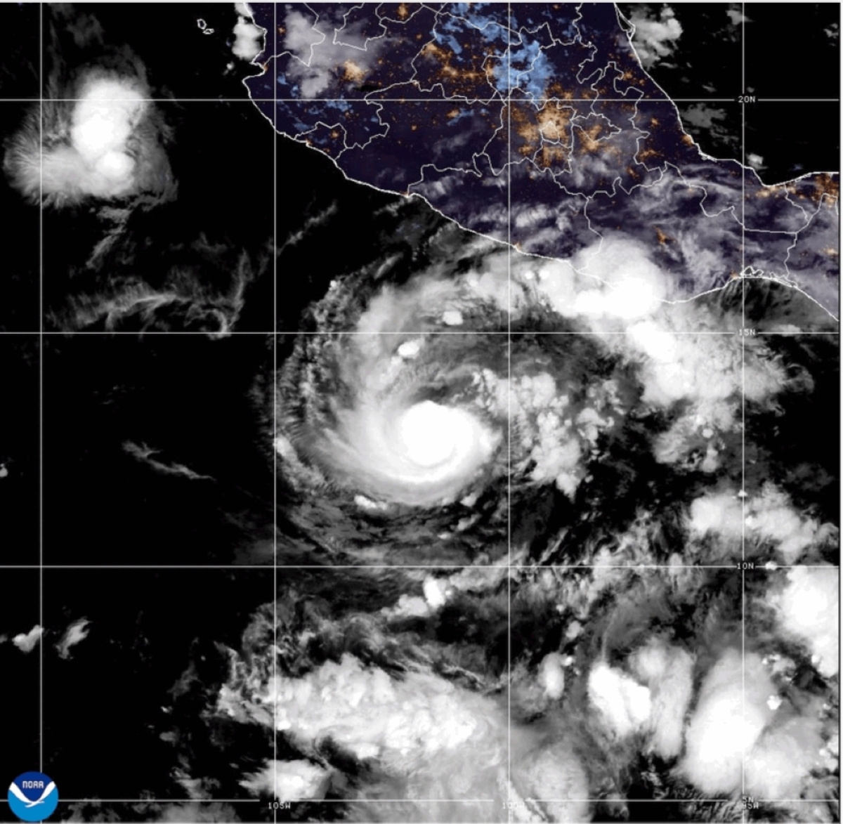 Hurricane Trudy grows stronger, nears Mexico
MIAMI — Trudy strengthened to a Category 2 hurricane as it moved toward Mexico’s southwestern and west-central Pacific coast on Saturday, the US National Hurricane Center said. A hurricane warning was in effect from…
-
 Hurricane Trudy Brings Heavy Rain, Strong Winds to Mexico’s Pacific Coast
Published 18 Oct 2026, 17:28 UTC Earlier on this story16 Oct: Hurricane Trudy Strengthens Into Category 3 Off Mexico’s Pacific Coast Hurricane Trudy strengthened to Category 2 near Mexico’s Pacific coast, bringing heavy…
-
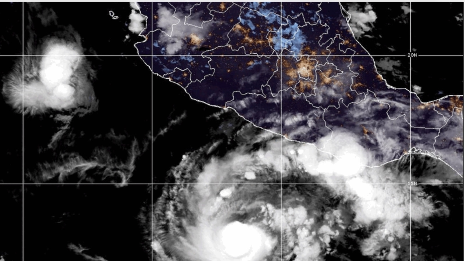 Hurricane Trudy brings heavy rain and strong winds to Mexico’s Pacific coast
Hurricane Trudy brings heavy rain and strong winds to Mexico’s southwestern and west-central Pacific coast, according to the U.S. National Hurricane Center MIAMI -- Hurricane Trudy lashed parts of Mexico’s Pacific coast…
-
 Hurricane Trudy approaches Mexico’s Pacific coast
Three Mexican states are expecting up to 200 mm of rain, with some areas seeing up to 300 mm. Forecasters warn of dangerous flooding and landslides. According to the U.S. National Hurricane Center, Hurricane Trudy has…
- Hurricane Trudy batters Mexico’s Pacific coast with heavy rain and strong winds
Hurricane Trudy brings heavy rain and strong winds to Mexico’s southwestern and west-central Pacific coast Heavy rain and strong winds hit portions of Mexico’s southwestern and west-central Pacific coast early on…
-
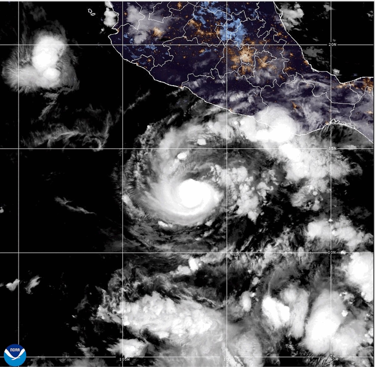 Hurricane Trudy strengthens to Category 2 as it approaches Mexico coast
MIAMI -- Trudy strengthened to a Category 2 hurricane as it moved toward Mexico 's southwestern and west-central Pacific coast on Saturday, the U.S. National Hurricane Center said. A hurricane warning was in effect from…
-
 Hurricane Trudy strengthens to category 2 as it heads toward Mexico
Hurricane warning in effect from Manzanillo to Cabo Corrientes as storm moves toward Pacific coast Trudy strengthened to a category 2 hurricane as it moved toward Mexico’s south-western and west-central Pacific coast on…
- Trudy Approaches Mexico, Champy Passes Guam
Oct 18, 2026 04:22 70 Hurricane Trudy is approaching Mexico's west-central Pacific coast, while Typhoon Champy has passed Guam as a powerful Category 4 storm. Both storms have issued warnings of dangerous winds, heavy…
Sun & moon
Nearby
- Corrientes 15 km
- Barranqueras 5 km
- Fontana 7 km
- San Luis del Palmar 43 km
- La Leonesa 55 km
- Puerto Tirol 14 km
- Puerto Vilelas 7 km
- Paso de la Patria 44 km
- Margarita Belén 23 km
- Makallé 41 km
- San Cosme 48 km
- Riachuelo 27 km
Forecasts, observations and alerts in the United States come from the National Weather Service (NOAA); radar from NOAA's Multi-Radar Multi-Sensor system; satellite imagery from NASA's Global Imagery Browse Services (GIBS) and NOAA's GOES satellites; the map from the U.S. Geological Survey's National Map; air quality from AirNow (EPA and its partners); hurricane information from the National Hurricane Center; climate normals and records from NOAA's Regional Climate Centers (ACIS). Forecasts outside the United States and the UV index: MET Norway (CC BY 4.0); observations outside the U.S.: airport reports via NOAA's Aviation Weather Center. Place names: GeoNames (CC BY 4.0). Data are copied on a schedule and may lag the sources; for warnings that affect your safety, follow your local National Weather Service office and emergency officials. Weather news is drawn from the 4Search index and reflects what the press published. Terms of use.