Install
Nicaragua weather
Cities
| City | Now | Temp | High | Low | Precip |
|---|---|---|---|---|---|
| Managua, Nicaragua | Cloudy | 25° | 31° | 24° | – |
| León, Nicaragua | Cloudy | 25° | 32° | 24° | – |
| Masaya, Nicaragua | Cloudy | 23° | 29° | 23° | – |
| Chinandega, Nicaragua | Forecast loading — check back in a minute. | ||||
| Matagalpa, Nicaragua | Cloudy | 20° | 26° | 20° | – |
| Estelí, Nicaragua | Cloudy | 19° | 28° | 19° | – |
| Granada, Nicaragua | Cloudy | 25° | 30° | 25° | – |
| Mateare, Nicaragua | Cloudy | 25° | 30° | 25° | – |
| Jinotega, Nicaragua | Cloudy | 18° | 25° | 18° | – |
| El Viejo, Nicaragua | Fog | 25° | 32° | 24° | – |
| Nueva Guinea, Nicaragua | Cloudy | 22° | 28° | 22° | – |
| Tipitapa, Nicaragua | Partly cloudy | 25° | 31° | 24° | – |
| Juigalpa, Nicaragua | Cloudy | 24° | 31° | 24° | – |
| Ciudad Sandino, Nicaragua | Cloudy | 25° | 30° | 25° | – |
| Bluefields, Nicaragua | Heavy rain | 24° | 29° | 24° | – |
| Diriamba, Nicaragua | Cloudy | 22° | 27° | 21° | – |
| Ocotal, Nicaragua | Cloudy | 21° | 28° | 20° | – |
| Puerto Cabezas, Nicaragua | Heavy showers | 23° | 30° | 23° | – |
| Chichigalpa, Nicaragua | Partly cloudy | 24° | 31° | 24° | – |
| Rivas, Nicaragua | Light rain | 25° | 29° | 25° | – |
| San Rafael del Sur, Nicaragua | Cloudy | 24° | 31° | 24° | – |
| Jinotepe, Nicaragua | Cloudy | 22° | 27° | 21° | – |
| Boaco, Nicaragua | Cloudy | 22° | 29° | 22° | – |
| Nagarote, Nicaragua | Cloudy | 26° | 31° | 26° | – |
| Jalapa, Nicaragua | Forecast loading — check back in a minute. | ||||
| La Paz Centro, Nicaragua | Cloudy | 26° | 32° | 25° | – |
| San Marcos, Nicaragua | Cloudy | 22° | 27° | 21° | – |
| Masatepe, Nicaragua | Partly cloudy | 27° | – | – | – |
| Nandaime, Nicaragua | Partly cloudy | 24° | 30° | 23° | – |
| Rama, Nicaragua | Cloudy | 23° | 30° | 23° | – |
Weather news
More-
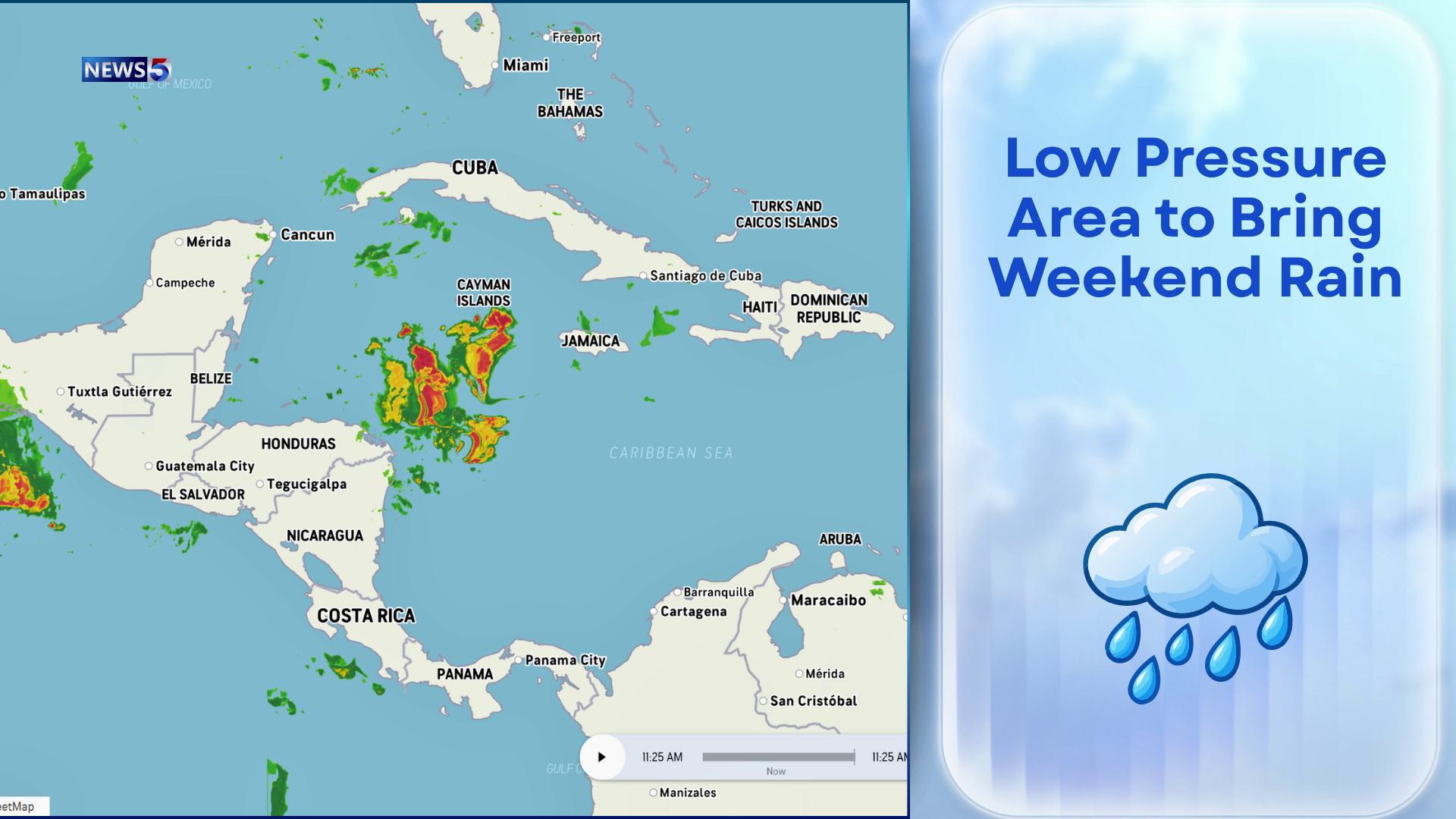 Downpours Could Drench Belize Through Weekend
Keep the umbrellas close and the weekend plans flexible. An area of low pressure near Honduras and Nicaragua could begin soaking Belize as early as tonight, bringing increased showers and thunderstorms through the…
-
 WEATHER VAULT: El Niño Hurricanes - Gladys 1968
MEMPHIS, Tenn. (WMC) - The Niño 2.4 region averaged 0.5 degrees Celsius, or nearly a degree Fahrenheit, above what is typical between September and November of 1968. That coincided with the landfall of Category 2…
More places
- Somoto
- Corinto
- Río Blanco
- Camoapa
- El Crucero
- Siuna
- Somotillo
- Santo Tomás
- Quilalí
- San Carlos
- Ciudad Darío
- Ticuantepe
- El Sauce
- Condega
- Acoyapa
- Matiguás
- Diriomo
- Telica
- San Lorenzo
- South End
- Bocana de Paiwas
- Las Praderas
- Villa Sandino
- San Juan del Sur
- Niquinohomo
- Larreynaga
- Puerto Morazán
- San Jorge
- Nindirí
- Dolores
- Wiwilí
- La Concepción
- Nandasmo
- Pearl City
- Waslala
- Waspán
- Posoltega
- Bonanza
- El Realejo
- Santo Domingo
- San Rafael del Norte
- Belén
- Los Copeles
- Potosí
- Villa El Carmen
- Tisma
- Masachapa
- San Juan de Limay
- Muy Muy
- Pueblo Nuevo
- San Sebastián de Yalí
- Puerto Sandino
- Teustepe
- Poneloya
- San Miguelito
- Jiquilillo
- Moyogalpa
- San Dionisio
- Diriá
- San Fernando
- San Juan de Río Coco
- Palacagüina
- Muelle de los Bueyes
- Achuapa
- La Libertad
- El Rosario
- Santa Rosa del Peñón
- San Ramón
- Altagracia
- El Almendro
- Tola
- La Paz de Carazo
- San Francisco de Cuapa
- San José de Bocay
- Mozonte
- Catarina
- Yalagüina
- Totogalpa
- La Concordia
- Valle San Francisco
- San José de los Remates
- San Juan de Oriente
- Telpaneca
- Quezalguaque
- Terrabona
- Santa Lucía
- Ciudad Antigua
- Buenos Aires
- La Cruz de Río Grande
- LLano de La Cruz
- El Jicaral
- San José de Cusmapa
- Morrito
- El Tortuguero
- Comalapa
- Las Sabanas
- Cárdenas
- Murra
- Nuevo Renacer
- La Conquista
- San Lucas
- Cinco Pinos
- Santa María
- Grey Town
- Santo Tomás del Norte
- Dipilto
- Prinzapolka
- Macuelizo
- Villanueva
- Tonalá
- Sébaco
- Santa Teresa
- San Pedro de Lóvago
- San Pedro del Norte
- San Nicolás
- San Isidro
- San Francisco Libre
- San Francisco del Norte
- El Cuá
- Mulukukú
Forecasts, observations and alerts in the United States come from the National Weather Service (NOAA); radar from NOAA's Multi-Radar Multi-Sensor system; satellite imagery from NASA's Global Imagery Browse Services (GIBS) and NOAA's GOES satellites; the map from the U.S. Geological Survey's National Map; air quality from AirNow (EPA and its partners); hurricane information from the National Hurricane Center; climate normals and records from NOAA's Regional Climate Centers (ACIS). Forecasts outside the United States and the UV index: MET Norway (CC BY 4.0); observations outside the U.S.: airport reports via NOAA's Aviation Weather Center. Place names: GeoNames (CC BY 4.0). Data are copied on a schedule and may lag the sources; for warnings that affect your safety, follow your local National Weather Service office and emergency officials. Weather news is drawn from the 4Search index and reflects what the press published. Terms of use.